


Map of 209 Things to do near Ririe, Idaho
first prev 2 3 4 5 6 7 8 9 10 11 next lastShowing results within 50 miles Distance miles of Ririe, ID, USA City, Zip, or Address
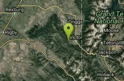
Grove Creek to Drake Creek
Victor, Idaho
28.9 miles EGreat loop trail that connects several trails through the area. This trail was recently rerouted, and so will have plenty of new switchbacks to take as riders climb the mountain. Originally this...
Mountain Bike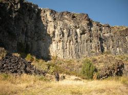
The Playground
Shelley, Idaho
28.9 miles SWThe Playground is a fun, moderate to hard place to sport rock climb. You can find approximately nine routes (popular ones include: Tied to the Whipping Post, Cure for the Hangover, Anchored to...
Rock Climb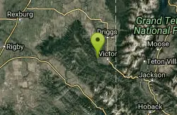
Rocky Peak Via Spooky Trail
Victor, Idaho
29.2 miles EYou will start up Spooky trail which is the only trail in the parking area. There is a trail junction on your left about 1.2-1.5 just keep going straight. At about 2.6 from TH you'll...
Mountain Bike
Long Gulch/Indian Trail
Swan Valley, Idaho
29.2 miles SEOff Highway Vehicles (OHV) less than or equal to 50 inches wide, Mountain Biking, Horse Riding, hiking. source: fs.usda.gov
Mountain Bike
Red Ridge Trail
Swan Valley, Idaho
29.3 miles SEOHV trail. source: fs.usda.gov
Mountain Bike

17 Mile Cave
Idaho Falls, Idaho
29.7 miles WSeventeen Mile Cave is a lava tube, a cave created by the pocket in which lava used to flow and was left empty when the volcano became inactive. The cave gets its name from its location, just 17...
Cave, Hike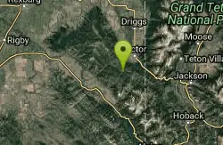
Sheep Driveway
Irwin, Idaho
30.3 miles EOHVs, mountain biking, day hiking, horse riding. source: fs.usda.gov
Mountain Bike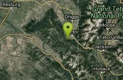
Allen Canyon-Pole Canyon Trail (014)
Victor, Idaho
30.8 miles EThis trail is locally known as the Pole Canyon Trail. Just South of Victor, ID, the Allen Canyon-Pole Canyon Trail (014) is a popular destination for local motorbikers, horseback...
Mountain Bike
Firth River Bottoms
Firth, Idaho
30.9 miles SWWhether you like to ride horses, picnic, camp, fish, learn about the past, or play baseball, this park has something for everyone. The Parks & Recreation Department and the IDaho Education...
Camp, Canoe, Hike
Hunts Corral
Irwin, Idaho
32.5 miles SENon-motorized use only. source: fs.usda.gov
Mountain Bike 5.6-8.3 mi
Palisades Creek Trail / Lakes and Waterfall Canyon
Irwin, Idaho
32.5 miles SEPalisades Creek Trail is located about 50 miles southeast of Idaho Falls and about 60 miles west of Jackson Hole WY in Swan Valley Idaho. The four mile hike up to lower Palisades Lake or the 6.2 mile...
Backpack, Camp, Hike, Horseback, Mountain Bike
River Rush
Ashton, Idaho
33.0 miles NEPaintball near Ashton, Idaho
Paintball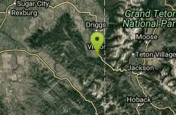
Teton Springs Trail
Victor, Idaho
33.5 miles ECLOSED. This trail is no longer accessible to the public. There is a new company which owns the resort and the loop land. Teton Springs Loop is a loop for cross-country skiing and snowshoeing. The...
Cross-country Ski, Snowshoe
Victor Bike Park
Victor, Idaho
33.6 miles EThe Victor Bike Park is home to a progressive jump line, pumptrack, and more stunts.
Mountain Bike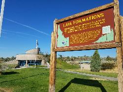
Hell's Half Acre Southbound Rest Stop
Blackfoot, Idaho
33.6 miles SWThis is a well maintained rest area with facilities to keep you happy as you travel through Idaho. This rest stop on Interstate 15 about 15 miles South of Idaho Falls has nice picnic tables and...
Hike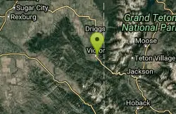
Pioneer Park Nordic Trail
Victor, Idaho
33.7 miles EDistance: 3 miles (4.5km) Trail Map: Pioneer_Park_2015.pdf Grooming Report: http://tvtap.org/nordic-grooming
Cross-country Ski, Snowshoe 3.9 mi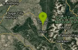
Three Wookie Trail
Driggs, Idaho
33.7 miles EMountain Bike near Driggs, Idaho
Mountain Bike
Hell's Half Acre Northbound Rest Stop
Blackfoot, Idaho
33.7 miles SWThis is a well maintained rest area with facilities to keep you happy as you travel through Idaho. This rest stop on Interstate 15 about 9 miles north of Blackfoot Idaho has nice picnic tables and...
Hike 0.9 mi
Hell's Half Acre Lava Walk
Blackfoot, Idaho
33.9 miles WThe Lava Trails traverse the desert of the Snake River Plain through contorted landscapes created from multiple lava flows. These Hawaiian-type lava flows are associated with the stretching of the...
Hike 0.8 mi
Conant Creek Pegram Truss Railroad Bridge
Ashton, Idaho
33.9 miles NEAs part of the Rails to Trails project, this old railroad bridge has been transformed into a very safe little viewing experience for the whole family. You can drive right up to the bridge where there...
Hike


