


Map of 213 Things to do near Ririe, Idaho
first prev 2 3 4 5 6 7 8 9 10 11 next lastShowing results within 50 miles Distance miles of Ririe, ID, USA City, Zip, or Address
Three Wookie Trail
Driggs, Idaho
33.7 miles EMountain Bike near Driggs, Idaho
Mountain Bike
Hell's Half Acre Northbound Rest Stop
Blackfoot, Idaho
33.7 miles SWThis is a well maintained rest area with facilities to keep you happy as you travel through Idaho. This rest stop on Interstate 15 about 9 miles north of Blackfoot Idaho has nice picnic tables and...
Hike 0.9 mi
Hell's Half Acre Lava Walk
Blackfoot, Idaho
33.9 miles WThe Lava Trails traverse the desert of the Snake River Plain through contorted landscapes created from multiple lava flows. These Hawaiian-type lava flows are associated with the stretching of the...
Hike 0.8 mi
Conant Creek Pegram Truss Railroad Bridge
Ashton, Idaho
33.9 miles NEAs part of the Rails to Trails project, this old railroad bridge has been transformed into a very safe little viewing experience for the whole family. You can drive right up to the bridge where there...
Hike
Teton Valley Disc Golf Course
Driggs, Idaho
34.2 miles EEnjoy 360-degree mtn views from this city park that also features a skateboard area. This course is on your way to the Grand Targhee course. Public (No Fee)
Disc Golf 0.1-0.2 mi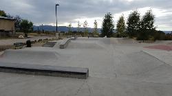
Driggs Bike and Skate Park
Driggs, Idaho
34.2 miles EThis is a great concrete skatepark and small mountain bike park with great features, both natural and wooden. There's a great pavilion right next to the skatepark and parking lot. While...
Mountain Bike, Skateboard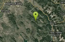
South Fork Bear Creek Trail
Wayan, Idaho
34.4 miles SEOHV trail. source: fs.usda.gov
Mountain Bike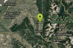
Driggs Nordic Trail
Driggs, Idaho
34.5 miles EDistance: 3.1 miles (5km) Trail Map: Driggs_Nordic_Track_2015.pdf Grooming Report: http://tvtap.org/nordic-grooming
Cross-country Ski, Snowshoe
Badger Creek
Tetonia, Idaho
34.9 miles NEBadger Creek is a stream located just 13.6 miles from Ashton, in Teton County, in the state of Idaho, United States, near France, ID. Whether you’re spinning, baitcasting or fly fishing your...
Camp, Cross-country Ski, Hike, Mountain Bike, Rock Climb 29.6 mi
Ashton to Tetonia Trail
Ashton, Idaho
34.9 miles NEThe Idaho Department of Parks and Recreation undertook the project to transform the old Teton Valley Branch of the Union Pacific Railroad from Ashton to Tetonia into a trail for bikes, ATVs, and...
Mountain Bike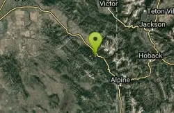
Bear Creek Campground at Palisades
Irwin, Idaho
35.1 miles SEPalisades Reservoir is ideal for water skiing in the summer and features many picnic spots and boat docks. The area forest service hosts nine campgrounds containing 181 family units. Boat launch...
Camp, Hike, Horseback, Mountain Bike
Calamity Campground
Irwin, Idaho
35.1 miles SECalamity Campground is located just 55 miles east of Idaho Falls, Idaho. This is the perfect area to access the Palisades Reservoir and enjoy the water activities available there. The water here is...
Camp, Canoe, Hike, Kayak, Mountain Bike, Swim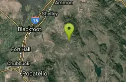
Blackfoot River Crossing at Trail Creek Road
Firth, Idaho
35.2 miles SIn Soda Springs, ID 34 N for ~11 mi; R (E) on Blackfoot River Rd at mp 69.9; zero odometer; travel 10.4 mi; stay to the L as rd turns to gravel at mi 10.9; mi 13.7 pass Mill Canyon Campground; mi...
Camp 3.3-10.0 mi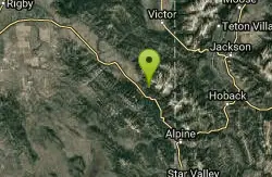
Sheep Creek Trail
Irwin, Idaho
35.3 miles SEHike and Mountain Bike near Irwin, Idaho
Hike, Mountain Bike
Mike Harris Campground
Victor, Idaho
35.6 miles EMike Harris Campground is located along scenic Teton Pass, just 5 miles from Victor, Idaho at an elevation of 6,200 feet. Visitors enjoy fishing, exploring local trails and sightseeing in this...
Camp
Rush Hour
Victor, Idaho
35.7 miles ETrail is a fun little out n back. 2 miles one way. Only gain about 340' in elevation throughout the trail. Perfect small workout trail and good intro to singletracks in the area. Trail turns...
Mountain Bike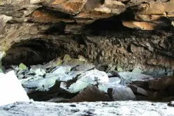
Civil Defense Caves
Rexburg, Idaho
36.2 miles NThe caves are large lava tubes. The name comes from the cold war era when they were anticipated as a safe area in the case of an attack. The entrance is pretty bouldery and does require a small...
Cave 13.2-13.5 mi
Bear Creek Hot Springs
Irwin, Idaho
36.7 miles SEBear Creek Hot Springs is a 15 mile out and back trail with a hot spring at the end. The trail is not well marked and is only recommended for very experienced outdoorsmen and primarily used for...
Backpack, Camp, Hike, Horseback, Hot Springs, Mountain Bike
Spring Creek Trail
Alta, Wyoming
37.4 miles EThis trail starts at the remains of the historic Rapid Creek Ranger Station. The trail heads east following an old road. After crossing Rapid Creek, the trail climbs up to a ridge...
Mountain Bike 4.5 mi
Aspen Trail
Alta, Wyoming
37.4 miles EAspen Trail (tr 034) is single track trail for 4.35 miles along 6,800 ft contour to Darby Canyon (tr 012). Spring Creek Trail (tr 032) is double track trail for 3.68 miles to end. The trail starts...
Hike, Mountain Bike


