


Bear Creek Hot Springs
Irwin, Idaho

| Address: | Forest Rd 058, Irwin, ID 83428, USA |
| GPS: |
43°16'33.3"N 111°13'56.6"W Maps | Directions |
| State: | Idaho |
| MTB Trail Type: | Singletrack |
| Trails/Routes: | 6.6-6.8 mi |
Backpack, Camp, Hike, Horseback, Hot Springs, and Mountain Bike
Bear Creek Hot Springs is one of eastern Idaho's most rewarding backcountry soaks — a natural rock pool hidden deep in the Caribou-Targhee National Forest, reached only on foot, by bike, or on horseback up a long and beautiful canyon. It sits near Irwin, just south of Palisades Reservoir on the Idaho–Wyoming line, and it's the kind of place you have to earn: roughly 13 miles round trip, which is exactly why the people who make it tend to have the pool to themselves.
The good news is that most of that distance is gentle. From the trailhead the route follows Bear Creek up a green, forested canyon under lodgepole and aspen, rolling along at an easy grade with the water always close by. Wildflowers fill the meadows in early summer, and thanks to newer bridges and dry bench paths you can now keep your feet out of the water and skip the old creek crossings (in spring runoff those fords ran high, so the dry routes are a welcome upgrade). It's pretty, low-effort walking for miles.
Then comes the part everyone remembers. The final stretch climbs hard — close to a thousand feet in the last mile — so save your energy for that last push and fill your water bottles before you start up. The reward is immediate: a clear natural pool, roughly 10 by 20 feet, sitting at just about the perfect soaking temperature after all that trail. Tucked this far back in the wilderness, it's quiet, private, and worth every step. One honest heads-up before you bring the family: the soak is frequently clothing-optional.
This is true backcountry, and it's a favorite across the board — hikers and backpackers come for the soak, mountain bikers ride the intermediate singletrack with its fun, branching loop options, and horseback riders share the same trail. Many turn the trip into an overnight, camping in the backcountry to enjoy a quiet, starlit soak before hiking out in the morning.
Come prepared for a remote mountain trip: pack plenty of water and plan to filter from the creek, bring bug repellent in early summer, and carry bear spray, since this is bear country and sightings are common. The trailhead has a parking area and a restroom, but no services beyond that, and there's no cell coverage once you're in the canyon — so let someone know your plan and give yourself plenty of daylight for the round trip. The trail is at its best from late spring through fall, roughly March into October, when the canyon is green and the water is just right. Few places in the region pay you back like Bear Creek does.
More Information
Bear Creek
Bear Creek is a singletrack mountain bike trail in Palisades, Idaho. View maps, videos, photos, and reviews of Bear Creek bike trail in Palisades.
http://www.singletracks.com/bike-trails/bear-creek-palisades/Bear Creek Hot Springs Trail Hiking Trail, Irwin, Idaho
You worked hard to get there and deserve a soak. Near Irwin, Idaho.
https://www.hikingproject.com/trail/7099161/bear-creek-hot-springs-trailBear Creek Hot Springs Trail Mountain Bike Trail, Irwin, Idaho
You worked hard to get there and deserve a soak. Near Irwin, Idaho.
https://www.mtbproject.com/trail/7057030/bear-creek-hot-springs-trailHomepage - Buckrail - Jackson Hole, news
Buckrail is brought to you with support from our Community Partners: Local weather The latest jackson weather SNAPPED of the daypresented by Keller Williams Jackson Hole AVAILABLE JOBS
https://buckrail.com/Idaho Bear Creek Hot Springs Loop Mountain Biking Route | Trailforks
Most people hike in from the Bear Creek trail head on the Palisades Reservoir side, this loops from South Fork Fall Creek Motorized Trail Head to the
https://www.trailforks.com/route/idaho-bear-creek-hot-springs-loop/Never modify trail features. Ride trails when they're dry enough that you won't leave ruts. Speak up when you see others on the trail and always yield to hikers, horses, and others coming uphill. Always ride on the established trail.
Read MoreBe courteous, informed, and prepared. Read trailhead guidelines, stay on the trail, and don't feed the wildlife.
Read More
Be careful. Pay attention to posted signs and always test the waters before you get in. Some hot springs can get up to boiling temperatures. Be sure to drink plenty of water to combat the dehydrating effect of the spring.
Be respectful of other soakers and the hot spring. Don't hog the pool. Camp at least 200 yards away and keep fires in designated areas. Keep your pets out of the water and never pee in thermal feature. Glass bottles should never go near a hot spring.
- Plan Ahead and Prepare
- Travel & camp on durable surfaces
- Dispose of waste properly
- Leave what you find
- Minimize campfire impacts
- Respect wildlife
- Be considerate of other visitors
Directions
From Irwin, Idaho
- Head west toward Valley Rd (269 ft)
- Turn left onto Valley Rd (446 ft)
- Turn left onto Old Irwin Rd (0.2 mi)
- Turn right onto US-26 E (6.2 mi)
- Turn right onto Gravel Wy (0.4 mi)
- Turn right onto Forest Rd 277 (0.1 mi)
- Turn left to stay on Forest Rd 277 (0.2 mi)
- Slight right onto Snake River Rd (1.5 mi)
- Turn left to stay on Snake River Rd (2.7 mi)
- Turn right onto Bear Creek Rd (5.6 mi)
- Turn right onto Bear Creek Trailhead Forest Service RdDestination will be on the left(0.3 mi)
The trail follows Bear Creek upstream (West) from the trailhead. The main trail crossed the river six times in the first four miles. Before each set, there's a detour to the right (North) that will take you up the hill and around the crossings. That will really save you when the water's higher. The first set has four crossings and the second set has two. At about 4 miles, you'll come to the North Fork of Bear Creek. If you've been detouring, it will look like another up and around detour. Don't do it. Follow the trail to cross over the North Fork and continue. About a mile further, you'll see Warm Springs Creek come in on your left (South). That's the really hard way to get there. Follow Bear Creek another 1/4 mile and watch off to your left(South) for a dirt bike trail up the hill. At this point, the leisurely hike is pretty much over. Follow the trail up South the hill. At one point, you'll cross over a little ravine. After that, there's about a mile or less to go. There's a pretty good campsite near the springs and the trail goes right to it.
wishfulangel
6/2/15 7:51 pm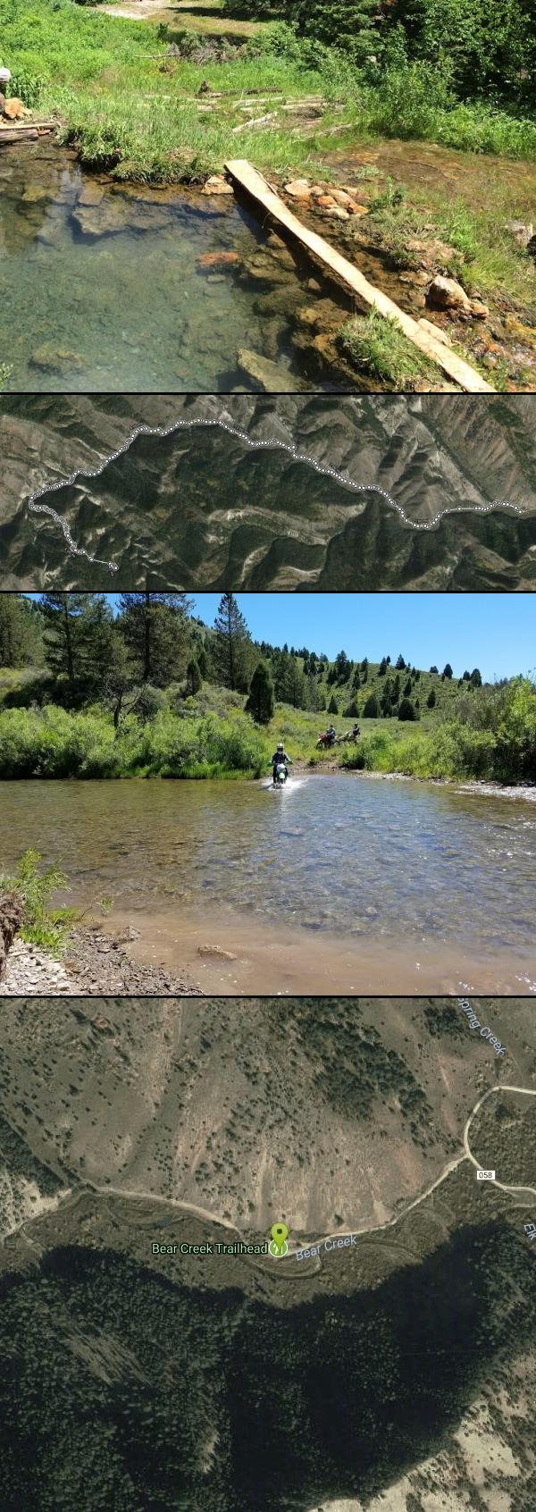 The actual hot springs pool. About 10x20 and a perfect temperature. courtesy of Victor Walker↗

 Hot Spring
 Dirt Bike Crossing by Lauren Brewer
 Beautiful start to the hike. If only we didn't have to cross that stream so often... courtesy of Victor Walker↗
 Love the steam in the morning air courtesy of Victor Walker↗
 Not a lot of shade on the way down. courtesy of Victor Walker↗
 This is a fresh-water spring where you can get cold clean water. And some pools to soak in when it i courtesy of Victor Walker↗

Other Mountain Bike Trails, Hiking Trails, Horseback Trails, Hot Springs, and Backpacking Trails Nearby

Calamity Campground
Irwin, Idaho
3.7 miles NA wooded Palisades Reservoir campground 55 miles east of Idaho Falls with clean blue water for swimming, boating, water skiing, and fishing — plus miles of ATV routes.
Camp, Canoe, Hike, Kayak, Mountain Bike, Swim
Palisades Hot springs
Swan Valley, Idaho
5.7 miles SEPalisades Hot Springs is a wild lakeshore soak where geothermal water seeps into Idaho's Palisades Reservoir — dig your own hot tub in the sand.
Hot Springs, Swim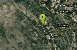
Sheep Creek/little Elk Connection
Irwin, Idaho
6.0 miles NEA rigorous climb to a plateau followed by a smooth singletrack descent through a canyon full of moose, with a shuttle option for downhill laps on the Little Elk Creek side.
Mountain Bike 3.9 mi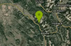
Little Elk Creek Trail
Irwin, Idaho
6.1 miles NEThe Little Elk Creek Trail is a demanding, lightly traveled route in the Caribou-Targhee National Forest above Irwin, Idaho, climbing into the Snake River Range in a corner of eastern Idaho better...
Backpack, Hike, Horseback, Mountain Bike 3.3-10.0 mi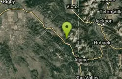
Sheep Creek Trail
Irwin, Idaho
6.6 miles NEThe Sheep Creek Trail is a long, demanding backcountry route in the Caribou-Targhee National Forest above Irwin, Idaho, in the rugged Snake River Range east of Idaho Falls. Most often tackled as the...
Hike, Mountain Bike 6.9 mi
Big Elk Creek
Irwin, Idaho
6.7 miles NEA versatile campground on a small dammed lake with fishing, kayaking, hiking and backpacking into the Caribou-Targhee National Forest, and stunning fall Aspen and Douglas-Fir colors on the Big Elk Creek Trail.
Backpack, Camp, Canoe, Hike, Horseback, Kayak 23.8 mi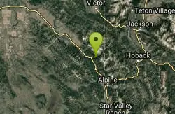
Big Elk Creek Trail
Irwin, Idaho
7.0 miles NEA non-motorized mountain bike trail along Big Elk Creek near Irwin, Idaho — open to MTB riders on BLM-adjacent forest land.
Mountain Bike
Red Ridge Trail
Swan Valley, Idaho
7.6 miles NWA designated OHV trail near Swan Valley in the Caribou-Targhee National Forest — ideal for off-highway vehicle adventures in the Idaho backcountry.
Mountain Bike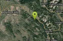
Long Gulch/Indian Trail
Swan Valley, Idaho
7.6 miles NWA multi-use trail near Swan Valley open to OHVs (under 50 inches wide), mountain biking, horses, and hiking along Long Gulch and the historic Indian Trail corridor.
Mountain Bike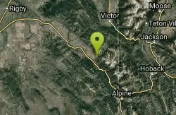
Hunts Corral
Irwin, Idaho
8.4 miles NA non-motorized trail near Irwin for quiet backcountry use — human-powered travel only on this Idaho route.
Mountain Bike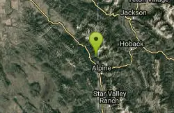
Indian Creek Campground (Palisades)
Irwin, Idaho
8.5 miles EA picturesque reservoir nestled between the Snake River and Caribou ranges, just 25 miles from Jackson Hole — a beautiful drive and a wildlife-rich fishing base.
Camp, Hike, Horseback, Swim 2.8-4.1 mi
Palisades Creek Trail / Lakes and Waterfall Canyon
Irwin, Idaho
8.5 miles NSpectacular mountain views, two landslide-formed alpine lakes, and mountain goat sightings — all within a 4-to-6-mile hike in the Swan Valley wilderness.
Backpack, Camp, Hike, Horseback, Mountain Bike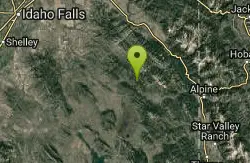
South Fork Bear Creek Trail
Wayan, Idaho
8.6 miles SWAn OHV trail in Wayan for off-highway vehicle riders in the Idaho backcountry.
Mountain Bike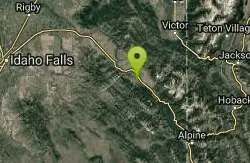
Flat Iron Trail
Swan Valley, Idaho
10.1 miles NWAn OHV trail in Swan Valley, Idaho — a motorized off-highway vehicle route through the national forest.
Mountain Bike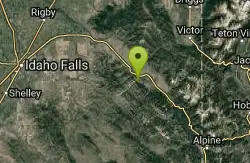
Echo/Indian Creek Trail
Swan Valley, Idaho
13.4 miles NWAn OHV trail through the Swan Valley area of Idaho — a rugged option in the Caribou-Targhee National Forest for off-highway vehicle enthusiasts.
Mountain Bike
Fall Creek Falls
Swan Valley, Idaho
13.5 miles NWA shaded Snake River campground near Swan Valley with abundant wildlife, great trout fishing, and Fall Creek Falls a quarter-mile away.
Camp, Cave, Hike, Kayak, Swim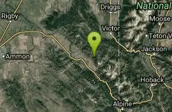
North/South Rainey Creek Trails
Irwin, Idaho
13.6 miles NA motorcycle trail through the North/South Rainey Creek area near Irwin, Idaho — suited for motorized trail riding.
Mountain Bike
South Fork Fall Creek Trail
Swan Valley, Idaho
13.6 miles NWAn OHV trail on the South Fork Fall Creek near Swan Valley, Idaho — open for off-highway vehicle use.
Mountain Bike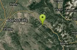
Echo Canyon aka Fall Creek
Ririe, Idaho
13.8 miles NWTrail goes to the top of Deadhorse Ridge for some amazing views. Double-track, single-track, and gravel road. Length: 15 miles
Mountain Bike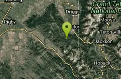
Sheep Driveway
Irwin, Idaho
17.7 miles NA multi-use trail near Irwin, Idaho, open to OHVs, mountain bikes, day hikers, and horse riders alike.
Mountain BikeNearby Campsites
Calamity Campground
Irwin, Idaho
3.7 miles NA wooded Palisades Reservoir campground 55 miles east of Idaho Falls with clean blue water for swimming, boating, water skiing, and fishing — plus miles of ATV routes.
Camp, Canoe, Hike, Kayak, Mountain Bike, Swim 6.9 mi
Big Elk Creek
Irwin, Idaho
6.7 miles NEA versatile campground on a small dammed lake with fishing, kayaking, hiking and backpacking into the Caribou-Targhee National Forest, and stunning fall Aspen and Douglas-Fir colors on the Big Elk Creek Trail.
Backpack, Camp, Canoe, Hike, Horseback, Kayak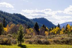
Big Elk Campground
Irwin, Idaho
6.7 miles NEA versatile campground near Palisade Reservoir with fishing, hiking, horseback riding, and kayaking — plus a small secluded lake on the drive in that's perfect for a quiet afternoon.
Camp
Indian Creek Campground (Palisades)
Irwin, Idaho
8.5 miles EA picturesque reservoir nestled between the Snake River and Caribou ranges, just 25 miles from Jackson Hole — a beautiful drive and a wildlife-rich fishing base.
Camp, Hike, Horseback, Swim 2.8-4.1 mi
Palisades Creek Trail / Lakes and Waterfall Canyon
Irwin, Idaho
8.5 miles NSpectacular mountain views, two landslide-formed alpine lakes, and mountain goat sightings — all within a 4-to-6-mile hike in the Swan Valley wilderness.
Backpack, Camp, Hike, Horseback, Mountain Bike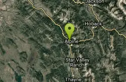
Alpine Campground
Alpine, Wyoming
11.0 miles SEA lodgepole-pine campground two miles west of Alpine near the south end of Palisades Reservoir, with boating, waterskiing, swimming, and canoeing plus excellent fishing for cutthroat, brown trout, kokanee salmon, and mackinaw.
Camp
Falls Campground
Victor, Idaho
12.6 miles NWA Snake River campground near Swan Valley with cottonwood shade, abundant wildlife — eagles, osprey, moose, and deer — and Fall Creek Falls just a quarter mile away; Palisades Reservoir is 20 miles out.
Camp
Fall Creek Falls
Swan Valley, Idaho
13.5 miles NWA shaded Snake River campground near Swan Valley with abundant wildlife, great trout fishing, and Fall Creek Falls a quarter-mile away.
Camp, Cave, Hike, Kayak, Swim
Pine Creek Campground
Victor, Idaho
20.6 miles NThe Pine Creek Campground has 10 single units and has restrooms.
Camp
Mike Harris Campground
Victor, Idaho
21.0 miles NEA scenic mountain campground at 6,200 feet along Teton Pass just 5 miles from Victor, Idaho — a peaceful base for fishing, trail exploring, and sightseeing in the Teton region.
Camp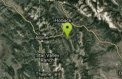
Bailey Lake
Jackson, Wyoming
26.0 miles ENamed by Congressional action in 1967 for prominent jurist Robert D. Bailey Sr., this reservoir on the Guyandotte River in West Virginia was dedicated in August 1980.
Camp, Hike, Horseback, Mountain Bike
Wolf Flats Recreation Area
Ririe, Idaho
29.3 miles NWWolf Flats is a completely free, dispersed, undeveloped camping area with 25 locations to camp. Some areas are large enough to accommodate groups of 50 people.
Camp
Darby Canyon Camping
Alta, Wyoming
29.5 miles NDispersed campsites with fire lays in scenic Darby Canyon — no official campground, just established spots in Wyoming wilderness. Leave No Trace and use existing rings only.
Camp
Moody Meadows
Driggs, Idaho
30.3 miles NWGood place for kids, they can ride bikes in the meadow, play in the stream, and camping is off of the road. Hiking, motorbiking, and horseback riding trails are abundant in the area.
Camp
Table Rock Campground
Ririe, Idaho
30.3 miles NWA campground in Caribou-Targhee National Forest — part of a 3-million-acre stretch from Montana to the Utah and Wyoming borders — with access to the Curlew National Grassland.
Camp
Kelly Island Campground
Ririe, Idaho
32.3 miles NWA BLM campground with 14 family sites and 1 group site for RVs or tents, open May through September — vault toilets, pets welcome, and rates from $5–$20 per night.
Camp
Paramount Wall / Blanche Rock
Ririe, Idaho
32.7 miles NWA sport climbing wall above the road near Ririe with great exposure, afternoon shade, and well-loved 5.9–5.10 lines — most routes work with a 50-meter rope, established by Chuck Oddette and crew.
Camp, Horseback, Rock Climb
Big Hole Dispersed Campsites
Ririe, Idaho
33.2 miles NWA network of dispersed campsites with fire rings in the Big Hole mountains above Kelly Canyon — first come, first served, no reservations, and Leave No Trace principles are essential.
Camp 1.3-4.3 mi
Phelps Lake
Jackson, Wyoming
33.4 miles NEA 5.5-mile loop around beautiful Phelps Lake with mountain scenery, majestic blue water, several Teton waterfalls, and lakeside campsites — plus a popular cliff jumping rock along the trail.
Backpack, Camp, Dive, Hike, Swim 0.5-3.5 mi
Webster's Dam
Ririe, Idaho
34.4 miles NWAn abandoned dam in Moody Creek canyon where sediment split the stream into two beautiful 15-foot waterfalls — stunning in spring runoff and blazing with fall colors.
Camp, Hike, Mountain Bike


