


Map of 169 Things to do near Shelley, Idaho
first prev 1 2 3 4 5 6 7 8 9 next lastShowing results within 50 miles Distance miles of Shelley, ID 83274, USA City, Zip, or Address

West Pine Creek Trail
Ririe, Idaho
43.1 miles ENon-motorized use. source: fs.usda.gov
Mountain Bike
Trail Canyon Trail
Ririe, Idaho
43.1 miles EThe Trail Canyon trail begins at Trail Canyon Parklot, T8s R43e Sec28 and ends at Intersect Trail 5251,t8s R43e Sec28. source: fs.usda.gov
Mountain Bike
Slate Mountain/Gibson Jack Trail
Pocatello, Idaho
43.6 miles SThe Gibson Jack trail offers great views of Southeastern Idaho and a favorite trail among moutain bikers. This trail is a continuation of the West Fork Mink Creek trail and takes travelers further...
Hike, Horseback, Mountain Bike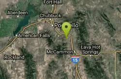
Driveway Canyon Trail
Inkom, Idaho
44.0 miles SMotorcycle traili. source: fs.usda.gov
Mountain Bike
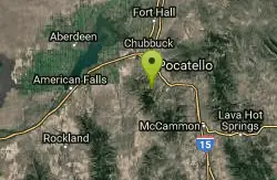
Gibson Jack/west Fork
Pocatello, Idaho
44.5 miles SThe West Fork is a mix of single/doubletrack with some fun rock spots and good scenery throughout. After climbing about 1500' in elevation, it's all downhill on singletrack on the...
Mountain Bike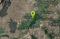
Sportsman's Park American Falls Reservoir
Aberdeen, Idaho
44.5 miles SWThis beautiful 30-acre park is a multi-use area with facilities and activities for a variety of recreational uses. Situated adjacent to the American Falls Reservoir, it provides primary access to...
Camp, Canoe, Hike
North/South Rainey Creek Trails
Irwin, Idaho
44.6 miles EMotorcycle trail. source: fs.usda.gov
Mountain Bike 3.2 mi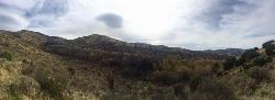
Kinney Creek Trail
Pocatello, Idaho
45.1 miles SKinney Creek Trail is in the Caribou-Targhee National Forest near Pocatello. This is a 6.4 out-and-back trail that takes you to the Indian Mountain Summit. It gives you views of Idaho...
Hike 13.2-13.5 mi
Bear Creek Hot Springs
Irwin, Idaho
45.4 miles EBear Creek Hot Springs is a 15 mile out and back trail with a hot spring at the end. The trail is not well marked and is only recommended for very experienced outdoorsmen and primarily used for...
Backpack, Camp, Hike, Horseback, Hot Springs, Mountain BikeHenry's Fork Green Way (St. Anthony Green Belt)
Saint Anthony, Idaho
45.5 miles NEThis is a great walk along the river. While it is nestled right next to the highway, the closeness and beauty of the river flowing on the other side of the trail more than make up for it. Halfway...
Hike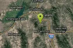
Cherry Springs
Pocatello, Idaho
45.6 miles SJust a short distance from Pocatello, the Cherry Springs Nature Area has thick green vegetation, an abundance of birds and viewing other wildlife. Take a picnic and a camera and head out on the...
Hike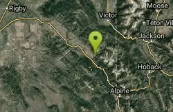
Hunts Corral
Irwin, Idaho
45.7 miles ENon-motorized use only. source: fs.usda.gov
Mountain Bike 5.6-8.3 mi
Palisades Creek Trail / Lakes and Waterfall Canyon
Irwin, Idaho
45.7 miles EPalisades Creek Trail is located about 50 miles southeast of Idaho Falls and about 60 miles west of Jackson Hole WY in Swan Valley Idaho. The four mile hike up to lower Palisades Lake or the 6.2 mile...
Backpack, Camp, Hike, Horseback, Mountain Bike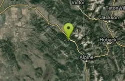
Bear Creek Campground at Palisades
Irwin, Idaho
45.8 miles EPalisades Reservoir is ideal for water skiing in the summer and features many picnic spots and boat docks. The area forest service hosts nine campgrounds containing 181 family units. Boat launch...
Camp, Hike, Horseback, Mountain Bike
Monkey Rock
Saint Anthony, Idaho
45.8 miles NECLOSED. PSA: Monkey Rock is no longer open to the public. The owner has posted "No Trespassing" signs and is asking the Fremont County Sheriff's Office to assist with keeping people out of their...
Swim
Calamity Campground
Irwin, Idaho
45.9 miles ECalamity Campground is located just 55 miles east of Idaho Falls, Idaho. This is the perfect area to access the Palisades Reservoir and enjoy the water activities available there. The water here is...
Camp, Canoe, Hike, Kayak, Mountain Bike, Swim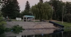
St. Anthony Sandbar
Saint Anthony, Idaho
46.0 miles NECLOSED. //// Sand Bar Update //// ***As of 27 June 2019 *** The Sand Bar is still closed to ALL swimming, please do not cross the boundary line. We are closely monitoring the river flows...
Dive, Swim
Hog Hollow Bridge
Saint Anthony, Idaho
46.0 miles NELess than 1/2 a mile down the road from the Monkey Rock waterfall, Hog Hollow Bridge is a favorite spot for adrenaline junkies to cool off. The place to jump is off the East side of the bridge where...
Dive, Swim
Wright Creek Trail
Tetonia, Idaho
46.3 miles NEOpen to MTB, horseback riding, snowshoeing, and hiking. source: fs.usda.gov
Mountain Bike 1.2 mi
Spooky
Victor, Idaho
46.5 miles ETrail serves as the stem to Red Creek or access to Corral Creek as well as other possibilities in the big hole mountains. Nice fun singletrack to run as an out n back if your time is...
Mountain Bike


