


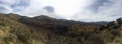
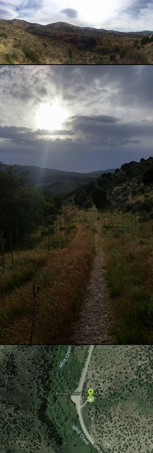
Kinney Creek Trail
Pocatello, Idaho
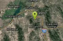
| Address: | S Mink Creek Rd, Pocatello, ID 83204, USA |
| GPS: |
42°45'38.1"N 112°23'48.8"W Maps | Directions |
| State: | Idaho |
| Trail Type: | Out & Back |
| Hike Difficulty: | Beginner |
| Elevation Gain: | 4920 feet |
| Trails/Routes: | 3.2 mi |
Trails Wildflowers
Hike
Kinney Creek Trail is in the Caribou-Targhee National Forest near Pocatello. This is a 6.4 out-and-back trail that takes you to the Indian Mountain Summit. It gives you views of Idaho backcountry including trees, wildflowers, and wildlife. This is an ideal spot for birdwatching as it's a place where you can see various species such as: raptors, shorebirds, songbirds, upland birds, waterbirds, waterfowl.
Kinney Creek Trail is best used during the warmer months. Dogs are allowed on the trail.
More Information
Add ResourceBe courteous, informed, and prepared. Read trailhead guidelines, stay on the trail, and don't feed the wildlife.
Read More- Plan Ahead and Prepare
- Travel & camp on durable surfaces
- Dispose of waste properly
- Leave what you find
- Minimize campfire impacts
- Respect wildlife
- Be considerate of other visitors
Directions
From Pocatello, Idaho
- Head southeast on N 7th Ave toward E Wyeth St (0.2 mi)
- Turn right onto E Clark St (0.2 mi)
- Turn left onto N 4th Ave (0.3 mi)
- Turn right onto E Benton St (171 ft)
- Continue straight to stay on E Benton St (0.4 mi)
- Turn left onto S Arthur Ave (0.3 mi)
- Continue onto W Putnam St (0.1 mi)
- Continue onto S Main St (1.3 mi)
- Continue onto Bannock HwyDestination will be on the left(6.6 mi)


Trails
Distance ?
3.2 milesElevation Gain ?
-2,378 feetReal Ascent ?
43 feetReal Descent ?
2,421 feetAvg Grade (-8°)
-15%Grade (-26° to 9°)
-49% to 16%Elevation differences are scaled for emphasis. While the numbers are accurate, the cut-away shown here is not to scale.
Other Hiking Trails Nearby
Cherry Springs
Pocatello, Idaho
0.6 miles SJust a short distance from Pocatello, the Cherry Springs Nature Area has thick green vegetation, an abundance of birds and viewing other wildlife. Take a picnic and a camera and head out on the...
Hike
Valve House Draw
Pocatello, Idaho
2.8 miles SWThis trail is a motorized, doubletrack trail, as well as a great place to go hiking. For the most part, the trail is all uphill through a forest. There are some technical sections of the route as...
Cross-country Ski, Hike, Horseback, Mountain Bike
Slate Mountain/Gibson Jack Trail
Pocatello, Idaho
2.8 miles NWThe Gibson Jack trail offers great views of Southeastern Idaho and a favorite trail among moutain bikers. This trail is a continuation of the West Fork Mink Creek trail and takes travelers further...
Hike, Horseback, Mountain Bike
West Fork Mink Creek Trail
Pocatello, Idaho
2.9 miles SWA popular trail in the Eastern Idaho area for horseback riding, hiking, and mountain biking. The trail is a little over three and a half miles of single track riding. For the majority of the trail...
Hike, Horseback, Mountain Bike
South Fork Of Mink Creek Trail
Pocatello, Idaho
3.9 miles SCross Country Ski, Hike, Mountain Bike, and Snowshoe near Pocatello, Idaho
Cross-country Ski, Hike, Mountain Bike, Snowshoe
East Fork Mink Creek Trail
Pocatello, Idaho
3.9 miles SIf it's early in the season and you're anxious to dust off the skis, the East Fork Road is a good starting place. The East Fork road to Justise Park Rec Area joins the Bannock Highway about...
Cross-country Ski, Hike, Horseback, Mountain Bike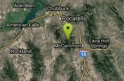
Scout Mountain Campground
Pocatello, Idaho
5.0 miles SScout Mountain Campground is located on beautiful Scout Mountain at an elevation of 6,900 feet, just 13 miles south of Pocatello, Idaho. Scout Mountain is part of the Mink Creek area, a popular...
Camp, Hike 0.2-9.7 mi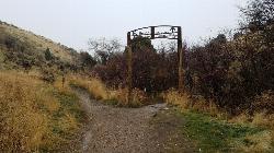
City Creek
Pocatello, Idaho
6.9 miles NWThe City Creek Management Area (CCMA) Trail System is a vast network of trails maintained by the City of Pocatello. There are trails to go up and others to come down. Most trails come back to the...
Hike, Horseback, Mountain Bike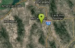
Garden Creek Gap
McCammon, Idaho
13.6 miles SGarden Creek Gap is the defile Garden Creek cuts through as it flows toward Marsh Creek on the east side of the Bannock Range after draining a sizable chunk of territory on the west side of those...
Cross-country Ski, Hike, Horseback, Rock Climb
Sportsman's Park American Falls Reservoir
Aberdeen, Idaho
23.3 miles NWThis beautiful 30-acre park is a multi-use area with facilities and activities for a variety of recreational uses. Situated adjacent to the American Falls Reservoir, it provides primary access to...
Camp, Canoe, Hike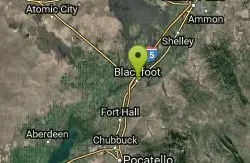
Blackfoot, ID 83221, United States
Blackfoot, Idaho
29.8 miles NHike and Mountain Bike near Blackfoot, Idaho
Hike, Mountain Bike
Hell's Half Acre Northbound Rest Stop
Blackfoot, Idaho
38.0 miles NThis is a well maintained rest area with facilities to keep you happy as you travel through Idaho. This rest stop on Interstate 15 about 9 miles north of Blackfoot Idaho has nice picnic tables and...
Hike
Hell's Half Acre Southbound Rest Stop
Blackfoot, Idaho
38.2 miles NThis is a well maintained rest area with facilities to keep you happy as you travel through Idaho. This rest stop on Interstate 15 about 15 miles South of Idaho Falls has nice picnic tables and...
Hike
Firth River Bottoms
Firth, Idaho
39.1 miles NWhether you like to ride horses, picnic, camp, fish, learn about the past, or play baseball, this park has something for everyone. The Parks & Recreation Department and the IDaho Education...
Camp, Canoe, Hike 0.1 mi
40 Horse Cave
Firth, Idaho
42.5 miles NEThe naming of the cave comes from a story of two men who were caught in a bad storm. Upon hiking, these two guys were able to find the cave. One of them commented to the other, "This cave could...
Cave, HikeNearby Campsites
Scout Mountain Campground
Pocatello, Idaho
5.0 miles SScout Mountain Campground is located on beautiful Scout Mountain at an elevation of 6,900 feet, just 13 miles south of Pocatello, Idaho. Scout Mountain is part of the Mink Creek area, a popular...
Camp, Hike
Hawkins Reservoir Campground
Arimo, Idaho
17.5 miles S14 campsites on a small impoundment, which despite its size, attracts a great deal of wildlife. Spring through fall, plovers, sandpipers and geese frolic in the mudflats and swim in the waters....
Camp, Canoe
Sportsman's Park American Falls Reservoir
Aberdeen, Idaho
23.3 miles NWThis beautiful 30-acre park is a multi-use area with facilities and activities for a variety of recreational uses. Situated adjacent to the American Falls Reservoir, it provides primary access to...
Camp, Canoe, Hike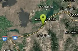
Pipeline Campground
American Falls, Idaho
25.6 miles W5 campsites on the Snake River near American Falls Reservoir. Fishing for trophy brown and rainbow trout. More than 30 species of migratory shorebirds rest at the reservoir. From the campground, you...
Camp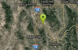
Downata Hot Springs
Downey, Idaho
30.3 miles SEDownata Hot Springs is a full-service hot springs resort south of Pocatello. During the summer, Downata offers a variety of activities for families including a large naturally-heated pool, four large...
Camp, Hot Springs, Swim
Blackfoot River Crossing at Trail Creek Road
Firth, Idaho
35.4 miles NEIn Soda Springs, ID 34 N for ~11 mi; R (E) on Blackfoot River Rd at mp 69.9; zero odometer; travel 10.4 mi; stay to the L as rd turns to gravel at mi 10.9; mi 13.7 pass Mill Canyon Campground; mi...
Camp
Firth River Bottoms
Firth, Idaho
39.1 miles NWhether you like to ride horses, picnic, camp, fish, learn about the past, or play baseball, this park has something for everyone. The Parks & Recreation Department and the IDaho Education...
Camp, Canoe, Hike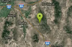
Sublett Creek Campground
Malta, Idaho
44.2 miles SW5500-foot elevation. 9 campsites on Sublett Creek, and 2 miles east of Sublett Reservoir. Access to Sublett Reservoir from the north shore.Campground can be used for picnicking and holds 40 people....
Camp, Canoe
Sealander Park
Idaho Falls, Idaho
48.3 miles NThe story of Sealander park begins with Carl Sealander. Leaving Sweden in 1893 at the age of seventeen, Carl worked in mining communities across Colorado and Utah before meeting his wife, Lizzie...
Camp


