Trinity River below Pidgeon Point
Junction City, California
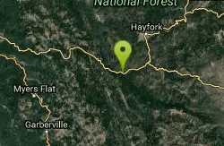
| Address: | ~Dutch Creek Road, Shasta-Trinity National Forest, Junction City, CA 96048, USA |
| GPS: |
40°46'1.1"N 123°7'58.6"W Maps | Directions |
| State: | California |
Whitewater
This is probably the third best intermediate run in California, after the Stanislaus Camp 9 run (under New Melones Reservoir most of the time) and the South Fork of the American near Coloma. The Trinity is seldom or never crowded, and runs all year long, although it could be too high after big rainstorms. Water is clear and clean, and somewhat warmer than Sierra rivers. Camping is plentiful, although possibly mosquito-infested in springtime. Motel rooms are often available if you prefer not to rough it. Best of all, there are no put-in or take-out fees!
Two drawbacks are the long drive from population centers, and the short river distance. The second problem can be overcome by aggressive surfing, by making two runs in a day, or by combining this run with class II stretches downstream.
For details about each run and each point of the run, see http://cacreeks.com/trin-hel.htm
More Information
California Creeks - Trinity Pigeon Point
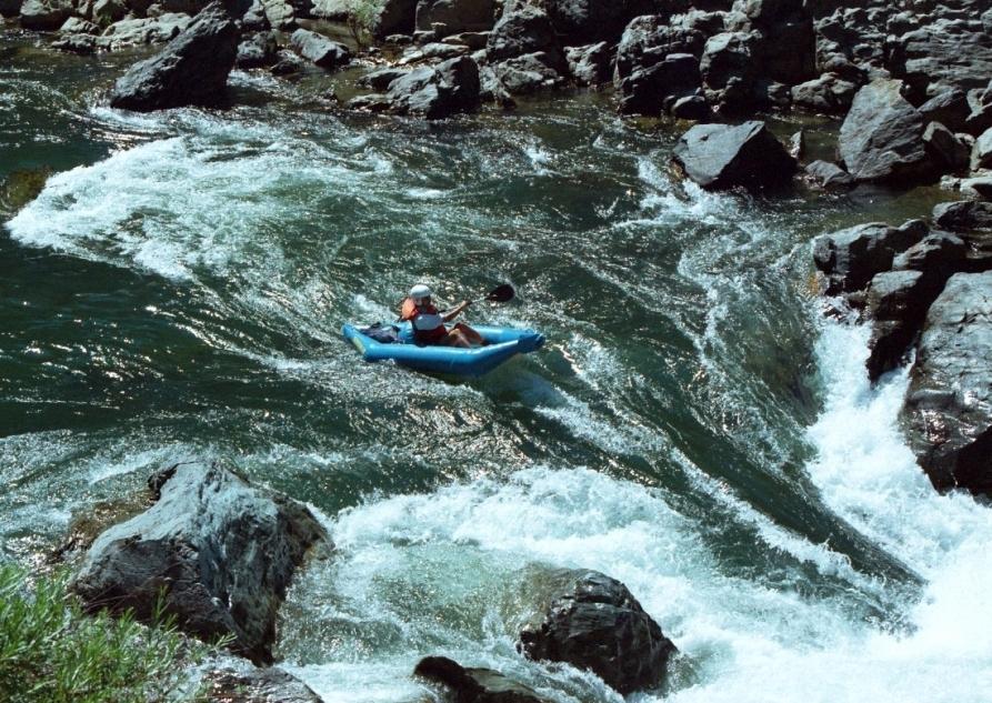
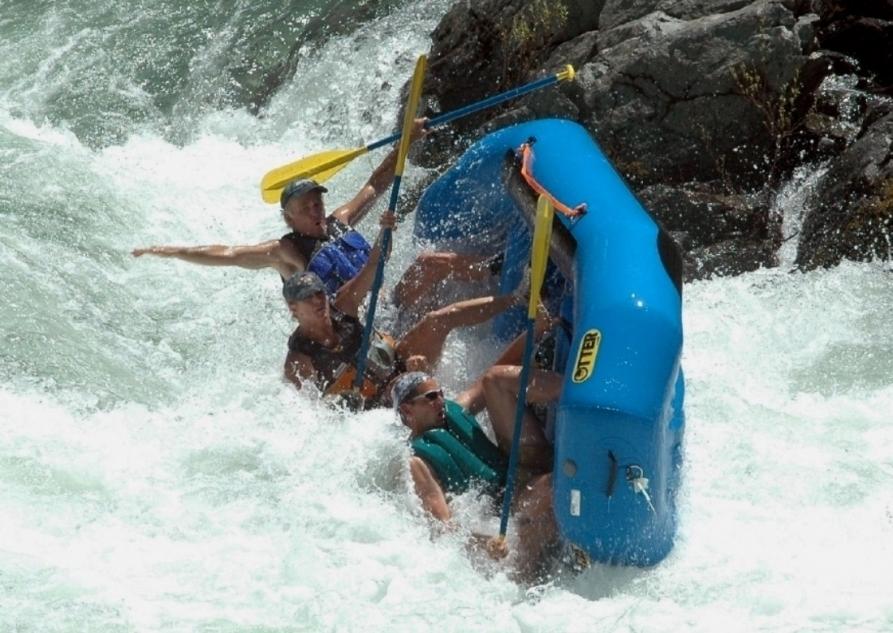
Trinity River below Pigeon Point Stretch: North Fork Confluence to Big Flat campground Difficulty: Class III with one IV- (harder above 1000 cfs) Distance: 5.5 miles, half day Flows: rafts (500) 800 - 5000, kayaks 500 - 4000, IK minimum 400 Gauge: interpolate flows at Douglas City (DGC) and Hoopa (HPA) Gradient: 27 fpm average, pool and drop Put-in: highway bridge at North Fork confluence, 1375' Take-out: along highway near Big Flat campground, 1225' Shuttle: 6 miles (10 minutes) one-way Maps: USFS Trinity NF, AAA North California, nice PDF map, Topo Season: year round, from dam release and snowmelt Agency: USFS, private, guided Whitewater Rafting Notes: © 1998, 2012 Bill Tuthill, CreeksYahoo Here is the latest Flow Release Schedule for Lewiston Dam. This is probably the third best intermediate run in California, after the Stanislaus Camp 9 run (under New Melones Reservoir most of the time) and the South Fork of the American near Coloma. The Trinity is seldom or never crowded, and runs all year long, although it could be too high after big rainstorms. Water is clear and clean, and somewhat warmer than Sierra rivers. Camping is plentiful, although possibly mosquito-infested in springtime. Motel rooms are often available if you prefer not to rough it. Best of all, there are no put-in or take-out fees! Two drawbacks are the long drive from population centers, and the short river distance. The second problem can be overcome by aggressive surfing, by making two runs in a day, or by combining this run with class II stretches downstream. David Elliott made the following remarks about downstream runs: Big Flat to French Bar, 8.3 miles. While it may look flat from the road, this section offers quite a few nice class II-II+ rapids. This is a good section to tack onto the end of the Pigeon Point run on a hot day when the river is more inviting than the campground. There are plenty of swimming spots between the rapids. French Bar is a good take-out for the last day of boating, because the rocks make a good place to dry out boats and clothing for the trip home. When flows are high, this can be a good starting point for a run all the way to Cedar Flat, but don't even consider the full run below 1600 cfs, and even then you'll want to get on the river by 11:00 AM. French Bar to Hayden Flat, 3.4 miles. The California Whitewater book mentions a class II+ rapid and a cave right below French Bar, but I have never seen the cave and the rapid doesn't compensate for the run below. This is the boring section. If you aren't doing the entire run to spend the whole day on the river, this section really isn't worth it. Hayden Flat to Cedar Flat, 6.7 miles. This section has the best rapids of the three, and is more popular with kayakers and tubers than the sections above. There are several class II+ rapids with big holes and waves, and one long gorge that ends in a big hole (see photos of the Trinity above Cedar Flat). The gorge borders on class III and can be seen from the road. Just above take-out, Don Juan rapid contains some big waves. For class II people at flows below 2000 cfs, choose either Big Flat to French Bar, or Hayden Flat to Cedar Flat; at flows above 2000 cfs, the whole run is recommended. For class III people, run Pigeon Point to Big Flat every day you can. Add on the section to French's Bar if flows are higher than 2500 cfs or if you just want to relax (below 1000 cfs however, don't bother with the class II sections). This mile-by-mile description covers only the class III section from the north fork confluence (above Pigeon Point campground) to Big Flat (near a private and USFS campground). mile0 Put in under the highway 299 bridge over the North Fork. Upstream the scenery has been degraded by hydraulic mining. .2 Pigeon Point USFS campground on the right bank makes an alternate put-in, but involves a carry down to the river. .5 unnamed class II+ Just beyond a cliff on the right, the river drops along the left bank and piles straight into a rock at the bottom. 2.1 slalom, class II+ Close to the highway, a long rock garden offers many opportunities for ferrying and surfing. 2.4 Z Drop, class III The river narrows and drops almost a meter thru a rock slot. At low and moderate flows you can scout from bedrock on the left. At high flows the bedrock creates a large reversal. Entering the V slick of Z Drop This boater does a partial tailstand! 2.7 Eagle Creek enters on the left. Between here and Hell Hole, boaters encounter 3 excellent class III- rapids that tend to be overlooked in anticipation of Hell Hole, and forgotten afterwards. The final one is a complicated rock slalom at low flows, with many surfing spots at higher flows. 3.5 Hell Hole, AKA Dynamite, class IV-, scout left A ledge drop against a rock wall on the left, with boulder garden (not runnable at low flows) on the right. At typical flows the best route for inflatable kayaks is very close to the rock wall, where a surging wave circumvents a large reversal created by the ledge drop. It is almost impossible for inflatable kayaks to run the ledge drop hole without flipping. Fortunately the swim is clean and there is a large recovery pool below. At higher flows the boulder garden is your best route: above 2500 cfs, the right side is a series of 4 to 6 big waves with nearby holes, and lots of fun! Jonika goes vertical right into the hole Larry gets sideways and does a nice Cha-cha-cha Those views are from the photographer spot near river level. These views are from the road on river right. Lined up ready to punch Hell Hole! The paddler washes out in the surging hydraulics A photographer records this for posterity Rearview mirror view downstream of Hell Hole 4.2 Sailor's Bar, class III This contains several large holes behind submerged boulders, all of which can be avoided if you choose the correct line. 5.3 Triple Drop, class III A long boulder garden with many possible routes. One route starts on the left with a foot-high falls, moves center over another drop, and finishes with a third drop on the right. Other routes avoid all three drops. 5.4 Fish Tail, class III Several shallow drops over bedrock lead to the final hydraulic, which slaps you (like a fish tail) against the right bank. Sideways over the shallow drops After being slapped by the Fishtail 5.5 Take out at a sandy beach on the right bank. Big Flat campground is just across the highway. Shuttle Directions To reach take-out, drive west from Redding on highway 299 about 65 miles to the hamlet of Big Flat, where there is a store with trailer park, not far west of the USFS campground. To reach put-in from there, drive upstream about 6 miles past Pigeon Point campground to the Helena side road, where the North Fork enters. Parking near the highway bridge is somewhat limited. To find nearby food and lodging, type Weaverville into the box and click Search. @import url(http://www.google.com/cse/api/branding.css); Custom Search Creeks Navigation Home Recommended Runs Map of Rivers Alphabetic Index Alphabetic Table Text Search Sponsored Links (adsbygoogle = window.adsbygoogle || []).push({});
https://cacreeks.com/trin-hel.htm
- Plan Ahead and Prepare
- Travel & camp on durable surfaces
- Dispose of waste properly
- Leave what you find
- Minimize campfire impacts
- Respect wildlife
- Be considerate of other visitors
Directions
From Junction City, California
- Head north on CA-299 W toward Power House Rd (6.6 mi)