


Oak Bottom River Access
Somes Bar
Camp, Kayak, and Swim
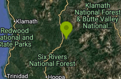
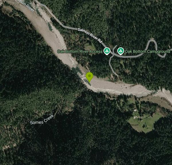
Oak Bottom River Access is a free Klamath National Forest access point on the Salmon River, a federally designated Wild and Scenic River, about a mile east of Somes Bar in Siskiyou County. It sits directly across Salmon River Road from Oak Bottom Campground, which is run by the Ukonom Ranger District of Six Rivers National Forest. The Karuk name for the place is Vunxarak. The two sites work as a pair: campers walk across the road to the water, and day visitors park on the river bar without paying anything.
From Orleans, drive about 8 miles north on Highway 96 to Somes Bar, then turn east onto Salmon River Road (County Road 2B01) and go roughly 2.2 miles to a gravel road on the right. That graded gravel ramp drops to a parking area on an open cobble bar. From there it is a short walk over rocks to the water. Coming from the campground, it is a walk across the road and down the ramp. The campground itself takes trailers up to 35 feet.
The river here runs through a steep canyon of Douglas fir and hardwoods. The bar is cobble and gravel, so water shoes help. Just downstream of the parking area the current is squeezed against a boulder bar and forms the Oak Bottom rapid, a Class II set of standing waves that kayakers surf. Swimmers should stay in the slower water along the bar and well upstream of that wave. The Salmon is cold and pushy during spring snowmelt and settles into much lower, warmer summer flows; the USGS gauge at Somes Bar, about a mile downstream, is the best way to check conditions before you go. There are no lifeguards, no posted swim area and no water temperature reporting.
Day use of the river access is free, and the Forest Service lists no fee and no set hours. Overnight camping is not allowed on the bar, and there is no drinking water or listed restroom there. Oak Bottom Campground across the road has 25 sites at $10 per night including one vehicle, plus $5 for each additional vehicle, paid in cash (exact change) or check to USDA. Sites can be reserved on Recreation.gov, some are first come, first served, and the campground is open from mid-May through mid-October. It has vault toilets, drinking water (the Forest Service notes the system is sometimes under repair), bear lockers, tables and fire rings.
Wildfire closures and seasonal fire restrictions are common along the Salmon in late summer, so check the forest alerts pages before you go. Oak Bottom Campground is a designated fire safe site under Six Rivers fire restriction orders, while on the river bar the Klamath National Forest requires a California Campfire Permit for any stove or fire and local restrictions take precedence. This stretch of river is Karuk ancestral territory; nearby George Geary River Access is closed at times each summer for tribal ceremonies, and visitors are asked to respect those closures.
Other public accesses on the lower Salmon include Blue Hole, about two miles upriver from Highway 96, and George Geary, a day-use bar popular with local families. Somes Bar has a small store with groceries, propane and tackle. Spring brings rafters and kayakers for the Class III to V whitewater upstream, and fall brings salmon and steelhead anglers to the Klamath River, about 15 minutes away.
More Information
Klamath National Forest & Butte Valley National Grassland | Oak Bottom River Access | Forest Service
Across the road from the Oak Bottom Campground this access is a graded gravel ramp to parking on a cobble bar. Boats must be carried a short distance to the water.
https://www.fs.usda.gov/r05/klamath/recreation/oak-bottom-river-accessKlamath National Forest & Butte Valley National Grassland | Salmon National Wild & Scenic River | Fo
The Salmon River was designated a Scenic River and Recreational River within the National Wild & Scenic Rivers System in 1981. The South Fork of the Salmon was designated a Scenic and Recreational River, and the North Fork of the Salmon was designated a Wild and Recreational River, also in 1981.The watersheds of two great wilderness areas combine to form the Salmon River. The North Fork of the Salmon River begins high up in the Marble Mountains Wilderness, and the South Fork of the Salmon finds its origins in the Trinity Alps Wilderness. The two forks join forces at a place aptly called Forks of Salmon. Twenty miles further west, the Salmon River empties into the Klamath and continues on to the Pacific Ocean. This area is rich with the culture of native people and the history of gold seekers and pioneers.
https://www.fs.usda.gov/r05/klamath/recreation/salmon-national-wild-scenic-river-0Lower Salmon | American Whitewater
National Whitewater Inventory
https://www.americanwhitewater.org/content/River/view/river-detail/11392/mainOak Bottom (Vunxàrak), California boat ramp and access | How's Your River
Public boat ramp and water access at Oak Bottom (Vunxàrak) on Salmon in California. Map, directions, nearby USGS conditions, and amenities.
https://www.howsyourriver.com/access_sites/oak-bottom-caOak Bottom Campground, Six Rivers National Forest - Recreation.gov
Explore Oak Bottom Campground in Six Rivers National Forest, California with Recreation.gov. PLEASE NOTE THIS IS NOT OAK BOTTOM CAMPGROUND AT WHISKEYTOWN LAKE. FOR THAT SITE NEAR REDDING, CALL 530-359-2269 Open from mid-May through mid-October, this
https://www.recreation.gov/camping/campgrounds/234608Six Rivers National Forest | Forest Fire Restrictions | Forest Service
Due to dry conditions and increasing fire danger, the Six Rivers National Forest is implementing fire restrictions, beginning July 3, 2026. These restrictions apply to all of the Six Rivers National Forest (SRF) and land administered by the SRF which includes the Ukonom Ranger District of the Klamath National Forest. Forest visitors may still have a campfire within a designated fire safe site, developed recreation site, and in designated Wilderness areas. Restrictions are expected to be lifted on November 16, 2026, conditions permitting.
https://www.fs.usda.gov/r05/sixrivers/alerts/forest-fire-restrictionsSix Rivers National Forest | Oak Bottom Campground | Forest Service
Oak Bottom Campground is located on a gently sloping hillside in a mixed Douglas fir and hardwood forest. It offers a peaceful environment, free from road noise and other distractions. Located near the California Salmon River, the campground is popular with whitewater enthusiasts in the spring. Many challenging rapids ranging from class 3 to 5 are a short distance away. Swimming is also popular in the summer and numerous river accesses are a short drive or walk from the campground. In the fall salmon and steelhead fishing in the Klamath River are within a 15 minute drive. The small town of Somes Bar is 2.5 miles from the campground where propane, groceries, post office and tackle are available at the store. Maximum trailer length of 35'.Note: this is NOT the Oak Bottom campground at Whiskeytown Reservoir.
https://www.fs.usda.gov/r05/sixrivers/recreation/oak-bottom-campground
- Plan Ahead and Prepare
- Travel & camp on durable surfaces
- Dispose of waste properly
- Leave what you find
- Minimize campfire impacts
- Respect wildlife
- Be considerate of other visitors
Directions
From Somes Bar
- Head southwest toward CA-96 E (0.7 mi)
- Turn right onto CA-96 E (0.3 mi)
- Turn right onto Salmon River Rd (2.2 mi)
- Turn right (394 ft)
Other Swimming Holes and Kayaking Areas Nearby
Clear Creek
Happy Camp, California
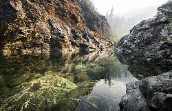
23.2 miles NCrystal-clear pools in a beautiful, secluded canyon near Happy Camp — two swimming areas, the second with slightly easier access, and light crowds all summer.
Swim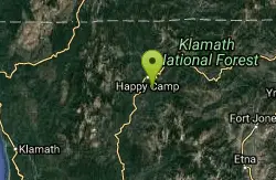
Elk Creek Holes
Happy Camp, California
26.3 miles NThese swimming holes are found along the Elk Creek. If willing to hike around and explore, there are several different spots that visitors can stop and take a swim.
Swim
Big Rock Day Use Area & River Access
Willow Creek
30.9 miles SBig Rock is a free Six Rivers National Forest day-use access on the Trinity River in Willow Creek, used for swimming, picnicking, fishing and floating. No lifeguard, cold spring flows and strong current around the rock.
Kayak, Swim
The Eddy
Happy Camp, California
31.9 miles NA popular family swimming hole and tubing spot on a Klamath River tributary near remote Happy Camp, California — uncrowded thanks to the town's off-the-beaten-path location.
Swim
Happy Camp Area
Happy Camp, California
31.9 miles NSwim near Happy Camp, California
Swim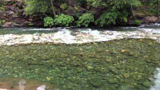
Indian Creek, South Fork
Happy Camp, California
34.9 miles NIndian Creek's South Fork swirls through several natural Jacuzzi-like eddies, with a popular calm pool right after the bridge that's gentle enough for any swimmer.
Swim
Stuarts Fork Swimming Hole
Trinity Center, California
42.2 miles SEStuart Fork next to the trailhead parking in Trinity County offers a quiet local swimming hole at the edge of California's Trinity Alps wilderness.
Swim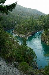
Forks River Access
Hiouchi
42.6 miles NWFree Forest Service day-use access at the confluence of the South Fork and the Smith River near Hiouchi, with short paths to sand and pebble beaches, cliff pools and the Second Bridge swim spot.
Canoe, Hike, Kayak, Swim
Willow Creek Area
Olympic Valley, California
43.9 miles SSwim near Olympic Valley, California
Swim
Stoney Creek Swim Area
Weaverville
48.0 miles SEA small, sheltered Forest Service swim beach on a Stoney Creek inlet of Trinity Lake's Stuart Fork arm, 14 miles north of Weaverville. $10 per vehicle, open May 20 to Sept. 12 while lake levels allow.
Swim
Applegate Area
Princeton, Oregon
49.8 miles NSwim near Princeton, Oregon
Swim


