


5 Bucket List by christensenda
first prev 1 next last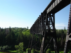
Ashton to Tetonia Trail
Ashton, Idaho
0.7 miles NE of Ashton, IdahoThe Idaho Department of Parks and Recreation undertook the project to transform the old Teton Valley Branch of the Union Pacific Railroad from Ashton to Tetonia into a trail for bikes, ATVs, and snowmobiles, runners, cross-country skiers, and horses. The trail goes from Ashton to Tetonia and can be accessed via Ashton, Marysville, Bitch Creek, Felt, or Tetonia. Information can be found at kiosks in Marysville and at Bitch Creek.
Elevation Gain (Southbound): 787 ft
Length: 29.6 mi
Blacktail Day Use Area
Ririe, Idaho
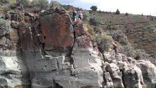
3.9 miles SE of Ririe, IdahoTucked onto the north end of Ririe Reservoir east of Idaho Falls, the Blacktail Day Use Area is eastern Idaho's go-to spot for cliff jumping and lakeside thrills. While the main reservoir draws boaters and swimmers, this rugged little park is all about the rocks — a string of cliffs above clear, deep water that has made it a summer rite of passage for adventurous locals.
From the south end of the parking lot, a trail leads down along the cliffs to a series of jumping spots that range from low, beginner-friendly ledges just above the water all the way up to dramatic perches as high as 80 feet. Whether you want a gentle splash or a serious leap, there's a launch point to match your nerve — and the same cliffs draw rock climbers looking to scramble the rugged shoreline.
Cliff jumping is genuinely dangerous, so use your head. Always check the water depth and watch for submerged or shifting rocks before you jump, since conditions and water levels change through the season. Start low, never dive headfirst, never jump into water you haven't checked, and skip the higher ledges unless you really know the spot. There are no lifeguards here, so look out for each other and know your limits.
The Blacktail Day Use Area is managed by Bonneville County, with a modest day-use fee (around $3 on weekdays and $5 on weekends and holidays). Summer is the season, when the water's warm and the cliffs are busy with sun-seekers; weekday mornings are quieter if you'd rather have a little more room.
Bring water, sun protection, and sturdy shoes for the rocky trail, pack out everything you bring in, and you'll see why this cliff-lined corner of Ririe Reservoir is one of eastern Idaho's most exhilarating summer hangouts.
Ryder Park
Idaho Falls, Idaho
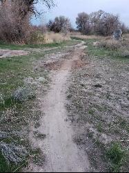
2.4 miles SW of Idaho Falls, IdahoAdjacent to the pond at Ryder Park is a great little jump park. There are a few different lines of varying difficulty, all of them rather short, and a nice bike path to climb back to the top and do it all over again. The community that works on this park is very active with regular build nights through the riding season.
Ryder Park makes a great mountain biking option whether you just need to be on your bike when the hills aren't yet rideable, need something close to town for a quick ride, want to work on your jumps, or want to ride with your family or other group of varying skill levels.
Founder's Square Hill (Under the Water Tower)
Rexburg, Idaho
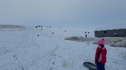
1.8 miles SE of Rexburg, IdahoThis is a great sledding hill. It's about the perfect steepness and really wide. It's also big enough to make it worth a little run on a snowboard or an inner tube. While this is a pretty popular hill, it's pretty hard for it to get overcrowded.
In 2017, some houses were built at the bottom of the hill that make it a little less perfect but there's still plenty of hill for a good time. You just need to be respectful of the people's homes and the end of the slope. There's also a little winding rutted dirt road that comes down to the left of the hill that sometimes is a pretty great little run if the snow's just right.
Intermittent Spring (Periodic Spring)
Afton, Wyoming
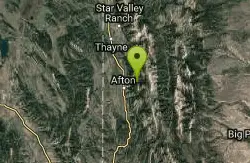
4.1 miles NE of Afton, WyomingThe Periodic spring is the largest of three intermittent springs in the world. From late August to May, the flow cycles on and off at regular, predictable intervals. The spring runs up to 100 cubic feet per second of clear, ice cold water for about 18 minutes. The water then begins to subside and gradually ceases altogether for 15-20minutes. The Spring is located approximately five miles East of Afton, Wyoming.
Getting there: a short, easy trail of about three-quarters of a mile leads to the spring from the trailhead five miles east of Afton, up Swift Creek Canyon. The path is wide and lightly graveled, narrowing near the end where it crosses a couple of logs before a footbridge over Swift Creek brings you to the spring. Picnic tables sit nearby and the shallow water is a fun place for kids to play. It is an easy enough walk that a stroller works to the point where the trail narrows. Expect company on summer weekends.


