


Worlds End State Park Swimming Area
Forksville
Camp, Hike, Kayak, and Swim
Closed for the season. Pennsylvania runs the Worlds End swim area from Memorial Day weekend through Labor Day, sunrise to sunset, and outside that window the beach is shut. Plan a trip here between late May and early September or the water is off limits.
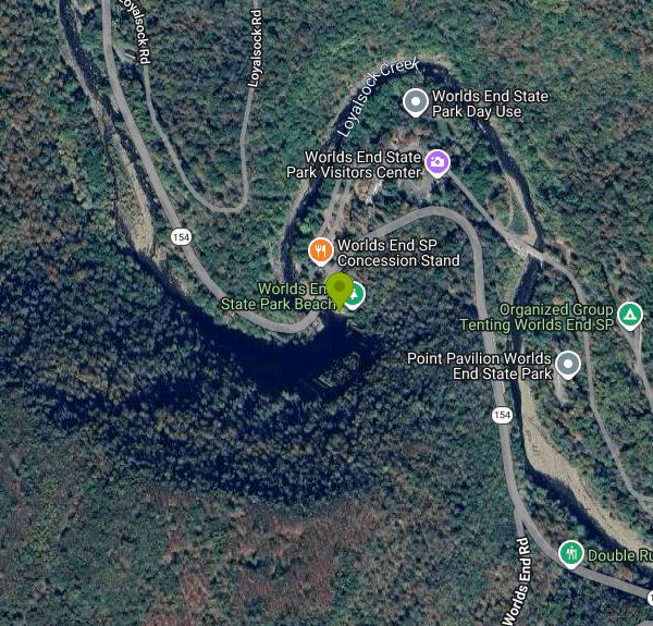
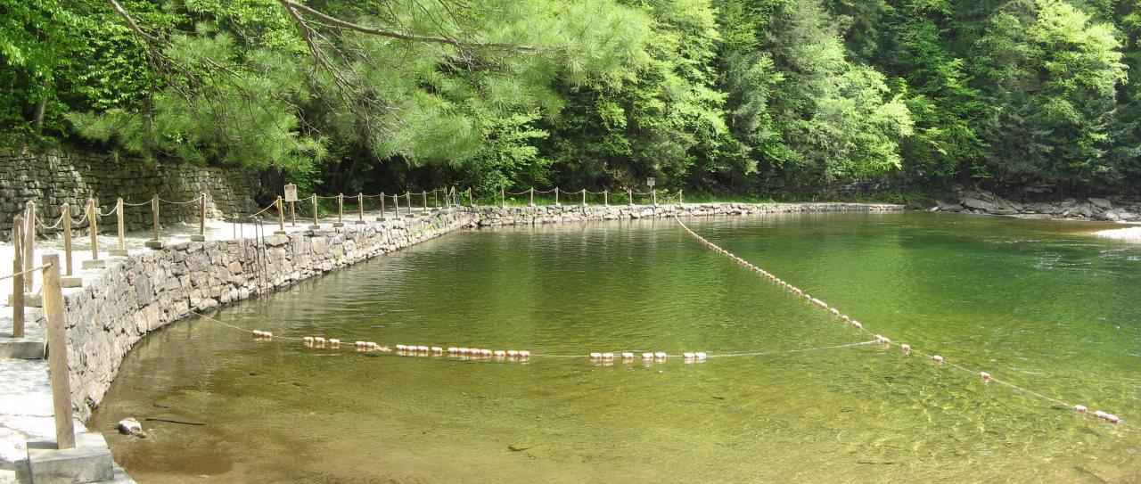
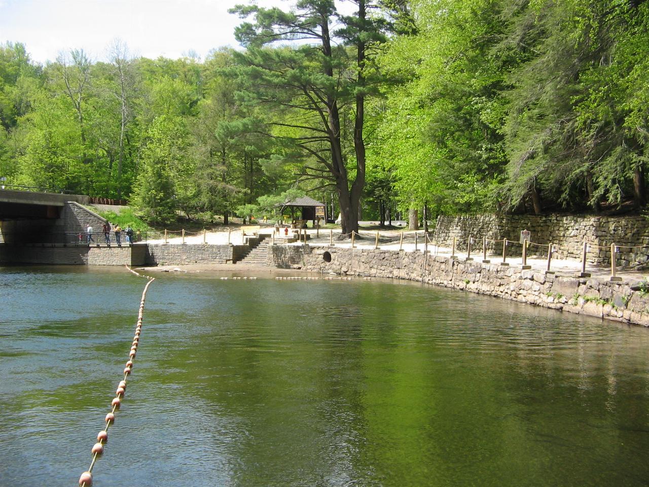
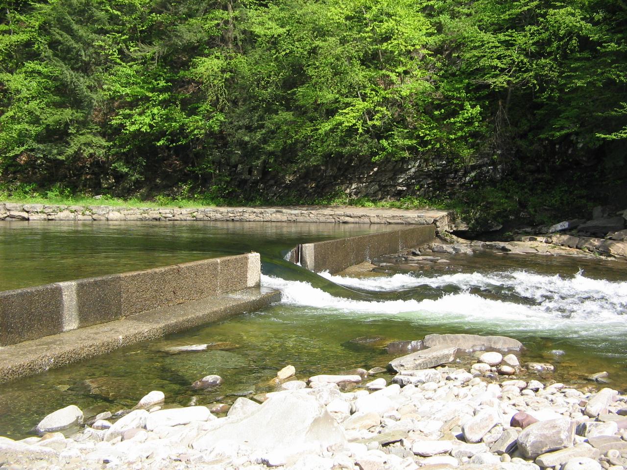
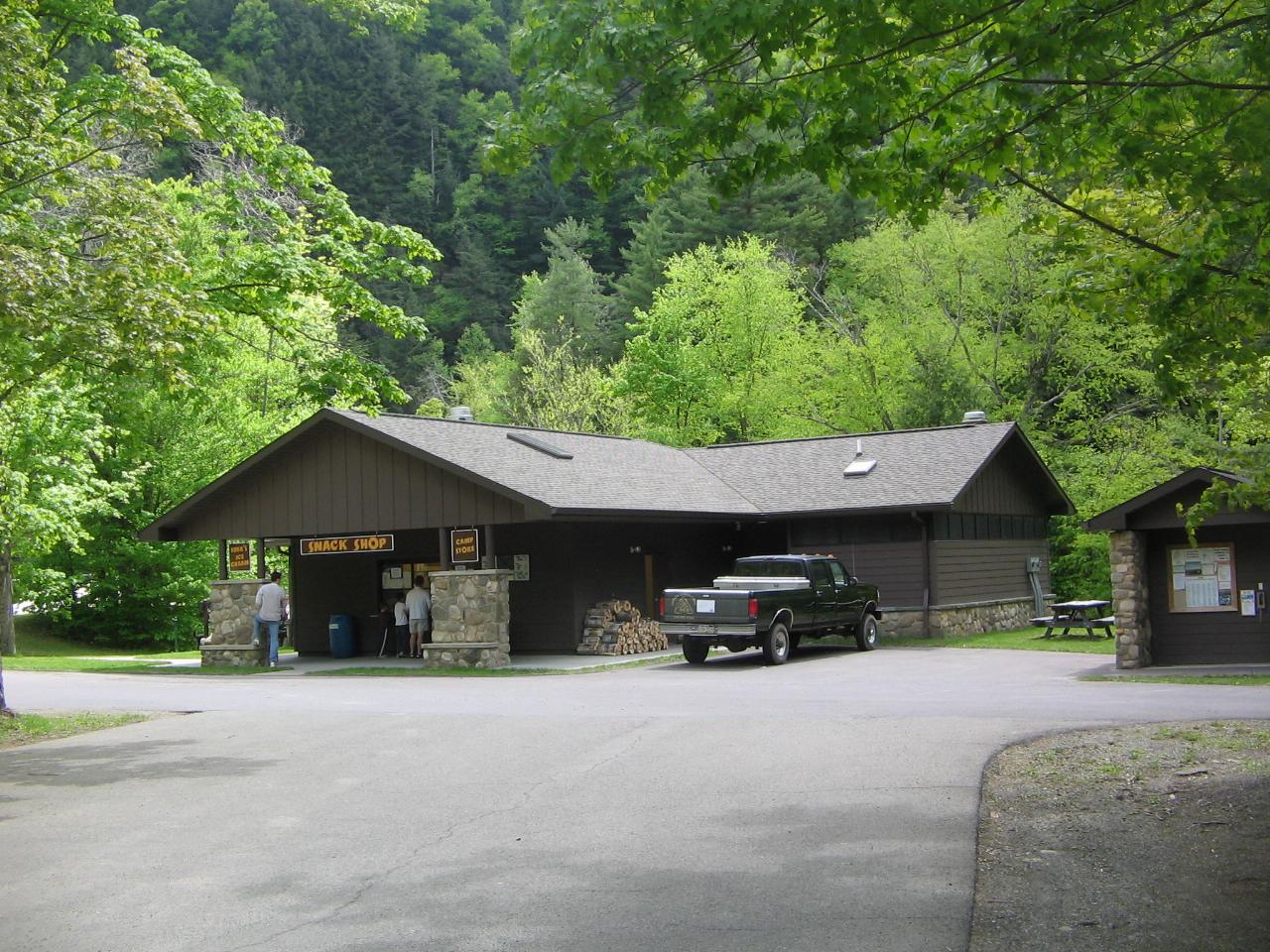
The listing name points at the wrong building. The visitors center is a 4,300 square foot facility that opened in 2002 near the park entrance, and nobody swims there. The actual swimming hole sits about 300 yards downstream of the park office on Cabin Bridge Road, where a seven foot dam built by the Civilian Conservation Corps in the 1930s backs Loyalsock Creek up into a pool of roughly one acre. The CCC crews blasted bedrock out of the creek bed to deepen it. A gravel and sand beach lines the bank, a stone beach house and concession stand stand just above it, and a boat chute notches the dam at the downstream end.
Nothing costs anything to get in. DCNR states plainly that there are no entrance fees or day use fees for any state park in Pennsylvania, so parking, the beach and the water are free. Money only changes hands for camping, the cabins and reservation fees.
There has been no lifeguard on this beach since 2008. You swim at your own risk and the posted rules at the beach are the ones that apply. Swimming is also confined to the marked area: 17 Pa. Code section 11.217 makes swimming outside a designated swimming area a violation in every Pennsylvania state park, which means the rest of Loyalsock Creek inside the park boundary is not a legal alternative. That includes the waterfall on High Rock Run reached by the one mile High Rock Trail and the pools scattered through the Rock Garden. Those are worth the walk, but they are for looking at.
The creek itself is the thing to respect. Loyalsock drains steep forested ground upstream, and DCNR warns paddlers that the water level fluctuates rapidly and to check conditions before driving in. The same warning applies to swimmers. Rain in the headwaters arrives here within hours and the pool can go from a flat green swimming hole to pushy brown current. The park's flood record is long: the August 1933 flood wrecked the newly built CCC camp, another came in 1936, and 1972, 1975, 1996 and 2011 all set marks. Hurricane Irene and Tropical Storm Lee hit within eleven days of each other in 2011 and campers had to be evacuated.
Water temperature is the other thing people are not ready for. This is a shaded mountain stream at about 1,175 feet of elevation and it stays cold through August. Paddlers get the creek in spring, March through May, when it runs Class II to III plus with harder sections, and DCNR says outright that it is not suitable for open canoes. In summer the beach reach is closed to boats. Access is off PA Route 154 in Sullivan County, a few miles south of Forksville, with day use parking a short walk from the sand.
More Information
17 Pa. Code § 11.217. Swimming.
Information included at this site has been derived directly from the Pennsylvania Code, the Commonwealth
https://www.pacodeandbulletin.gov/Display/pacode?file=/secure/pacode/data/017/chapter11/s11.217.html&d=reduceLoyalsock Creek at Loyalsockville, PA - USGS Water Data for the Nation
Discover water data collected at monitoring location USGS-01552000, located in Lycoming County, Pennsylvania and find additional nearby monitoring locations.
https://waterdata.usgs.gov/monitoring-location/USGS-01552000State Park Prices | Department of Conservation and Natural Resources| Commonwealth of Pennsylvania
There are no entrance fees or day use fees for any state park in Pennsylvania.
https://www.pa.gov/agencies/dcnr/recreation/where-to-go/state-parks/state-park-pricesWhitewater Boating at Worlds End State Park | Department of Conservation and Natural Resources| Comm
Whitewater boaters may use Loyalsock Creek at any time of the year, although the area by the swimming beach is closed during the summer. The best water is March to May. Due to rapid fluctuations in wa...
https://www.pa.gov/agencies/dcnr/recreation/where-to-go/state-parks/find-a-park/worlds-end-state-park/whitewater-boatingWorlds End State Park - Wikipedia
Worlds End State Park and Loyalsock Creek from the Canyon Vista on Cold Run Road
https://en.wikipedia.org/wiki/Worlds_End_State_ParkBe courteous, informed, and prepared. Read trailhead guidelines, stay on the trail, and don't feed the wildlife.
Read More
- Plan Ahead and Prepare
- Travel & camp on durable surfaces
- Dispose of waste properly
- Leave what you find
- Minimize campfire impacts
- Respect wildlife
- Be considerate of other visitors
Directions
From Forksville
- Head southeast on Cottage Ln toward Bridge St (33 ft)
- Turn left onto Bridge St (276 ft)
- Turn right onto PA-154 EDestination will be on the right(1.7 mi)
 The dammed pool on Loyalsock Creek that forms the park swimming area courtesy of User:Ruhrfisch↗ (CC BY-SA 3.0↗)
 Beach and swim area seen from near the dam courtesy of User:Ruhrfisch↗ (CC BY-SA 3.0↗)
 The seven foot CCC dam that holds the swimming pool back courtesy of User:Ruhrfisch↗ (CC BY-SA 3.0↗)
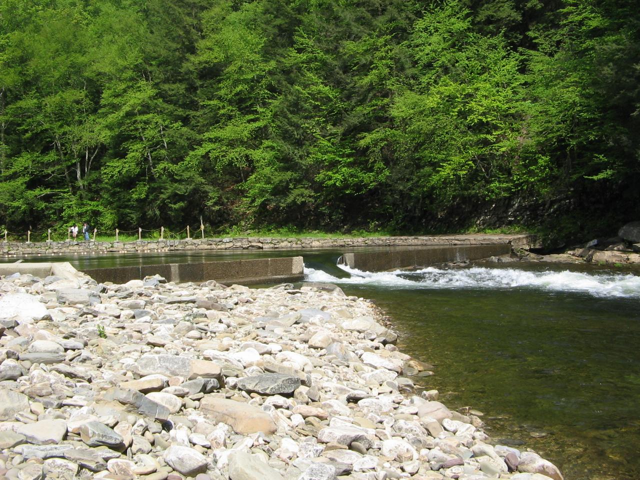
 Boat chute notched into the dam at the downstream end of the pool courtesy of User:Ruhrfisch↗ (CC BY-SA 3.0↗)
 Beach house and concession stand above the swim area courtesy of User:Ruhrfisch↗ (CC BY-SA 3.0↗)
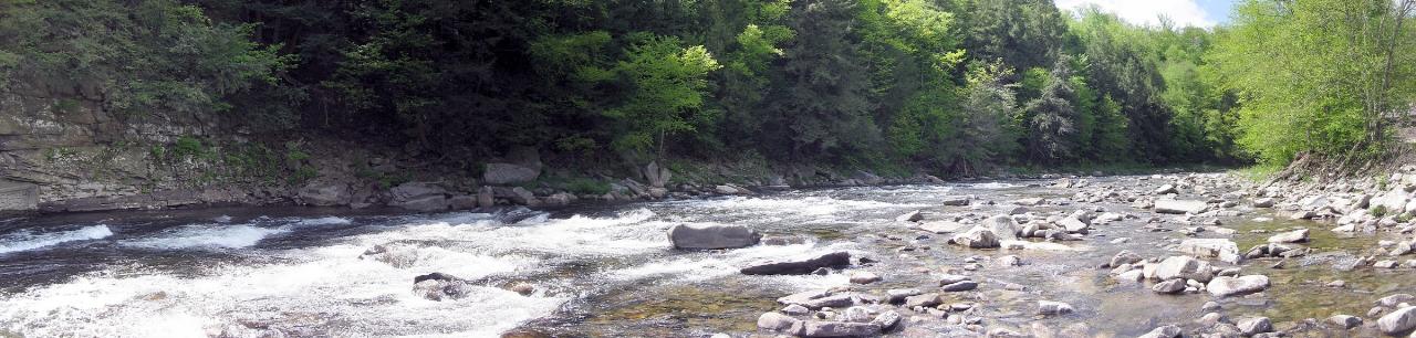
 Loyalsock Creek just upstream of the PA Route 154 bridge courtesy of User:Ruhrfisch↗ (CC BY-SA 3.0↗)
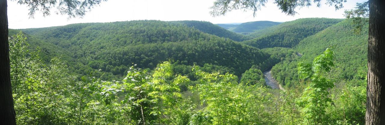
 The Loyalsock Creek valley seen from Canyon Vista above the park courtesy of User:Ruhrfisch↗ (CC BY-SA 3.0↗)
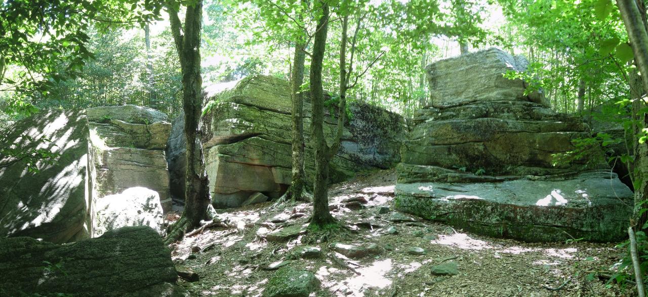
 Pottsville Formation conglomerate in the Rock Garden courtesy of User:Ruhrfisch↗ (CC BY-SA 4.0↗)
Other Swimming Holes, Hiking Trails, and Kayaking Areas Nearby
Rockrun Area
Carregal do Sal, Viseu
18.5 miles WSwimming holes in beautiful Rock Run Creek in Tidaghton State Forest, Pennsylvania — a serene natural spot where bathing suits may be optional.
Swim
Ricketts Glen State Park
Benton, Pennsylvania
18.7 miles SESwim near Benton, Pennsylvania
Swim
Loyalsock Creek Area
Forksville, Pennsylvania
19.8 miles SWSwim near Forksville, Pennsylvania
Swim
Sugar Creek
Troy, Pennsylvania
23.7 miles NWSwim near Troy, Pennsylvania
Swim
Pirate Rock
Blossburg, Pennsylvania
26.5 miles NWPirate Rock is an off-the-grid Upper Tioga River swimming hole near Blossburg, PA — strikingly clear blue water (from acid mine drainage upstream).
Swim
Little Shickshinny Creek Falls
Shickshinny, Pennsylvania
30.9 miles SESwim near Shickshinny, Pennsylvania
Swim
Raymond B. Winter State Park
Lewisburg, Pennsylvania
35.1 miles NWSwim near Lewisburg, Pennsylvania
Swim 1.0 mi
Little Rocky Glen
Factoryville, Pennsylvania
39.2 miles EA beautiful gorge with waterfalls, pools, and hemlock-lined walls winds through this 59-acre Lackawanna County preserve on Little Rocky Glen Creek — great for fit hikers.
Hike
Pine Creek Area
Cross Fork, Pennsylvania
40.3 miles WSwim near Cross Fork, Pennsylvania
Swim
Short Hole
Osceola, Pennsylvania
49.3 miles NWSwim near Osceola, Pennsylvania
Swim


