


Beaver Creek Dispersed Camping
Rimrock, Arizona

| Address: | Soda Springs Rd, Rimrock, AZ 86335, USA |
| GPS: |
34°40'24.6"N 111°43'47.4"W Maps | Directions |
| State: | Arizona |
Camp
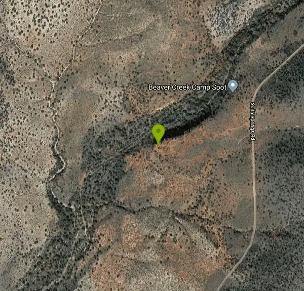
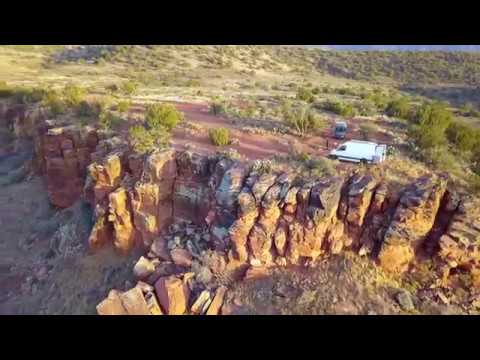
This free dispersed camping area sits on the cliffs above Wet Beaver Creek in the Coconino National Forest of central Arizona, in the red-rock and juniper country near Rimrock and Camp Verde, not far south of Sedona. Perched on the rim overlooking the creek, it offers exactly what desert dispersed camping should: a free, quiet, scenic spot to pitch a tent or park a rig under big Arizona skies, with one of the region's best swimming and hiking creeks right below.
The setting is the draw. The sites sit up on the cliffs and benches above Wet Beaver Creek, reached by the forest roads (the FR618 corridor) that thread this stretch of the Coconino, with sweeping views over the creek's green ribbon and the surrounding high desert. It's a popular free alternative to the developed campgrounds nearby, and it puts you within easy reach of the water and trails for the cost of nothing but a tank of gas.
Wet Beaver Creek itself is the reason many people come. The cool, clear waters are an excellent place to swim, wade, fish, hike and birdwatch, a genuine desert oasis, and the nearby Wet Beaver Wilderness and the famous swimming holes along the creek (including the well-known "Crack") give campers a real destination just below their tents. Cottonwoods and Arizona sycamores line the creek, a welcome contrast to the dry rim above.
This is undeveloped dispersed camping, so it's a fully self-supported outing: there is no water, no toilets and no trash service, and standard Coconino dispersed-camping rules apply, including stay limits and fire restrictions that are common and strictly enforced in this fire-prone country, so always check current fire status before lighting anything. The clifftop sites also mean watching footing and keeping an eye on kids and pets near the edges.
Fall through spring is the comfortable season here, since summer in the Verde Valley is genuinely hot, though the creek below offers relief; spring brings green and flowing water, and the shoulder seasons are ideal for both camping and the creek. Come with all your own water, a plan for packing out every bit of trash, a shovel and fire knowledge, sun protection, and sturdy footwear for the rimrock. For free, scenic, cliff-top dispersed camping above one of central Arizona's finest creeks, this is a rewarding spot.
More Information
Coconino National Forest | Wet Beaver Creek | Forest Service
This clear, cool brook remains pleasantly secluded in the deep red rock canyon it has cut into the southern rim of the Colorado Plateau. For much of its length, the land bordering Wet Beaver Creek has been declared a Wilderness Area, the Wet Beaver Wilderness.In addition to the opportunities for solitude such an area offers, the stream's pools and riffles are a popular place to fish, hike, swim, and bird watch. The waters of the stream are stocked with trout. The lush riparian area beside its banks is alive with a full palette of songbirds. The desert beyond that oasis bristles with the highly adapted plants of the upper Sonoran Desert.
https://www.fs.usda.gov/r03/coconino/recreation/wet-beaver-creek
- Plan Ahead and Prepare
- Travel & camp on durable surfaces
- Dispose of waste properly
- Leave what you find
- Minimize campfire impacts
- Respect wildlife
- Be considerate of other visitors
Directions
From Rimrock, Arizona
- Head north on Pusher St/
Thunderhead Trail toward E Valley Vista Rd Continue to follow Thunderhead Trail(0.1 mi) - Turn left onto E Valley Vista Rd (0.1 mi)
- Turn right onto N Lookout Point Rd (0.1 mi)
- Turn left onto N Montezuma Ave/
E Montezuma Lake Ave (499 ft) - Turn left onto County Rd 77/
E Beaver Creek Rd Continue to follow County Rd 77(1.8 mi) - Merge onto I-17 N via the ramp to Flagstaff (5.5 mi)
- Take exit 298 for AZ-179 N toward Sedona (0.2 mi)
- Turn right onto Forest Service Rd 618 (1.8 mi)
- Sharp right onto Soda Springs Rd (0.6 mi)
Other Arenas Nearby
The Crack at Wet Beaver Creek
Rimrock, Arizona
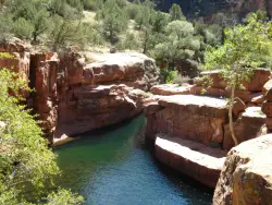
0.9 miles ECrystal-clear water and cliffs high enough to jump from, about 3.5 miles down Bell Trail along Wet Beaver Creek — a rewarding desert hike to a stunning red-rock swimming hole.
Dive, Hike, Horseback, Swim 
Beaver Creek Campground
Camp Verde, Arizona
1.0 miles EBeaver Creek is a refreshing creekside oasis in the high desert of central Arizona, where the cool, clear waters of Wet Beaver Creek wind beneath big cottonwoods and sycamores in the Coconino...
Camp, Canoe, Kayak, Swim 
Cathedral Rock Trail
Sedona, Arizona
7.7 miles NAccess via a tunnel under Highway 179, this Sedona trail delivers fast rolling flow with some good-sized drops on the downhill sections.
Mountain Bike 
Slim Shady
Sedona, Arizona
8.0 miles NA 2.4-mile one-way backbone trail connecting Yavapai Point to Made in the Shade, Hiline, and more — a key link in Sedona's trail network for mountain bikers.
Mountain Bike 
Bell Rock Area Trails
Sedona, Arizona
8.4 miles NThe Bell Rock Area Trails in Sedona offer the easiest riding in town — a great place for beginners seeking big views with manageable terrain.
Mountain Bike 
Bell Rock Trailway
Sedona, Arizona
8.4 miles NA smooth, wide 3.5-mile trailway through Oak Creek trees and slickrock that connects to Big Park Loop, Courthouse Rock, Llama, Templeton, and Little Horse trails in Sedona.
Mountain Bike 
Made In The Shade
Sedona, Arizona
8.4 miles NA singletrack connector linking the Templeton Trail to the Village of Oak Creek in Sedona, with moderate climbs, red rock views, and a super descent to finish.
Mountain Bike 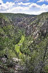
Bullpen Day Use Area
Camp Verde, Arizona
9.3 miles SA big red jumping rock on West Clear Creek, shaded picnic areas, and trails down a stunning canyon below the Mogollon Rim — a full afternoon of swimming and hiking.
Backpack, Dive, Hike, Swim 8.4 mi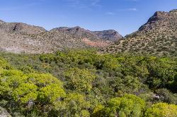
West Clear Creek Trail No. 17
Camp Verde, Arizona
9.3 miles SWest Clear Creek Trail winds down a shaded canyon to cool creek swimming, fishing, and dispersed camping — bring wading shoes, because wet feet are guaranteed.
Backpack, Hike, Swim 3.0 mi
Blodgett Basin Trail No. 31
Camp Verde, Arizona
9.4 miles SA 3-mile riparian canyon trail through West Clear Creek Wilderness with 1,700 feet of elevation change, fishing, camping, and wading in a desert oasis — expect to get your feet wet.
Backpack, Hike, Swim 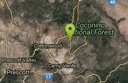
Hiline
Sedona, Arizona
9.5 miles NAn expert-level mountain bike trail in Sedona best ridden from the Village of Oak Creek side — narrow and ledgy on the climb, with steep and loose sections on the descent.
Mountain Bike 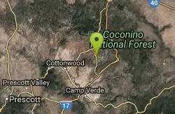
Yavapai Point Trails
Sedona, Arizona
9.5 miles NTightly wound singletrack near the trailhead gives way to longer trails like Slim Shady further out — a versatile trail system near Sedona's Yavapai Point.
Mountain Bike 
Templeton
Sedona, Arizona
10.7 miles NA twisting Sedona singletrack through two tunnels under Highway 179 and along Cathedral Rock's slickrock contours, with river stretches and technical switchbacks to cap it off.
Mountain Bike 0.2 mi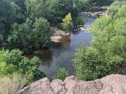
Mormons Crossing
Cornville, Arizona
10.8 miles NWShaded swimming holes, gentle rapids, and a rope swing along Oak Creek — an easy spot to cool off in Cornville.
Swim 0.4 mi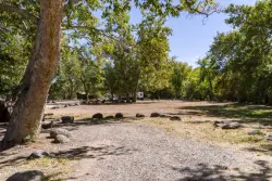
Clear Creek Campground
Camp Verde, Arizona
11.1 miles SA grassy creekside campground shaded by tall cottonwoods on West Clear Creek — ideal for hiking, swimming, fishing for smallmouth bass and sunfish, and wildlife watching in a desert canyon oasis.
Camp, Hike, Swim 
Baldwin Loop
Sedona, Arizona
11.2 miles NWA 2.25-mile Sedona loop with steps, ledges, and technical moves — best ridden clockwise to tackle descents naturally, and easily combined with Templeton Trail for a longer lollipop.
Mountain Bike 
Pig Tail
Sedona, Arizona
11.3 miles NA short, one-way downhill blast packed with jumps, drops, berms, and rocks — Pig Tail in Sedona is pure descent fun from start to finish.
Mountain Bike 
Red Rock State Park
Sedona, Arizona
11.4 miles NWRed Rock's crimson sandstone layers tell 275 million years of geologic history — from ancient beachfronts to sand dunes to shallow seas — and inspired an art migration that fills the area with museums and galleries today.
Hike, Swim 
Broken Arrow Trail System
Sedona, Arizona
11.7 miles NA system of classic Sedona rides — Broken Arrow, Hog Heaven, Hog Wash, Pig Tail and more — ranging from relatively easy to technical double-black-diamond exposure.
Mountain Bike 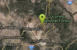
Ram's Head Trail
Sedona, Arizona
11.9 miles NWA family- and beginner-friendly figure-eight mountain bike route in Sedona linking Ram's Head Trail and Ridge Trail with a sandy wash crossing and a few optional walk-your-bike moments.
Mountain BikeNearby Campsites
Beaver Creek Campground
Camp Verde, Arizona
1.0 miles EBeaver Creek is a refreshing creekside oasis in the high desert of central Arizona, where the cool, clear waters of Wet Beaver Creek wind beneath big cottonwoods and sycamores in the Coconino...
Camp, Canoe, Kayak, Swim 0.4 mi
Clear Creek Campground
Camp Verde, Arizona
11.1 miles SA grassy creekside campground shaded by tall cottonwoods on West Clear Creek — ideal for hiking, swimming, fishing for smallmouth bass and sunfish, and wildlife watching in a desert canyon oasis.
Camp, Hike, Swim 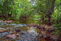
Chavez Crossing
Sedona, Arizona
12.0 miles NA campground on Oak Creek in Sedona's red-rock canyon, perfectly placed for cool water play, sunsets over Munds Mountain, and access to nearby swimming holes.
Camp, Hike, Swim 0.1-0.7 mi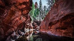
Cave Springs
Sedona, Arizona
22.3 miles NAn 84-site campground on Oak Creek in Sedona's canyon, with picnic tables and natural tree shade, close to Slide Rock, swimming holes, and the Coconino National Forest.
Camp, Hike, Swim 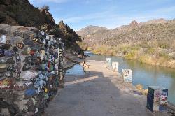
Verde Hot Springs
Camp Verde, Arizona
22.6 miles SNatural hot spring pools beside the Verde River — the remnants of an old resort — reached by wading upstream from a dispersed camping area with no amenities near Sedona.
Camp, Hike, Hot Springs 1.1-3.5 mi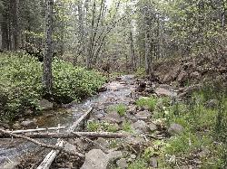
Horton Springs
Payson, Arizona
42.9 miles SEA spring on the Mogollon Rim where water emerges dramatically from the mountainside — hike the easy Horton Creek Trail through wildflowers and maples, splash in the cold creek, and camp near the spring.
Backpack, Camp, Hike 
Upper Tonto Creek Campground
Payson, Arizona
43.1 miles SEA 9-site first-come-first-served campground at the junction of Tonto and Horton Creeks — with vault toilets, drinking water, and trailheads for Horton Spring and the Highline Trail nearby.
Camp, Hike 0.1-7.8 mi
Wolf Creek Falls
Prescott, Arizona
44.6 miles WSix miles of trails, two campgrounds, and a 90-foot waterfall that roars in spring storms and glitters as a frozen cascade in winter — Wolf Creek Falls is dramatic in every season.
Camp, Hike, Swim 1.1 mi
Christopher Creek Campground
Payson, Arizona
46.7 miles SEA creekside campground east of Payson with swimming holes, small waterfalls, spring trout stocking, and cross-country skiing in winter — open for day-use and overnight camping spring through fall.
Camp, Canyoneer, Cross-country Ski, Hike, Swim 
Hell's Gate
Payson, Arizona
47.7 miles SEHellsgate Wilderness hides deep canyon pools possibly separated by impassable falls in a remote 37,000-acre preserve — a true adventure for spring and fall explorers.
Backpack, Camp, Hike, Swim


