


Beaver Creek Campground
Camp Verde, Arizona

| Address: | Beaver Creek, Camp Verde, AZ 86322, USA |
| GPS: |
34°40'11.7"N 111°42'47.5"W Maps | Directions |
| State: | Arizona |
Restrooms Picnic Tables Rivers
Camp, Canoe, Kayak, and Swim
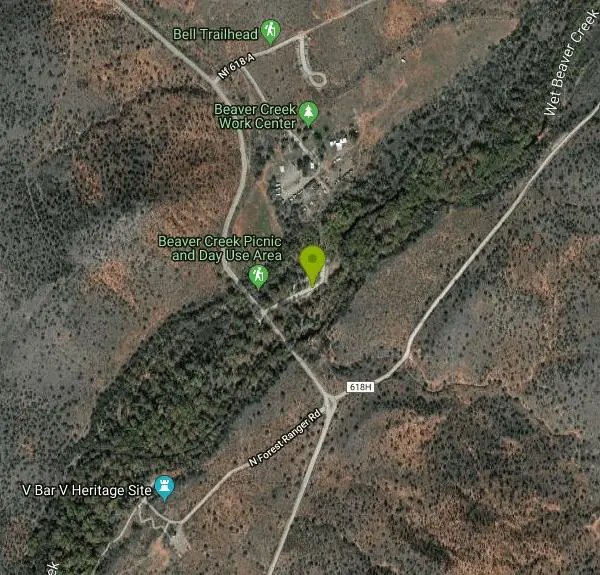
Beaver Creek is a refreshing creekside oasis in the high desert of central Arizona, where the cool, clear waters of Wet Beaver Creek wind beneath big cottonwoods and sycamores in the Coconino National Forest near Camp Verde. An easy stop just off Interstate 17 between Sedona and the Verde Valley, it's a popular place to wade, swim, picnic, and watch for birds in the shade along the water.
Though long known as a campground, the site is now a day-use area — a relaxing spot for water play in summer and for picnicking and birding year-round. The creek's clear pools and gravel bars are perfect for cooling off on a hot Arizona afternoon, with shallow areas for kids to splash and deeper spots for a proper dip, all framed by shady riparian forest that feels worlds away from the surrounding desert.
It's also a gateway to some excellent hiking. Nearby, the popular Bell Trail heads up into the 6,155-acre Wet Beaver Wilderness, following the creek for a few miles before climbing toward the Mogollon Rim — and leading adventurous hikers to “the Crack,” a famous deep-water swimming and cliff-jumping hole a few miles upstream.
To get there, take Exit 298 off I-17 near Camp Verde and follow Forest Road 618 a couple of miles to the site. Summer is prime for water play, while spring and fall are lovely for hiking and birding in milder temperatures. Bring water shoes for the rocky creek bottom, sun protection, and plenty of drinking water, mind the creek level after storms, and pack out everything you bring in. Easy to reach and genuinely refreshing, Beaver Creek is a perfect Verde Valley spot to slow down and cool off.
More Information
Coconino National Forest | Recreation | Forest Service
Find and Discover Recreation Sites and Trails in Coconino National Forest
https://www.fs.usda.gov/r03/coconino/recreationWet Beaver Creek - Coconino National Forest (USFS)
We’re here to help you dream up your next trip, figure out the details, and reserve experiences at over 3,600 facilities and 103,000 individual sites across the country.
https://www.fs.usda.gov/r03/coconino/recreation/wet-beaver-creek
- Plan Ahead and Prepare
- Travel & camp on durable surfaces
- Dispose of waste properly
- Leave what you find
- Minimize campfire impacts
- Respect wildlife
- Be considerate of other visitors
Directions
From Camp Verde, Arizona
- Head north on S Main St toward E Hollamon St (0.1 mi)
- Turn right onto Pecan Ln (135 ft)
- Continue onto S Montezuma Castle Hwy (0.3 mi)
- Slight left onto Montezuma Castle Hwy (0.8 mi)
- Continue onto N Montazuma Castle Way (262 ft)
- Continue onto N Montezuma Castle Way (1.6 mi)
- Continue onto W Middle Verde Rd (0.4 mi)
- At the traffic circle, take the 2nd exit and stay on W Middle Verde Rd (407 ft)
- At the traffic circle, take the 1st exit onto the I-17 N ramp (0.3 mi)
- Merge onto I-17 N (8.5 mi)
- Take exit 298 for State Hwy 179 N toward Sedona (0.2 mi)
- Turn right onto Forest Service Rd 618 (2.4 mi)
- Turn left toward Fr 618 B (200 ft)
- Continue onto Fr 618 B (161 ft)

Other Swimming Holes, Canoeing Areas, and Kayaking Areas Nearby
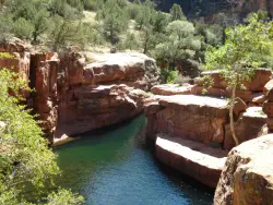
The Crack at Wet Beaver Creek
Rimrock, Arizona
0.3 miles NCrystal-clear water and cliffs high enough to jump from, about 3.5 miles down Bell Trail along Wet Beaver Creek — a rewarding desert hike to a stunning red-rock swimming hole.
Dive, Hike, Horseback, Swim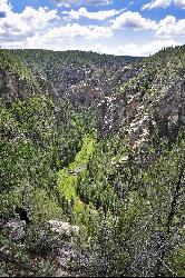
Bullpen Day Use Area
Camp Verde, Arizona
9.0 miles SA big red jumping rock on West Clear Creek, shaded picnic areas, and trails down a stunning canyon below the Mogollon Rim — a full afternoon of swimming and hiking.
Backpack, Dive, Hike, Swim 8.4 mi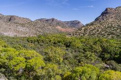
West Clear Creek Trail No. 17
Camp Verde, Arizona
9.0 miles SWest Clear Creek Trail winds down a shaded canyon to cool creek swimming, fishing, and dispersed camping — bring wading shoes, because wet feet are guaranteed.
Backpack, Hike, Swim 3.0 mi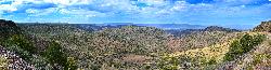
Blodgett Basin Trail No. 31
Camp Verde, Arizona
9.0 miles SA 3-mile riparian canyon trail through West Clear Creek Wilderness with 1,700 feet of elevation change, fishing, camping, and wading in a desert oasis — expect to get your feet wet.
Backpack, Hike, Swim 0.4 mi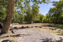
Clear Creek Campground
Camp Verde, Arizona
11.1 miles SA grassy creekside campground shaded by tall cottonwoods on West Clear Creek — ideal for hiking, swimming, fishing for smallmouth bass and sunfish, and wildlife watching in a desert canyon oasis.
Camp, Hike, Swim 0.2 mi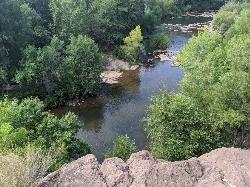
Mormons Crossing
Cornville, Arizona
11.7 miles NWShaded swimming holes, gentle rapids, and a rope swing along Oak Creek — an easy spot to cool off in Cornville.
Swim
Red Rock State Park
Sedona, Arizona
12.0 miles NWRed Rock's crimson sandstone layers tell 275 million years of geologic history — from ancient beachfronts to sand dunes to shallow seas — and inspired an art migration that fills the area with museums and galleries today.
Hike, Swim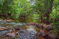
Chavez Crossing
Sedona, Arizona
12.5 miles NA campground on Oak Creek in Sedona's red-rock canyon, perfectly placed for cool water play, sunsets over Munds Mountain, and access to nearby swimming holes.
Camp, Hike, Swim 3.0 mi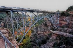
Huckaby Trail
Sedona, Arizona
13.7 miles NA 3-mile Sedona trail through Arizona Sycamores and striking Red Rock formations — crossing Oak Creek at the bottom where you can take a dip, with a boulder passage and optional mountain bike cruise on the other side.
Canoe, Hike, Mountain Bike 3.4 mi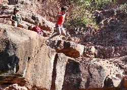
Grasshopper Point
Sedona, Arizona
15.1 miles NCrimson red rock walls frame a teal swimming hole in Oak Creek Canyon — with multiple cliff jumping spots, picnic tables, restrooms, and access via Allen's Bend and the Huckaby Trail.
Dive, Hike, Swim 0.6-2.9 mi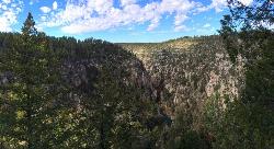
Tramway Trail No. 32
Happy Jack, Arizona
18.3 miles SEA steep, rock-scrambling descent through the Mogollon Rim to West Clear Creek, with deep fishing and swimming holes waiting at the bottom — not for beginners.
Hike, Rock Climb, Swim 0.3 mi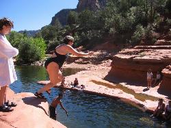
Slide Rock
Sedona, Arizona
19.0 miles NAn 80-foot-long natural waterslide lined with algae on Oak Creek — named one of America's Top Ten Swimming Holes, inside a 43-acre historic apple farm homestead in a stunning red rock canyon.
Hike, Swim 1.1 mi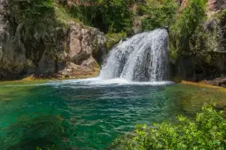
Fossil Creek Waterfall
Pine, Arizona
19.2 miles SOne of Arizona's two Wild and Scenic rivers, with a short hike from a dirt-road parking area to a deep pool at the base of the falls — watch for snakes on the trail.
Hike, Swim 1.0 mi
Maxwell Trail No. 37
Happy Jack, Arizona
19.6 miles SEMaxwell Trail drops from the Mogollon Rim down into West Clear Creek, ending at shaded swimming holes, small caves, and great fishing — water shoes required.
Hike, Swim 0.1-3.8 mi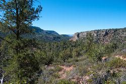
Fossil Springs Trail No. 18
Pine, Arizona
20.0 miles SEA 4.75-mile desert canyon trail to the springs and an old dam in the Fossil Springs Wilderness — little shade and a brutal uphill return make summer visits genuinely dangerous.
Hike, Horseback, Swim 1.1-4.6 mi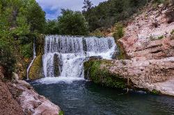
Fossil Creek Dam (Toilet Bowl)
Pine, Arizona
20.0 miles SEA waterfall over an old Fossil Creek dam with a spinning natural rock slide that launches swimmers into the main pool — plus a shallow cave for shade on hot Arizona days.
Dive, Hike, Swim 0.1-0.7 mi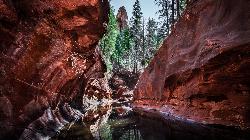
Cave Springs
Sedona, Arizona
22.6 miles NAn 84-site campground on Oak Creek in Sedona's canyon, with picnic tables and natural tree shade, close to Slide Rock, swimming holes, and the Coconino National Forest.
Camp, Hike, Swim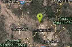
Sycamore Canyon
Sedona, Arizona
24.9 miles NWA pleasant 3.5-mile round-trip canyon hike along a perennial stream to several swimming holes — bathing suits may be optional at the more distant pools in Sycamore Canyon.
Swim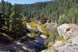
East Clear Creek
Happy Jack, Arizona
32.4 miles EA Wild and Scenic river winding through the Mogollon Rim with canyon views, cliff-scaling canyoneers, trout fishing, and deep swimming holes for a full adventure day.
Canyoneer, Hike, Swim 0.2-0.6 mi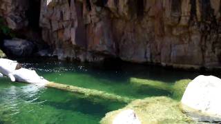
Ellison Creek Falls
Payson, Arizona
32.8 miles SEFour waterfalls, multiple swimming holes, and trout fishing along Ellison Creek near Payson — the most popular stop is a short walk from the parking lot.
Dive, Hike, SwimNearby Campsites

Beaver Creek Dispersed Camping
Rimrock, Arizona
1.0 miles WThis free dispersed camping area sits on the cliffs above Wet Beaver Creek in the Coconino National Forest of central Arizona, in the red-rock and juniper country near Rimrock and Camp Verde, not far...
Camp 0.4 mi
Clear Creek Campground
Camp Verde, Arizona
11.1 miles SA grassy creekside campground shaded by tall cottonwoods on West Clear Creek — ideal for hiking, swimming, fishing for smallmouth bass and sunfish, and wildlife watching in a desert canyon oasis.
Camp, Hike, Swim
Chavez Crossing
Sedona, Arizona
12.5 miles NA campground on Oak Creek in Sedona's red-rock canyon, perfectly placed for cool water play, sunsets over Munds Mountain, and access to nearby swimming holes.
Camp, Hike, Swim
Verde Hot Springs
Camp Verde, Arizona
22.3 miles SNatural hot spring pools beside the Verde River — the remnants of an old resort — reached by wading upstream from a dispersed camping area with no amenities near Sedona.
Camp, Hike, Hot Springs 0.1-0.7 mi
Cave Springs
Sedona, Arizona
22.6 miles NAn 84-site campground on Oak Creek in Sedona's canyon, with picnic tables and natural tree shade, close to Slide Rock, swimming holes, and the Coconino National Forest.
Camp, Hike, Swim 1.1-3.5 mi
Horton Springs
Payson, Arizona
42.0 miles SEA spring on the Mogollon Rim where water emerges dramatically from the mountainside — hike the easy Horton Creek Trail through wildflowers and maples, splash in the cold creek, and camp near the spring.
Backpack, Camp, Hike
Upper Tonto Creek Campground
Payson, Arizona
42.1 miles SEA 9-site first-come-first-served campground at the junction of Tonto and Horton Creeks — with vault toilets, drinking water, and trailheads for Horton Spring and the Highline Trail nearby.
Camp, Hike 0.1-7.8 mi
Wolf Creek Falls
Prescott, Arizona
45.5 miles WSix miles of trails, two campgrounds, and a 90-foot waterfall that roars in spring storms and glitters as a frozen cascade in winter — Wolf Creek Falls is dramatic in every season.
Camp, Hike, Swim 1.1 mi
Christopher Creek Campground
Payson, Arizona
45.7 miles SEA creekside campground east of Payson with swimming holes, small waterfalls, spring trout stocking, and cross-country skiing in winter — open for day-use and overnight camping spring through fall.
Camp, Canyoneer, Cross-country Ski, Hike, Swim
Hell's Gate
Payson, Arizona
46.8 miles SEHellsgate Wilderness hides deep canyon pools possibly separated by impassable falls in a remote 37,000-acre preserve — a true adventure for spring and fall explorers.
Backpack, Camp, Hike, Swim 4.0 mi
Woods Canyon Lake
Payson, Arizona
49.5 miles SEA trout-fishing lake near Payson with a scenic loop hike and Mogollon Rim views — swimming is not recommended, but the scenery and fishing make it well worth the visit.
Camp, Hike, Swim
Aspen Campground
Payson, Arizona
49.8 miles SEA large, popular campground near Woods Canyon Lake in the Apache-Sitgreaves National Forest — note that Rim Road closes in winter, so the site is inaccessible during that time.
Camp


