


Arroyo Pescadero Park
Whittier, California
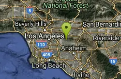
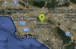
| GPS: |
33°57'57.7"N 118°0'2.8"W Maps | Directions |
| State: | California |
Hike
Located in the Puente Hills, and managed by the Puente Hills Habitat Preservation Authority, Arroyo Pescadero serves as a link in a wildlife corridor that connects lands that reach from the Whittier Narrows Recreation area in the west to the Cleveland National Forest to the east in Orange County. Park features include an ADA-accessible interpretive trail and decorative gates designed by local high school students and steel artist Brett Goldstone.
More Information
Lamountains
LAMountains: Exploring the Great Outdoors, From Peaks to Streets.
https://lamountains.com/Be courteous, informed, and prepared. Read trailhead guidelines, stay on the trail, and don't feed the wildlife.
Read More- Plan Ahead and Prepare
- Travel & camp on durable surfaces
- Dispose of waste properly
- Leave what you find
- Minimize campfire impacts
- Respect wildlife
- Be considerate of other visitors
Directions
From Whittier, California
- Head east on Philadelphia St toward Painter Ave (49 ft)
- Turn right at the 1st cross street onto Painter Ave (0.4 mi)
- Turn left onto Mar Vista St (2.0 mi)
- Turn left onto Colima Rd (0.3 mi)
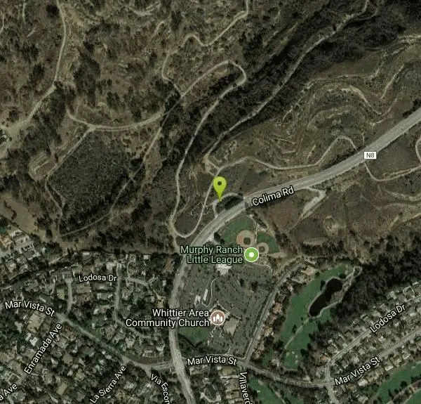
- Turn left to stay on Colima RdDestination will be on the left(381 ft)
From Los Angeles, take the 10 Freeway east to the south 605 freeway, and then the Pomona Freeway (60) east. Exit at Hacienda Road. Make a right at Colima Road. Head south. The parking lot is on the right side located at 7531 South Colima Road in Whittier. Access is on the west side of Colima across from Murphy Ranch Little League Fields.
Other Hiking Trails Nearby
laguna lake park trail
Fullerton, California
5.5 miles SEA level loop trail around a 25-acre natural lake and open hillsides with views of the surrounding Morros in this 450-acre Fullerton park with deep Chumash history.
Hike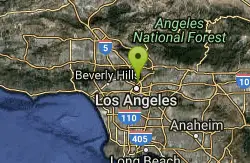
Elysian Park
Los Angeles, California
15.8 miles NWA sprawling municipal park in Central Los Angeles encompassing Chavez Ravine and Dodger Stadium's neighborhood — green space and open land in the heart of the city.
Hike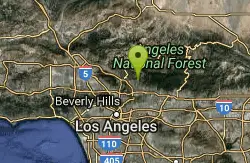
Sam Merrill Trailhead
Altadena, California
18.0 miles NWA historically significant San Gabriel Mountain trail built in the 1930s climbs through Las Flores Canyon to the top of Echo Mountain, once home to the Mount Lowe Railway.
Hike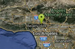
Hollywood Sign on Mt. Lee
Los Angeles, California
21.7 miles NWThe iconic Hollywood Sign sits on the southern slope of Mount Lee in Griffith Park, best viewed driving north up Gower Street or along Beachwood Drive.
Hike
Switzer Falls
Los Angeles-Long Beach-Santa Ana, CA, California
21.8 miles NWA relatively easy hike into a spectacular San Gabriel canyon where the stream meanders under oaks and alder, cascades over granite into mirror pools, and passes above the 50-foot Switzer Falls.
Hike
Bandido Group Campground
Pearblossom, California
26.2 miles NA rustic group campground in the Angeles National Forest designed for equestrian campers, with horse corrals, hitch racks, and five sites accommodating up to 150 campers total.
Camp, Hike, Horseback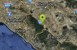
Horse Thief Canyon
Corona, California
36.9 miles SEA hidden off-road playground tucked along the roadside with rocks, trees, and sandpits — a local secret for outdoor fun in the Lake Elsinore/Corona area.
Airsoft, Hike 0.3-1.0 mi
Rock Pool
Agoura Hills, California
42.7 miles WA river-fed swimming hole deep in Malibu Creek State Park, ringed by forest and rock formations — reach it via a short level path from the Visitor Center or a scenic 2-mile out-and-back from the campsite.
Camp, Hike, Swim
Malibu Creek State Park
Calabasas, California
42.8 miles WJust 25 miles from downtown LA, 15 miles of streamside trail wind through oak and sycamore woodlands in a park with rich Chumash history and film location fame.
Camp, Hike, Horseback, Mountain Bike, Rock Climb
Point Dume State Beach
Malibu, California
46.4 miles WHeadlands, rocky coves, a quiet beach, gray whale watching from December to April, an easy coastal hike to sweeping views, and a fun Iron Man movie cameo — all at Point Dume in Malibu.
Dive, Hike, Rock Climb, SwimNearby Campsites
Bandido Group Campground
Pearblossom, California
26.2 miles NA rustic group campground in the Angeles National Forest designed for equestrian campers, with horse corrals, hitch racks, and five sites accommodating up to 150 campers total.
Camp, Hike, Horseback 0.3-1.0 mi
Rock Pool
Agoura Hills, California
42.7 miles WA river-fed swimming hole deep in Malibu Creek State Park, ringed by forest and rock formations — reach it via a short level path from the Visitor Center or a scenic 2-mile out-and-back from the campsite.
Camp, Hike, Swim
Malibu Creek State Park
Calabasas, California
42.8 miles WJust 25 miles from downtown LA, 15 miles of streamside trail wind through oak and sycamore woodlands in a park with rich Chumash history and film location fame.
Camp, Hike, Horseback, Mountain Bike, Rock Climb


