


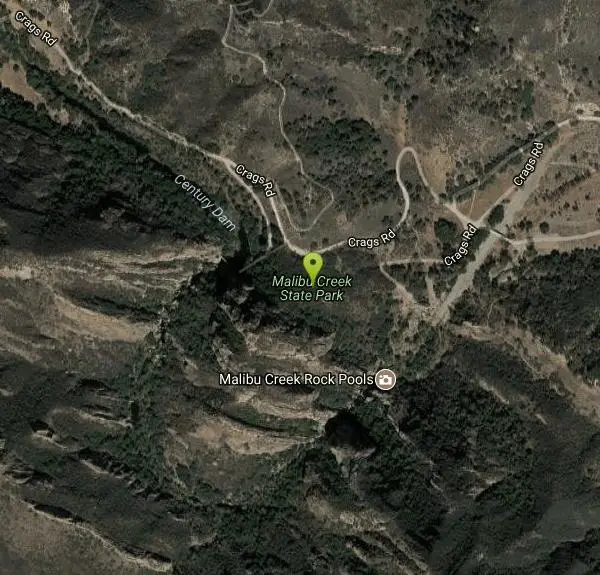
Malibu Creek State Park
Calabasas, California

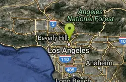
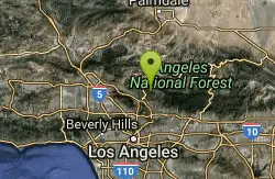
| Address: | 1925 Las Virgenes Rd, Calabasas, CA 91302 |
| GPS: |
34°5'52.6"N 118°43'53.1"W Maps | Directions |
| State: | California |
Trails Rocks State Park
Camp, Hike, Horseback, Mountain Bike, and Rock Climb
Malibu Creek State Park has something for everyone! Just 25 miles from downtown Los Angeles, the park features hiking, fishing, bird watching and horseback riding opportunities. There are 15 miles of streamside trail through oak and sycamore woodlands on chaparral-covered slopes. Twenty-five mile Malibu Creek in the park is the principal watercourse of the Santa Monica Mountains, from Boney Mountain to Malibu Lagoon. The park was the center of Chumash Native American life for centuries and was once used to film numerous movies and TV shows, such as Planet of the Apes and M*A*S*H.
More Information
Add ResourceNever modify trail features. Ride trails when they're dry enough that you won't leave ruts. Speak up when you see others on the trail and always yield to hikers, horses, and others coming uphill. Always ride on the established trail.
Read MoreBe courteous, informed, and prepared. Read trailhead guidelines, stay on the trail, and don't feed the wildlife.
Read More- Plan Ahead and Prepare
- Travel & camp on durable surfaces
- Dispose of waste properly
- Leave what you find
- Minimize campfire impacts
- Respect wildlife
- Be considerate of other visitors
Directions
From Calabasas, California
- Head north on Cll JoaquinRestricted usage road(453 ft)
- Continue onto Cll CedroRestricted usage road(0.2 mi)
- Turn left onto Paseo PrimarioRestricted usage road(154 ft)
- Turn left onto Cam PortalPartial restricted usage road(259 ft)
- At the traffic circle, take the 1st exit onto Parkway Calabasas (1.5 mi)
- Take the ramp onto US-101 N (2.7 mi)
- Take exit 32 for Las Virgenes Rd toward Malibu Canyon (0.1 mi)
- Turn left onto Las Virgenes Rd (3.9 mi)
- Turn right onto Crags Rd/Waycross Dr (0.6 mi)
- Turn left to stay on Crags Rd/Waycross Dr (0.1 mi)
- Turn right onto Century Mtwy/Crags RdContinue to follow Crags RdDestination will be on the left(0.7 mi)
The park is located four miles south of Highway 101 on Las Virgenes/Malibu Canyon Road.


Other Rock Climbing Walls, Mountain Bike Trails, Hiking Trails, and Horseback Trails Nearby

Rock Pool
Agoura Hills, California
0.2 miles SRock Pool is a gem that can be found in the heart of Malibu State Creek Park. This swimming hole can be reached using multiple trails, making this the perfect choose your own adventure. Parking and...
Camp, Hike, Swim
Point Dume State Beach
Malibu, California
7.9 miles SWPoint Dume State Beach features headlands, cliffs, rocky coves and vast beach access. The beach is presently operated by Los Angeles County, which also operates Zuma County Beach. These facilities...
Dive, Hike, Rock Climb, Swim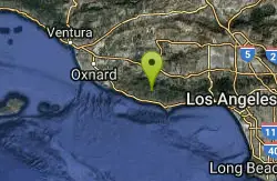
Arroyo Sequit Park
Malibu, California
9.1 miles WAccessed from Mulholland Highway, Arroyo Sequit Park is one of the most beautiful destinations in the western Santa Monica Mountains. Park features include a perennial stream, a loop trail, rocks,...
Hike, Horseback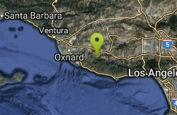
Satwiwa Loop Trail
Westlake Village, California
13.7 miles WSatwiwa Loop Trail is an easy, 2.5 mile hike in the Santa Monica Mountains National Recreation Area that will take about 1.5 hours to complete with Fido. This picturesque hike is close to the city...
Hike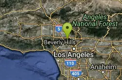
Hollywood Sign on Mt. Lee
Los Angeles, California
23.6 miles EMount Lee is a peak in the Santa Monica Mountains, located in Griffith Park in Los Angeles, California, USA. The famous Hollywood Sign is located on its southern slope. The sign is visible north of...
Hike
Elysian Park
Los Angeles, California
28.3 miles EElysian Park is the name of a municipal park and of an adjacent neighborhood in Central Los Angeles, California. Encompassing Chavez Ravine, where Dodger Stadium is located, the neighborhood is...
Hike
Switzer Falls
Los Angeles-Long Beach-Santa Ana, CA, California
34.8 miles EThis is a relatively easy hike into one of the loveliest sections of the San Gabriel mountains. The hike meanders back and across the stream running down the spectacular Arroyo Seco Canyon. The...
Hike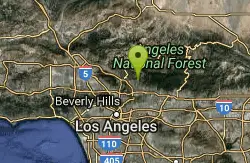
Sam Merrill Trailhead
Altadena, California
35.2 miles EThe Sam Merrill Trail is a major hiking trail in the Las Flores Canyon of the San Gabriel Mountain Range north of Altadena, California, which leads to the top of Echo Mountain. It was built by...
Hike
Fish Creek
Lake Hughes, California
39.5 miles NWe suggest wearing some techamphibians or some vibrams or just an old pair of shoes you don't give a crap about. The upper pool here is super deep, lower pool only about 5 feet. You can slide the...
Hike, Rock Climb, Swim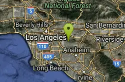
Arroyo Pescadero Park
Whittier, California
42.9 miles ELocated in the Puente Hills, and managed by the Puente Hills Habitat Preservation Authority, Arroyo Pescadero serves as a link in a wildlife corridor that connects lands that reach from the Whittier...
Hike
Bandido Group Campground
Pearblossom, California
44.9 miles EGroups of all types will enjoy staying at the Bandido Group Campground, which boasts beautiful scenery in a relaxing, rustic atmosphere. The site accommodates groups of up to 150 campers, but is...
Camp, Hike, Horseback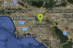
laguna lake park trail
Fullerton, California
47.4 miles ELaguna Lake Park encompasses 450 acres, including a 25 acre natural lake and a large undeveloped open space with hiking trails. The area was once used by the Chumash Indians for hunting and fishing....
Hike
Carpinteria State Beach
Carpinteria, California
49.4 miles NWTwelve miles south of Santa Barbara, Carpinteria State Beach offers a mile of beach for swimming, surf fishing, tidepool exploring and camping. The Spanish named the area Carpinteria because of the...
Camp, Hike, SwimNearby Campsites
Rock Pool
Agoura Hills, California
0.2 miles SRock Pool is a gem that can be found in the heart of Malibu State Creek Park. This swimming hole can be reached using multiple trails, making this the perfect choose your own adventure. Parking and...
Camp, Hike, Swim
Bandido Group Campground
Pearblossom, California
44.9 miles EGroups of all types will enjoy staying at the Bandido Group Campground, which boasts beautiful scenery in a relaxing, rustic atmosphere. The site accommodates groups of up to 150 campers, but is...
Camp, Hike, Horseback
Carpinteria State Beach
Carpinteria, California
49.4 miles NWTwelve miles south of Santa Barbara, Carpinteria State Beach offers a mile of beach for swimming, surf fishing, tidepool exploring and camping. The Spanish named the area Carpinteria because of the...
Camp, Hike, Swim


