


C.O.D.
Bend, Oregon
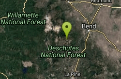
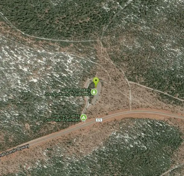
| Address: | ~State Hwy 372, Bend, OR 97701, USA |
| GPS: |
43°59'22.8"N 121°34'4.5"W Maps | Directions |
| State: | Oregon |
| Trail Length: | 4.00 miles |
| MTB Difficulty: | Intermediate |
| Trail Type: | Other |
| MTB Trail Type: | Singletrack |
Mountain Bike
This trail roughly parallels Century Drive, but it is WAY more fun than riding pavement! This is great Bend singletrack: mostly buff, dry, dusty singletrack. It connects to the Storm king trail on the westernmost end and to the Elfin Magic and KGB trails. Courtesy of Singletracks.com
More Information
C.O.D. Mountain Bike Trail in Bend, Oregon - Directions, Maps, Photos, and Reviews
C.O.D. is a singletrack mountain bike trail in Bend, Oregon. View maps, videos, photos, and reviews of C.O.D. bike trail in Bend.
http://www.singletracks.com/bike-trails/cod/Never modify trail features. Ride trails when they're dry enough that you won't leave ruts. Speak up when you see others on the trail and always yield to hikers, horses, and others coming uphill. Always ride on the established trail.
Read More
- Plan Ahead and Prepare
- Travel & camp on durable surfaces
- Dispose of waste properly
- Leave what you find
- Minimize campfire impacts
- Respect wildlife
- Be considerate of other visitors
Directions
From Bend, Oregon
- Head southeast on NW Franklin Ave toward NW Wall St (56 ft)
- Turn right at the 1st cross street onto NW Wall St (0.4 mi)
- Turn right onto Cascade Lakes National Scenic Byway/NW Colorado Ave (0.4 mi)
- At the traffic circle, take the 2nd exit onto Cascade Lakes National Scenic Byway/SW Colorado Ave (0.7 mi)
- At the traffic circle, take the 3rd exit onto Cascade Lakes National Scenic Byway/SW Century Dr (0.3 mi)
- At the traffic circle, take the 2nd exit and stay on Cascade Lakes National Scenic Byway/SW Century DrContinue to follow Cascade Lakes National Scenic Byway(13.5 mi)
- Turn right (226 ft)
- Turn leftDestination will be on the left(0.1 mi)
Other Mountain Bike Trails Nearby
Swampy Dutchman Trail
Bend, Oregon
0.0 miles NA cross-country ski and snowmobile corridor repurposed as a mountain bike trail in summer, connecting Swampy Lakes to Dutchman Sno-Park.
Mountain Bike
Swampy Lakes Trail
Bend, Oregon
0.1 miles NWA popular mountain bike connector near Bend linking North Fork and the Metolius-Windigo loop back to Tumalo Falls — note that the adjacent Bend Municipal Watershed is closed to bikes, dogs, and horses.
Mountain Bike
Sector 16
Bend, Oregon
0.5 miles WA 3.7-mile one-way intermediate singletrack near Bend circling a large private parcel from the Swede Ridge area to the Whoops Trail — stay on the trail.
Mountain Bike
Larsen Trail
Bend, Oregon
1.3 miles EA 3-mile one-way intermediate trail running from Kiwa Springs to the Tiddlywinks Trail, paralleling a forest road through central Oregon forest near Bend.
Mountain Bike
Tiddlywinks
Bend, Oregon
1.7 miles EA gradual singletrack descent near Bend with a hidden half-mile flow section packed with berms, jumps, and pure speed — classic buff Bend riding at its best.
Mountain Bike
Whoops
Bend, Oregon
2.3 miles EA renowned flow and jump trail in Bend connecting to Ben's Trail and the Swede Ridge loop — Whoops lives up to its name.
Mountain Bike
Farewell
Bend, Oregon
2.9 miles NA flowy 3.5-mile descent down the far side of the North Fork trail, ending at Tumalo Falls with snowcapped mountain views and classic loose Bend singletrack.
Mountain Bike
North Fork
Bend, Oregon
2.9 miles NA steep opening half-mile mellows into a fantastic singletrack canyon climb past six additional waterfalls to Happy Valley, with the Metolius/Windigo trail opening loop options at the top.
Mountain Bike
Tumalo Trail System
Bend, Oregon
3.9 miles NEA massive trail system in the national forest west of Bend, Oregon — plenty of room to explore for all ability levels.
Mountain Bike
Tumalo Creek
Bend, Oregon
3.9 miles NEEasy classic Bend singletrack paralleling Skyliner Road with gradual climbs, sweet mountain views, and a free starting point versus the paid Tumalo Falls trailhead.
Mountain Bike
Skyliners
Bend, Oregon
3.9 miles NEA 3.2-mile intermediate singletrack connection from the Skyliners trailhead to the corner of Phil's Area, unlocking massive mountain ride options higher up.
Mountain Bike
Phil's Area
Bend, Oregon
3.9 miles NEThe go-to trail system in Bend — buff, flowy singletrack with great corners, sandy tread, optional rock gardens and jumps, and ride-arounds making it beginner-friendly despite its size.
Mountain Bike
Catch and release
Bend, Oregon
7.3 miles EA flowing, mostly easy singletrack with fun rock sections at the south end — a great connector to Century or back to town without hitting the road.
Mountain Bike
Storm King
Bend, Oregon
7.3 miles EA north-south mountain bike connector through dense forest and lava rock gardens, climbing 4 miles to a Helicopter Pad with multiple descent options.
Mountain Bike
Inn Loop
Bend, Oregon
8.1 miles EA moderately easy 13-mile forest road ride through lodgepole and ponderosa pines near Bend — detailed milepost directions make navigation straightforward on the Inn Loop.
Mountain Bike
Ben's Lower
Bend, Oregon
9.7 miles NEA 7-mile cross-country singletrack with a two-way lower section and a downhill-only upper section — smooth and flowing through the Bend trail system.
Mountain Bike
Phil's Trail
Bend, Oregon
9.8 miles EPhil's Trail in Bend has achieved incredible flow over the years — fast, pedally, and in outstanding shape thanks to COTA's dedicated maintenance.
Mountain Bike
Entrada Loop Trail
Bend, Oregon
10.4 miles EA versatile trail near Bend usable for day hiking or as a mountain bike connector between the Tumalo Trail System and the Deschutes River Trail.
Mountain Bike
Horse Ridge Recreation Area
Bend, Oregon
13.4 miles EExcellent mountain biking at Horse Ridge Recreation Area near Bend — a destination-worthy riding spot in the high desert.
Mountain Bike
Horse Butte
Bend, Oregon
16.6 miles EA quieter alternative to Bend's busy west-side trails — multi-use trails primarily designated for horses, so be courteous to other users.
Mountain Bike


