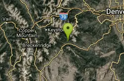
Little Scraggy
Sedalia, Colorado
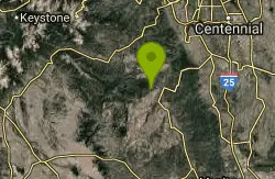
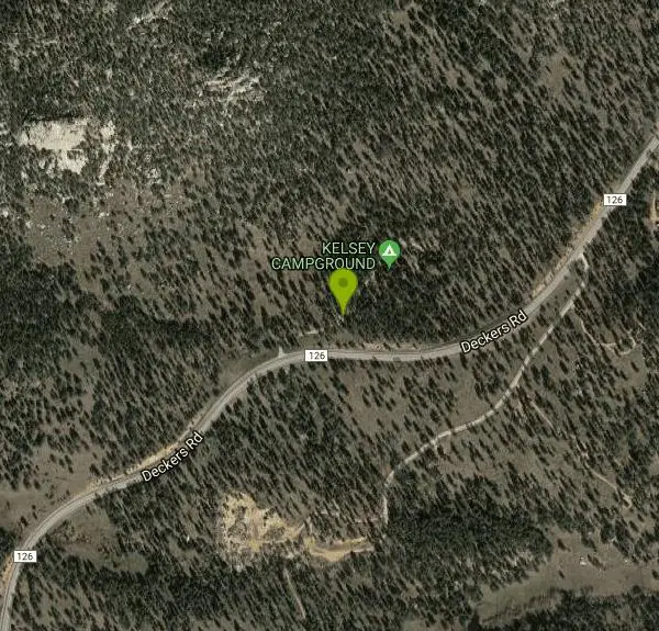
| Address: | ~22212 Deckers Rd, Sedalia, CO 80135, USA |
| GPS: |
39°18'19.8"N 105°15'56.6"W Maps | Directions |
| State: | Colorado |
| Trail Length: | 5.00 miles |
| MTB Difficulty: | Intermediate |
| Trail Type: | Out & Back |
| MTB Trail Type: | Singletrack |
Mountain Bike
This new intermediate trail was built by COMBA, just completed after a few years of work. From the Little Scraggy TH, cross FR 550, and you will see the start, going south. Trail is a meandering track through interesting features. Has some options for more technical features. Also a very cool 100' long slab rock. Trail goes up/down, with only one serious climb about midway. Currently ends at a campground, but will eventually encircle Little Scraggy Peak.This is a true intermediate trail, with few unrideable spots for intermediate riders.I've ridden almost all of the trails at Buffalo Creek, and I believe this one will quickly become a classic. Courtesy of Singletracks.com
More Information
Little Scraggy Mountain Bike Trail in Pine, Colorado - Directions, Maps, Photos, and Reviews
Little Scraggy is a singletrack mountain bike trail in Pine, Colorado. View maps, videos, photos, and reviews of Little Scraggy bike trail in Pine.
http://www.singletracks.com/bike-trails/little-scraggy/Never modify trail features. Ride trails when they're dry enough that you won't leave ruts. Speak up when you see others on the trail and always yield to hikers, horses, and others coming uphill. Always ride on the established trail.
Read More
- Plan Ahead and Prepare
- Travel & camp on durable surfaces
- Dispose of waste properly
- Leave what you find
- Minimize campfire impacts
- Respect wildlife
- Be considerate of other visitors
Directions
From Sedalia, Colorado
- Head south on Karcher St toward N Plum Ave (138 ft)
- Turn right onto N Plum Ave (0.1 mi)
- Turn left onto CO-67 S/Manhart AveContinue to follow CO-67 S(13.1 mi)
- Slight right onto W Pine Creek Rd (3.1 mi)
- Turn left onto N Platte River Rd (4.5 mi)
- Continue straight onto CO-67 S (5.1 mi)
- Sharp right onto Deckers RdDestination will be on the left(7.8 mi)
Other Mountain Bike Trails Nearby
Colorado Trail: Buffalo Creek To Lost Creek Wilderness Boundary
Pine, Colorado
2.7 miles NA beautiful point-to-point Colorado Trail ride from FR 550 through Buffalo Creek to the Lost Creek Wilderness boundary — bikes must turn back at the wilderness line.
Mountain Bike
Chair Rocks
Pine, Colorado
2.7 miles NA seldom-used trail through the Buffalo Creek burn area with smooth tread, gentle hills, endless singletrack, rock formations, wildlife, and expansive mountain vistas.
Mountain Bike
Colorado Trail: Morrison Creek / Lunar Loop
Pine, Colorado
2.8 miles NA loop through burned-out forest and open terrain climbing about 800 feet, with Morrison Creek singletrack connecting the Shingleman trail — more exposed than the Green Mountain option.
Mountain Bike
Colorado Trail: Green Mountain
Pine, Colorado
2.8 miles NSweet, smooth singletrack with a great mix of climbs and descents through beautiful scenery — described as the Front Range's answer to the Tsali trails.
Mountain Bike
Buffalo Creek
Pine, Colorado
4.2 miles NWAn epic mountain bike loop near Pine with a steady climb up Buffalo Creek Road, slickrock on Baldy Trail, and screaming singletrack descents on Charlie's Cutoff and Sandy Wash.
Mountain Bike
Baldy Trail
Pine, Colorado
4.5 miles NWA loop trail that pairs with Gashouse Gulch for a 6-mile ride from the Gashouse trailhead or stretches to 9 miles via Redskin Creek Trail from Meadows Campground.
Mountain Bike
Blackjack / Raspberry Ridge
Pine, Colorado
6.6 miles NWA gnarly black diamond freeride trail at Buffalo Creek with drops up to five feet, steep chutes, chunky rock gardens, and double-black-diamond features that demand respect.
Mountain Bike
Colorado Trail: Redskin Mountain
Bailey, Colorado
7.6 miles WA mix of Colorado Trail singletrack and forest roads near Bailey — mostly downhill for the first 5 miles, with Gashouse and Miller Gulch trails rounding out a solid if route-complex loop.
Mountain Bike
North Fork
Littleton, Colorado
8.7 miles NEA smooth, nearly rock-free machine-made singletrack running along the mountainside from South Platte River — gradual climbing on Hummingbird leads to a flowing North Fork descent.
Mountain Bike
Devil's Head Stretch
Sedalia, Colorado
10.4 miles NEMoto-carved berms, chutes, dips, and rollers on a multi-use trail shared heavily with dirt bikes on weekends — best ridden on a quiet weekday after a good rain firms things up.
Mountain Bike
Colorado Trail: South Platte To Buffalo Creek
Conifer, Colorado
11.3 miles NA gradual, sustained singletrack climb on the Colorado Trail from South Platte to Buffalo Creek — the return trip is where this ride really shines with fast downhill singletrack.
Mountain Bike
Colorado Trail
Littleton, Colorado
15.6 miles NEEpic Colorado singletrack with killer views and lung-busting elevation — detours around six wilderness areas are required, but day trip routes and connecting trails abound.
Mountain Bike
Indian Creek Loop
Littleton, Colorado
15.8 miles NE17 miles of off-road trail with significant climbing and route-finding along the Colorado Trail from Waterton Canyon to the Indian Creek Loop — bring a detailed map near Littleton.
Mountain Bike
Colorado Trail: Waterton To South Platte
Littleton, Colorado
15.8 miles NESeventeen miles of the Colorado Trail from Waterton Canyon to South Platte, with sweet singletrack, forested sections, rocky climbs, and only about 460 miles left to Durango.
Mountain Bike
Meyer Ranch Park
Morrison, Colorado
16.6 miles NA short network of singletrack trails climbing roughly 800 vertical feet near Morrison — a solid quick ride when you want a mellow spin on the way back from the mountains.
Mountain Bike
Flying J Ranch
Conifer, Colorado
16.8 miles NSuper easy singletrack with a clockwise Shadow Pine loop that feels longer on the descent than what you earned on the climb — perfect for true beginners on the Front Range.
Mountain Bike
Dawson's Butte
Castle Rock, Colorado
18.5 miles EA simple, hard-to-get-lost loop through ponderosa forest and open meadows, just over 5 miles with about 300 feet of elevation — run it counter-clockwise for the better downhill.
Mountain Bike
Cub Creek Trail
Evergreen, Colorado
19.2 miles NWide singletrack through loose gravel that climbs into the Mt. Evans Wilderness boundary — a significant uphill first stretch with a good five miles of riding before the turnaround.
Mountain Bike
Maxwell Falls
Evergreen, Colorado
19.8 miles NA steep, rocky, technical climb that rewards the suffer with a descent that makes it all worthwhile — link with Cub Creek for extra mileage.
Mountain Bike
Columbine Open Space
Castle Rock, Colorado
20.0 miles ETwo beginner lollipop loops — a 1-mile South loop and a 1.5-mile North loop — with moderate climbs, packed gravel, and easy access right off the interstate.
Mountain Bike