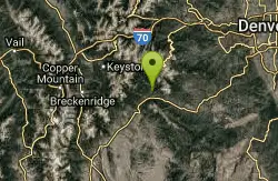
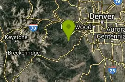
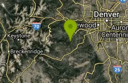
Maxwell Falls
Evergreen, Colorado
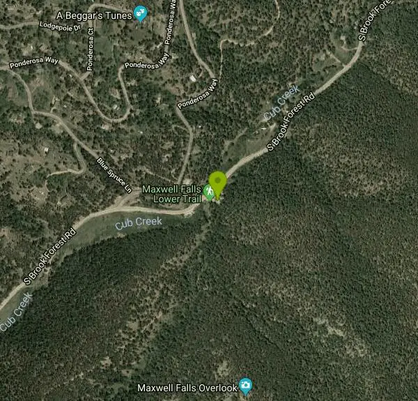
| Address: | ~31623 Ponderosa Way, Evergreen, CO 80439, USA |
| GPS: |
39°34'56.8"N 105°21'39.0"W Maps | Directions |
| State: | Colorado |
| Trail Length: | 6.00 miles |
| MTB Difficulty: | Advanced |
| Trail Type: | Lariat |
| MTB Trail Type: | Singletrack |
Mountain Bike
This is a steep rocky technical climb. The ride back down makes it all worth while. It was a short fun ride I made it a little longer by connecting with Cub Creek Trail and riding to the wilderness boundary. Courtesy of Singletracks.com
Never modify trail features. Ride trails when they're dry enough that you won't leave ruts. Speak up when you see others on the trail and always yield to hikers, horses, and others coming uphill. Always ride on the established trail.
Read More- Plan Ahead and Prepare
- Travel & camp on durable surfaces
- Dispose of waste properly
- Leave what you find
- Minimize campfire impacts
- Respect wildlife
- Be considerate of other visitors
Directions
From Evergreen, Colorado
- Head northeast on S Forest Hill Rd (89 ft)
- Turn left onto Forest Hill Rd (105 ft)
- Turn left onto Bear Creek Rd (0.2 mi)
- Turn left onto Co Rd 73/County Hwy 73 (1.0 mi)
- Turn right onto S Brook Forest RdDestination will be on the left(3.6 mi)
Other Mountain Bike Trails Nearby
Cub Creek Trail
Evergreen, Colorado
1.5 miles SWThis trail serves as an entrance to the Mt Evans Wilderness Area. Don't let the Wilderness sign at the trailhead fool you--you can ride a good five miles before hitting the Wilderness...
Mountain Bike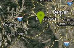
3 Sisters / Alderfer
Evergreen, Colorado
2.8 miles NFirst off, there are two parking areas for this trail. I would suggest parking at the first one you see if it's not full. This makes your ride an up and down rather than a down then...
Mountain Bike
Flying J Ranch
Conifer, Colorado
3.3 miles SESuper easy singletrack with a couple of very short challenging sections. Very possibly the best beginner's trail on the Front Range and just a lovely little park. Going clockwise on...
Mountain Bike
Meyer Ranch Park
Morrison, Colorado
5.3 miles SEThere's nothing special about this ride, but a good little spot to ride a couple of miles if you're coming back from the mountains and have had quite enough for the day. This is a...
Mountain Bike
Bergen Peak
Evergreen, Colorado
5.6 miles NThe trail is part of Elk Meadow trails. Pick up onto meadow view trail and climb to Bergen Peak trail. The climb is not to be underestimated!Joins the Too Long trail and ride down the...
Mountain Bike
Elk Meadow
Evergreen, Colorado
5.6 miles NThere are two different flavours of rides here. The Meadow trail is the easier option. The singletrack is wide most of the way and has only a few technical sections (switchbacks,...
Mountain Bike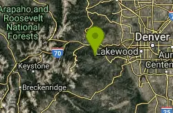
Hicks Mountain
Evergreen, Colorado
7.7 miles NWThis is a good beginner ride or a way to add 5 miles to Beaver Brook . This was a fun ride on an old road. The first couple miles are fairly flat and open. The trail becomes steeper...
Mountain Bike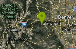
Beaver Brook Watershed
Evergreen, Colorado
8.1 miles NWThis Clear Creek Open Space is located 10 miles from Idaho Springs or just west of Bergen Park on hwy. 103. Currently there is no designated trail system. It looks like Clear Creek...
Mountain Bike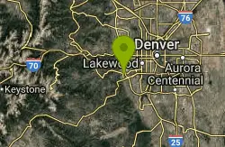
Mount Falcon Park
Morrison, Colorado
10.2 miles NEThe ride is actually a 'lollipop' configuration with an out and back attached to a loop at the top. Ride up the Castle trail where you'll climb about 1800 feet in 3.5 miles. Once you...
Mountain Bike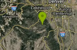
Colorado Trail: South Platte To Buffalo Creek
Conifer, Colorado
10.3 miles SEThe initial climb out of the parking lot is by far the hardest part of this section of the Colorado Trail. Within the past several years, a re-routed portion of trail was created and...
Mountain Bike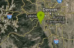
Ken Caryl Valley
Littleton, Colorado
10.3 miles ESingle Track linked togather with a couple short road segments
Mountain Bike
5-Parks
Morrison, Colorado
10.7 miles NELink up of several parks above Morrison.
Mountain Bike
Bear Creek Lake Park
Lakewood, Colorado
11.0 miles NEThis is a good trail system to ride when the foothills and mountains are covered in snow. Located just to the south of Green Mountain, it provides a close-in alternative for riders to...
Mountain Bike
Matthews Winters
Golden, Colorado
11.4 miles NEMatthews/Winters is a good starting point for more than one trail. From the parking lot, go down the trail and over the bridge. Just after the bridge is the Villiage Walk loop, a...
Mountain Bike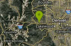
Centennial Cone Park
Golden, Colorado
11.6 miles NThis Jefferson County Open Space Park is only about 10 miles from Idaho Springs.The remains of many ranches and homesteds are scatterd across this Open Space Park. When completed the...
Mountain Bike
Green Mountain
Lakewood, Colorado
11.9 miles NEThis park has three parking areas. The loop is the same from all. From any trailhead, begin a clockwise loop in the park. On the south-east sides of the park, this loop maintains fairly...
Mountain Bike
Apex Park
Golden, Colorado
12.1 miles NEFrom the Heritage Square parking lot, take Apex trail west into Apex gulch. Take a right onto the first trail that branches off about a mile up. This is the Pick n' Sledgetrail. Follow...
Mountain Bike
Hayden Green Mountain Park
Lakewood, Colorado
13.4 miles NEWith more than 2,400 acres of open space, William Frederick Hayden Park on Green Mountain is the second largest park in Lakewood. The park features a challenging network of multi-use trails. The...
Mountain Bike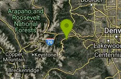
Barbour Fork Loop
Idaho Springs, Colorado
13.8 miles NWThis is a tough but rewarding ride. Some insane climbs and some killer downhill sections all of which can be ridden! Lots of technical rocky sections. You ride through open meadows....
Mountain Bike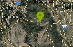
Blackjack / Raspberry Ridge
Pine, Colorado
13.8 miles SAccess the new Raspberry Ridge / Blackjack trails by dropping down the Homestead trail and picking up Raspberry Ridge as it peels off to the left.Raspberry ridge is a technical climb...
Mountain Bike