


Crosier Mountain
Drake, Colorado
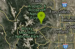
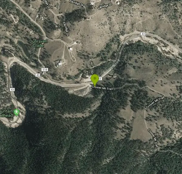
| Address: | ~9497 Co Rd 43, Drake, CO 80515, USA |
| GPS: |
40°27'25.3"N 105°25'32.6"W Maps | Directions |
| State: | Colorado |
| Trail Length: | 10.00 miles |
| MTB Difficulty: | Advanced |
| Trail Type: | Other |
Mountain Bike
*This is a sensitive trail. Please excercise caution to minimize erosions effects. It is a mulit-user trail. There are 3 forks to this trail, and they join up near the summit. The middle fork begins at the rainbow pit trailhead in between Glen Haven(West) and Drake (East). This section sucks, avoid. The best place to start is in Glenn Have. The(technical, steep) climb with snaky switchbacks You will come to a crossroads that will take you west to Glen Haven down a wicked-fast bobsled run of rocks and slabs, thru a usually elk-laden Piper Meadows. It's all downhill from here. Or you can continue up for toward the summit trail. The actual summit trail is not really recommended for bikes. It's just not that fun. Steep, loose. More erosion that it's worth. Keep on rocking past the summit and you'll fly through singletrack meadows and glades and sweeping views of the Big Thompson Canyon. Be warned: continuing on this path will present you with one of two options. 1. Continue to the easternmost trailhead nearest Drake. For wimpy bikers this will mean extensive Hike-a-biking down eroded sections and rock stairs (not the fun kind), and an up-hill road ride back to the car. This trail received a LOT of damage from the floods and used to be 100% downhill ridable by the badass, now even the bad ass are walking a fair amount of the downhill. 2. Turn tail and head back up to the summit area and take the roller-coaster back to Glen Haven. Courtesy of Singletracks.com
More Information
Add ResourceNever modify trail features. Ride trails when they're dry enough that you won't leave ruts. Speak up when you see others on the trail and always yield to hikers, horses, and others coming uphill. Always ride on the established trail.
Read More
- Plan Ahead and Prepare
- Travel & camp on durable surfaces
- Dispose of waste properly
- Leave what you find
- Minimize campfire impacts
- Respect wildlife
- Be considerate of other visitors
Directions
From Drake, Colorado
- Head northeast on US-34 E toward River Fork Rd (2.6 mi)
- Keep right (0.2 mi)
- Merge onto US-34 E (2.6 mi)
- Turn right onto Tracy Trail Rd (138 ft)
- Turn left toward US-34 W (92 ft)
- Turn left onto US-34 W (2.8 mi)
- Merge onto US-34 W (2.6 mi)
- Turn right onto Co Rd 43 (5.9 mi)
- Turn left onto Crosier Mt Trail (148 ft)
Other Mountain Bike Trails Nearby
East Crosier
Estes Park, Colorado
3.0 miles SWA steep, rocky mountain bike trail near Estes Park — short on description but big on challenge.
Mountain Bike
Pole Hill
Estes Park, Colorado
7.1 miles SA complex multi-loop trail rising to nearly 8,500 feet with rocky uphill climbs, technical rock outcroppings, epic views, and fun descents — GPS recommended for the network.
Mountain Bike
Lion Gulch
Estes Park, Colorado
8.8 miles SA short but rocky 6-mile technical ride up to a hilltop fire road and old homesteads — the boulder-field climbing is tough, but the singletrack descent is pure fun.
Mountain Bike
Eden Valley Spur
Loveland, Colorado
10.2 miles EA 1.5-mile out-and-back singletrack at Bobcat Ridge open space near Loveland that rolls along the base of the hogback — mileage-adder territory for experienced riders, a fun beginner challenge with just enough rocks.
Mountain Bike
Bobcat Ridge
Loveland, Colorado
10.7 miles EAn easy-to-intermediate mountain bike loop at Bobcat Ridge in Loveland through a cabin, a burn area, and varied terrain — rideable well into shoulder seasons.
Mountain Bike
Herrington
Loveland, Colorado
14.0 miles NETwo sections of singletrack linking Spring Creek to Stout to Towers and back, offering interesting routing alternatives and loop-building options in Horsetooth Mountain Park near Loveland.
Mountain Bike
Coulson Gulch
Lyons, Colorado
14.3 miles SA sweet descent to the North Saint Vrain River, then a couple of miles following the river upstream — easy to follow, with optional connections to Button Rock Preserve.
Mountain Bike
Sawmill
Fort Collins, Colorado
14.4 miles NEA narrow singletrack in Horsetooth Mountain Park connecting mid-mountain trails to the reservoir, with tight switchbacks and rocky obstacles — typically ridden downhill.
Mountain Bike
Wathen Trail
Fort Collins, Colorado
14.6 miles EA technical singletrack challenge near Horsetooth Park, 10 minutes from Fort Collins, with man-made log stairs, a ridge climb, and a fast, sweet descent back to the access road.
Mountain Bike
Devil's Backbone
Loveland, Colorado
14.7 miles EThree connected trails — the Backbone, the Wilds, and the Hunters — through stunning geology near Loveland, with rattlesnakes possible and very little shade; soon to link 50+ miles of trail.
Mountain Bike
Horsetooth Mountain Park
Fort Collins, Colorado
14.7 miles ESome of the best riding on the Front Range near Fort Collins — a mix of singletrack and fire road with as much technical challenge and climbing as you want.
Mountain Bike
Nomad
Fort Collins, Colorado
14.9 miles NERolling singletrack near Horsetooth Reservoir connecting lower Towers trail to Sawmill and Lory State Park — mostly packed dirt with easy up-and-down through gullies.
Mountain Bike
Rimrock
Fort Collins, Colorado
15.3 miles EA very technical loop near Fort Collins that will have you hopping off your bike for some sections — come prepared for hike-a-bike.
Mountain Bike
Pineridge Natural Area
Fort Collins, Colorado
15.8 miles EA 7-mile-plus trail network at Pineridge Natural Area near Fort Collins with a small lake, wetlands, forested hillside, and prairie — great beginner-to-intermediate riding within pedaling distance of town.
Mountain Bike
Johnny Park Road
Allenspark, Colorado
16.1 miles SA forest road near Allenspark, Colorado open to motorized vehicles — a simple, accessible ride or drive through the area.
Mountain Bike
Heil Valley Ranch
Boulder, Colorado
18.1 miles SEOver 13.5 miles of bike-legal singletrack at Heil Valley Ranch near Boulder with characteristic Front Range rockiness, serious flow on the descents, and amazing views from the ridge top.
Mountain Bike
Picture Rock Trail
Lyons, Colorado
18.8 miles SEAccess to Heil Valley Ranch trails past old buildings and a shot-up car, with the option to extend through Wild Turkey, Ponderosa, and the top-of-ranch loops.
Mountain Bike
Hall Ranch
Boulder, Colorado
22.3 miles SA physically and technically demanding loop near Boulder that climbs through rough singletrack, a valley meadow, and switchbacks on Bitterbrush and Nelson Loop trails.
Mountain Bike
Bunce School Road To T33 Crash Site
Lyons, Colorado
23.0 miles SA mostly Class 2 doubletrack ride near Lyons, Colorado with a middle Class 4 stretch — leading to a WWII T-33 jet crash site with large aluminum fragments still visible on the ground.
Mountain Bike
Ceran Saint Vrain Loop
Ward, Colorado
23.1 miles SFairly easy trails in a scenic valley near Ward with some technical sections along steep drops — plenty of exploring possible, but the area can be confusing; expect company on weekends.
Mountain Bike


