


Heil Valley Ranch
Boulder, Colorado
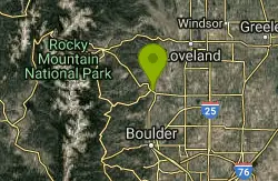
| Address: | ~314 Main St, Boulder, CO 80302, USA |
| GPS: |
40°13'28.0"N 105°16'5.5"W Maps | Directions |
| State: | Colorado |
| Trail Length: | 14.00 miles |
| MTB Difficulty: | Intermediate |
| Trail Type: | Lariat |
| MTB Trail Type: | Singletrack |
Mountain Bike
There are currently 13.5 miles of bike-legal trails at Heil Valley ranch, but in order to ride all of them at once you’d have to do at least 23-24 miles of pedaling. The trail system is basically laid out with a figure 8 around the top of the mountain/ridge, and an out-and-back trail running up to it from the north and one from the south. The trailhead location given here, and one of the most popular rides, is to ride from the southern trailhead, up the 2.5-mile trail, around some of the trails on top, and back down. The out-and-back trail coming in from the north is 5.5 miles one-way, so riding from the northern trailhead would make for a longer ride… and riding absolutely everything would make for a grueling experience with tons of climbing.But all of that climbing is worth it, though! The trails here sport that characteristic Front Range rockiness, with plenty of chunk to pedal through on the climb up and around the upper trails. However, there are a few buff sections of trail thrown in at random, and none of the rocks are seriously big. It is all very easy to pedal through, and by Front Range standards is probably only intermediate in difficulty.Once at the top, be sure to take in the amazing views of the Front Range! Then get ready to descend. The descent back down is what it’s all about, and despite all of the rocks these trails sport some serious flow! All of the undulations, grade reversals, and swooping turns are just perfect, allowing you to carry some serious speed. But since both of the trails climbing to the top are ridden out-and-back, be sure to watch for oncoming traffic and to always ride in control. This trail is very popular, so keep your eyes peeled and don’t get too crazy… but have fun, because the bomb back down is awesome! Courtesy of Singletracks.com
More Information
Add ResourceNever modify trail features. Ride trails when they're dry enough that you won't leave ruts. Speak up when you see others on the trail and always yield to hikers, horses, and others coming uphill. Always ride on the established trail.
Read More- Plan Ahead and Prepare
- Travel & camp on durable surfaces
- Dispose of waste properly
- Leave what you find
- Minimize campfire impacts
- Respect wildlife
- Be considerate of other visitors
Directions
From Boulder, Colorado
- Head south on 19th St toward Arapahoe Ave (138 ft)
- Turn right at the 1st cross street onto Arapahoe Ave (0.4 mi)
- Turn right onto Broadway (3.5 mi)
- Turn left onto US-36 W (10.8 mi)
- Turn left to stay on US-36 WDestination will be on the left(1.4 mi)
Other Mountain Bike Trails Nearby
Picture Rock Trail
Lyons, Colorado
0.9 miles SAccess to Heil Valley Ranch trails past old buildings and a shot-up car, with the option to extend through Wild Turkey, Ponderosa, and the top-of-ranch loops.
Mountain Bike
Hall Ranch
Boulder, Colorado
5.5 miles SA physically and technically demanding loop near Boulder that climbs through rough singletrack, a valley meadow, and switchbacks on Bitterbrush and Nelson Loop trails.
Mountain Bike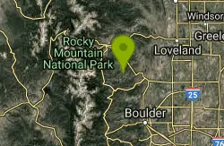
Coulson Gulch
Lyons, Colorado
7.7 miles WA sweet descent to the North Saint Vrain River, then a couple of miles following the river upstream — easy to follow, with optional connections to Button Rock Preserve.
Mountain Bike
Boulder Valley Ranch
Boulder, Colorado
7.9 miles SDirt road, doubletrack, and singletrack wind through a working cattle ranch near Boulder, with good plains and mountain views and a connection to Boulder Reservoir via Eagle and Sage trails.
Mountain Bike
Lobo Trail
Longmont, Colorado
10.5 miles SEA graded double-track trail (with some paved greenway) following train tracks diagonally across the Front Range from Longmont to Boulder.
Mountain Bike
Ceran Saint Vrain Loop
Ward, Colorado
11.6 miles SWFairly easy trails in a scenic valley near Ward with some technical sections along steep drops — plenty of exploring possible, but the area can be confusing; expect company on weekends.
Mountain Bike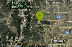
Bald Mountain Trail
Boulder, Colorado
12.8 miles SA short, steep trail on Bald Mountain with a spectacular summit view — ride counter-clockwise to avoid the technical uphill section, and keep an eye out for mountain lions.
Mountain Bike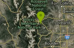
Lion Gulch
Estes Park, Colorado
13.2 miles NWA short but rocky 6-mile technical ride up to a hilltop fire road and old homesteads — the boulder-field climbing is tough, but the singletrack descent is pure fun.
Mountain Bike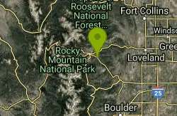
Pole Hill
Estes Park, Colorado
13.4 miles NWA complex multi-loop trail rising to nearly 8,500 feet with rocky uphill climbs, technical rock outcroppings, epic views, and fun descents — GPS recommended for the network.
Mountain Bike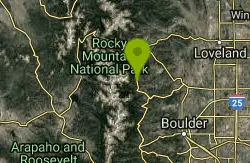
Johnny Park Road
Allenspark, Colorado
13.9 miles WA forest road near Allenspark, Colorado open to motorized vehicles — a simple, accessible ride or drive through the area.
Mountain Bike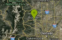
Chapman Drive
Boulder, Colorado
14.1 miles SA 940-foot climb up the backside of Flagstaff Mountain on a 1930s CCC dirt road, with vintage stone bridges and views north to Longs Peak — downhill access added in April 2013.
Mountain Bike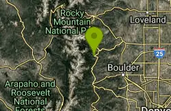
Bunce School Road To T33 Crash Site
Lyons, Colorado
14.2 miles SWA mostly Class 2 doubletrack ride near Lyons, Colorado with a middle Class 4 stretch — leading to a WWII T-33 jet crash site with large aluminum fragments still visible on the ground.
Mountain Bike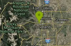
Devil's Backbone
Loveland, Colorado
14.3 miles NEThree connected trails — the Backbone, the Wilds, and the Hunters — through stunning geology near Loveland, with rattlesnakes possible and very little shade; soon to link 50+ miles of trail.
Mountain Bike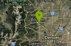
CU Dirt Jumps
Boulder, Colorado
14.9 miles SA compact 0.75-mile jump network with dirt jumps for all levels — from beginners catching their first air to advanced riders launching big.
Mountain Bike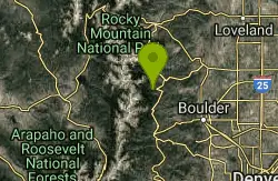
Buchanan Pass
Lyons, Colorado
15.0 miles SWA 4.5-mile singletrack that drops to a creek crossing and follows it to the wilderness boundary — or loop it with the 4x4 road and Buchanan Pass for technical descents.
Mountain Bike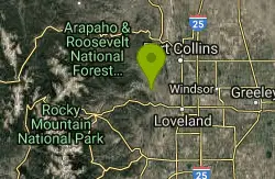
Eden Valley Spur
Loveland, Colorado
17.4 miles NA 1.5-mile out-and-back singletrack at Bobcat Ridge open space near Loveland that rolls along the base of the hogback — mileage-adder territory for experienced riders, a fun beginner challenge with just enough rocks.
Mountain Bike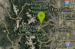
East Crosier
Estes Park, Colorado
17.4 miles NWA steep, rocky mountain bike trail near Estes Park — short on description but big on challenge.
Mountain Bike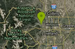
Bobcat Ridge
Loveland, Colorado
17.8 miles NAn easy-to-intermediate mountain bike loop at Bobcat Ridge in Loveland through a cabin, a burn area, and varied terrain — rideable well into shoulder seasons.
Mountain Bike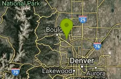
Davidson Mesa
Louisville, Colorado
17.9 miles SA small network of tame trails linking together in various ways across the mesa — the steepest trail is still manageable, making this a great ride for kids.
Mountain Bike
Crosier Mountain
Drake, Colorado
18.1 miles NWA multi-fork mountain bike trail near Drake with snaky switchbacks, a wicked-fast downhill bobsled run through elk-laden Piper Meadows, and big views of Big Thompson Canyon — flood damage means even strong riders will walk some downhill sections.
Mountain Bike


