


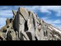
Gannett Peak
| Address: | Gannett Peak, Wyoming 82513, USA |
| GPS: |
43°11'3.8"N 109°39'14.5"W Maps | Directions |
| State: | Wyoming |
| Trails/Routes: | 21.2-25.2 mi |
Backpack and Hike
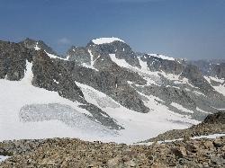
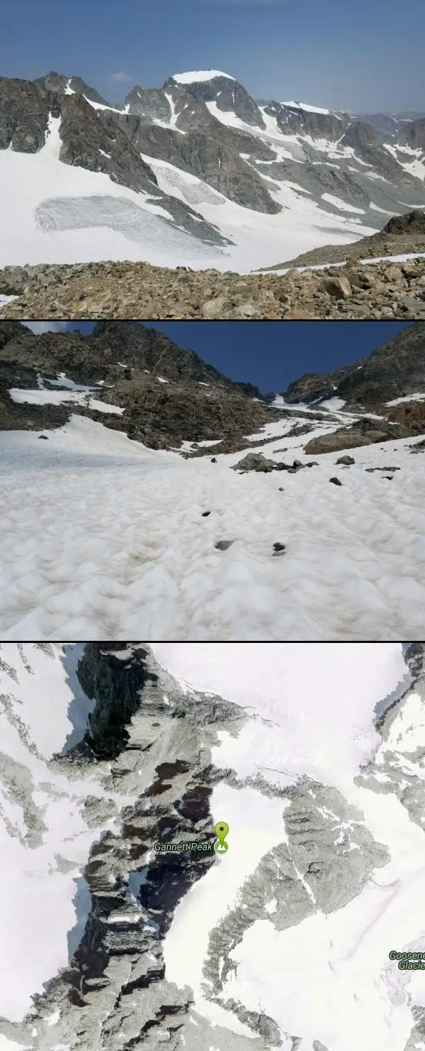
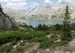
At 13,308 feet in elevation, Gannett Peak is considered to be one of the most difficult state highpoints, rivaled only by Alaska's Denali, Washington's Mount Rainier, and Montana's Granite Peak which have a range of difficulties based on weather and conditions of the climb.
July to August are considered to be the best times to go. If you try too early in the season, all the streams and lakes are still frozen over. If you go too late, then snow and bad weather is more common which makes more a much more strenuous hike. The downside to going in July and August is that the Wind Rivers are renowned for horrendous swarms of voracious mosquitoes. Many climbing parties prefer visiting during July when the Gooseneck Glacier bergschrund (and other crevasses) are not yet fully opened (if at all). Snowpack can actually make a summit attempt less strenuous than travelling on ice and/or rock for long distances.
There are three major trails to the top:
- Pole Creek Trail to Titcomb Basin
This is a 40 mile round trip with approximately 9050 feet cumulative elevation gain. This route has long been considered the main standard approach for Gannett Peak, although the Glacier Trail approach from the east has been gaining popularity during recent years. This western approach is a well-travelled route full of spectacular scenery and views. - Glacier Trail
This trail is a 50 mile round trip from the Dubois side and has a cumulative elevation gain of 10,750 feet. The biggest advantage to this route is it puts you at a higher camp for your summit day giving you a better chance of success and less strenuous terrain than the standard western approach. - Ink Wells Trail
The advantage of this route is that a large amount of distance and effort can be saved by the time the route intersects with the Glacier Trail. However, the disadvantage of this route is that access is both limited and expensive. This route crosses the Wind River Indian Reservation, which requires special permission, guidance, and transportation to travel through. Reservations are required in advance and sometimes difficult to achieve, and even if a reservation can be made, the cost can be substantial.
Mapped Route/Trail Distances
| Pole Creek Trail to Titcomb Basin | 21.2 miles |
| Glacier Trail | 25.2 miles |
More Information
Be courteous, informed, and prepared. Read trailhead guidelines, stay on the trail, and don't feed the wildlife.
Read More- Plan Ahead and Prepare
- Travel & camp on durable surfaces
- Dispose of waste properly
- Leave what you find
- Minimize campfire impacts
- Respect wildlife
- Be considerate of other visitors
Directions
- Get directions on Google Maps


Trails
Distance ?
21.2 milesElevation Gain ?
4,456 feetReal Ascent ?
8,069 feetReal Descent ?
3,613 feetAvg Grade (2°)
4%Grade (-48° to 54°)
-111% to 137%Distance ?
25.2 milesElevation Gain ?
6,226 feetReal Ascent ?
9,413 feetReal Descent ?
3,187 feetAvg Grade (3°)
5%Grade (-26° to 46°)
-48% to 103%Elevation differences are scaled for emphasis. While the numbers are accurate, the cut-away shown here is not to scale.
Other Hiking Trails and Backpacking Trails Nearby
Island Lake
Pinedale, Wyoming
13.4 miles SBackpack, Hike, and Horseback near Pinedale, Wyoming
Backpack, Hike, Horseback 16.7 mi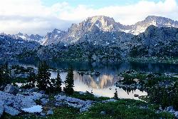
Fremont Peak
Pinedale, Wyoming
13.4 miles SFremont Peak is the third highest peak in Wyoming and straddles the boundary between Fremont and Sublette counties. It is named for American explorer John C. Fremont who climbed the peak with Charles...
Backpack, HikeNearby Campsites
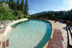
Granite Hot Springs
Jackson, Wyoming
41.8 miles WThis from a report: Civilian Conservation Corps (CCC) constructed Granite Hot Springs Pool. While the hot springs have attracted visitors for thousands of years, it wasn't until the mid-1930s...
Camp, Hot Springs, Swim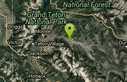
Crystal Creek Campground
Jackson, Wyoming
48.8 miles NWCrystal Creek Campground is located along the Gros Ventre River and Crystal Creek, both designated Wild and Scenic Rivers for the spectacular surrounding scenery and excellent fishing opportunities....
Camp


