


138 Hiking Trails near 'A' Mountain at Hayden Butte
first prev 1 2 3 4 5 6 7 next lastShowing Hiking Trails within 50 miles Distance miles of 311 E Veterans Way, Tempe, AZ 85281, USA City, Zip, or Address

Tom's Thumb to Bell Pass
Scottsdale, Arizona
16.1 miles NHike and Mountain Bike near Scottsdale, Arizona
Hike, Mountain Bike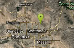
Horseshoe Loop Hike
Scottsdale, Arizona
16.1 miles NHike near Scottsdale, Arizona
Hike
Gateway and Tom's Thumb Loop Trail
Scottsdale, Arizona
16.1 miles NStarting at the 104th St trailhead, head toward the Gateway loop trail. Turn right at the Gateway loop. Next take the Bell pass trail and be prepared for a steep climb. Once you hit...
Hike, Horseback, Mountain Bike
Gatewa-Prospector-Thompson Peak Road Trail
Scottsdale, Arizona
16.1 miles NHike near Scottsdale, Arizona
Hike
Inspiration Point
Scottsdale, Arizona
16.1 miles NInspiration Point is a 5.7, moderate hike located on the McDowell Sonoran Preserve near Scottsdale, Arizona. You'll begin your hike at the Gateway area, where you can find a parking lot...
Hike, Mountain Bike 0.6 mi
Horseshoe Trail
Scottsdale, Arizona
16.3 miles NHorseshoe trail is a short, fun singletrack with a lot of quick turns created by wash areas and rocks. It's a nice warm-up heading to Gateway Loop Trail. In some areas there are a lot of cactus,...
Hike, Horseback, Mountain Bike
Sonoran Trail Fountain Hills
Fountain Hills, Arizona
17.4 miles NEHike near Fountain Hills, Arizona
Hike
Dixie Mine
Fountain Hills, Arizona
17.4 miles NEMcDowell Mountain Regional Park 16300 McDowell Mountain Park Dr. MMRP Arizona 85255 Ph: 480-471-0173 Fax: 602-372-8507 [email protected] Mailing...
Hike
Thompsons Peak
Fountain Hills, Arizona
17.4 miles NEHike near Fountain Hills, Arizona
Hike 2.1 mi
Lower Salt River Nature Trail
Fort McDowell, Arizona
17.8 miles NEThe Lower Salt River Nature Trail is a scenic walk to take at the Tonto National Forest. This trail provides stunning views as you walk alongside the Salt River. This rustic trail is older and less...
Camp, Hike
Fountain Hills Park
Fountain Hills, Arizona
17.8 miles NEFountain Park is a 1.3 mile loop trail located near Phoenix, Arizona ( in Fountain Hills) and is good for all skill levels. The trail is primarily used for hiking and is accessible...
Hike
Fountain Park Trail
Fountain Hills, Arizona
17.8 miles NEFountain views, Four Peaks view, desert vegetation, close to coffee! The trail is well groomed and well marked. It parallels some house as you begin to go up the first hill. About 15...
Hike, Mountain Bike
Scarlett Canyon
Phoenix, Arizona
18.3 miles NScarlett Canyon trail (not officially named) is an unmarked trail adjacent to the Scarlett Canyon residential neighborhood. This is a 3 mile loop trail considered to be easy to...
Hike, Horseback, Mountain Bike, Rock Climb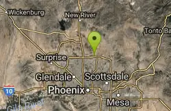
Reach 11 Trail
Phoenix, Arizona
18.4 miles NHike near Phoenix, Arizona
Hike
Buckhorn Campground Nature Trail
Apache Junction, Arizona
18.4 miles ECamp and Hike near Apache Junction, Arizona
Camp, Hike 1.7 mi
Levee Trail
Mesa, Arizona
18.5 miles ELocated within the Usery Mountain Regional Park, the Levee trail is named so because it mostly follows the top of levee, running parallel to a large section of the channel trail and a Phoenix...
Hike, Horseback, Mountain Bike
Crismon Wash Trail
Mesa, Arizona
18.5 miles EThe Crismon Wash Trail is 1.8 mile trail that is accessible from the south at the Crismon road trailhead. It is also accessible from the Blevins train to the north. There are several...
Hike, Horseback, Mountain Bike 1.5 mi
Moon Rock Loop
Apache Junction, Arizona
18.6 miles ELocated within the larger Usery Mountain Regional Park, the Moon Rock loop is a fast and smooth trail that adds 1.3 miles to the more famous Blevins Trail. Although the Moon Rock loop is not known as...
Hike, Horseback, Mountain Bike

Glendale Canal
Glendale, Arizona
19.7 miles NWHike, Horseback, and Mountain Bike near Glendale, Arizona
Hike, Horseback, Mountain Bike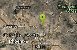
Tom's Thumb, Feldspar, and Marcus Landslide Loop
Scottsdale, Arizona
20.1 miles NHike near Scottsdale, Arizona
Hike


