


7 Hiking Trails near Spotsylvania County, VA
first prev 1 next lastShowing Hiking Trails within 50 miles Distance miles of Spotsylvania County, VA, USA City, Zip, or Address
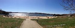
Swim Beach at Lake Anna State Park
Mineral
13.8 miles SWA groomed sand beach on the public side of Lake Anna, with a buoyed swimming area, a bathhouse and a seasonal snack bar at the end of the state park road. Swimming is unguarded and free; only parking is charged.
Camp, Canoe, Hike, Kayak, Swim 5.2 mi

Hazel River Falls
Sperryville, Virginia
45.1 miles NWA 5.3-mile moderate hike in Shenandoah National Park leading to two moss-covered waterfalls, a wading and swimming pool, flat sunbathing rocks, and small caves to explore.
Hike, Swim
Rose River
Syria, Virginia
46.2 miles NWA moderately difficult 4-mile forested loop in Shenandoah National Park descending to the Rose River and a stunning 67-foot waterfall — wading is possible in some spots.
Hike, Swim 2.8 mi
Cedar Run Falls
Oldrag, Virginia
47.2 miles NWSix waterfalls, a natural waterslide, and a deep swimming hole reward experienced hikers who tackle this strenuous 8-mile, 2,794-ft-elevation Shenandoah trail.
Hike, Swim
Whiteoak Canyon
Syria, Virginia
47.9 miles NWA Shenandoah hike featuring both a two-tiered lower waterfall and a classic single-drop upper falls — with cool wading spots along the trail for a well-earned break before the 1,040-foot climb back.
Hike, Swim 0.3 mi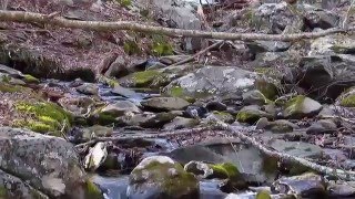
Big Rock Falls
Syria, Virginia
48.5 miles NWA moderately challenging 1.5-mile trail follows Mill Prong River to a beautiful cascading waterfall with a swimming hole that fills up nicely at higher water levels.
Hike, Swim
Nicholson Hollow Trail
Morning Star, Virginia
49.5 miles NWAn 8-mile moderately strenuous Shenandoah hike past stream crossings, small cascading waterfalls, shaded forest, and the historic Corbin Cabin — wading is possible in low-flow conditions.
Hike, Swim


