


7 Hiking Trails near Wisdom, MT 59761
first prev 1 next lastShowing Hiking Trails within 50 miles Distance miles of Wisdom, MT 59761, USA City, Zip, or Address
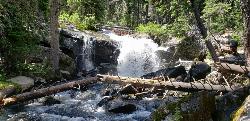
Pintler Falls
Wise River, Montana
16.8 miles NHike near Wise River, Montana
Hike
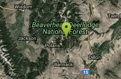
Minneopa Lake
Polaris, Montana
28.3 miles SEThis is a beautiful short hike that is easily the start of a great trip between several lakes or just a nice easy kid hike. Length: .25 mile (.5 mile roundtrip)
Backpack, Camp, Hike 0.1 mi
Canyon Creek Charcoal Kilns
Melrose, Montana
28.4 miles ETwenty remarkably preserved brick-dome charcoal kilns from the 1880s silver-mining boom stand as a ghost of a multi-million-dollar industry that vanished by 1915.
Hike
Lake Agnes
Glen, Montana
30.5 miles EA steep 1.5-mile climb through dense timber leads to 99-acre Agnes Lake, with sandy driftwood-covered beaches tucked in the Pioneer Mountains of southwestern Montana.
Camp, Hike, Mountain Bike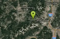
Spring Hill Campground and Picnic Area
Anaconda, Montana
40.7 miles NA scenic mountain campground beside Warm Springs Creek in Beaverhead-Deerlodge National Forest, with 28 sites, great trout fishing, and Georgetown Lake just 8 miles away.
Camp, Hike, Horseback, Mountain Bike, Swim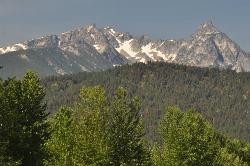
Trapper Peak
Darby, Montana
42.2 miles WTrapper Peak is the highest summit in Montana's Bitterroot Mountains, a rugged 10,157-foot granite crown rising some 6,000 feet above the Bitterroot Valley near the town of Darby in the...
Hike
North Fork Canyon (River of No Return)
McCall, Idaho
44.8 miles SWThe longest free-flowing river within one state in the lower 48 — 425 miles of the Salmon River from Sawtooth origins through designated wild and recreational corridors in central Idaho.
Camp, Canoe, Cave, Hike, Horseback, Mountain Bike, Whitewater


