


Trapper Peak
Darby, Montana
| Address: | Trapper Peak Trailhead, Bitterroot National Forest, R 5630, Darby, MT 59829, USA |
| GPS: |
45°50'49.6"N 114°15'52.7"W Maps | Directions |
| State: | Montana |
Hike
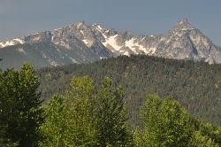
Trapper Peak is the highest summit in Montana's Bitterroot Mountains, a rugged 10,157-foot granite crown rising some 6,000 feet above the Bitterroot Valley near the town of Darby in the state's southwest corner. A strenuous but non-technical climb rewards hikers with staggering views across the Bitterroot and Sapphire ranges — a bucket-list summit for peak-baggers in western Montana.
The route follows Trail #133 from the Trapper Peak Trailhead, climbing roughly 6 miles with about 4,000 feet of elevation gain to the summit — a steep, demanding day hike. The first miles wind in and out of forest with growing views of Boulder Mountain and the peak ahead; the trees gradually give way to an open boulder field, and the final stretch works up toward the saddle and along the ridge above treeline to the top. The reach of the view from the summit is immense.
To reach the trailhead from Darby, head south on US Highway 93, turn west onto West Fork Road (State Highway 473), and follow it toward Forest Service Road 5630 and the trailhead. July and August are the prime months, as snow covers much of the trail before July.
Come prepared for a serious mountain hike: carry plenty of water (there is none along the trail), sun protection, layers for cool and windy high-country conditions, and sturdy footwear for the rocky upper slopes. Start early, watch for afternoon thunderstorms, and turn around if the weather turns. For fit hikers, standing atop the Bitterroots' highest point is an unforgettable Montana adventure.
More Information
Trapper Peak Trail | Visit Montana
Trapper Peak Trail (133) is maintained every two years. Difficult, steep trail that gets moderate to high use.
https://visitmt.com/listing/trapper-peak-trail-4387Be courteous, informed, and prepared. Read trailhead guidelines, stay on the trail, and don't feed the wildlife.
Read More
- Plan Ahead and Prepare
- Travel & camp on durable surfaces
- Dispose of waste properly
- Leave what you find
- Minimize campfire impacts
- Respect wildlife
- Be considerate of other visitors
Directions
From Darby, Montana
- Head west on E Miles Ave toward N Water St (0.2 mi)
- Turn left onto US-93 S/N Main StContinue to follow US-93 S(4.2 mi)
- Turn right onto State Hwy 473 (11.3 mi)
- Turn right onto R 5630Destination will be on the left(6.5 mi)


Other Hiking Trails Nearby
North Fork Canyon (River of No Return)
McCall, Idaho
33.5 miles SThe longest free-flowing river within one state in the lower 48 — 425 miles of the Salmon River from Sawtooth origins through designated wild and recreational corridors in central Idaho.
Camp, Canoe, Cave, Hike, Horseback, Mountain Bike, Whitewater 0.6 mi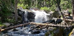
Pintler Falls
Wise River, Montana
39.7 miles EPintler Falls is a peaceful backcountry waterfall in the Anaconda-Pintler Wilderness of southwestern Montana, a reward at the end of a pretty forest-and-creek hike in the high mountains of the...
HikeNearby Campsites
Salmon River
Salmon, Idaho
32.5 miles SThe longest free-flowing river in the lower 48 states — the Salmon River runs undammed for 425 miles from Sawtooth peaks to Hells Canyon, draining 14,000 square miles of wild Idaho.
Camp, Whitewater
North Fork Canyon (River of No Return)
McCall, Idaho
33.5 miles SThe longest free-flowing river within one state in the lower 48 — 425 miles of the Salmon River from Sawtooth origins through designated wild and recreational corridors in central Idaho.
Camp, Canoe, Cave, Hike, Horseback, Mountain Bike, Whitewater 
Pintler Lake Campground and Picnic Area
Wise River, Montana
39.8 miles EPintler Lake Campground and Picnic Area is a tiny, free, wonderfully remote campground on the edge of a small mountain lake in the Beaverhead-Deerlodge National Forest of southwestern Montana, at the...
Camp, Canoe, Kayak, Swim


