


North Fork Canyon (River of No Return)
McCall, Idaho
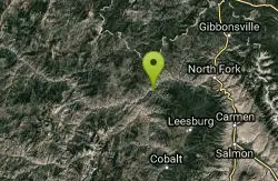
Camp, Canoe, Cave, Hike, Horseback, Mountain Bike, and Whitewater
Known as "The River of No Return," the Salmon River is the longest free-flowing river (425 miles) within one state in the lower 48. It originates in the Sawtooth and Lemhi Valleys of central and eastern Idaho, and snows from the Sawtooth and Salmon River Mountains in the south, and the Clearwater and Bitterroot Mountains in the north, feed this river. The upper section passes through the Frank Church River of No Return Wilderness, while the lower section forms the southern boundary of the Gospel-Hump Wilderness. In recognition of the river's many outstanding values, including scenery, recreation, geology, fish, wildlife, water quality, botany, prehistory, history and cultural traditional use, Congress designated 46 miles of the river, from North Fork to Corn Creek, as a recreational river and 79 miles, from Corn Creek to Long Tom Bar, as a wild river.
More Information
National Wild and Scenic River System | Rivers.gov
The National Wild and Scenic Rivers System was created by Congress in 1968 to preserve rivers with outstanding natural, cultural, and recreational values.
https://rivers.gov/rivers/river/salmon-idahoNever modify trail features. Ride trails when they're dry enough that you won't leave ruts. Speak up when you see others on the trail and always yield to hikers, horses, and others coming uphill. Always ride on the established trail.
Read MoreBe courteous, informed, and prepared. Read trailhead guidelines, stay on the trail, and don't feed the wildlife.
Read More
- Plan Ahead and Prepare
- Travel & camp on durable surfaces
- Dispose of waste properly
- Leave what you find
- Minimize campfire impacts
- Respect wildlife
- Be considerate of other visitors
Directions
From McCall, Idaho
- Head east on E Lake St toward N 3rd St (135 ft)
- E Lake St turns right and becomes ID-55 S/N 3rd StContinue to follow ID-55 S(65.0 mi)
- Turn left onto County Hwy 17/Banks Lowman RdContinue to follow County Hwy 17(33.3 mi)
- Turn left onto ID-21 N (58.1 mi)
- Turn left onto ID-75 N (54.9 mi)
- Turn left onto US-93 N (60.3 mi)
- Turn left onto US-93 N/Main St (signs for Hamilton/Missoula)Continue to follow US-93 N(21.6 mi)
- Turn left onto NF-30/Salmon River Rd (19.8 mi)
The river turns abruptly north at the confluence with the Little Salmon River at Riggins, about 87 miles (140 km) above its mouth. From there the river flows almost due north, passing White Bird, before looping northwest and south to its confluence with the Snake River north of Hells Canyon, 15 miles (24 km) south of the Washington border and 40 miles (64 km) south of Lewiston.

Other Mountain Bike Trails, Hiking Trails, Canoeing Areas, Caves, Horseback Trails, and Whitewater Rapids Nearby
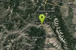
Salmon River
Salmon, Idaho
14.1 miles EThe longest free-flowing river in the lower 48 states — the Salmon River runs undammed for 425 miles from Sawtooth peaks to Hells Canyon, draining 14,000 square miles of wild Idaho.
Camp, Whitewater 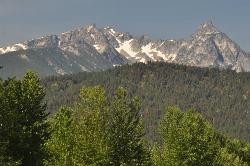
Trapper Peak
Darby, Montana
33.5 miles NTrapper Peak is the highest summit in Montana's Bitterroot Mountains, a rugged 10,157-foot granite crown rising some 6,000 feet above the Bitterroot Valley near the town of Darby in the...
Hike 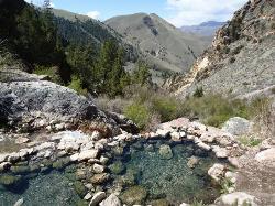
Goldbug (Elk Bend) Hot Springs
Salmon, Idaho
36.3 miles SEA 4-mile out-and-back hike near Salmon, Idaho, leading to rock-laid hot springs on a hillside — the first stretch crosses private property, so please be respectful of that access.
Hike, Hot Springs


