


Joes Valley Reservoir
Orangeville
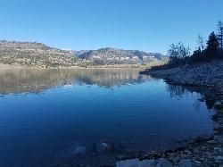
Camp, Canoe, Hike, Kayak, and Swim
Joes Valley Reservoir is a Bureau of Reclamation lake of roughly 1,190 acres on the Wasatch Plateau in Emery County, the centerpiece of the Joes Valley Recreation Area on the Ferron Ranger District of the Manti-La Sal National Forest. Reclamation built the 192-foot earthfill dam on Seely Creek between 1963 and 1965 as part of the Emery County Project, and the Emery Water Conservancy District runs it for irrigation and municipal water. The lake sits at about 7,000 feet in an open, high valley below the cliffs of the plateau.
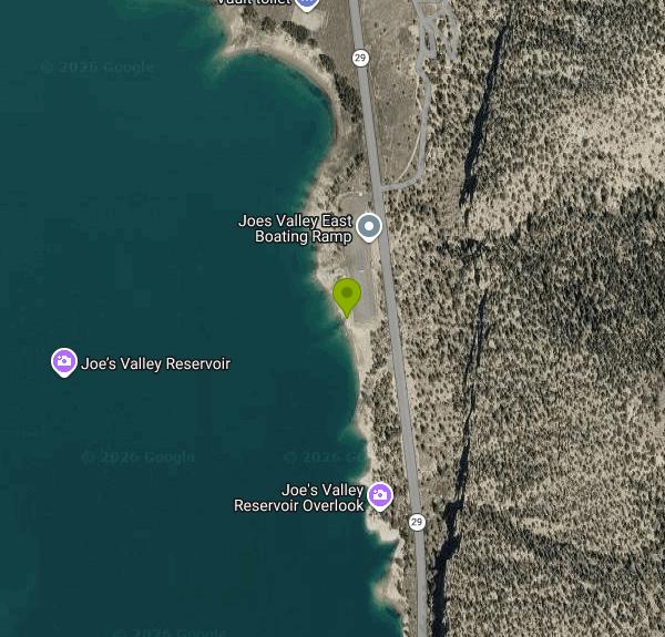
From Orangeville, follow State Route 29 northwest up Straight Canyon for about 13 to 14 miles until the reservoir comes into view. The road is paved but narrow, and climbers and anglers often park on the shoulders in the canyon, so drive slowly. About a mile past the first view of the water, after the Joes Valley Overlook pullout, the Joes Valley Boat Ramp East turnoff is on the west side of the highway. It is a day-use site with a large paved lot and vault toilets but no drinking water, and this pin marks the shoreline just south of the ramp.
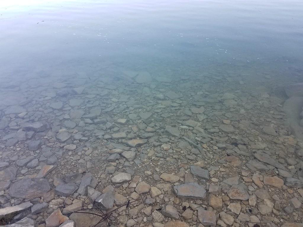
There is no designated swim beach, roped area or lifeguard anywhere on the reservoir. People swim from the open national forest shoreline, most often along the east side near the ramp, where the edge is a mix of gravel and flat cobble that slopes into clear water. Bring water shoes for the rocks. This is a high-elevation reservoir filled by snowmelt, so the water stays cold well into summer, and the same water is used by powerboats, water-skiers and anglers, so stay well clear of the ramp lane. Because the lake stores irrigation water, levels drop through late summer and fall and the shoreline widens.
Day use at the boat ramps and fishing sites is free; the Forest Service lists no day-use fee for them, and the ramp is open for day use only with no overnight camping. Overnight stays cost money: the Joes Valley Campground charges $10 per night for a single site and $18 for a double, and the Pavilion group site is $50 per night for up to 100 people, both reservable on Recreation.gov. The recreation season usually starts in May, and weather and snowmelt decide when sites open and close.
Check current conditions before you go. As of September 2026 the Forest Service reports that drinking water is not available at Joes Valley Campground, so bring your own. Joes Valley Marina is listed as permanently closed, and the Forest Service page for Joes Valley Boat Ramp West shows that site as closed, so use the east ramp. The Forest Service also warns that the Orangeville to Ephraim road beyond the reservoir is impassable at higher elevations, and that conditions change with weather and spring runoff, so call the Ferron Ranger District before a trip early or late in the season. The nearest gas and groceries are back in Orangeville.
Fishing is the main draw for many visitors. The Utah Division of Wildlife Resources stocks splake and tiger muskie, and cutthroat and tiger trout are also caught; state rules here allow only one trout over 18 inches. The Reeder Trailhead connects to the Arapeen OHV trail system, the historic Orange Olsen Cabin and Dwelling can be rented through the Forest Service, and the boulders of Straight Canyon and Cottonwood Canyon below the dam draw climbers from across the country.
More Information
Bureau of Reclamation
Bureau of Reclamation - Managing water and power in the West
https://www.usbr.gov/projects/index.php?id=447Federal Register :: Proposed Recreation Fee Sites
The Manti-La Sal National Forest is proposing to establish several recreation fee sites. Proposed recreation fees collected at the proposed recreation fee sites and for the proposed special recreation permit would be used for operation, maintenance, and improvement of the sites and the special...
https://www.federalregister.gov/documents/2026/09/08/2026-18245/proposed-recreation-fee-sitesJoes Valley Reservoir — Emery County
0 Skip to Content @supports (-webkit-backdrop-filter: none) or (backdrop-filter: none) { .header-blur-background { } } Attractions Main Attractions Westside The Swell Green River Activities All Activities HIke Swim Horseback Fish Disc Golf Picnic Learn Night Skies Photography Birdwatching Climb Boat Golf Ride Bike About Events Recharge Lodging Dining Events 2 Plan Your Trip .top-bun, .patty, .bottom-bun { height: 1px; } Open Menu Close Menu Attractions Main Attractions Westside The Swell Green River Activities All Activities HIke Swim Horseback Fish Disc Golf Picnic Learn Night Skies Photography Birdwatching Climb Boat Golf Ride Bike About Events Recharge Lodging Dining Events 2 Plan Your Trip .top-bun, .patty, .bottom-bun { height: 1px; } Open Menu Close Menu Folder: Attractions Back Main Attractions Westside The Swell Green River Folder: Activities Back All Activities HIke Swim Horseback Fish Disc Golf Picnic Learn Night Skies Photography Birdwatching Climb Boat Golf Ride Bike About Events Folder: Recharge Back Lodging Dining Events 2 Plan Your Trip (function() { var header = document.getElementById('header'); if (!header) { return; } function setHeaderHeightVar() { document.documentElement.style.setProperty( '--header-height', header.getBoundingClientRect().height + 'px' ); } setHeaderHeightVar(); var images = header.getElementsByTagName('img'); for (var i = 0; i < images.length; i++) { if (!images[i].complete) { images[i].addEventListener('load', setHeaderHeightVar); } } })(); //# sourceURL=reserveSpaceForHeader.js .fe-667b28479c0bfc3deafff019 { --grid-gutter: calc(var(--sqs-mobile-site-gutter, 6vw) - 0.0px); --cell-max-width: calc( ( var(--sqs-site-max-width, 1500px) - (0.0px * (8 - 1)) ) / 8 ); display: grid; position: relative; grid-area: 1/1/-1/-1; grid-template-rows: repeat(45,minmax(24px, auto)); grid-template-columns: minmax(var(--grid-gutter), 1fr) repeat(8, minmax(0, var(--cell-max-width))) minmax(var(--grid-gutter), 1fr); row-gap: 0.0px; column-gap: 0.0px; overflow-x: hidden; overflow-x: clip; } @media (min-width: 768px) { .background-width--inset .fe-667b28479c0bfc3deafff019 { --inset-padding: calc(var(--sqs-site-gutter) * 2); } .fe-667b28479c0bfc3deafff019 { --grid-gutter: calc(var(--sqs-site-gutter, 4vw) - 0.0px); --cell-max-width: calc( ( var(--sqs-site-max-width, 1500px) - (0.0px * (24 - 1)) ) / 24 ); --inset-padding: 0vw; --row-height-scaling-factor: 0.0215; --container-width: min(var(--sqs-site-max-width, 1500px), calc(100vw - var(--sqs-site-gutter, 4vw) * 2 - var(--inset-padding) )); grid-template-rows: repeat(28,minmax(calc(var(--container-width) * var(--row-height-scaling-factor)), auto)); grid-template-columns: minmax(var(--grid-gutter), 1fr) repeat(24, minmax(0, var(--cell-max-width))) minmax(var(--grid-gutter), 1fr); } } .fe-block-0380e0ce84d4c8f70a4b { grid-area: 1/1/12/11; z-index: 1; @media (max-width: 767px) { } } .fe-block-0380e0ce84d4c8f70a4b .sqs-block { justify-content: center; } .fe-block-0380e0ce84d4c8f70a4b .sqs-block-alignment-wrapper { align-items: center; } @media (min-width: 768px) { .fe-block-0380e0ce84d4c8f70a4b { grid-area: 1/1/11/27; z-index: 1; } .fe-block-0380e0ce84d4c8f70a4b .sqs-block { justify-content: center; } .fe-block-0380e0ce84d4c8f70a4b .sqs-block-alignment-wrapper { align-items: center; } } .fe-block-493667596d8423d6ca73 { grid-area: 2/2/4/10; z-index: 2; @media (max-width: 767px) { } } .fe-block-493667596d8423d6ca73 .sqs-block { justify-content: flex-start; } .fe-block-493667596d8423d6ca73 .sqs-block-alignment-wrapper { align-items: flex-start; } @media (min-width: 768px) { .fe-block-493667596d8423d6ca73 { grid-area: 4/14/7/22; z-index: 3; } .fe-block-493667596d8423d6ca73 .sqs-block { justify-content: flex-start; } .fe-block-493667596d8423d6ca73 .sqs-block-alignment-wrapper { align-items: flex-start; } } .fe-block-8563bc30f3371e794f28 { grid-area: 4/2/6/10; z-index: 3; @media (max-width: 767px) { } } .fe-block-8563bc30f3371e794f28 .sqs-block { justify-content: flex-start; } .fe-block-8563bc30f3371e794f28 .sqs-block-alignment-wrapper { align-items: flex-start; } @media (min-width: 768px) { .fe-block-8563bc30f3371e794f28 { grid-area: 6/17/9/24; z-index: 8; } .fe-block-8563bc30f3371e794f28 .sqs-block { justify-content: flex-start; } .fe-block-8563bc30f3371e794f28 .sqs-block-alignment-wrapper { align-items: flex-start; } } .fe-block-9cb4140c7a445d2d35d1 { grid-area: 7/2/16/10; z-index: 5; @media (max-width: 767px) { } } .fe-block-9cb4140c7a445d2d35d1 .sqs-block { justify-content: center; } .fe-block-9cb4140c7a445d2d35d1 .sqs-block-alignment-wrapper { align-items: center; } @media (min-width: 768px) { .fe-block-9cb4140c7a445d2d35d1 { grid-area: 3/3/26/13; z-index: 4; } .fe-block-9cb4140c7a445d2d35d1 .sqs-block { justify-content: center; } .fe-block-9cb4140c7a445d2d35d1 .sqs-block-alignment-wrapper { align-items: center; } } .fe-block-02ce821ba90b117ff051 { grid-area: 17/2/43/10; z-index: 4; @media (max-width: 767px) { } } .fe-block-02ce821ba90b117ff051 .sqs-block { justify-content: flex-start; } .fe-block-02ce821ba90b117ff051 .sqs-block-alignment-wrapper { align-items: flex-start; } @media (min-width: 768px) { .fe-block-02ce821ba90b117ff051 { grid-area: 12/14/27/25; z-index: 11; } .fe-block-02ce821ba90b117ff051 .sqs-block { justify-content: center; } .fe-block-02ce821ba90b117ff051 .sqs-block-alignment-wrapper { align-items: center; } } .fe-block-2ebdb0ac9b56e01e7299 { grid-area: 41/1/46/11; z-index: 6; @media (max-width: 767px) { } } .fe-block-2ebdb0ac9b56e01e7299 .sqs-block { justify-content: center; } .fe-block-2ebdb0ac9b56e01e7299 .sqs-block-alignment-wrapper { align-items: center; } @media (min-width: 768px) { .fe-block-2ebdb0ac9b56e01e7299 { grid-area: 19/1/29/13; z-index: 5; } .fe-block-2ebdb0ac9b56e01e7299 .sqs-block { justify-content: center; } .fe-block-2ebdb0ac9b56e01e7299 .sqs-block-alignment-wrapper { align-items: center; } } #block-0380e0ce84d4c8f70a4b .sqs-shape-block-container-system_desktop { display: flex; } #block-0380e0ce84d4c8f70a4b .sqs-block-alignment-wrapper { justify-content: center; } #block-0380e0ce84d4c8f70a4b .sqs-shape > * { stroke: none; } #block-0380e0ce84d4c8f70a4b { --shape-block-background-color: hsla(var(--accent-hsl), 1) ; } #block-0380e0ce84d4c8f70a4b .sqs-shape-block-container-system_desktop { display: flex; } @media screen and (max-width: 767px) { #block-0380e0ce84d4c8f70a4b .sqs-block-alignment-wrapper { justify-content: center; } #block-0380e0ce84d4c8f70a4b { --shape-block-background-color: hsla(var(--accent-hsl), 1) ; } } Joes Valley #block-493667596d8423d6ca73 { --stroke-style: none;--stroke-thickness: 6px; } #block-493667596d8423d6ca73 .sqs-html-content { --tweak-text-block-padding: 6% 6% 6% 6%; --tweak-text-block-padding: initial; } .fe-block-493667596d8423d6ca73 { mix-blend-mode: var(--tweak-text-block-blend ); border-radius: var(--tweak-text-block-radius); } .fe-block-493667596d8423d6ca73 { --tweak-text-block-radius: 0px 0px 0px 0px; } .fe-block-493667596d8423d6ca73 { --tweak-text-block-blend : normal; } .fe-block-493667596d8423d6ca73 { --blur-value: blur(15px);} @media screen and (max-width: 767px) { #block-493667596d8423d6ca73 { } } @media screen and (max-width: 767px) { #block-493667596d8423d6ca73 .sqs-html-content { } } @media screen and (max-width: 767px) { } Reservoir #block-8563bc30f3371e794f28 { --stroke-style: none;--stroke-thickness: 6px; } #block-8563bc30f3371e794f28 .sqs-html-content { --tweak-text-block-padding: 6% 6% 6% 6%; --tweak-text-block-padding: initial; } .fe-block-8563bc30f3371e794f28 { mix-blend-mode: var(--tweak-text-block-blend ); border-radius: var(--tweak-text-block-radius); } .fe-block-8563bc30f3371e794f28 { --tweak-text-block-radius: 0px 0px 0px 0px; } .fe-block-8563bc30f3371e794f28 { --tweak-text-block-blend : normal; } .fe-block-8563bc30f3371e794f28 { --blur-value: blur(15px);} @media screen and (max-width: 767px) { #block-8563bc30f3371e794f28 { } } @media screen and (max-width: 767px) { #block-8563bc30f3371e794f28 .sqs-html-content { } } @media screen and (max-width: 767px) { } #block-9cb4140c7a445d2d35d1 { --image-component-focal-point: 50% 50%; --image-component-object-fit: cover; --image-component-overlay-opacity: 0; --image-component-overlay-blend-mode: normal; --image-component-native-aspect-ratio: 4032/1908; } #block-9cb4140c7a445d2d35d1 .fluid-image-container.visitor-mode { overflow: hidden;-webkit-mask-image: -webkit-radial-gradient(white, black);clip-path: none;-webkit-clip-path: none; } #block-9cb4140c7a445d2d35d1 .js-content-mode-element-wrapper { position: relative; width: 100%; height: 100%; display: none; } #block-9cb4140c7a445d2d35d1 .js-content-mode-element-system_desktop { display: block; } Joe's Valley is situated on the Wasatch Plateau in Central Utah. Juniper, pinyon pine and sagebrush cover the area, and aspens and pines dot the surrounding hillsides.
https://visitemerycounty.com/joes-valley-reservoirJoes Valley Reservoir, Manti-La Sal National Forest - Recreation.gov
Explore Joes Valley Reservoir in Manti-La Sal National Forest, Utah with Recreation.gov. Joe's Valley Reservoir Campground is located in a high mountain valley next to its namesake, at an elevation of 7,000 feet. Visitors enjoy boating, fishing and
https://www.recreation.gov/camping/campgrounds/232253Manti-La Sal National Forest | Joes Valley Boat Ramp East | Forest Service
Boating site on east side of Joes Valley Reservoir, between the Joes Valley Overlook and the Joes ValleyFishing Site East.
https://www.fs.usda.gov/r04/manti-lasal/recreation/joes-valley-boat-ramp-eastManti-La Sal National Forest | Joes Valley Campground | Forest Service
Joes Valley Reservoir Campground is located in a high mountain valley adjacent to and just above Joes Valley Reservoir at an elevation of ~7,000 feet. Juniper, pinyon pine and sagebrush cover the area, and aspen and pine dot the surrounding hillsides. Several sites provide nice views of the reservoir, and some sites are shaded. The campground contains several single- and double-family campsites, all of which are accessible. Vault toilets and drinking water are provided. Roads and parking spurs are paved. A boat ramp is located within the campground. The reservoir offers good fishing for cutthroat, rainbow trout and trophy splake. Visitors enjoy boating, fishing, water skiing, and canoeing, as well as horseback riding, hiking and mountain biking. The expansive Arapeen OHV Trail System can be accessed just west of the reservoir and has more than 350 miles of designated, well-maintained trails that are suitable for all riding skill levels.
https://www.fs.usda.gov/r04/manti-lasal/recreation/joes-valley-campgroundManti-La Sal National Forest | Joes Valley Recreation Area | Forest Service
Joe's Valley is situated on the Wasatch Plateau in Central Utah. A 1200-acre reservoir (Joes Valley Reservoir) is the center of activities in the Joes Valley Recreation Area. This recreation area includes picnic sites, campgrounds, a pavilion group campground, fishing sites, a marina, boat ramps, hiking trails, OHV trails, climbing sites, and an overlook/observation site. Pinyon pine, juniper, and sagebrush cover the area, while aspen and pine trees dot the surrounding hillsides. Just 14 miles northwest of Orangeville, it is the perfect basecamp for boating, water skiing, canoeing, fishing, hunting, camping, hiking, climbing, mountain biking, horseback riding, and OHVing. Vault toilets and drinking water are provided in the campgrounds. Roads and parking spurs are paved. Joe's Valley Resort is also nearby, offering a restaurant and general store. Boat, personal watercraft, off-highway vehicle (OHV) and bike rentals are available there.
https://www.fs.usda.gov/r04/manti-lasal/recreation/joes-valley-recreation-areaManti-La Sal National Forest | Joes Valley Reservoir | Forest Service
Is a 1,192 acre Reservoir located next to Joes Valley Campground. The Department of Wildlife Resources of Utah (DWR) stocks this reservoir with Splake (hybrid between Brook and Lake Trout) and Muskie Tiger. Anglers have caught trophy splake up to 16 pounds. Likely catches in this reservoir are: Splake, Cutthroat Trout, and Tiger Trout.
https://www.fs.usda.gov/r04/manti-lasal/recreation/joes-valley-reservoirBe courteous, informed, and prepared. Read trailhead guidelines, stay on the trail, and don't feed the wildlife.
Read More
- Plan Ahead and Prepare
- Travel & camp on durable surfaces
- Dispose of waste properly
- Leave what you find
- Minimize campfire impacts
- Respect wildlife
- Be considerate of other visitors
Directions
From Orangeville
- Head west on Broadway toward Diane Dr (2.6 km)
- Turn left onto Dutch Ln/
Dufferin County Rd 3 (signs for Dufferin Rd 3) Continue to follow Dufferin County Rd 3(16.7 km) - Continue onto Orangeville-Fergus Rd/
County Rd 3/ Regional Rd 3 (1.4 km) - Continue onto Wellington Rd 18 (1.4 km)
- At the roundabout, continue straight (66 m)
- Continue onto Wellington Rd 18 (4.5 km)
- Turn left onto 4 Line (2.4 km)
- Turn right onto Eramosa Garafraxa Townline/
Townline Eramosa Garafraxa (5.3 km) - Turn left onto Jones Baseline (0.5 km)
- Turn right onto 4 Line (1.5 km)
- Turn left onto Hwy 6 S (10.9 km)
- Turn right onto Marden Rd/
Wellington Rd 30/ Wellington County Rd 30 (signs for Maryhill) Continue to follow Wellington Rd 30/(6.6 km)Wellington County Rd 30 - Turn left onto Township Rd 3 (2.9 km)
- Continue onto Wellington Rd 32 (2.8 km)
- Turn right onto Paisley Rd (2.1 km)
- Turn left onto Township Road 1 (2.9 km)
- Turn right onto Wellington Rd 124 (0.6 km)
- At the roundabout, take the 2nd exit onto Waterloo Regional Rd 24 (4.6 km)
- At the roundabout, take the 2nd exit and stay on Waterloo Regional Rd 24 (1.8 km)
- At the roundabout, take the 2nd exit and stay on Waterloo Regional Rd 24 (0.4 km)
- Merge onto ON-401 W via the ramp to London (98.3 km)
- Keep right to continue on ON-402 W, follow signs for SarniaToll road(102 km)
- Continue onto Blue Water Brg WToll roadEntering the United States of America (Michigan)(1.0 km)
- Continue onto I-69/
Blue Water Brg W Toll road(1.3 km) - Keep left to continue on I-69/
I-94 W, follow signs for Detroit/ Flint/ Lansing Toll road(4.2 km) - Take exit 271 for I-69 toward Flint/
Lansing (1.4 km) - Continue onto I-69 W (201 km)
- Slight right onto I-69 S (signs for Charlotte/
Ft Wayne) (55.2 km) - Take exit 38 to merge onto I-94 W toward ChicagoPassing through IndianaEntering Illinois(249 km)
- Continue onto I-80 WToll road(10.7 km)
- Keep right to stay on I-80 W, follow signs for IowaToll road(13.0 km)
- Keep left to stay on I-80 W (26.1 km)
- Slight left (7.9 km)
- Keep left (0.3 km)
- Continue straight (2.0 km)
- Merge onto I-80 W (184 km)
- Take the exit to stay on I-80 W toward DavenportEntering Iowa(288 km)
- Take exit 137A on the left to merge onto I-235 W toward Des Moines (21.5 km)
- Take exit 1A for 50th St toward W Des Moines (0.6 km)
- Turn left onto 50th St (0.9 km)
- Turn right onto Ashworth Rd (7.1 km)
- Turn left onto Grand Prairie Pkwy (0.8 km)
- Take the ramp onto I-80 W (125 km)
- Take exit 40 for US-59 toward Avoca/
Harlan (0.5 km) - Turn left onto US-59 S/
N Chestnut St (0.3 km) - Make a U-turn (0.3 km)
- Turn left to merge onto I-80 W toward Council BluffsEntering Nebraska(629 km)
- Take exit 102 for I-76 W toward Denver (2.3 km)
- Continue onto I-76 WEntering Colorado(299 km)
- Take the exit onto I-70 W (34.7 km)
- Continue straight to stay on I-70 WEntering Utah(585 km)
- Take exit 116 toward Moore (0.4 km)
- Turn right onto Co Rd 803 (70 m)
- Turn left onto S Moore Cutoff Rd (26.5 km)
- Turn right onto N Moore Rd (5.9 km)
- Turn right onto UT-10 N/
State St (20.7 km) - Take exit 34 toward Orangeville (0.3 km)
- Turn left onto UT-57 N (10.6 km)
- Take the UT-29 ramp to Orange Ville (0.2 km)
- Turn left onto UT-29 WDestination will be on the left(18.0 km)
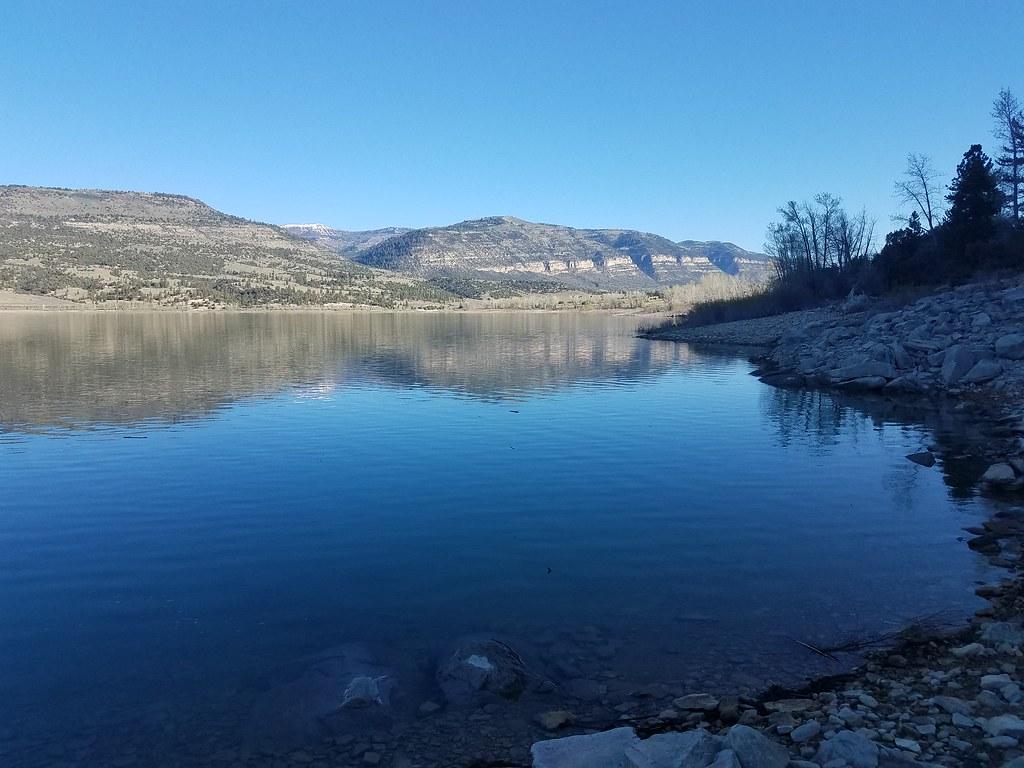
 Calm water along the rocky east shoreline of Joes Valley Reservoir near the boat ramp. courtesy of Frost Museum↗ (CC BY 2.0↗)
 Clear shallow water over the flat cobble bottom at the reservoir's east edge. courtesy of Frost Museum↗ (CC BY 2.0↗)
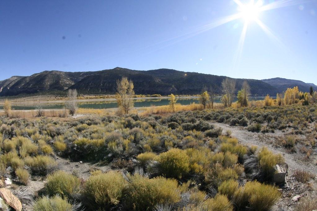
 Joes Valley Reservoir in autumn, seen across sagebrush flats from the shore. courtesy of borderlys↗ (CC BY 2.0↗)
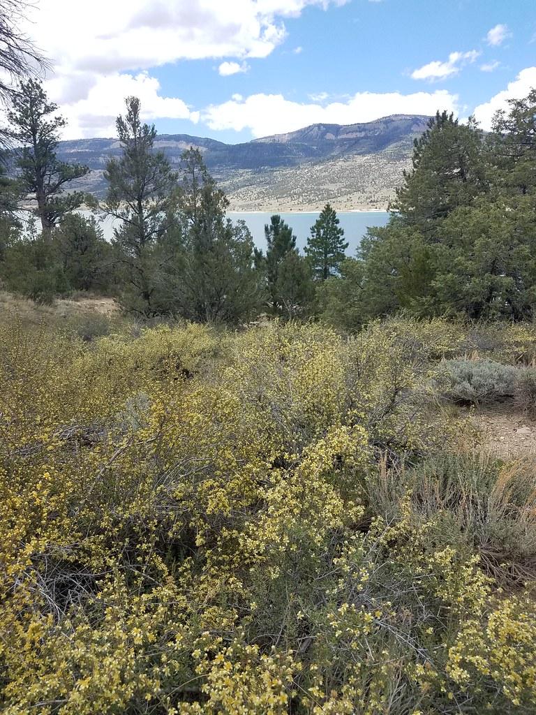
 The reservoir seen through pines and blooming shrubs on the east side. courtesy of Frost Museum↗ (CC BY 2.0↗)
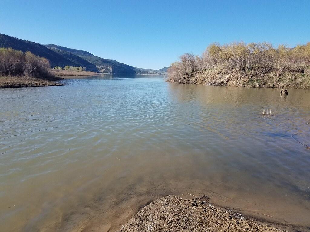
 The north arm of the reservoir where the inlet stream enters the lake. courtesy of Frost Museum↗ (CC BY 2.0↗)
Other Swimming Holes, Hiking Trails, Canoeing Areas, and Kayaking Areas Nearby
Millsite State Park
Ferron
15.1 miles SMillsite Reservoir sits at the mouth of Ferron Canyon in Emery County, with a sandy state park beach on the south shore under 2,000 feet of sandstone. Swimming is open, day use is $10 per vehicle, and the pool drops through the summer as the reservoir irr
Camp, Hike, Kayak, Swim
Maple Canyon
Fountain Green, Utah
27.7 miles NWMaple Canyon's one-of-a-kind cobblestone conglomerate cliffs host 140+ bolted routes from 5.4 to 5.14, making it one of the most unique climbing destinations in the US.
Camp, Hike, Mountain Bike, Rock Climb 1.1 mi
Gordon Creek Falls
Helper, Utah
27.8 miles NEUpper and lower waterfalls, an old prospector's cabin, and ancient pictographs reward those who make the remote ATV or hiking journey into Gordon Creek Canyon.
Hike, Mountain Bike, Swim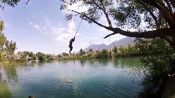
Mona Rope Swing
Midway, Utah
46.6 miles NWA classic rope swing over the Burraston Ponds — built in the 1930s and still swinging — with stocked trout fishing, picnic grills, and Wasatch mountain views.
Swim
Grotto Falls
Payson, Utah
49.6 miles NWA gentle wooded creek trail with bridges leads to a waterfall and limestone grotto you can crawl around — all ages welcome and especially stunning in fall color season.
HikeNearby Campsites
Millsite State Park
Ferron
15.1 miles SMillsite Reservoir sits at the mouth of Ferron Canyon in Emery County, with a sandy state park beach on the south shore under 2,000 feet of sandstone. Swimming is open, day use is $10 per vehicle, and the pool drops through the summer as the reservoir irr
Camp, Hike, Kayak, Swim
Maple Canyon
Fountain Green, Utah
27.7 miles NWMaple Canyon's one-of-a-kind cobblestone conglomerate cliffs host 140+ bolted routes from 5.4 to 5.14, making it one of the most unique climbing destinations in the US.
Camp, Hike, Mountain Bike, Rock Climb


