


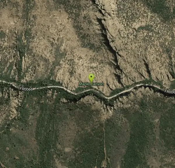
Maple Canyon
Fountain Green, Utah

| Address: | FR0066, Fountain Green, UT 84632, USA |
| GPS: |
39°33'19.3"N 111°40'39.7"W Maps | Directions |
| State: | Utah |
Restrooms Picnic Tables Trails Rocks
Camp, Hike, Mountain Bike, and Rock Climb
Maple Canyon is a fantastic place for hiking, rock climbing, and camping. This maple tree-filled canyon is one of the nation's most unique rock climbing areas and is well-known for sport climbing. Climbers from around the world come to test their skills on Maple Canyon's one-of-a-kind cliffs. On any given weekend climbers of all abilities, ranging from novice to expert, can be seen testing their skills on the cobblestone cliffs. The canyon also provides great bouldering opportunities. The canyon has over 40 cliffs all ranging from 30 - 300 feet. There are over 140 bolted routes available with climbing grades from 5.4 to 5.14.
The Maple Canyon campground provides multiple single family sites. Some of these sights require walking a short distance with your gear from the parking area. Vault toilets are provided, but there isn't any drinking water. This is a "pack in and pack out" site, so make sure to pack out all the garbage and things you brought with you.
There is so much to explore and do, you would be hard pressed to fit everything you want to do into one day here at Maple Canyon.
Last updated May 19, 2017
More Information
Never modify trail features. Ride trails when they're dry enough that you won't leave ruts. Speak up when you see others on the trail and always yield to hikers, horses, and others coming uphill. Always ride on the established trail.
Read MoreBe courteous, informed, and prepared. Read trailhead guidelines, stay on the trail, and don't feed the wildlife.
Read More- Plan Ahead and Prepare
- Travel & camp on durable surfaces
- Dispose of waste properly
- Leave what you find
- Minimize campfire impacts
- Respect wildlife
- Be considerate of other visitors
Directions
From Fountain Green, Utah
- Head east on W 100 N St toward N State St (213 ft)
- Turn right at the 1st cross street onto N State St (0.5 mi)
- Turn right onto W 400 S St (0.4 mi)
- Turn left (0.3 mi)
- Continue onto West Side Rd (5.3 mi)
- Turn right onto S Freedom Rd (0.5 mi)
- Turn right (1.5 mi)
- Continue onto FR0066Destination will be on the right(0.9 mi)
From Fountain Green, Utah, head south on West Side Road for 7 miles to Freedom Road in Freedom. Turn right onto Freedom Road and watch for Maple Canyon signs. Travel 3 miles northeast of Freedom to the campground.
From Moroni go 9 miles west, following the signs for Maple Canyon.
OR
From Salt Lake City take I-15 South to Nephi Utah. At Nephi take exit 225 to Manti/Ephraim. Travel on Highway 132 to Fountain Green. Once you enter the town you will see a sign for Maple canyon. Turn right on 400-south and travel approx 6 miles to Freedom Road. From this point just following the signs.


Other Rock Climbing Walls, Mountain Bike Trails, and Hiking Trails Nearby

Yuba State Park
Levan, Utah
20.4 miles SWExcellent rides.Restrooms and drinking water available at state park entrance. Entry to state park not required to ride. Courtesy of Singletracks.com
Mountain Bike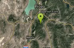
Blackhawk Loop
Salem, Utah
26.7 miles NThe Blackhawk loop is one of the premier singletrack rides in Utah! Blackhawk loop is composed of couple of different trails, so the name changes from time to time. I would recommend...
Mountain Bike
Grotto Falls
Payson, Utah
27.4 miles NGrotto Falls is a short trail into the Payson Canyon. Visitors will enjoy a quick walk through the woods along the creek, as they cross over several bridges and make their way towards the Grotto....
Hike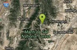
Donnercicle - Joe's Valley
Orangeville, Utah
27.4 miles SEAnother great ice climbing route in Joe's Valley Campground. Joes Valley Reservoir Campground is located in a high mountain valley adjacent to and just above Joes Valley Reservoir at an...
Rock Climb
CCC Falls - Joe's Valley
Orangeville, Utah
27.8 miles SEJoe's Valley is one of the better ice climbing areas in Utah and usually has the benefit of not being crowded. This beautiful valley on the edge of the San Rafael Swell has a multitude of good...
Rock Climb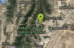
Highway to Heaven - Joe's Valley
Orangeville, Utah
31.2 miles SEJoe's Valley is one of the better ice climbing areas in Utah and usually has the benefit of not being crowded. This beautiful valley on the edge of the San Rafael Swell has a multitude of good...
Rock Climb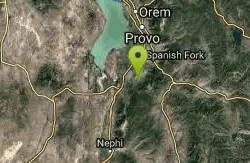
4 Bay
Elk Ridge, Utah
31.3 miles NTrails are smooth with some rocky or root spots. Gradual climbs and descents. Crosses 4 wheeler trails. South of the small water reservoir, look for metal signs on wood posts with trail...
Mountain Bike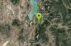
Sheepherder Loop
Payson, Utah
32.3 miles NSheepherder, along with the Blawkhawk trail are two of the best singletrack rides around! The Sheepherder trail is one of those "impossible, uphill loops"!! With all of the short climbs...
Mountain Bike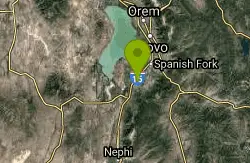
P Mountain and Little Mountain
Payson, Utah
33.9 miles NP mountain can be seen from many of the points in Payson. Ask any local and they can guide you there!
Hike
Dripping Rock
Spanish Fork, Utah
36.8 miles NDripping Rock is along a paved path adjacent to Spanish Oaks Golf Course.
Hike 2.3 mi
Gordon Creek Falls
Helper, Utah
38.8 miles EGordon Creek Falls is a set of waterfalls (upper and lower) accessable usually by ATV, but also by hiking, if desired. The trail will take you to the first set of falls, as marked below, and from...
Hike, Mountain Bike, Swim 4.7 mi
Fifth Water Hot Springs
Provo, Utah
40.3 miles NEAKA Diamond Fork Hot Springs A beautiful drive and a 2.5 mile hike along the river will end you at an amazing set of hot springs that's well worth the trip. There's a variety of...
Backpack, Camp, Hike, Hot Springs, Mountain Bike, Swim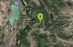
Three Forks Loop
Springville, Utah
40.4 miles NEThe Three Forks Loop is a strong-intermediate to advanced trail. Length is 16 miles, with 1900 vertical feet of elevation change. The trail begins at Three Forks, where Cottonwood...
Mountain Bike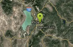
Squaw Peak Trail
Springville, Utah
42.8 miles NStart at Rock Canyon trailhead, ride straight up the trail, passing a green gate and subsequently 5 wooden bridges. 1/4 mile after the last bridge, take a left on "Squaw Peak Trail."...
Mountain Bike
Bicentennial Park
Provo, Utah
45.6 miles NBicentennial Park is a favorite among disc golfers and families in the Provo area. The park has a 16-hole golf course, a duck pond, a playground, and a nature trail which features natural springs...
Disc Golf, Hike, Sled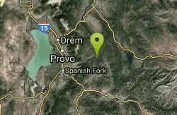
Wardsworth Creek
Springville, Utah
46.7 miles NThis trail is intermediate technical and moderate aerobic. The scenery is great as you follow the creek up the canyon. Enjoy some rooty and rocky climbs on your way up to a small pond...
Mountain Bike
Y-Mountain Summit Trail
Provo, Utah
47.9 miles NY Mountain is located directly east of Brigham Young University (BYU) in Provo, Utah, United States. The Slide Canyon/Y Mountain Trail leads to a large block Y located 1.2 miles (1.9 km) from a...
Camp, HikeNearby Campsites
Fifth Water Hot Springs
Provo, Utah
40.3 miles NEAKA Diamond Fork Hot Springs A beautiful drive and a 2.5 mile hike along the river will end you at an amazing set of hot springs that's well worth the trip. There's a variety of...
Backpack, Camp, Hike, Hot Springs, Mountain Bike, Swim
Y-Mountain Summit Trail
Provo, Utah
47.9 miles NY Mountain is located directly east of Brigham Young University (BYU) in Provo, Utah, United States. The Slide Canyon/Y Mountain Trail leads to a large block Y located 1.2 miles (1.9 km) from a...
Camp, Hike


