


Gordon Creek Falls
Helper, Utah

| Address: | Trestle Rd, Helper, UT 84526, USA |
| GPS: |
39°37'16.6"N 110°57'14.1"W Maps | Directions |
| State: | Utah |
| Trails/Routes: | 1.1 mi |
Waterfalls Rocks Bicycles Motorized Use
Hike, Mountain Bike, and Swim
Gordon Creek Falls is a refreshing pair of waterfalls tucked into the high desert canyons near Helper, Utah, in the Carbon County backcountry. With an accessible lower falls and a more remote upper falls, it's a fun, scenic outing for hikers, mountain bikers, and ATV riders looking to chase some flowing water in an otherwise dry landscape.
The lower falls is the main draw and the easier to reach — roughly a mile from the Trestle Road trailhead along a route popular with hikers, bikers, ATVs, and horses. From there, the upper falls lies about a mile and a half further along the trail for those wanting more adventure (and a historic cabin awaits even deeper in, around 6.4 miles round trip). The falls are at their most impressive in spring and early summer, when snowmelt sends the water roaring.
You can get right up close and even dip your toes at the top of the falls, but take real care here: this is a flash-flood-prone canyon, so never venture in when rain threatens, and watch your footing — the rocks around the falls are slippery and the water moves faster than it looks. Keep kids close and stay back from the edges.
Spring and early summer bring the fullest flow; the route can be hot and exposed in midsummer. The road in toward the creek gets steep and soft, so a capable high-clearance or four-wheel-drive vehicle (or your own two feet) is the way to go. Dogs are welcome on the trail. Bring plenty of water, watch the weather, and pack out your trash — Gordon Creek Falls is one of Carbon County's most rewarding little adventures.
More Information
Buckhorn Wash & Gordon Creek – May 2014 | Gardiner Family Adventures
May 9-10, 2014 A few months ago we tried to plan a spring break ride with the Bradley family since we both have kids attending the University of Utah. We were not able to arrange a time that worked, so we decided to do a trip as soon as the semester ended, in early May.…
https://gardinerfamilyadventures.wordpress.com/2014/05/19/buckhorn-wash-gordon-creek-may-2014/Gordon Creek Falls | DesertWoodrat
On Saturday, I took another ATV ride. This time I headed North to the Gordon Creek Falls. I staged near the North Springs shooting range and rode from there finding several geocaches along the way. First stop was a tunnel going under the old railroad through Haley Canyon. I climbed up and into the tunnel, neat spot.…
https://desertwoodrat.wordpress.com/2012/11/03/gordon-creek-falls/Hiking to Gordon Creek Waterfalls, Helper, Utah - Girl on a Hike
Gordon Creek Waterfall is near Helper, Utah. Most people like to arrive here by ATV, however it's a super easy hike that is great for the whole family.
https://girlonahike.com/gordon-creek-waterfalls.htmlMany Places to Explore at Gordon Creek - ETV News
The Gordon Creek Falls ATV and hiking trail is a beautiful, mild-moderate road leading to two separate falls and an abandoned cabin. The area is full of wildlife and beauty, as well as many opportunities to play in the water. Distance from Price: 11 miles, about 15 minute drive Trail Distance: Approximately 15 miles Average Time: Times vary
https://etvnews.com/articles/local-sports/many-places-to-explore-at-gordon-creek/Never modify trail features. Ride trails when they're dry enough that you won't leave ruts. Speak up when you see others on the trail and always yield to hikers, horses, and others coming uphill. Always ride on the established trail.
Read MoreBe courteous, informed, and prepared. Read trailhead guidelines, stay on the trail, and don't feed the wildlife.
Read More
- Plan Ahead and Prepare
- Travel & camp on durable surfaces
- Dispose of waste properly
- Leave what you find
- Minimize campfire impacts
- Respect wildlife
- Be considerate of other visitors
Directions
From Helper, Utah
- Head south on S Main St toward Ivy St (0.1 mi)
- Turn right onto Poplar St (0.3 mi)
- Slight left onto US-191 S/US-6 E (2.0 mi)
- Turn right onto N 3550/Consumers RdContinue to follow Consumers Rd(3.2 mi)
- Turn left onto Trestle RdDestination will be on the right(3.4 mi)
Drive about 3 miles south of Helper, UT on HWY 191. Turn right onto Consumers Road, and drive 2.7 miles. Veer left onto a dirt road. If you drive past the railroad track you've gone too far. Once down the dirt road, cross the first cattle guard and continue driving. At 1.6 miles you will be parallel to the railroad track on your right. At 2.5 miles cross the railroad track and continue down the dirt road to the left, and the railroad track will now be on your left. At 3.1 miles cross the 2nd cattle guard. At 3.3 miles look for the Gordon Creek Trail sign on your right. Park anywhere near this sign. The trail literally starts here, so to get to the falls just walk down this ATV road. Courtesy of girlonahike.com




Other Mountain Bike Trails, Swimming Holes, and Hiking Trails Nearby
Strawberry Narrows
Heber City, Utah
35.5 miles NA well-maintained roller-coaster singletrack near Heber City that starts in open fields and flows through thick forest narrows — only a few hundred feet of elevation change.
Mountain Bike 4.7 mi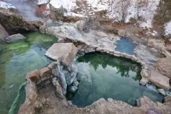
Fifth Water Hot Springs
Provo, Utah
38.4 miles NWA scenic 2.5-mile riverside hike to the famous Diamond Fork rock pools and waterfall, with soaks up to 108°.
Backpack, Camp, Hike, Hot Springs, Mountain Bike, Swim 
Three Forks Loop
Springville, Utah
38.4 miles NWA 16-mile strong-intermediate to advanced mountain bike loop through Three Forks canyon with 1,900 feet of elevation, waterfalls, and Fifth Water singletrack — a full-day adventure.
Mountain Bike 
Maple Canyon
Fountain Green, Utah
38.8 miles WMaple Canyon's one-of-a-kind cobblestone conglomerate cliffs host 140+ bolted routes from 5.4 to 5.14, making it one of the most unique climbing destinations in the US.
Camp, Hike, Mountain Bike, Rock Climb 
Blackhawk Loop
Salem, Utah
42.7 miles NWOver 14 miles of blue-ribbon singletrack near Salem, Utah demanding stamina, technical skill, and route-finding — one of Utah's premier backcountry mountain bike experiences.
Mountain Bike 
Grotto Falls
Payson, Utah
44.5 miles NWA gentle wooded creek trail with bridges leads to a waterfall and limestone grotto you can crawl around — all ages welcome and especially stunning in fall color season.
Hike 
Wardsworth Creek
Springville, Utah
45.9 miles NWAn intermediate technical creek trail climbing past rooty and rocky terrain to a small pond, with the option to link into Dry Fork trail for a longer ride.
Mountain Bike 
Dripping Rock
Spanish Fork, Utah
46.7 miles NWDripping Rock is along a paved path adjacent to Spanish Oaks Golf Course.
Hike 
4 Bay
Elk Ridge, Utah
47.1 miles NWSmooth singletrack with gradual climbs, a few rocky spots, and named trails — Lariat, Taze, and Ray Gun — spreading south of a small water reservoir.
Mountain Bike 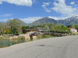
Salem Pond
Salem, Utah
48.4 miles NWA community gem with kayaking, paddleboarding, fishing, a trail around the whole pond, a bridge for summer jumping, and Christmas lights in winter — Salem Pond does it all.
Canoe, Kayak, Skateboard, Swim 
Sheepherder Loop
Payson, Utah
49.6 miles NWAn 'impossible uphill' singletrack loop near Payson, Utah with punchy climbs through old-growth pine and some rough spots on the Big Spring Creek descent — absolutely rewarding.
Mountain Bike 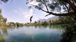
Mona Rope Swing
Midway, Utah
50.0 miles WA classic rope swing over the Burraston Ponds — built in the 1930s and still swinging — with stocked trout fishing, picnic grills, and Wasatch mountain views.
SwimNearby Campsites
Fifth Water Hot Springs
Provo, Utah
38.4 miles NWA scenic 2.5-mile riverside hike to the famous Diamond Fork rock pools and waterfall, with soaks up to 108°.
Backpack, Camp, Hike, Hot Springs, Mountain Bike, Swim
Maple Canyon
Fountain Green, Utah
38.8 miles WMaple Canyon's one-of-a-kind cobblestone conglomerate cliffs host 140+ bolted routes from 5.4 to 5.14, making it one of the most unique climbing destinations in the US.
Camp, Hike, Mountain Bike, Rock Climb


