


Jump Creek
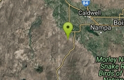
Marsing, Idaho
| GPS: |
43°28'52.1"N 116°55'28.0"W Maps | Directions |
| State: | Idaho |
Restrooms Waterfalls
Canyoneer, Hike, Rock Climb, and Swim
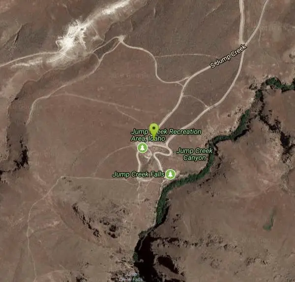
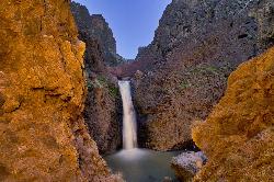
Jump Creek Falls is a surprising desert oasis in the Owyhee canyonlands southwest of Marsing, Idaho — a beautiful 60-foot waterfall pouring into a clear pool, tucked into a lush, rocky canyon that feels worlds away from the surrounding sagebrush high desert. Managed by the BLM and drawing more than 40,000 visitors a year, it's one of southwestern Idaho's most beloved short hikes and swimming spots.
The payoff comes fast. An easy trail of only about half a mile round trip leads up the canyon — a little rock-hopping and wading may be required — to the base of the falls, where a refreshing pool invites a cool dip on a hot day. The canyon is draped in water birch and red-osier dogwood, alive with birds and greenery, and there's also a Falls Overlook trail for those who'd rather stay high and dry. Rock climbers come for the canyon walls, too.
A few things to know. Poison ivy grows thick in spots along the creek and trail, so learn to spot it and give it room. The recreation area's posted hours are strictly enforced (due to past problems), and the lower parking area is closed in winter, roughly November through March. As always, pack out everything to protect this fragile desert canyon.
Spring and early summer are the most beautiful, when the falls run full and the canyon is greenest; summer is prime for swimming. To get there from the Marsing area, follow Highway 95 past the US-95 junction, turn onto Cemetery Road and then Jump Creek Road, and follow the signs to the gravel parking area. Bring water shoes, sun protection, and plenty of water, and enjoy one of Idaho's most rewarding little waterfall hikes.
More Information
Jump Creek Falls
Wow! I’m a guest blogger on Don’t Get Bored! I’m just tickled by that for a few reasons. First, because last June when I moved to Kuna from…
http://dontgetboredinidaho.blogspot.com/2011/04/jump-creek-falls.htmlBe courteous, informed, and prepared. Read trailhead guidelines, stay on the trail, and don't feed the wildlife.
Read More- Plan Ahead and Prepare
- Travel & camp on durable surfaces
- Dispose of waste properly
- Leave what you find
- Minimize campfire impacts
- Respect wildlife
- Be considerate of other visitors
Directions
From Marsing, Idaho
- Head west on ID-55 S/Main St toward Front StContinue to follow ID-55 S(1.9 mi)
- Continue onto US-95 N (1.9 mi)
- Turn left toward Cemetery Rd (0.1 mi)
- Continue onto Cemetery Rd (1.0 mi)
- Turn left onto S Jump Creek Rd (3.5 mi)
- Turn right toward Jump Creek Rd (0.2 mi)
- Continue onto Jump Creek Rd (0.2 mi)
- Keep right to continue on S Jump CreekDestination will be on the left(0.9 mi)
Southwest of Marsing, Idaho
From Boise, take Interstate 84 West to the Nampa exit for Highway 55 (Exit 33A). Follow Highway 55 through Marsing and on to the junction with US-95. Continue 1½ miles past the junction and turn left onto Cemetery Road. Turn left at the T-intersection with a STOP sign. The road becomes Jump Creek Road as it continues south. Just after passing under power transmission lines, the road curves right, through private land – stay on the roadway as it curves back to the left toward the entry to the recreation area.
Other Rock Climbing Walls, Swimming Holes, Hiking Trails, and Canyons Nearby
Jump Crick
Marsing, Idaho
4.5 miles NA surprising waterfall and lush riparian canyon filled with waterbirch and dogwood — visit on the easy quarter-mile Falls Trail, the dry overlook path, or take a refreshing dip at the base of the falls.
Canyoneer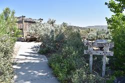
Halverson Lake
Melba, Idaho
25.2 miles SEA desert oasis on the canyon wall with trails through Bonneville Flood boulders, remnants of old placer claims, and a small lake at the base of the cliffs — plan several hours for 10-plus miles of exploring.
Hike, Horseback, Rock Climb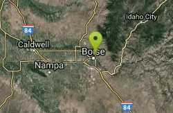
Central Foothills
Boise, Idaho
37.7 miles EIdaho's Central Foothills offer access to over 19,000 miles of trails — from paved urban paths to remote wilderness climbs, including the 1,200-mile Idaho Centennial Trail.
Hike, Mountain Bike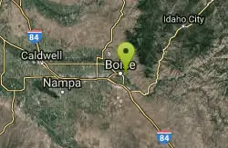
Military Reserve Trails
Boise, Idaho
38.2 miles EA 460-acre wildlife and recreation reserve near Boise with trails through a historic military range repurposed for the community — managed to preserve natural values alongside public recreation.
Hike, Mountain Bike
Old Dam Rope Swing
Emmett, Idaho
39.0 miles NEA rope swing about 15 feet above the water just off the road near an old dam — with a good swing you can clear 25 feet, but strong swimmers only in this spot.
Dive, Swim 1.4 mi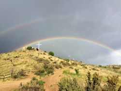
Table Rock
Boise, Idaho
39.7 miles EDirectly above downtown Boise, Table Rock rewards hikers with panoramic city, valley, and foothills views — especially stunning at sunrise or sunset, when the iconic white cross lights up on the peak.
Hike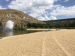
Sandy Point
Boise, Idaho
43.5 miles EA shallow, family-friendly lake inside Lucky Peak State Park with a playful fountain, a splash pad, paddleboard rentals, disc golf, volleyball, and free loaner life jackets.
Disc Golf, SwimNearby Campsites

Roystone Hot Springs
Emmett, Idaho
43.2 miles NEA private heated pool, huge hot tub, party room, and recreation area at Roystone Hot Springs in Sweet, Idaho — about 50 minutes from Boise for a relaxing day of soaking.
Camp, Hot Springs
Irish Boat Ramps
Boise, Idaho
47.2 miles EA year-round scramble starting at a Boise-area reservoir and climbing steeply up an old Jeep road along a ridgeline — the first 1.5 miles are very steep, with bumps and pine trees along the way.
Camp


