


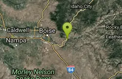
Table Rock
Boise, Idaho
| Address: | Boise, ID 83712, USA |
| GPS: |
43°35'54.8"N 116°8'51.3"W Maps | Directions |
| State: | Idaho |
| Trails/Routes: | 1.4 mi |
Hike
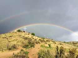
Table Rock is located directly above downtown Boise, Idaho and is part of the extreme southwestern portion of the Boise Mountains. It is recognizable by the tall white cross, that lights up. If you're in Boise, this isn't an experience you want to miss. The view from the top allows you to look over Boise, and is the most beautiful as the leaves are changing colors in fall.
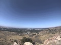
The two best times, to add to the experience, would to be either going before sunrise or sunset. Watching the sun rise is an emotional experience, especially after such a great hike. Or watching the sun set over Boise and watching the lights turn on all over the city, including the cross on the peak. The hike, or drive, offers grand views of the Boise skyline, foothills, and valley.
Pets are allowed on this hike, but they need to be on their leash. Don't let them run through the brush, especially suring summer months, where snakes hide in the brush. There are multiple paths to the peak, so choose your path before embarking on your hike. There are no fees for this hike.
WARNING: No fires or launching off fireworks from this location. It is too dry and can cause large wildfires. This happened in 2015, and the person who started the wildfire because of fireworks, which in turn burned homes, was convicted. Please be smart and use common sense, because this location is important and beloved by the citizens of Boise and other surrounding locations.
More Information
Table Rock : Climbing, Hiking & Mountaineering : SummitPost
Table Rock : SummitPost.org : Climbing, hiking, mountaineering
https://www.summitpost.org/table-rock/154473Be courteous, informed, and prepared. Read trailhead guidelines, stay on the trail, and don't feed the wildlife.
Read More- Plan Ahead and Prepare
- Travel & camp on durable surfaces
- Dispose of waste properly
- Leave what you find
- Minimize campfire impacts
- Respect wildlife
- Be considerate of other visitors
Directions
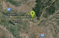
From Boise, Idaho
- Head southeast on W Main St toward N 6th St (0.1 mi)
- Turn left at the 2nd cross street onto N 5th St (0.3 mi)
- Turn right onto W State St (0.3 mi)
- Merge onto E Fort St (489 ft)
- At the traffic circle, take the 2nd exit onto Reserve St (0.5 mi)
- Slight right onto Shaw Mountain Rd (0.5 mi)
- Turn right to stay on Shaw Mountain Rd (0.7 mi)
- Slight right onto E Table Rock Rd (1.9 mi)
- Turn right to stay on E Table Rock Rd (0.7 mi)
From the trailhead, take Table Rock Trail that begins switchbacking up the hillside below some homes. After .25 miles the trail proceeds to break into a small valley immedietly below Table Rock and its large cross.
After a brief repreive from the uphill chugging, the trail reaches the base of Table Rock and steeply switchbacks to the summit in a total of about 1.5 miles.
From the summit are grand views of the entire valley as well as the footills. Respect restricted areas near antenaes and the large cross the faces west.


Other Hiking Trails Nearby
Military Reserve Trails
Boise, Idaho
2.4 miles NWA 460-acre wildlife and recreation reserve near Boise with trails through a historic military range repurposed for the community — managed to preserve natural values alongside public recreation.
Hike, Mountain Bike
Central Foothills
Boise, Idaho
3.6 miles NWIdaho's Central Foothills offer access to over 19,000 miles of trails — from paved urban paths to remote wilderness climbs, including the 1,200-mile Idaho Centennial Trail.
Hike, Mountain Bike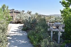
Halverson Lake
Melba, Idaho
27.5 miles SWA desert oasis on the canyon wall with trails through Bonneville Flood boulders, remnants of old placer claims, and a small lake at the base of the cliffs — plan several hours for 10-plus miles of exploring.
Hike, Horseback, Rock Climb
Crater Rings
Mountain Home, Idaho
31.7 miles SETwo perfectly symmetrical pit craters — among the few examples in the continental US — offer a rare look at volcanic collapse geology on the Snake River Plain.
Hike, Rock Climb
Mile Marker 4 (Skinnydipper Hotsprings)
Garden Valley, Idaho
34.5 miles NA backcountry hot spring about 45–60 minutes from Boise, reached by steep switchbacks after a half-mile hike — avoid during bad weather as the roads and trail become treacherous quickly.
Hike, Swim
Pine Flat Hot Springs
Garden Valley, Idaho
39.4 miles NEAn aqua-blue hot spring pool at the base of a small waterfall on the South Fork Payette River — just a quarter mile from Pine Flat Campground in the Boise National Forest.
Camp, Canoe, Hike, Hot Springs, Kayak, Whitewater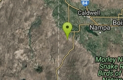
Jump Creek
Marsing, Idaho
39.8 miles WA lush surprise in the Idaho desert — a 0.25-mile trail to a beautiful waterfall through waterbirch and dogwood, with a refreshing dip at the base and an optional dry overlook trail above.
Canyoneer, Hike, Rock Climb, Swim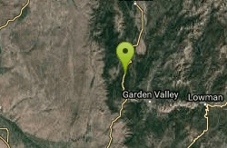
Swinging Bridge Beach
Cascade, Idaho
42.4 miles NA scenic riverside campground at 4,000 feet elevation 10 miles north of Banks, with a sandy swimming hole beach, large flat rocks to sun on, and whitewater kayaking on the North Fork Payette River.
Hike, SwimNearby Campsites
Irish Boat Ramps
Boise, Idaho
7.8 miles EA year-round scramble starting at a Boise-area reservoir and climbing steeply up an old Jeep road along a ridgeline — the first 1.5 miles are very steep, with bumps and pine trees along the way.
Camp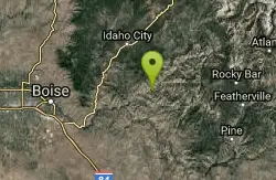
Badger Creek Campground
Boise City-Nampa, ID, Idaho
22.2 miles EA small 5-site riverside campground at 3,200-foot elevation on the Middle Fork of the Boise River, with fishing for rainbow, cutthroat, and whitefish and access to the William Pogue National Recreational Trail nearby.
Camp
Roystone Hot Springs
Emmett, Idaho
26.6 miles NWA private heated pool, huge hot tub, party room, and recreation area at Roystone Hot Springs in Sweet, Idaho — about 50 minutes from Boise for a relaxing day of soaking.
Camp, Hot Springs
Loftus Hot Spring
Mountain Home, Idaho
28.5 miles ELoftus Hot Spring is a free Boise National Forest soak on the Middle Fork Boise River, with a hot waterfall between ~110F and ~104F pools.
Camp, Hot Springs
Pine Flat Hot Springs
Garden Valley, Idaho
39.4 miles NEAn aqua-blue hot spring pool at the base of a small waterfall on the South Fork Payette River — just a quarter mile from Pine Flat Campground in the Boise National Forest.
Camp, Canoe, Hike, Hot Springs, Kayak, Whitewater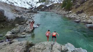
Kirkham Hot Springs Campground
Lowman, Idaho
44.4 miles NEMultiple hot waterfalls flowing into shallow rock pools right along a highway 21 pullout near the Boise National Forest — popular in both summer and winter seasons.
Camp, Hot Springs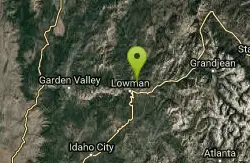
Park Creek Campground
Lowman, Idaho
45.5 miles NEA small, tranquil campground in an old-growth forest along Park Creek in the Baker Lake basin, close to Baker Lake and the larger Swift Creek Campground.
Camp


