


Kokopelli Trail
Cisco, Utah
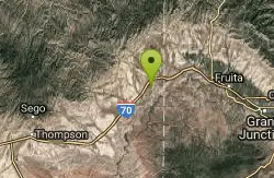
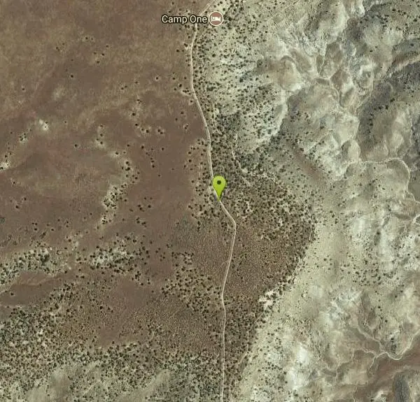
| Address: | ~Unnamed Road, Cisco, UT 84515, USA |
| GPS: |
39°9'8.6"N 109°7'9.3"W Maps | Directions |
| State: | Utah |
| Trail Length: | 140.00 miles |
| MTB Difficulty: | Advanced |
| Trail Type: | Other |
Mountain Bike
This trail was named after Kokopelli,the ancient god of fertility. The hump-back flute player, is a symbol seen all over the southwest. Kokopelli's Trail starts in Loma and goes all the way to Moab about 140 miles. A combination of dirt, OHV, and 4x4 roads with some singletrack. The trail is marked every 1/4 mile and at intersections, look for the Kokopelli symbol. The first 12 miles is mostly singletrack with some nice rock drops that are like stairs, some exposure, and some tecnical sections that you will probably have to carry your bike across. This is a spectacular canyon with great views. Sometimes you are only riding a few feet from the edge of huge dropoffs!! Check out the trailhead map or pick up a copy at the Welcome Colorado Inf. center in Fruita. From the parking lot head west on the frontage road turn left and cross the ridge. Just past More Fun Trail there is a nice singletrack that parallels the road . At about .5 the trail takes off to the right. This is a short climb that turns into a nice slickrock section. At 2 miles you come to Horsethief Bench Loop a 3.6 loop that's hard to pass up! Continue on you will come to a gate then Mary's Kiosk just past this you will get a taste of the tecnical sections to come. At 5.5 miles Steve's Loop takes off to the left although not the designated route this 3 mile loop is the way I always go. It's my favorite loop, with the most exposure. It rejoins the Kokopelli Trail and Mary's Loop. Follow the Kokopelli Trail signs as the trail follws part of the Lyon's Loop that takes off to the west. This is where the trail gets more difficult and steep the trail turns into singletrack when you come out the road turn right and start climbing back up the ridge after about 3/4 mile the Kokopelli Trail takes off to the left an follows part of Troy Built Loop. Some nice downhill singltrack here. you will come to a sandstone creek bottom the trail is kind of obscure here so look for the rock carins. Juat past this section you can see the Kokopelli trail as it makes it's way down to Salt Creek Once you cross the Salt Creek Bridge prepare yourself for a hike-a-bike section up to the top of the ridge.Once on top of the ridge the trail follows a road in the directin of I-70.Just before I-70 the Kokopelli trail takes off to the west and follows Rabbit Valley Road one more hill and it's downhill for a well deserved rest. Follow the Kokopelli Trail through Rabbit Valley.A couple miles past Rabbit Valley You come to a rock formation known as Castle Rock the Utah State Line is a short distance further. There are many ways to do this ride: a lolopop from Rabbit Valley, a point to point shuttle or ride it in two parts You will just have to figure out your favorite route. Courtesy of Singletracks.com
More Information
Kokopelli Trail
Kokopelli Trail is a singletrack mountain bike trail in Fruita, Colorado. View maps, videos, photos, and reviews of Kokopelli Trail bike trail in Fruita.
http://www.singletracks.com/bike-trails/kokopellis-trail/Never modify trail features. Ride trails when they're dry enough that you won't leave ruts. Speak up when you see others on the trail and always yield to hikers, horses, and others coming uphill. Always ride on the established trail.
Read More
- Plan Ahead and Prepare
- Travel & camp on durable surfaces
- Dispose of waste properly
- Leave what you find
- Minimize campfire impacts
- Respect wildlife
- Be considerate of other visitors
Directions
From Cisco, Utah
- Head east on UT-128 (5.5 mi)
- Turn right to merge onto I-70 E (12.4 mi)
- Take exit 227 toward W Water (0.4 mi)
- Turn right onto BLM 192/Harley Dome Rd (3.5 mi)
- Turn left (4.3 mi)
Other Mountain Bike Trails Nearby
Westwater Mesa / Overlook
Thompson, Utah
2.1 miles SWScenic singletrack hugging the Colorado River canyon rim, shared with motos but surprisingly solid, with some technical sections and optional Western Rim connections.
Mountain Bike
Top Of The World
Cisco, Utah
25.6 miles SWA fun 4x4 trail with challenging bike steps to climb and descend and an unbelievable view at the top — a rewarding ride for true mountain bike enthusiasts.
Mountain Bike
Little Creek/ Corral Fork
34.5 miles SE
A loop through sage, old spruce forest, and fun singletrack combining Little Creek and Corral Fork trails — about 1.5 miles of true singletrack with a great downhill finish.
Mountain Bike
Arches NP Main Road
Moab, Utah
36.1 miles SWA paved scenic road ride through Arches National Park with beautiful views, optional 4x4 spur trails, and water only at the visitor center and the turnaround — start early in summer.
Mountain Bike
Mega Steps
40.5 miles SW
Sandy start leads to slickrock climbing and twisty ridgetop singletrack through pines and boulders with fantastic views of Salt Valley and Arches National Park beyond.
Mountain Bike
Klondike Bluffs
41.2 miles SW
A complex trail system of slickrock, singletrack, and 4x4 roads at Klondike Bluffs near Moab stretching for miles in all directions along a dry wash valley.
Mountain Bike
Miner's Loop
Moab, Utah
41.3 miles SWAn advanced loop near Klondike Bluffs south trailhead in Moab — climbs to a bluff top and then rips back down rippled slickrock in a fast, rewarding descent.
Mountain Bike
Baby Steps
Moab, Utah
41.4 miles SWNewer Moab singletrack that spurs off Klondike Bluffs with a fun mix of doubletrack, slickrock, and singletrack — great as an out-and-back or a loop.
Mountain Bike
The Whole Enchilada
Moab, Utah
42.5 miles SA technically diverse epic mountain bike ride starting at 10,000 feet and descending through forests, aspen lands, creeks, open prairie, and gnarly Porcupine singletrack all the way to the Colorado River.
Mountain Bike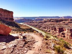
Porcupine Rim
Moab, Utah
42.6 miles SOne of Moab's most dramatic and challenging trails, winding from technical climbs through trees and slickrock to 360-degree canyon views and close-up Colorado River scenery.
Mountain Bike
UPS And LPS
Moab, Utah
42.6 miles SA Moab classic linking Kokopelli, UPS, and LPS trails for technical sections, steep drops, exposed areas, and great Castle Valley views — with Porcupine Rim as a natural finale.
Mountain Bike
Sovereign Single Track
Moab, Utah
43.0 miles SWA mix of slickrock and singletrack through dramatic terrain near Moab, climbing past Salt Wash and Cedar Mountain with a rim option and a fast technical finish.
Mountain Bike
Salt Wash
Moab, Utah
43.0 miles SWA technical mix of flowy singletrack and slickrock with a narrow corridor and a steep, rocky summit descent — best saved for experienced riders near Moab.
Mountain Bike
Hazard County
Moab, Utah
44.2 miles SA super-fast downhill with cool features, bermed turns, great views, and hairpin turns through the scrub brush — one of Moab's most fun trails.
Mountain Bike
Fins n Things
Moab, Utah
44.6 miles SWA varied double-track loop off Sand Flats Road near Slickrock, rolling over sandstone fins with sand traps, canyon views, and easy camp access near Moab.
Mountain Bike
Monitor & Merrimac/Courthouse Pasture
Moab, Utah
44.7 miles SWA guided-tour favorite near Moab with dinosaur bones, wildlife, dramatic rock formations, and slickrock riding through Courthouse Pasture.
Mountain Bike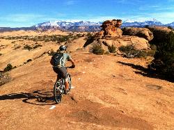
Slickrock Trail
Moab, Utah
45.0 miles SWMoab's famous Slickrock Trail offers insanely good grip on dotted-line routes through steep, rocky terrain — with smaller loops for less experienced riders.
Mountain Bike
Maverick
Moab, Utah
45.3 miles SWA short, flowy 0.4-mile dirt singletrack with berms and swooping descents connecting North 40 on both ends — a highlight of Moab Brand worth every pedal stroke.
Mountain Bike
Rockin' A
Moab, Utah
45.6 miles SWOnly 1.5 miles, Rockin' A mixes singletrack and slickrock in the Moab Brands trail system, with views of Arches National Park at every turn.
Mountain Bike
Deadman's Ridge
Moab, Utah
45.6 miles SWThe most technical trail in the Moab Bar M network — a 3-mile mix of slickrock, hardpan, tight switchbacks, and short technical climbs and drops with connector options to the Bar B trail.
Mountain Bike


