


Lewis & Clark Caverns Trails
Whitehall, Montana

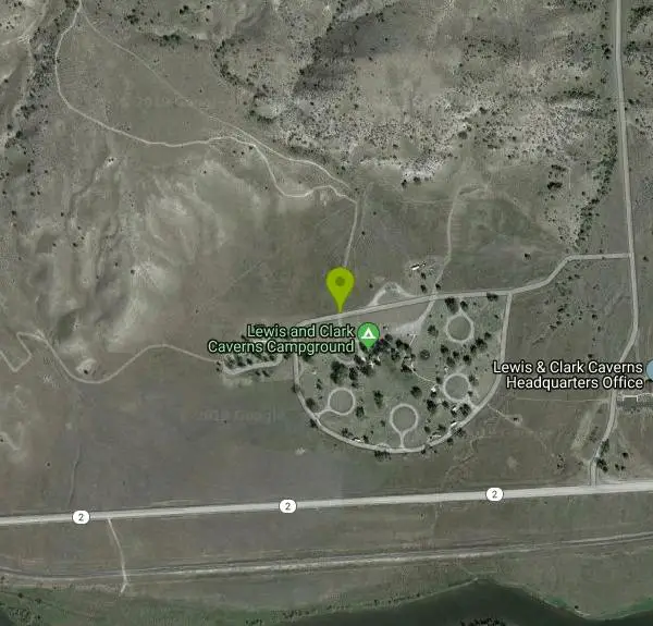
| Address: | Lewis & Clark Caverns State Park, 25 Lewis & Clark Caverns Road, Whitehall, MT 59759, USA |
| GPS: |
45°49'26.9"N 111°51'24.9"W Maps | Directions |
| State: | Montana |
| Trails/Routes: | 1.3-3.9 mi |
Restrooms Picnic Tables Trails Pet Friendly State Park
Hike and Mountain Bike
Lewis & Clark Caverns State Park is a 3,000-acre park with over 10 miles of trails open to hikers and mountain bikers. It is easy to be one with nature as you explore these adventurous trails.
The trails in Lewis & Clark Caverns State Park come in a variety of difficulty levels. The easiest trail, Nature Loop Trail, is a quarter mile loop that can be easily completed in a short amount of time. Fishing Access Trail is a 1.3-mile trail from the park’s campground. This trail has about a 100-foot elevation gain. These trails are wonderful for hikers and mountain bikers looking for an easy route where you can connect with nature.
Some of the more difficult trails in Lewis & Clark include East Side Trail and Cave Gulch Trail. East Side Trail is an almost four-mile trail that stretches from the top of the park to the bottom, with an 831-foot elevation change. Cave Gulch trail is shorter, about two miles in length, and steeper with an over 1000-foot change in elevation. Parts of these trails very rocky or washed out making for an exciting ride.
Lewis & Clark Caverns State Park has the perfect set up for a shuttle. Most trails can be accessed from the main road at the top or at the bottom of the trail. All trails in the park are connected making it easy to have an all-day adventure exploring every trail.
More Information
Eastside Trail Mountain Bike Trail, Whitehall, Montana
An early season singletrack. Near Whitehall, Montana.
https://www.mtbproject.com/trail/7024626/eastside-trailLewis & Clark Caverns Trail System | Visit Montana
The trails of Lewis and Clark Caverns State Park allow the visitor to enjoy and experience many aspects of the park above and beyond the caverns themselves. There is over 3000 acres of terrain in this park and almost 1600 vertical feet.
https://visitmt.com/listing/lewis-clark-caverns-trail-system-3088Never modify trail features. Ride trails when they're dry enough that you won't leave ruts. Speak up when you see others on the trail and always yield to hikers, horses, and others coming uphill. Always ride on the established trail.
Read MoreBe courteous, informed, and prepared. Read trailhead guidelines, stay on the trail, and don't feed the wildlife.
Read More
- Plan Ahead and Prepare
- Travel & camp on durable surfaces
- Dispose of waste properly
- Leave what you find
- Minimize campfire impacts
- Respect wildlife
- Be considerate of other visitors
Directions
From Whitehall, Montana
- Head east on MT-2 E/W Legion Ave toward N Division StContinue to follow MT-2 E(7.3 mi)
- Turn left to stay on MT-2 E (7.4 mi)
- Turn left (0.2 mi)
- Turn leftDestination will be on the right(0.3 mi)


Other Mountain Bike Trails and Hiking Trails Nearby
Lewis & Clark Caverns
Whitehall, Montana
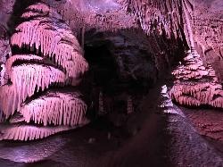
1.3 miles NWLewis & Clark Caverns State Park combines colorful guided cave tours at a constant 48°F with mountain biking, year-round fishing, and camping in 3,015 scenic Montana acres.
Camp, Canoe, Cave, Hike, Mountain Bike 
Spire Rock
Whitehall, Montana
21.0 miles WA mountain bike route in the Pipestone area near Whitehall — a veritable maze of trails pointing toward the Tobacco Root Mountains, with doubletrack, singletrack, and impressive scenery to explore.
Mountain Bike 
Homestake To Pipestone Pass
Butte, Montana
27.6 miles WButtery smooth singletrack with rock features through a bouldery landscape near Butte — a 5-mile intermediate climb to a Butte vista and a fast, stout descent to Pipestone Pass. Plan for a 10 or 19.5-mile ride.
Mountain Bike 
Toll Canyon
Butte, Montana
28.1 miles WA mountain bike ride near Butte starting with a moderate climb, singletrack at the top, a steep switchback descent, and a gradual 3-mile return — combine with the Beaver Ponds loop for a 15-mile figure eight.
Mountain Bike 
Beaver Ponds
Butte, Montana
28.4 miles WA serious singletrack adventure above Butte with a brutal initial climb rewarded by flowy riding, a beautiful descent, and a marshy meadow crossing before a superb final drop.
Mountain Bike 
CDT: Highland
Butte, Montana
29.5 miles WA spectacular loop on the Continental Divide Trail through the Mt. Haggin Wildlife Management Area, with the Pintlar Range as your backdrop and very little traffic outside of hunting season.
Mountain Bike 
Maud S. Canyon
Butte, Montana
31.1 miles WA fun, fast, easy mountain bike ride near Butte tracing Maud S Canyon to the Continental Divide Trail, with aspen groves, wildlife, and an optional spur toward the Our Lady of the Rockies statue.
Mountain Bike 
Rawhide Creek
Boulder, Montana
33.3 miles NAn ATV and mountain bike doubletrack route that passes impressive granite rock formations and includes some very steep pitches, though the overall grade stays fairly manageable.
Mountain Bike 
Muskrat Creek
Boulder, Montana
34.4 miles NA punishing 7-mile climb with roots, rocks, and creek crossings that rewards you with a screaming, naturally flowing downhill back to the trailhead.
Mountain Bike 
Garnett Mountain
Gallatin Gateway, Montana
40.6 miles SEA merciless but rewarding singletrack climb near Gallatin Gateway — relentlessly steep all the way to a forest service cabin, with a great downhill return and loop option via Rat Lake.
Mountain Bike 
Ousel Falls
Gallatin Gateway, Montana
47.5 miles SEA 1.7-mile out-and-back trail near Big Sky, Montana, leading through forest to a beautiful waterfall — accessible from May through October for a rewarding short hike.
Hike, Rock Climb, Swim 
Ousel Falls
Big Sky, Montana
47.5 miles SEA scenic switchback trail near Big Sky that climbs to a gorgeous waterfall, with a swimming hole under a bridge, horses and bikes welcome, and bathroom at the top.
Mountain Bike 0.1 mi
Canyon Creek Charcoal Kilns
Melrose, Montana
49.9 miles WTwenty remarkably preserved brick-dome charcoal kilns from the 1880s silver-mining boom stand as a ghost of a multi-million-dollar industry that vanished by 1915.
HikeNearby Campsites
Lewis & Clark Caverns Campground
Whitehall, Montana
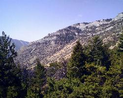
0.1 miles SEA versatile campground inside Lewis & Clark Caverns State Park with 40 RV and tent sites, three cabins, a tipi, playgrounds, showers, and a dump station open year-round.
Camp 1.1 mi
Lewis & Clark Caverns
Whitehall, Montana
1.3 miles NWLewis & Clark Caverns State Park combines colorful guided cave tours at a constant 48°F with mountain biking, year-round fishing, and camping in 3,015 scenic Montana acres.
Camp, Canoe, Cave, Hike, Mountain Bike


