


Ousel Falls
Gallatin Gateway, Montana
| GPS: |
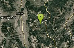
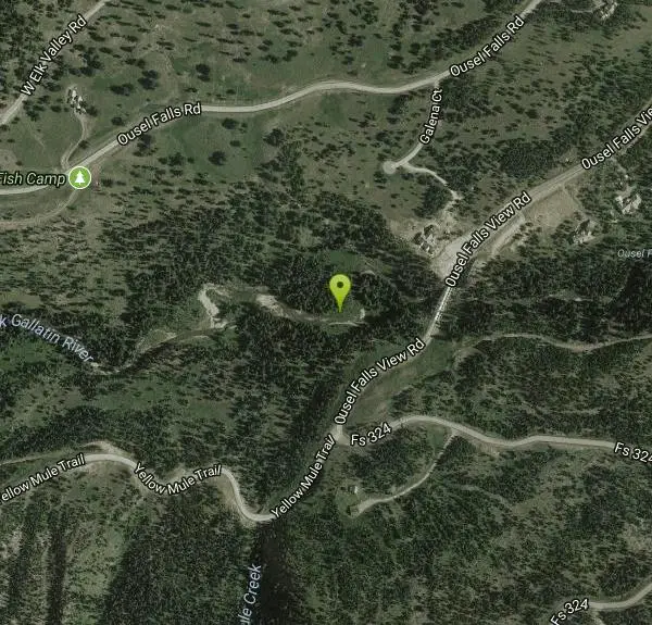
45°14'17.8"N 111°20'51.5"W Maps | Directions |
| State: | Montana |
Hike, Rock Climb, and Swim
Ousel Falls is the crown jewel of Big Sky, Montana's town trails — a beautiful 100-foot waterfall reached by one of the most popular and family-friendly short hikes in the region. Tucked into a forested ravine on the South Fork of the West Fork of the Gallatin River, just minutes from Big Sky Town Center, it's an easy, scenic outing that rewards hikers of all ages with a genuinely impressive cascade.
The trail is a gem in its own right. The well-built path — smooth, with bridges and a stroller-friendly surface near the start — descends gently into the ravine, crossing the river before reaching the falls in under a mile each way (about 1.6 miles round trip). Picnic tables along the way and at the falls make it easy to linger, and once the cascade comes into view, short side paths lead to the base, the top, and a scenic overlook.
A safety note on the water: as inviting as the pool below the falls looks, swimming is not recommended here — the current is strong and the water stays extremely cold year-round. It's a fine spot to cool your feet and wade carefully at the edge, but keep children close and stay well back from the powerful water near the falls.
Ousel Falls is a true four-season trail, accessible roughly May through October for hiking (and snowshoeing in winter). Spring snowmelt makes the falls thunder, while summer brings cool shade and wildflowers. From Big Sky Town Center, drive about 2 miles south on Ousel Falls Road to the well-marked trailhead. Bring water and sturdy shoes, pack out your trash, and enjoy one of southwest Montana's most rewarding short hikes.
More Information
Ousel Falls - World of Waterfalls
Hike to Ousel Falls in the Custer Gallatin National Forest to witness a spectacular 100-foot waterfall surrounded by lush green forests. The trail is well-maintained, featuring bridges and groomed paths, making it accessible for many hikers. Along the way, you’ll find overlooks that offer magnificent views of the valley, and the falls themselves are truly incredible. The trail also provides access to the base of the waterfall, allowing for up-close views of the cascading water. During the summer months, keep an eye out for wildlife, as this area is known for its population of Ousel Birds, also called the American Dipper.
https://www.world-of-waterfalls.com/waterfalls/pacific-northwest-ousel-falls/Be courteous, informed, and prepared. Read trailhead guidelines, stay on the trail, and don't feed the wildlife.
Read More
- Plan Ahead and Prepare
- Travel & camp on durable surfaces
- Dispose of waste properly
- Leave what you find
- Minimize campfire impacts
- Respect wildlife
- Be considerate of other visitors
Directions
From Gallatin Gateway, Montana
- Head east on Gateway South Rd/Mill St toward US-191 N (161 ft)
- Turn right at the 1st cross street onto US-191 S/Gallatin Rd (28.3 mi)
- Turn right onto Lone Mountain Trail (2.9 mi)
- Turn left onto Ousel Falls Rd (2.0 mi)
- Turn left to stay on Ousel Falls Rd (0.3 mi)
- Turn left onto 0usel Falls View Rd (0.4 mi)
From Bozeman drive west on Huffine Lane 9 miles to Four Corners, turn south on US Highway 191 for another 34 miles. You cross the beautiful Gallatin River many times and view some of Montana finest scenery in the Gallatin Canyons, before the turnoff to the Big Sky Road. Next take a right driving west 2.4 miles to Ousel Falls Road. Straight ahead you can’t help but notice awesome Lone Mountain, home to Big Sky Ski resort and one of the highest peaks in the Gallatin National Forest at 11,188 feet. At Ousel Falls Road go left for another 2 miles to Ousel Falls Park and the trailhead's at the backside of the parking lot. (Courtesy of waterfallsmontana.com)
Other Rock Climbing Walls, Swimming Holes, and Hiking Trails Nearby
Daly Creek
Gallatin Gateway, Montana
16.6 miles SEA 5.2-mile out-and-back trail good for all skill levels near Gallatin Gateway, Montana, primarily used for hiking and accessible from May through October.
Hike 10.1 mi
Sky Rim Trail to Sheep Mountain
Big Sky, Montana
18.1 miles SEA challenging 10-mile out-and-back hike climbing to some of Yellowstone's highest peaks — Sky Rim Trail rewards with sweeping views and bighorn sheep sightings near Big Horn and Sheep Mountain.
Backpack, Hike 
Hyalite Creek Trail
Gallatin Gateway, Montana
22.5 miles NEAn 11-mile hike with 11 waterfalls and frequent black bear sightings — dogs on leashes are common on the trail, and timeshare activity rules apply on certain days.
Hike, Horseback, Mountain Bike 
Practice Rock
Bozeman, Montana
25.9 miles NEA classic Bozeman climbing spot about 2.8 miles into the canyon — a roadside pullout leads to a steep approach and several fun routes, though it draws crowds on nice days.
Rock Climb 
Revenue Flats
Norris, Montana
29.4 miles NWA premier rock climbing destination in southwestern Montana with mountain biking, camping, and rock hounding across scenic Revenue Flats, 36 miles from Bozeman.
Rock Climb 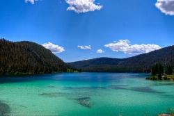
Wade Lake
Cameron, Montana
31.6 miles SWade Lake is a hidden gem of southwestern Montana — a spring-fed mountain lake famous for its glassy, aquamarine water, tucked into a forested ravine at the southern end of the Gravelly Range....
Camp, Canoe, Kayak, Swim 7.9 mi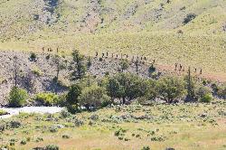
Rescue Creek Trail
Mammoth Hot Springs, Yellowstone National Park
35.4 miles SEA level, well-marked 8-mile point-to-point hike across the Montana-Wyoming border through colorful grasslands near Yellowstone, with frequent bighorn sheep, pronghorn, and elk sightings.
Hike 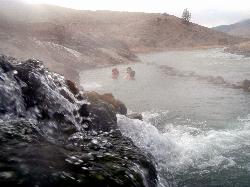
Boiling River
North Entrance, Yellowstone National Park
36.3 miles SEWhere a hot spring pours into the Gardner River in Yellowstone, warm soaking awaits — but never enter the scalding upstream runoff channel, which reaches 113–140°F. Check with a ranger first.
Hot Springs, Swim 
Mammoth/Gardiner Back Road
Mammoth Hot Springs, Yellowstone National Park
36.4 miles SEThe only road open into Yellowstone in winter runs from Gardiner, Montana through park headquarters at Mammoth Hot Springs and east to Silver Gate and Cooke City.
Hike, Mountain Bike 8.1 mi
Sepulcher Mountain Trail
Mammoth Hot Springs, Yellowstone National Park
36.4 miles SEAn 11-mile loop from Mammoth Hot Springs to the 9,652-foot peak of Sepulcher Mountain, passing colorful meadows, aspen forests, and stunning views of Electric Peak — with frequent bighorn, moose, and grizzly sightings.
Hike 5.3 mi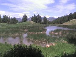
Beaver Ponds Trail
Mammoth, Yellowstone National Park
36.4 miles SEA 5-mile loop above Mammoth Hot Springs with beaver ponds of varying sizes, elk, wildflowers, birds, and occasional bear sightings — a perfect morning or evening hike.
Hike 0.1-5.3 mi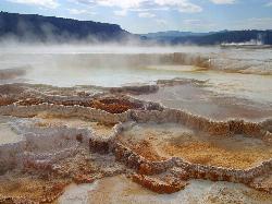
Mammoth Hot Springs
Mammoth, Yellowstone National Park
36.4 miles SEColorful limestone terraces covered in glistening hot-spring water, a 1-mile boardwalk with 300 feet of elevation, elk in the parking lot, and an easy family-friendly loop — Yellowstone's showiest geology.
Camp, Hike 2.0 mi
Snow Pass Trail
Yellowstone National Park Wyoming
36.6 miles SEA moderately difficult 2.4-mile out-and-back with 700 feet of gain near Mammoth Hot Springs, passing impressive boulder hoodoos and ending at a secluded mountain valley — hike in groups and carry bear spray.
Backpack, Hike 4.0 mi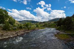
Lava Creek Trail
Mammoth Hot Springs, Yellowstone National Park
36.8 miles SEA 4.2-mile hike along scenic Lava Creek to the 60-foot tiered Undine Falls, with distant Mammoth Hot Springs views, meadows, Mount Everts, and frequent elk and bison sightings.
Hike 7.8 mi
Osprey Falls Trail
Mammoth Hot Springs, Yellowstone National Park
36.9 miles SEAn 8-mile out-and-back near Mammoth Hot Springs hiking green meadows and burned forest to the rim of Sheepeater Canyon and a breathtaking 150-foot waterfall on the Gardner River.
Hike 4.0 mi
Bunsen Peak Trail
Mammoth Hot Springs, Yellowstone National Park
37.0 miles SEA moderately difficult 4.6-mile hike to Bunsen Peak with a 1,300-foot climb and sweeping views of Mammoth Hot Spring Terraces, Swan Lake Flats, and the Gallatin Mountains.
Hike 0.8 mi
Wraith Falls Trail
Mammoth Hot Springs, Yellowstone National Park
40.9 miles SEA less-than-a-mile family-friendly hike near Mammoth Hot Springs to the unique fan-shaped 79-foot Wraith Falls — open year-round and easy for all skill levels.
Hike 7.4 mi
Blacktail Deer Creek to Yellowstone River Trail
Mammoth Hot Springs, Yellowstone National Park
41.7 miles SEA 7-mile out-and-back trail dropping through green fields and boulder formations to waterfall views along the Yellowstone River, with a suspension bridge connecting onward trails.
Hike 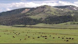
Forces of the Northern Range
Mammoth, Yellowstone National Park
42.8 miles SEA half-mile boardwalk on Yellowstone's Blacktail Deer Plateau with mountain peak displays, a wildlife primer, and a view-packed introduction to the Northern Range's forces of nature.
Hike 0.8 mi
Harlequin Lake Trail
Madison, Yellowstone National Park
47.1 miles SEA half-mile stroll through peaceful pine forest leads to a lily-pad-covered lake frequented by Harlequin ducks and other waterfowl — quiet and uncrowded even in busy Yellowstone.
HikeNearby Campsites
Wade Lake
Cameron, Montana
31.6 miles SWade Lake is a hidden gem of southwestern Montana — a spring-fed mountain lake famous for its glassy, aquamarine water, tucked into a forested ravine at the southern end of the Gravelly Range....
Camp, Canoe, Kayak, Swim 0.1-5.3 mi
Mammoth Hot Springs
Mammoth, Yellowstone National Park
36.4 miles SEColorful limestone terraces covered in glistening hot-spring water, a 1-mile boardwalk with 300 feet of elevation, elk in the parking lot, and an easy family-friendly loop — Yellowstone's showiest geology.
Camp, Hike 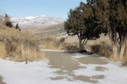
Mammoth Hot Springs Campground
Mammoth Hot Springs, Yellowstone National Park
36.7 miles SEThe only year-round campground in Yellowstone, with 85 first-come sites at 5 miles from the North Entrance, walking distance to the famous Mammoth Hot Springs Terraces and nearby hiking and fishing.
Camp 
Indian Creek Campground Yellowstone
Mammoth Hot Springs, Yellowstone National Park
38.9 miles SEIndian Creek Campground is a quiet, wooded, tent-friendly Yellowstone campground near Mammoth Hot Springs, big on wildlife and peace.
Camp 
Norris Campground
Norris, Yellowstone National Park
47.1 miles SECentrally located in Yellowstone NP, this campground puts you within a short drive of Grand Canyon of the Yellowstone, Hayden Valley, Old Faithful, and Yellowstone Lake.
Camp 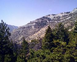
Lewis & Clark Caverns Campground
Whitehall, Montana
47.3 miles NWA versatile campground inside Lewis & Clark Caverns State Park with 40 RV and tent sites, three cabins, a tipi, playgrounds, showers, and a dump station open year-round.
Camp 
Madison Campground
Madison, Yellowstone National Park
47.4 miles SEA partly wooded riverside campground at 6,800 feet in Yellowstone, close to Old Faithful and the geyser basins, with great fishing on the Madison River and 270-plus individual sites.
Camp 1.1 mi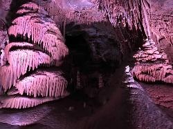
Lewis & Clark Caverns
Whitehall, Montana
48.6 miles NWLewis & Clark Caverns State Park combines colorful guided cave tours at a constant 48°F with mountain biking, year-round fishing, and camping in 3,015 scenic Montana acres.
Camp, Canoe, Cave, Hike, Mountain Bike 
Hellroaring Creek Trail
Yellowstone National Park
48.9 miles SEA suspension bridge over the Yellowstone River leads to sandy creek-side beaches and a mild backcountry trail past Yellowstone's largest granite slab — great for all ages.
Camp, Hike, Swim


