


CDT: Highland
Butte, Montana
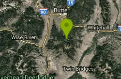
| Address: | ~Fish Creek Rd, Butte, MT 59701, USA |
| GPS: |
45°48'41.2"N 112°28'10.0"W Maps | Directions |
| State: | Montana |
| Trail Length: | 7.00 miles |
| MTB Difficulty: | Intermediate |
| Trail Type: | Out & Back |
| MTB Trail Type: | Singletrack |
Mountain Bike
This is a new addition to the Continental Divide Trail. Go through the gate to the west with the CDT sign. There are a couple pieces of doubletrack--take the one with another CDT sign. As you reach the top of the first climb, look for singletrack to the right with yet another CDT sign heading into the woods. This is where the fun starts. for the next 7 miles, you can have a great time on well-designed, flowy, roller coaster singletrack. You're in dense woods most of the time, so you don't always have CDT-type views, but what's under your knobbies is mostly sweet. As of 2007, much of the trail is new, so there are some soft, sandy, difficult sections, but they should become packed over time, making the whole trail superb. Courtesy of Singletracks.com
More Information
CDT: Highland Mountain Bike Trail in Butte, Montana - Directions, Maps, Photos, and Reviews
CDT: Highland is a singletrack mountain bike trail in Butte, Montana. View maps, videos, photos, and reviews of CDT: Highland bike trail in Butte.
http://www.singletracks.com/bike-trails/highland-cdt/Never modify trail features. Ride trails when they're dry enough that you won't leave ruts. Speak up when you see others on the trail and always yield to hikers, horses, and others coming uphill. Always ride on the established trail.
Read More
- Plan Ahead and Prepare
- Travel & camp on durable surfaces
- Dispose of waste properly
- Leave what you find
- Minimize campfire impacts
- Respect wildlife
- Be considerate of other visitors
Directions
From Butte, Montana
- Head west on Iron St toward S Colorado St (0.2 mi)
- Turn left onto Montana St (0.4 mi)
- Continue straight to stay on Montana St (0.4 mi)
- Turn left onto La Salle St (367 ft)
- Take the Interstate 15 N/Interstate 90 E ramp on the left (0.2 mi)
- Merge onto I-90 (4.0 mi)
- Take exit 228 toward Continental Dr (0.2 mi)
- Turn right onto Mt Highland Dr (312 ft)
- Turn left at the 1st cross street onto Continental Dr (4.0 mi)
- Turn left onto MT-2 E (2.3 mi)
- Turn right (2.3 mi)
- Turn left toward Roosevelt Dr (157 ft)
- Continue onto Roosevelt Dr (0.5 mi)
- Turn left onto Lime Kiln Rd (4.9 mi)
Other Mountain Bike Trails Nearby
Toll Canyon
Butte, Montana
3.4 miles NEA mountain bike ride near Butte starting with a moderate climb, singletrack at the top, a steep switchback descent, and a gradual 3-mile return — combine with the Beaver Ponds loop for a 15-mile figure eight.
Mountain Bike
Beaver Ponds
Butte, Montana
3.9 miles NA serious singletrack adventure above Butte with a brutal initial climb rewarded by flowy riding, a beautiful descent, and a marshy meadow crossing before a superb final drop.
Mountain Bike
Homestake To Pipestone Pass
Butte, Montana
7.8 miles NButtery smooth singletrack with rock features through a bouldery landscape near Butte — a 5-mile intermediate climb to a Butte vista and a fast, stout descent to Pipestone Pass. Plan for a 10 or 19.5-mile ride.
Mountain Bike
Maud S. Canyon
Butte, Montana
10.6 miles NA fun, fast, easy mountain bike ride near Butte tracing Maud S Canyon to the Continental Divide Trail, with aspen groves, wildlife, and an optional spur toward the Our Lady of the Rockies statue.
Mountain Bike
Spire Rock
Whitehall, Montana
12.3 miles NEA mountain bike route in the Pipestone area near Whitehall — a veritable maze of trails pointing toward the Tobacco Root Mountains, with doubletrack, singletrack, and impressive scenery to explore.
Mountain Bike
Lake Agnes
Glen, Montana
27.1 miles SWA steep 1.5-mile climb through dense timber leads to 99-acre Agnes Lake, with sandy driftwood-covered beaches tucked in the Pioneer Mountains of southwestern Montana.
Camp, Hike, Mountain Bike 1.1 mi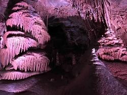
Lewis & Clark Caverns
Whitehall, Montana
28.5 miles ELewis & Clark Caverns State Park combines colorful guided cave tours at a constant 48°F with mountain biking, year-round fishing, and camping in 3,015 scenic Montana acres.
Camp, Canoe, Cave, Hike, Mountain Bike 1.3-3.9 mi
Lewis & Clark Caverns Trails
Whitehall, Montana
29.5 miles EA 3,000-acre Montana state park with over 10 miles of trails from a quarter-mile nature loop to a rugged 4-mile descent with 831 feet of elevation change — perfect for a full-day shuttle adventure.
Hike, Mountain Bike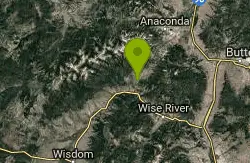
Dry Creek Loop
Wise River, Montana
31.4 miles WA spectacular Continental Divide Trail loop through the Mt. Haggin Wildlife Management Area with the Pintlar Range as your backdrop and very little traffic outside of hunting season.
Mountain Bike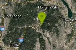
Rawhide Creek
Boulder, Montana
38.8 miles NEAn ATV and mountain bike doubletrack route that passes impressive granite rock formations and includes some very steep pitches, though the overall grade stays fairly manageable.
Mountain Bike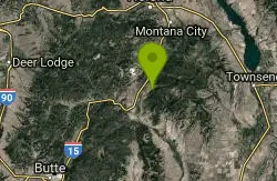
Muskrat Creek
Boulder, Montana
40.2 miles NEA punishing 7-mile climb with roots, rocks, and creek crossings that rewards you with a screaming, naturally flowing downhill back to the trailhead.
Mountain Bike
Spring Hill Campground and Picnic Area
Anaconda, Montana
41.5 miles NWA scenic mountain campground beside Warm Springs Creek in Beaverhead-Deerlodge National Forest, with 28 sites, great trout fishing, and Georgetown Lake just 8 miles away.
Camp, Hike, Horseback, Mountain Bike, Swim
Little Blackfoot Meadows Loop
Elliston, Montana
42.5 miles NA high-quality singletrack mountain bike trail near Elliston through unusually lush Montana forest, with a gradual climb, two creek crossings, and a choice between a sweet out-and-back or a 15-mile loop with a tough climb.
Mountain BikeNearby Campsites
Lake Agnes
Glen, Montana
27.1 miles SWA steep 1.5-mile climb through dense timber leads to 99-acre Agnes Lake, with sandy driftwood-covered beaches tucked in the Pioneer Mountains of southwestern Montana.
Camp, Hike, Mountain Bike 1.1 mi
Lewis & Clark Caverns
Whitehall, Montana
28.5 miles ELewis & Clark Caverns State Park combines colorful guided cave tours at a constant 48°F with mountain biking, year-round fishing, and camping in 3,015 scenic Montana acres.
Camp, Canoe, Cave, Hike, Mountain Bike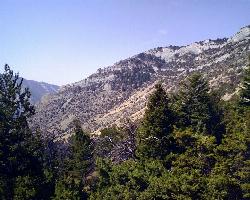
Lewis & Clark Caverns Campground
Whitehall, Montana
29.6 miles EA versatile campground inside Lewis & Clark Caverns State Park with 40 RV and tent sites, three cabins, a tipi, playgrounds, showers, and a dump station open year-round.
Camp
Lost Creek State Park
Anaconda, Montana
37.5 miles NWCamp near Anaconda, Montana
Camp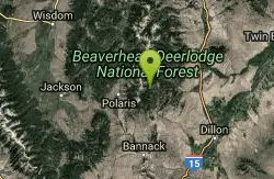
Minneopa Lake
Polaris, Montana
37.6 miles SWMinneopa Lake is a genuinely rare thing: a big, beautiful alpine lake at over 8,100 feet that you can reach with a quarter-mile walk. Set in the Rattlesnake Creek drainage of the East Pioneer...
Backpack, Camp, Hike
Spring Hill Campground and Picnic Area
Anaconda, Montana
41.5 miles NWA scenic mountain campground beside Warm Springs Creek in Beaverhead-Deerlodge National Forest, with 28 sites, great trout fishing, and Georgetown Lake just 8 miles away.
Camp, Hike, Horseback, Mountain Bike, Swim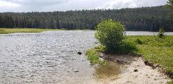
Pintler Lake Campground and Picnic Area
Wise River, Montana
46.6 miles WPintler Lake Campground and Picnic Area is a tiny, free, wonderfully remote campground on the edge of a small mountain lake in the Beaverhead-Deerlodge National Forest of southwestern Montana, at the...
Camp, Canoe, Kayak, Swim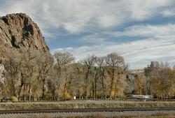
Barretts Station Park
Dillon, Montana
49.0 miles SA free highway-side campground doubles as a tubing takeout and rock-climbing base — note the diversion dam 200 yards downstream and exit the water well before it.
Camp, Rock Climb, Swim
Flint Creek Campground
Philipsburg, Montana
49.4 miles NWA free 3-acre campground in Beaverhead-Deerlodge National Forest next to Flint Creek, with 15 fire-pit sites and fishing for brown, cutthroat, and rainbow trout — bring your own drinking water.
Camp


