


Loman Idaho Stevens Point
Lowman, Idaho
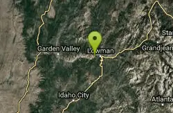
Mountain Bike
The Stevens Point Trail is a 2 mile side trip ending at a large granite outcrop that affords expansive views of the Deadwood River drainage. About .5 mile past the Stevens Point Trail, the Julie Creek Trail (#020) connects from the west. The trail follows Deadwood Ridge north gradually losing altitude as it descends toward Whitehawk Basin. About 5 miles beyond the Julie Creek Trail intersection, the trail intersects with the NF Road 503. This road is closed to motorized travel Oct. 1 through June 30. The trail crosses the road and continues about a mile and a half down into Whitehawk Basin. The trail continues north through the Basin and reaches its northern terminus at the NF Road 510. From this point northward, the Deadwood Ridge Trail is closed seasonally during elk calving season between Oct. 1 and June 30 to minimize disturbance during elk calving season. Plants and wildlife are abundant in the area. Bull moose have been seen towards the Basin end of the trail. Deer, elk, and bear are common in the area as are rattlesnakes. Wildflowers are profuse in Whitehawk Basin during the early summer. Make a loop trip by combining the Julie Creek Trail (#020) with the southern portion of the Deadwood Ridge Trail.
More Information
Boise National Forest | Recreation | Forest Service
Find and Discover Recreation Sites and Trails in Boise National Forest
https://www.fs.usda.gov/r04/boise/recreationNever modify trail features. Ride trails when they're dry enough that you won't leave ruts. Speak up when you see others on the trail and always yield to hikers, horses, and others coming uphill. Always ride on the established trail.
Read More
- Plan Ahead and Prepare
- Travel & camp on durable surfaces
- Dispose of waste properly
- Leave what you find
- Minimize campfire impacts
- Respect wildlife
- Be considerate of other visitors
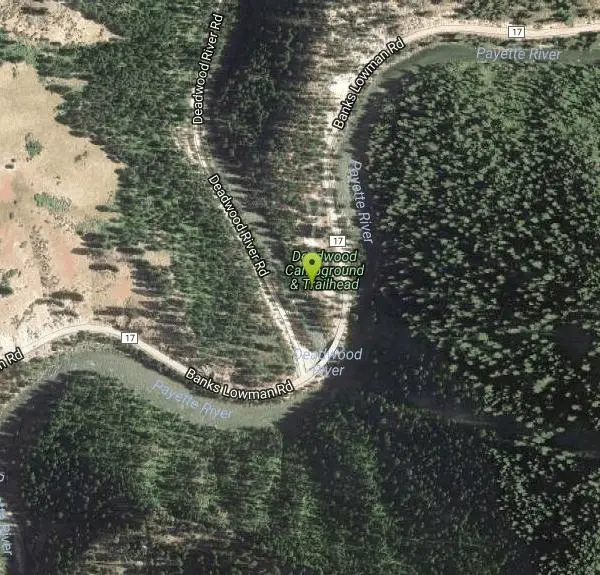
Directions
From Lowman, Idaho
- Head northeast on ID-21 N toward River Front Rd (0.2 mi)
- Turn left onto County Hwy 17 (3.3 mi)
- Turn right onto Forest Rd 24HBDestination will be on the left(105 ft)
25 miles long; The trail climbs a high ridge overlooking the Deadwood River and moves north, passing through conifer forests and crossing many small creeks, before descending into Whitehawk Basin.
Other Mountain Bike Trails Nearby
Deadwood Ridge Trail
Lowman, Idaho
0.8 miles NA demanding 17-mile mountain bike climb on Deadwood Ridge near Lowman, Idaho, with spectacular mountain range views, a creek cooling station at East Fork Stevens Creek, and multiple options at the summit.
Mountain Bike 
Idaho City Park and Ski
Lowman, Idaho
4.7 miles SEStrap on skis or snowshoes and explore over 180 miles of groomed and ungroomed trails across 17 Park N' Ski areas in some of Idaho's most scenic backcountry terrain.
Cross-country Ski, Mountain Bike 
Elkhorn Loop
Lowman, Idaho
4.7 miles SEA fun, non-technical loop with great views near Lowman, Idaho — start up the dirt road, follow the Elkhorn Loop markers, and it kicks you right back to where you began.
Mountain Bike 
Elk Meadows
Horseshoe Bend, Idaho
30.7 miles SWAn easy doubletrack ride past Pioneer Lodge and tennis courts that gradually becomes more defined as you climb east toward Elk Meadows near Horseshoe Bend.
Mountain Bike 
Mahalo
Horseshoe Bend, Idaho
31.1 miles SWA new Boise-area singletrack with great flow, technical features like skinnies and small drops, connecting Bogus Basin trails to Ridge to Rivers and down to Dry Creek or Hard Guy.
Mountain Bike 
Eastside Trail
Horseshoe Bend, Idaho
31.4 miles SWA fast, swoopy intermediate singletrack with stream crossings and optional technical features built on old logging roads — the main trunk of the Stack Rock trail system near Boise.
Mountain Bike 
Stack Rock Loop
Boise, Idaho
32.2 miles SWA single-track loop around a massive rock formation near Boise — a steep uphill to the Stack Rock summit with great views, followed by a rewarding single-track return.
Mountain Bike 
East Side Trail
Boise, Idaho
33.0 miles SWA mostly downhill mountain bike ride from the top of Bogus Basin Ski Resort's East Side trail to the Hard Guy parking area — with a big climb near the end and a reported bear sighting along the way.
Mountain Bike 
Coyote Run
Boise, Idaho
36.7 miles SWDusty, dry singletrack mixed with some doubletrack at the top near Boise — a straightforward desert ride on Coyote Run.
Mountain Bike 
Spring Valley
Boise, Idaho
36.7 miles SWSmooth singletrack with some rocky technical spots winds through the scenic Spring Creek drainage in the Avimore trail network outside Boise.
Mountain Bike 
Orchard / 5 Mile / Watchman
Boise, Idaho
38.3 miles SWOrchard Gulch, 5 Mile Gulch, and Watchman form a connected upper foothills network above Boise with good gulch riding, bench-cut exposure, and great views of the city.
Mountain Bike 
8th Street Motorcycle Trail
Boise, Idaho
38.5 miles SWSteep, rocky, and sandy mountain biking near Boise where motorcycles have carved up the first half — the second half delivers the classic technical singletrack challenge you came for.
Mountain Bike 
Hidden Springs
Boise, Idaho
38.5 miles SWA small three-trail singletrack network winding through the Dry Creek valley in scenic Boise foothills — includes Redtail, Lookout Loop, and Current Creek trails.
Mountain Bike 
Corrals
Boise, Idaho
38.9 miles SWA wide trail connecting to Bob's, Scotts, 8th Street, and Hard Guy access — less traveled than Hulls Gulch, with some ripping descents and nice scenery in the Boise foothills.
Mountain Bike 
Polecat Gulch
Garden City, Idaho
39.5 miles SWWinding singletrack through Polecat Gulch on the Polecat Loop and connector trails, with nice area views and a few sandy stretches.
Mountain Bike 
Corral Loop
Boise, Idaho
40.1 miles SWA double-track foothills loop climbing to Bonneville Point, a historic Oregon Trail landmark, with rewarding ridge-line views and a fast downhill return.
Mountain Bike 
Crest Line To Lower Hull's Gulch
Boise, Idaho
40.1 miles SWA nice mountain bike loop starting on Crestline and looping back via Lower Hull's Gulch in the Boise foothills.
Mountain Bike 
Williams Creek
Stanley, Idaho
40.1 miles EFlowy, fast, and full of great corners with awesome views — Williams Creek forms the backbone of the popular Fisher Creek Loop near Stanley, Idaho.
Mountain Bike 
Three Bears #26, Trail #5, Fat Tire #42, Trail #4
Boise, Idaho
40.8 miles SWA connector route through the Boise Foothills linking Military Reserve to 8th Street and Hulls Gulch via a mix of old roadbed, bench-cut singletrack, and a shared OHV downhill.
Mountain Bike 
Hillside to the Hollow
Boise, Idaho
40.8 miles SWOpen space in the central Boise foothills with multi-use trails offering an accessible, enjoyable ride on familiar terrain.
Mountain BikeNearby Campsites

Pine Flat Hot Springs
Garden Valley, Idaho
1.8 miles SWAn aqua-blue hot spring pool at the base of a small waterfall on the South Fork Payette River — just a quarter mile from Pine Flat Campground in the Boise National Forest.
Camp, Canoe, Hike, Hot Springs, Kayak, Whitewater 
Park Creek Campground
Lowman, Idaho
4.6 miles NEA small, tranquil campground in an old-growth forest along Park Creek in the Baker Lake basin, close to Baker Lake and the larger Swift Creek Campground.
Camp 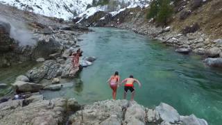
Kirkham Hot Springs Campground
Lowman, Idaho
5.8 miles EMultiple hot waterfalls flowing into shallow rock pools right along a highway 21 pullout near the Boise National Forest — popular in both summer and winter seasons.
Camp, Hot Springs 
Bonneville Hot Springs
Lowman, Idaho
17.9 miles EA series of soaking pools fed by a warm waterfall, plus a natural hot spring and a private iron-tub soak shack — all a quarter mile from Bonneville Campground beside Warm Springs Creek near Lowman.
Camp, Hike, Hot Springs 
Loftus Hot Spring
Mountain Home, Idaho
24.7 miles SLoftus Hot Spring is a free Boise National Forest soak on the Middle Fork Boise River, with a hot waterfall between ~110F and ~104F pools.
Camp, Hot Springs 
Badger Creek Campground
Boise City-Nampa, ID, Idaho
29.0 miles SA small 5-site riverside campground at 3,200-foot elevation on the Middle Fork of the Boise River, with fishing for rainbow, cutthroat, and whitefish and access to the William Pogue National Recreational Trail nearby.
Camp 
Roystone Hot Springs
Emmett, Idaho
35.7 miles WA private heated pool, huge hot tub, party room, and recreation area at Roystone Hot Springs in Sweet, Idaho — about 50 minutes from Boise for a relaxing day of soaking.
Camp, Hot Springs 
Irish Boat Ramps
Boise, Idaho
37.9 miles SWA year-round scramble starting at a Boise-area reservoir and climbing steeply up an old Jeep road along a ridgeline — the first 1.5 miles are very steep, with bumps and pine trees along the way.
Camp


