


Anderson Ranch Reservoir
Pine
Camp, Canoe, Hike, Kayak, and Swim
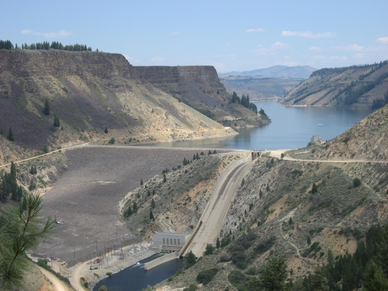
Anderson Ranch Reservoir fills a long mountain valley on the South Fork Boise River in Elmore County, Idaho, northeast of Mountain Home. The lake is roughly 14 miles long and about a mile wide, with around 50 miles of shoreline and water more than 300 feet deep near the dam. Anderson Ranch Dam, an earth and rockfill structure 456 feet high, was started by the Bureau of Reclamation in 1941 and finished in 1950, when it was the tallest dam of its type in the world. Its main job is storing irrigation water for the Boise Project, with a 40 megawatt powerplant at its base. The Boise National Forest's Mountain Home Ranger District runs the campgrounds and boat ramps around the shore.
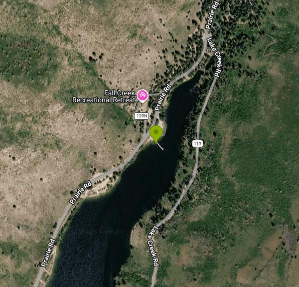
This listing is pinned on the Fall Creek Boat Ramp, a concrete launch on the reservoir's west shore. The Forest Service lists it as a no-fee site with a vault toilet and no drinking water, open from about May 15 to October 1 or until snow closes the roads. It has a boarding dock and a large parking area, and Fall Creek Resort across the road sells supplies. The Forest Service also lists swimming here, but this is a boat launch with no designated beach or lifeguard, so swimmers should stay well clear of the ramp lane. Two campgrounds the Forest Service lists as no-fee sit a short drive south along the same shore road: Castle Creek and Evans Creek, which has fire rings, picnic tables and a vault toilet.
Getting there takes some gravel. From Mountain Home, drive about 21 miles on US 20 to Forest Road 134, follow it about 6 miles to Anderson Ranch Dam, then turn onto Forest Road 120 and follow the west shore northeast past Evans Creek and Castle Creek. Plan on about an hour and twenty minutes from Mountain Home. The other approach leaves US 20 on the paved Pine-Featherville road (Forest Highway 61), which runs up the east side of the lake to the small community of Pine at the upper end. From Pine, Forest Roads 128, 113 and 120 wind back down the west shore to Fall Creek, about 10 miles.
Other access points are spread around the lake. Curlew Creek, on the Pine-Featherville road about 14 miles north of US 20, has a boat ramp, dock, drinking water, and 18 day-use sites next to its campground. Pine Campground has a concrete ramp and dock near the head of the reservoir. Deer Creek Boat Ramp has a small dirt lot for about 15 vehicles and charges a $3 per vehicle day-use fee. Fees and seasons differ from site to site, so check each Forest Service page before you go.
Fishing is the main draw. Idaho Fish and Game manages Anderson Ranch mostly as a kokanee fishery and stocks kokanee every spring. After slow years from 2020 to 2022, strong year classes in 2023 through 2025 brought catch rates back up, and the department's 2026 outlook expects plenty of kokanee in the 10 to 13 inch range. Kokanee season usually starts in mid to late April with fish shallow, from 1 to 15 feet down. By summer, most anglers run downriggers at 35 to 80 feet. The lake also holds smallmouth bass, rainbow trout, yellow perch, bull trout and some fall chinook, and the river below the dam is a known fly fishing stretch for rainbow trout.
Boaters, water skiers and personal watercraft share the lake on summer weekends, so paddlers in kayaks and canoes do best in the quieter coves near Fall Creek and Castle Creek, especially early in the day before boat traffic builds. Because the reservoir is run for irrigation, the water level drops through the summer and fall, and the ends of some ramps can end up high and dry in low-water years. Check current storage on Reclamation's Boise River water data before hauling a boat up. In late summer, it is also worth checking Idaho DEQ's cyanobacteria advisories before swimming.
Big changes are planned for the dam. Reclamation and the Idaho Water Resource Board plan to raise Anderson Ranch Dam by six feet, adding roughly 29,000 acre-feet of storage. Final designs for the dam raise and the reservoir rim work were finished in March 2026. The rim work covers erosion control, recreation facilities and the Pine airstrip. Environmental review is expected to wrap up in late 2026 or early 2027, with construction contracting to follow through 2027. Once work begins, Reclamation expects a temporary detour across the dam and some full closures of the dam road, so watch for notices if you plan to come in from the dam side.
More Information
2026 Anderson Ranch Reservoir kokanee outlook | Idaho Fish and Game
The 2026 kokanee fishery at Anderson Ranch Reservoir is expected to be very similar to what anglers experienced in 2025. Biologists anticipate higher than average catch rates of medium-sized kokanee throughout the season, providing consistent opportunities for anglers.
https://idfg.idaho.gov/article/2026-anderson-ranch-reservoir-kokanee-outlookAnderson Ranch Dam Raise, CPN Region
Anderson Ranch Dam Raise, Boise River, Feasibility Study, Pacific Northwest, Bureau of Reclamation - Managing water and power in the West
https://www.usbr.gov/pn/studies/boisefeasibility/andersonraise/milestones.htmlAnderson Ranch Reservoir Boat Ramps | Recreation.gov
Reserve camping, permits & activities at Anderson Ranch Reservoir Boat Ramps. Book official reservations on Recreation.gov.
https://www.recreation.gov/gateways/106Anderson Ranch Reservoir | Idaho Fishing Planner
Anderson Ranch Reservoir in Elmore County is 4,607.7 acres.
https://idfg.idaho.gov/ifwis/fishingplanner/water/1153993433934Boise National Forest | Castle Creek Campground | Forest Service
Castle Creek Campground is located on the west shore of Anderson Ranch Reservoir. It is accessed from State Highway 20. This non-fee campground.Excellent fishing in the lake for bass and salmon. There is a boat ramp at the Fall Creek campground.For site specific question, contact the Mountain Home Ranger District.
https://www.fs.usda.gov/r04/boise/recreation/castle-creek-campgroundBoise National Forest | Curlew Creek Campground | Forest Service
The Curlew Creek Campground offers 9 overnight camping sites and 18 day use sites along Anderson Ranch Reservoir.There is excellent fishing for smallmouth bass and Kokanee salmon in the reservoir.Try your luck at fly fishing for rainbow trout just below the dam.Waterskiing is another favored activity here. The Curlew boat ramp is accessible.
https://www.fs.usda.gov/r04/boise/recreation/curlew-creek-campgroundBoise National Forest | Deer Creek Boat Ramp | Forest Service
The Deer Creek Boat Ramp provides access to Anderson Ranch Reservoir. There is a restroom and a small dirt parking area big enough for about 15 vehicles.For site specific questions, contact the Mountain Home Ranger District.
https://www.fs.usda.gov/r04/boise/recreation/deer-creek-boat-rampBoise National Forest | Fall Creek Boat Ramp | Forest Service
The Fall Creek Boat Ramp provides access to Anderson Ranch Reservoir. There is a restroom on site. The Fall Creek Resort is located across road 120.For site specific questions, contact the Mountain Home Ranger District.
https://www.fs.usda.gov/r04/boise/recreation/fall-creek-boat-rampFall Creek Boat Launch — Anderson Ranch Reservoir Area | Idaho Campground Review
Idaho Campground Review — Campgrounds, hiking trails, and points of interest across Idaho and the Northwest.
https://idahocampgroundreview.com/campgrounds/andersonranch/support_pages/and_fallBe courteous, informed, and prepared. Read trailhead guidelines, stay on the trail, and don't feed the wildlife.
Read More
- Plan Ahead and Prepare
- Travel & camp on durable surfaces
- Dispose of waste properly
- Leave what you find
- Minimize campfire impacts
- Respect wildlife
- Be considerate of other visitors
Directions
From Pine
- Head north on Eaton Ln toward Klejeski Rd (1.1 mi)
- Turn left onto Klejeski Rd (2.0 mi)
- Turn right onto Prison Rd (1.0 mi)
- Turn left onto MN-123 S (1.1 mi)
- Turn right onto Co Hwy 64/
Main St Continue to follow Co Hwy 64(0.4 mi) - Continue onto MN-23 E (3.0 mi)
- Continue straight onto MN-18 W (1.5 mi)
- Turn left to stay on MN-18 W (31.5 mi)
- Turn right onto MN-18 W/
State Hwy 47 N (9.1 mi) - Turn left onto MN-18 W (12.6 mi)
- Turn left onto US-169 S (2.1 mi)
- Turn right onto 450th Ave (1.3 mi)
- Continue straight onto 228th St (0.8 mi)
- 228th St turns slightly left and becomes Round Lake Rd (2.0 mi)
- Turn left onto Co Rd 10 (0.4 mi)
- Turn right onto MN-18 W (14.4 mi)
- Continue straight onto Oak St (2.1 mi)
- Turn right onto S 6th St (0.4 mi)
- Turn left onto MN-210 W/
Great River Rd/ Washington St Continue to follow MN-210 WPass by Dairy Queen (Treat) (on the left in 0.4 mi)(21.9 mi) - Turn right onto US-10 W (25.8 mi)
- At the traffic circle, continue straight to stay on US-10 W (83.2 mi)
- Exit onto MN-336 S toward I-94 (2.4 mi)
- Turn right to merge onto I-94 WPassing through North DakotaEntering Montana(607 mi)
- Continue onto I-90 W (206 mi)
- Take exit 249 for MT-55 toward MT-69/
Whitehall (0.2 mi) - Turn left onto MT-55 S/
N Whitehall St (0.6 mi) - Turn right onto MT-2 W/
MT-55 S/ MT-69 N/ W Legion Ave (0.4 mi) - Turn left onto MT-55 S (12.0 mi)
- Continue onto MT-41 S (14.4 mi)
- Turn right onto MT-41 S/
W 4th Ave Continue to follow MT-41 S(27.2 mi) - Turn right onto I-15BL N/
I-15BUS (0.5 mi) - Merge onto I-15 S via the ramp to Idaho FallsEntering Idaho(93.0 mi)
- Take exit 167 for ID-22 W toward Dubois (0.3 mi)
- Turn right onto ID-22 W (43.7 mi)
- Turn right onto ID-33 W (8.7 mi)
- Turn left to stay on ID-33 W (15.9 mi)
- Turn right onto US-20 W/
US-26 W (7.5 mi) - Turn left onto US-20 W/
US-26 W/ US-93 S/ W Grand Ave Continue to follow US-20 W/(44.1 mi)US-26 W/ US-93 S - Turn right onto US-20 W/
Queen Crown Rd Continue to follow US-20 W(79.6 mi) - Turn right onto Anderson Dam Rd/
N E Anderson Rnch Dm Rd (5.0 mi) - Turn left onto N E Anderson Rnch Dm Rd (0.3 mi)
- Turn right onto Anderson Dam Rd/
N E Anderson Rnch Dm Rd/ Prairie Rd (2.0 mi) - Turn right to stay on Anderson Dam Rd/
N E Anderson Rnch Dm Rd/ Prairie Rd (6.4 mi)
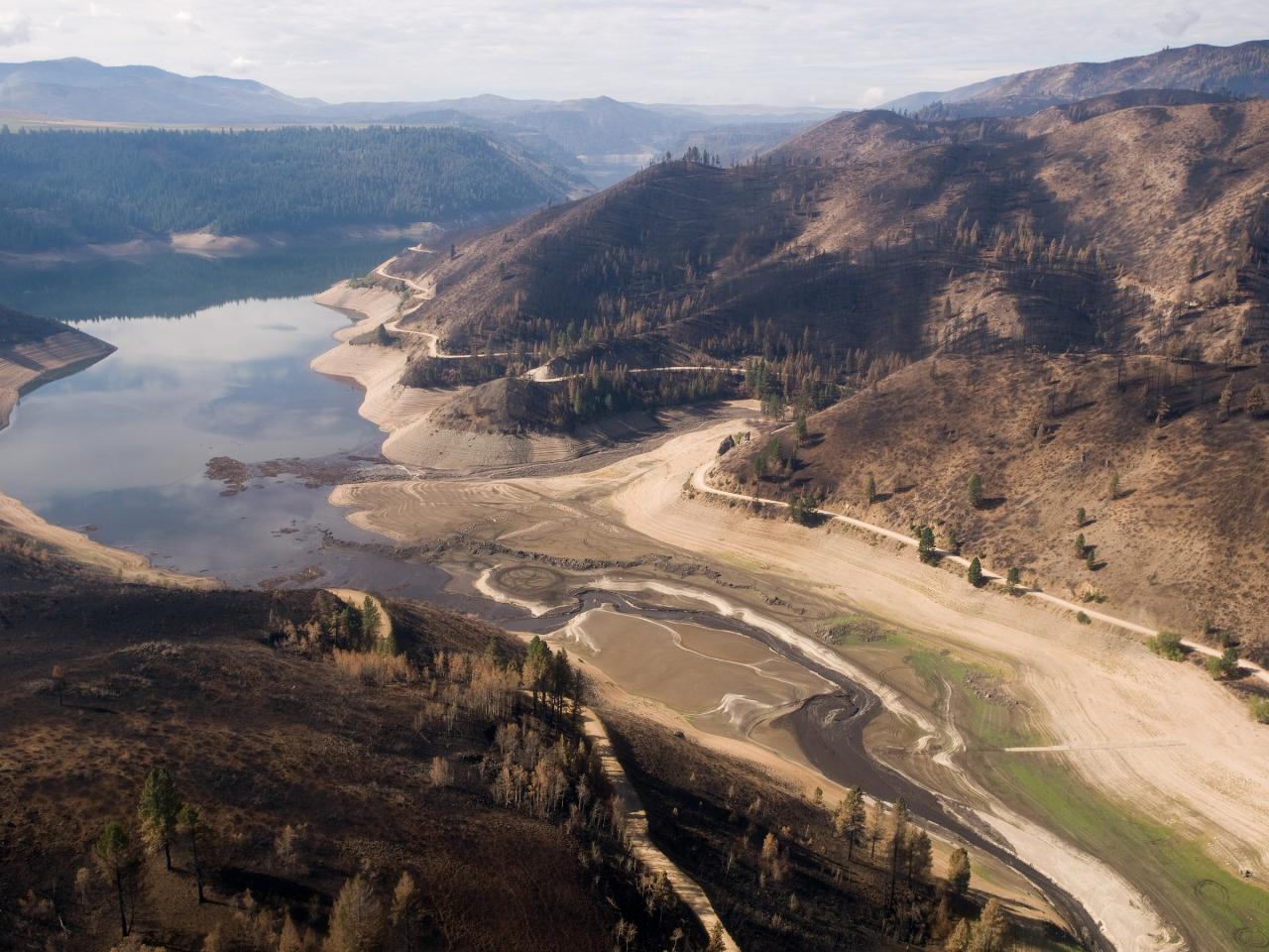
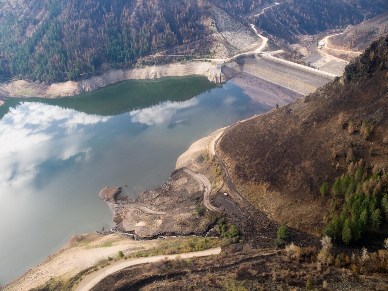
 Fall and Castle creeks entering Anderson Ranch Reservoir after the 2013 Elk Complex Fire courtesy of U.S. Forest Service↗ (Public domain↗)
 Anderson Ranch Dam and the reservoir behind it, August 2009 courtesy of Riverwild↗ (CC BY-SA 3.0↗)
 Elk Creek arm near Anderson Ranch Dam after the 2013 Elk Complex Fire courtesy of U.S. Forest Service↗ (Public domain↗)
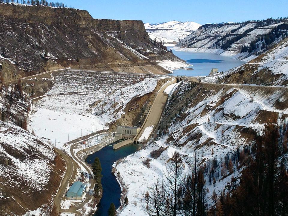
 Anderson Ranch Dam in winter 2014, with hillsides burned in the 2013 fires courtesy of Bureau of Reclamation↗ (CC BY-SA 2.0↗)

Other Swimming Holes, Hiking Trails, Canoeing Areas, and Kayaking Areas Nearby
Little Camas Reservoir
Mountain Home
5.0 miles SIrrigation reservoir on the western Camas Prairie northeast of Mountain Home, with a free Forest Service boat ramp, primitive shoreline camping and trout fishing. Water levels swing hard, and there is no trout stocking in 2026.
Camp, Canoe, Kayak
Crater Rings
Mountain Home, Idaho
28.3 miles SWTwo perfectly symmetrical pit craters — among the few examples in the continental US — offer a rare look at volcanic collapse geology on the Snake River Plain.
Hike, Rock Climb
Mormon Reservoir
Fairfield
31.0 miles EIrrigation reservoir on McKinney Creek about five miles south of Fairfield, with a free Idaho Fish and Game boat ramp, docks, toilets and primitive camping. It is stocked with rainbow trout, but the water drops hard by late summer and in dry years.
Camp, Canoe, Kayak 3.4 mi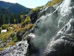
Skillern Hot Springs
Fairfield, Idaho
32.7 miles NEA stunning six-mile trail along crystal-clear Big Smoky Creek to a hot spring — spectacular in fall, with two trail options and a sign marking the final three miles.
Camp, Hike, Hot Springs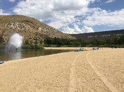
Sandy Point
Boise, Idaho
34.4 miles WA shallow, family-friendly lake inside Lucky Peak State Park with a playful fountain, a splash pad, paddleboard rentals, disc golf, volleyball, and free loaner life jackets.
Disc Golf, Swim
Bruneau Dunes
Bruneau, Idaho
38.8 miles SWNorth America's tallest single-structure sand dune rises 470 feet above twin lakes, with stargazing at Idaho's only public observatory on select evenings nearby.
Camp, Canoe, Hike, Horseback 1.4 mi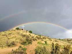
Table Rock
Boise, Idaho
40.0 miles WDirectly above downtown Boise, Table Rock rewards hikers with panoramic city, valley, and foothills views — especially stunning at sunrise or sunset, when the iconic white cross lights up on the peak.
Hike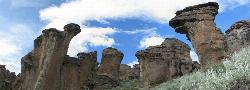
Little City of Rocks
Gooding, Idaho
41.2 miles SEA volcanic hoodoo landscape of natural arches, towers, and mushroom-cap formations near Gooding, Idaho — best visited in spring when desert wildflowers bloom and the main loop trail is scenic.
Camp, Hike
Military Reserve Trails
Boise, Idaho
42.2 miles WA 460-acre wildlife and recreation reserve near Boise with trails through a historic military range repurposed for the community — managed to preserve natural values alongside public recreation.
Hike, Mountain Bike
Central Foothills
Boise, Idaho
43.2 miles WIdaho's Central Foothills offer access to over 19,000 miles of trails — from paved urban paths to remote wilderness climbs, including the 1,200-mile Idaho Centennial Trail.
Hike, Mountain Bike
Pine Flat Hot Springs
Garden Valley, Idaho
46.7 miles NAn aqua-blue hot spring pool at the base of a small waterfall on the South Fork Payette River — just a quarter mile from Pine Flat Campground in the Boise National Forest.
Camp, Canoe, Hike, Hot Springs, Kayak, Whitewater
Thousand Springs State Park
Hagerman, Idaho
47.5 miles SEA southern Idaho state park near Hagerman with five non-contiguous areas offering several swimming places — fees apply, see the park website for current access details.
Swim
Magic Reservoir
Bellevue
48.4 miles EMagic Reservoir is a big irrigation lake on the Big Wood River surrounded by BLM sagebrush land, with free ramps and primitive camps. It is known for trout, perch and ice fishing, but water levels swing hard with irrigation demand.
Camp, Canoe, KayakNearby Campsites
Little Camas Reservoir
Mountain Home
5.0 miles SIrrigation reservoir on the western Camas Prairie northeast of Mountain Home, with a free Forest Service boat ramp, primitive shoreline camping and trout fishing. Water levels swing hard, and there is no trout stocking in 2026.
Camp, Canoe, Kayak
Badger Creek Campground
Boise City-Nampa, ID, Idaho
23.3 miles NWA small 5-site riverside campground at 3,200-foot elevation on the Middle Fork of the Boise River, with fishing for rainbow, cutthroat, and whitefish and access to the William Pogue National Recreational Trail nearby.
Camp
Loftus Hot Spring
Mountain Home, Idaho
23.6 miles NWLoftus Hot Spring is a free Boise National Forest soak on the Middle Fork Boise River, with a hot waterfall between ~110F and ~104F pools.
Camp, Hot Springs
Preis Hot Spring
Fairfield, Idaho
29.9 miles EA small sunken wooden box beside Forest Road 227 north of Fairfield that fits two people in clear, roughly 102 degree water. Pair it with Worswick Hot Springs a couple of miles away.
Camp, Hot Springs
Mormon Reservoir
Fairfield
31.0 miles EIrrigation reservoir on McKinney Creek about five miles south of Fairfield, with a free Idaho Fish and Game boat ramp, docks, toilets and primitive camping. It is stocked with rainbow trout, but the water drops hard by late summer and in dry years.
Camp, Canoe, Kayak
Worswick Hot Springs
Fairfield, Idaho
31.2 miles EFree hillside hot spring pools on Worswick Creek in the Sawtooth National Forest, about 20 miles north of Fairfield. The lower pools run about 90 to 105 degrees, and the source water is hot enough to scald.
Camp, Hot Springs
Irish Boat Ramps
Boise, Idaho
32.4 miles WA year-round scramble starting at a Boise-area reservoir and climbing steeply up an old Jeep road along a ridgeline — the first 1.5 miles are very steep, with bumps and pine trees along the way.
Camp 3.4 mi
Skillern Hot Springs
Fairfield, Idaho
32.7 miles NEA stunning six-mile trail along crystal-clear Big Smoky Creek to a hot spring — spectacular in fall, with two trail options and a sign marking the final three miles.
Camp, Hike, Hot Springs
Bruneau Dunes
Bruneau, Idaho
38.8 miles SWNorth America's tallest single-structure sand dune rises 470 feet above twin lakes, with stargazing at Idaho's only public observatory on select evenings nearby.
Camp, Canoe, Hike, Horseback
McKinney Butte Lava Tubes
Gooding, Idaho
39.4 miles SETwo forking lava tubes near Bliss — one open to anyone, the other gated (BLM permit required) — that survived the Bonneville Flood and a 1993 landslide.
Camp, Cave
Little City of Rocks
Gooding, Idaho
41.2 miles SEA volcanic hoodoo landscape of natural arches, towers, and mushroom-cap formations near Gooding, Idaho — best visited in spring when desert wildflowers bloom and the main loop trail is scenic.
Camp, Hike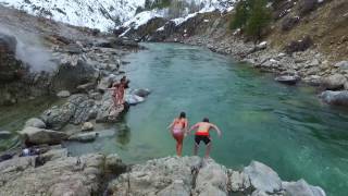
Kirkham Hot Springs Campground
Lowman, Idaho
45.7 miles NMultiple hot waterfalls flowing into shallow rock pools right along a highway 21 pullout near the Boise National Forest — popular in both summer and winter seasons.
Camp, Hot Springs
Pine Flat Hot Springs
Garden Valley, Idaho
46.7 miles NAn aqua-blue hot spring pool at the base of a small waterfall on the South Fork Payette River — just a quarter mile from Pine Flat Campground in the Boise National Forest.
Camp, Canoe, Hike, Hot Springs, Kayak, Whitewater
Galena Lodge
Ketchum, Idaho
48.0 miles NEA community-owned historic lodge 23 miles north of Sun Valley, open summer and winter as a hub for hikers, bikers, Nordic skiers, and snowshoers with rentals and great food.
Camp, Cross-country Ski, Snowshoe
Magic Reservoir
Bellevue
48.4 miles EMagic Reservoir is a big irrigation lake on the Big Wood River surrounded by BLM sagebrush land, with free ramps and primitive camps. It is known for trout, perch and ice fishing, but water levels swing hard with irrigation demand.
Camp, Canoe, Kayak
Park Creek Campground
Lowman, Idaho
49.1 miles NA small, tranquil campground in an old-growth forest along Park Creek in the Baker Lake basin, close to Baker Lake and the larger Swift Creek Campground.
Camp


