


Loon Lake
McCall, Idaho

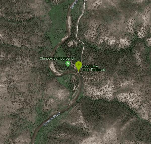
| Address: | Loon Lake Loop Trailhead, McCall, ID 83638, USA |
| GPS: |
45°12'43.9"N 115°48'32.2"W Maps | Directions |
| State: | Idaho |
| Trails/Routes: | 9.2-11.1 mi |
Motorized Use
Backpack, Hike, Horseback, and Mountain Bike
Boasting a 10+ mile hike, spectacular scenery, the quaint mountain lake is punctuated with a long abandoned ghost plane stashed at the leeward shore. Its got all the makings for a winning trip. Courtesy of visitidaho.org
The hike to Loon Lake begins at a trailhead outside Chinook Campground, which is 37 miles northeast of McCall. There are two well-maintained routes to the lake, which provides the opportunity to hike a loop instead of an out and back. The forested west side is 4.6 miles to the lake with 540 feet of elevation gain. The canyon trail on the east side is 5.7 miles with about 450 feet of elevation gain.Courtesy of idahostatesman.com
The shortest route [to the bomber] is to wade across Loon Creek on the north shore (we carried water shoes for that purpose) and bushwhack about 0.8 miles along the shore to the bomber. But the fallen trees, boulders and soggy ground were such a bear that one member of our party opted to walk in the lake. My 10-year-old son was sinking to his waist, so that didn’t work for us. We battled the rocks and logs and — eventually — won. It took nearly an hour, partly because we were so unsure of where we were going. It was Oliver’s favorite part of the hike; it was my least favorite.
The other option is to take the Duck Lake trail along the western shore and bushwhack about 0.4 miles from there to the bomber. But that route is longer overall — 1.4 miles from the Duck Lake junction to the bomber. Plus, the trail was littered with fallen trees (I got my worst cut of the day there) and there’s no sign telling you where to leave the trail and go cross country. If you take this route — we used it on the way out — you’ll cross the creek on the south end of the lake. You can test your balance on some well-placed logs, or wade.
Courtesy of eastidahonews.com
Never modify trail features. Ride trails when they're dry enough that you won't leave ruts. Speak up when you see others on the trail and always yield to hikers, horses, and others coming uphill. Always ride on the established trail.
Read MoreBe courteous, informed, and prepared. Read trailhead guidelines, stay on the trail, and don't feed the wildlife.
Read More
- Plan Ahead and Prepare
- Travel & camp on durable surfaces
- Dispose of waste properly
- Leave what you find
- Minimize campfire impacts
- Respect wildlife
- Be considerate of other visitors
Directions
From McCall, Idaho
- Head west on Rio Vista Blvd toward Yolanda Way (0.4 mi)
- Turn right onto Rowland St (0.3 mi)
- Turn right onto Hayes St/Herrick St (135 ft)
- Turn left onto W Lake St (75 ft)
- Turn right onto Warren Wagon Rd (34.9 mi)
- Turn right toward National Forest Rd 080 (0.2 mi)
- Continue onto National Forest Rd 080 (0.8 mi)
From Chinook Campground take trail #080. Trail #080 follows the Secesh River south towards Loon Creek. Just above Loon Creek take trail #084 west. Trail #084 becomes rocky and steep with many switch-backs, rising 800 feet in elevation in 1.3 miles. Trail #084 intersects with trail #081. Continue south along #081 to the junction of trail #-84. Head west again on #084. This trail runs 1.75 miles south along the west side of Loon Lake. Where the trail meets Loon Creek, leave the trail to follow the creek north to Loon Lake. The wreckage is on the south side of Loon Lake, approximately 150 feet into the trees.Courtesy of secesh.net



Other Mountain Bike Trails, Hiking Trails, Horseback Trails, and Backpacking Trails Nearby
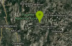
Cluster Hot Spring
Yellow Pine, Idaho
13.4 miles SEA remote hot spring hidden above the South Fork Salmon River — found by hikers who spotted steam across the canyon — requiring a raft and life jackets to reach.
Hike, Hot Springs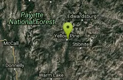
Elk River Campground
Yellow Pine, Idaho
23.2 miles SEA 24-site campground in a scenic pine forest beside Elk Creek, minutes from Idaho's largest waterfall and the largest and oldest cedar east of the Cascades.
Camp, Hike
Boulder Meadows Reservoir
McCall, Idaho
25.0 miles SA quiet, undeveloped reservoir in the Payette National Forest near McCall, Idaho: paddle, swim, and start the trail to alpine Boulder Lake.
Backpack, Canoe, Hike, Kayak, Swim 14.9 mi
Idaho Centennial Trail
Warren, Idaho
30.0 miles NEA 900-mile trail following the Salmon River, Snake River, and stunning red rock canyons across Idaho's wildest backcountry — completable by foot, mountain bike, or small motorized vehicle.
Camp, Hike
Big Baldy Fire Lookout
Cascade, Idaho
41.5 miles SEA demanding summit hike to a still-standing fire lookout deep in the Frank Church River of No Return Wilderness — the largest wilderness in the lower 48.
HikeNearby Campsites
Elk River Campground
Yellow Pine, Idaho
23.2 miles SEA 24-site campground in a scenic pine forest beside Elk Creek, minutes from Idaho's largest waterfall and the largest and oldest cedar east of the Cascades.
Camp, Hike 14.9 mi
Idaho Centennial Trail
Warren, Idaho
30.0 miles NEA 900-mile trail following the Salmon River, Snake River, and stunning red rock canyons across Idaho's wildest backcountry — completable by foot, mountain bike, or small motorized vehicle.
Camp, Hike


