


Meadow River East Area
Valley Head, West Virginia
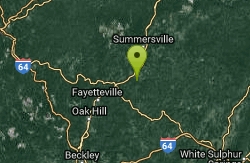
| GPS: |
38°8'5.8"N 80°53'16.5"W Maps | Directions |
| State: | Virginia |
Swim

- Plan Ahead and Prepare
- Travel & camp on durable surfaces
- Dispose of waste properly
- Leave what you find
- Minimize campfire impacts
- Respect wildlife
- Be considerate of other visitors
Directions
From Valley Head, West Virginia
- Head north on US-219 N toward Conley Run Rd/Marple Rd (0.6 mi)
- Turn left onto WV-15 W (29.8 mi)
- Turn left onto WV-20 S/Baker StContinue to follow WV-20 S(23.8 mi)
- Continue onto WV-55 W/W Webstrerd Rd (5.6 mi)
- Continue straight onto WV-41 S/W Webstrerd Rd (6.5 mi)
- Turn left onto US-19 S (7.6 mi)
- Turn left onto WV-41 S (285 ft)
- Turn right to stay on WV-41 S (6.4 mi)

Other Swimming Holes Nearby
Summersville Cliffs Area
Mount Nebo, West Virginia
7.0 miles NSwim near Mount Nebo, West Virginia
Swim
Cranberry River Area
Cedarville, West Virginia
21.1 miles NESwim near Cedarville, West Virginia
Swim
Glade Creek Area
Masontown, West Virginia
22.5 miles SA 6-mile-plus gorge hiking trail alongside beautiful Glade Creek with many swimming holes, accessible from both ends, and a small free campground at the lower end near the New River.
Swim
Sandstone Falls
Shady Spring, West Virginia
26.0 miles SSwim near Shady Spring, West Virginia
Swim
Anvil Rock
Alderson, West Virginia
32.3 miles SESwim near Alderson, West Virginia
Swim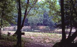
Blue Bend Recreation Area
White Sulphur Springs
37.0 miles SEA free swimming hole on a wide bend of Anthony Creek at a 1930s CCC-built Forest Service recreation area in the Monongahela National Forest, about 12 miles north of White Sulphur Springs.
Camp, Hike, Swim
Sutton Lake Beach
Sutton
37.6 miles NThe Corps of Engineers swim beach at Bee Run Day Use Area on Sutton Lake, a small roped-off sandy cove beside the marina near Sutton, West Virginia, with a $5 per vehicle day-use fee.
Camp, Canoe, Hike, Kayak, Swim
Bee Run Recreation Area Beach
Sutton
37.6 miles NThe roped-off sand swim beach at the Corps of Engineers' Bee Run day use area on Sutton Lake, next to the marina just east of Sutton. A $5 per vehicle day use fee applies, paid by card at machines.
Camp, Canoe, Hike, Kayak, Swim
Williams River Area
White Sulphur Springs, West Virginia
40.1 miles NESeveral swimming holes in and near the Cranberry Wilderness of West Virginia's Monongahela National Forest — bathing suits optional.
Swim
Watoga State Park
White Sulphur Springs, West Virginia
40.2 miles ESwim near White Sulphur Springs, West Virginia
Swim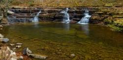
Campbell Falls
Camp Creek, West Virginia
45.6 miles SA 15-foot-tall, 40-foot-wide waterfall in Camp Creek State Park, most powerful after rain and most beautiful in spring — large flat rocks make a perfect perch to watch the cascade.
Camp, Hike, Mountain Bike, Swim
Knapp Creek Area
Webster Springs, West Virginia
45.7 miles ESwim near Webster Springs, West Virginia
Swim
Holly River State Park
Webster Springs, West Virginia
46.2 miles NESwim near Webster Springs, West Virginia
Swim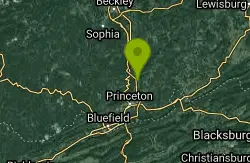
Brush Creek Falls
Athens, West Virginia
47.1 miles SA short waterfall hike in Brush Creek Nature Preserve with a gorgeous mossy backdrop perfect for long-exposure photography — wading possible but no real swimming. The spot draws parties, so expect some litter.
Swim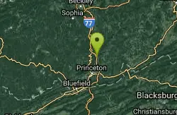
Camp Creek Area
Cabins, West Virginia
47.3 miles SSwim near Cabins, West Virginia
Swim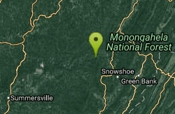
Elk River Area
Masontown, West Virginia
47.6 miles NESwim near Masontown, West Virginia
SwimNearby Campsites
Blue Bend Recreation Area
White Sulphur Springs
37.0 miles SEA free swimming hole on a wide bend of Anthony Creek at a 1930s CCC-built Forest Service recreation area in the Monongahela National Forest, about 12 miles north of White Sulphur Springs.
Camp, Hike, Swim
Sutton Lake Beach
Sutton
37.6 miles NThe Corps of Engineers swim beach at Bee Run Day Use Area on Sutton Lake, a small roped-off sandy cove beside the marina near Sutton, West Virginia, with a $5 per vehicle day-use fee.
Camp, Canoe, Hike, Kayak, Swim
Bee Run Recreation Area Beach
Sutton
37.6 miles NThe roped-off sand swim beach at the Corps of Engineers' Bee Run day use area on Sutton Lake, next to the marina just east of Sutton. A $5 per vehicle day use fee applies, paid by card at machines.
Camp, Canoe, Hike, Kayak, Swim
Campbell Falls
Camp Creek, West Virginia
45.6 miles SA 15-foot-tall, 40-foot-wide waterfall in Camp Creek State Park, most powerful after rain and most beautiful in spring — large flat rocks make a perfect perch to watch the cascade.
Camp, Hike, Mountain Bike, Swim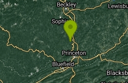
Mash Fork Falls
Camp Creek, West Virginia
46.0 miles SA 7-foot sandstone waterfall in Camp Creek State Park, best in spring, with a viewing platform, surrounding trails for hiking and mountain biking, and tent camping at $15/night.
Camp, Hike, Mountain Bike


