


91 Mountain Bike Trails near Calamity Campground
first prev 1 2 3 4 5 next lastShowing Mountain Bike Trails within 50 miles Distance miles of Forest Rd 241, Irwin, ID 83428, USA City, Zip, or Address

Probation And Burg Bumper
Tetonia, Idaho
29.1 miles NThe Probation part of the trail is the steepest downhill in the area. Has multiple bridges and log jumps in the short mile down. The Burg portion of the trail is uphill with some...
Mountain Bike 2.7 mi
Sidewinder Trail
Ririe, Idaho
29.2 miles NWSidewinder's claim to fame is that it's on a South facing hill just above the Snake River. That means that when all the other trails in the Kelly Canyon Trail network are covered with snow...
Mountain Bike 3.8 mi
Stinking Springs
Ririe, Idaho
29.2 miles NWStinking Springs is a great early to late season trail. Being at the edge of the Big Hole range, it gets spring earlier and winter later than other trails in the range. It's closed from December...
Hike, Mountain Bike 3.8 mi
Kelly Mountain Trail
Ririe, Idaho
29.2 miles NWKelly Canyon Trail is a moderate, uphill trail that can be used by hikers, mountain bikers, and ATV riders. The trail features views of hills, mountains, trees, wildflowers, and some wildlife. Dogs...
Cross-country Ski, Hike, Mountain Bike, Snowshoe 11.9 mi
Waterfall Loop
Ririe, Idaho
29.4 miles NWTrail is a mixture of single track, forest road and double track. Provides a variety of scenery. About 1400 feet of elevation change throughout the trail.GPS is a must unless you are going with...
Mountain Bike
Kelly Canyon Loops
Ririe, Idaho
29.8 miles NWThis mountain bike trail near Kelly Canyon Ski Area has several options available. Highlights are the views in all directions from the top of the mountain. Trails: Waterfall...
Mountain Bike
Kelly Canyon
Ririe, Idaho
30.3 miles NWThe trail switchbacks up Kelly Mountain, hitting two brief red-line climbs before you get up on the top. The famed "Shale Chute" is back there somewhere (so this is part of the route for...
Mountain Bike 1.7 mi
Randy's Cow Trail / Ken's Corner
Ririe, Idaho
30.6 miles NWThis trail descends from the fence corner at the West end of Batman and continues down to Lyon's Creek Parking just off Lyon's road. The top of this trail is only a couple hundred yards from...
Mountain Bike 2.1 mi
Batman
Ririe, Idaho
30.6 miles NWThis trail features rolling terrain, and multiple short, steep downhill sections followed by short steep uphill sections. This trail follows the fence line. Watch out for cows (and cow droppings)...
Mountain Bike 1.6 mi
Skyline
Ririe, Idaho
30.7 miles NWPunchy climb out of Little Kelly Canyon. Great vistas along a narrow traverse. Fast and loose downhill. A mix of narrow singletrack and old motorized trail.
Mountain Bike 0.6 mi
Packsaddle Lake
Tetonia, Idaho
31.5 miles NPacksaddle is one of the less well known lakes/trails in the area. If you've got a good offroad vehicle, you can probably make it all the way to the end of the road, otherwise, it's just an...
Dive, Hike, Mountain Bike, Snowshoe, Swim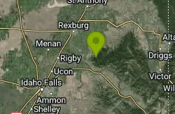
Cranky Cowboy
Herbert, Idaho
31.5 miles NWMountain Bike near Herbert, Idaho
Mountain Bike 13.3 mi
Cranky Buckskin Randy
Herbert, Idaho
31.5 miles NWThanks to the Snake River Trail Alliance, this route connects 3 great trails between the Buckskin Morgan parking area at the top and the Luthy's Corral parking at the bottom (new in...
Mountain Bike 4.5 mi
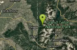
Sheep Bridge Trail
Driggs, Idaho
31.9 miles NThis is a great easy trail for beginner hikers or mountain bikers. In the early summer, you'll find many beautiful wildflowers and large kaleidoscopes of butterflies to go with them. You...
Hike, Mountain Bike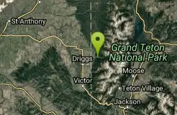
Cold Springs
Moose, Wyoming
32.0 miles NTrail is easiet down as a loop but can be done as a shuttle as well. Take a right into Teton Canyon and park at the first big parking lot on the left. About 50 yards from Ski Hill rd....
Mountain Bike 0.5-3.5 mi
Webster's Dam
Ririe, Idaho
32.0 miles NWAlso known as Manmade Falls or the Woodmansee Dam, Webster Dam is an abandoned dam located deep in Moody Creek canyon, the dam was abandoned when sediment built up behind the dam which then...
Camp, Hike, Mountain Bike 7.1 mi
Mill Creek Trail
Moose, Wyoming
32.0 miles NThere are two ways to do this ride, one as a loop with the Targhee road providing the bulk of the climb, or as an out and back (up the trail and back down). Keep in mind that this trail is...
Cross-country Ski, Mountain Bike, Snowshoe 3.0 mi
Cowboy Trail
Ririe, Idaho
32.2 miles NWMountain Bike near Ririe, Idaho
Mountain Bike
Wright Creek Trail
Tetonia, Idaho
32.8 miles NOpen to MTB, horseback riding, snowshoeing, and hiking. source: fs.usda.gov
Mountain Bike 4.0 mi
Quakie Ridge
Moose, Wyoming
34.1 miles NTrail starts at the base ski area on a service road then heads out on nice single track. Trail winds through meadows of wildflowers. Some minor altitude gain along the trail. The...
Mountain Bike


