


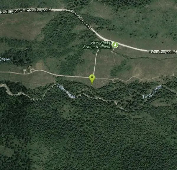
Sheep Bridge Trail
Driggs, Idaho

| Address: | ~1750 Teton Canyon Rd, Moose, WY 83012, USA |
| GPS: |
43°45'37.6"N 110°59'14.4"W Maps | Directions |
| State: | Wyoming |
| Trail Length: | 4.50 miles |
| MTB Difficulty: | Beginner |
| Trail Type: | Out & Back |
| MTB Trail Type: | Singletrack |
| Trails/Routes: | 4.5 mi |
Streams Wildflowers Bicycles Restrooms
Hike and Mountain Bike
This is a great easy trail for beginner hikers or mountain bikers. In the early summer, you'll find many beautiful wildflowers and large kaleidoscopes of butterflies to go with them. You may want to wear bright colors and walk slowly to entice the butterflies to land on you. There's often a wide variety so may even want a book to identify them all.
The new trailhead is just off Teton Canyon Road and has parking for 15-20 vehicles. From there, you'll follow the trail about 0.25 miles south to Teton Creek where you'll cross a bridge. After crossing the bridge, you'll find a short uphill but after that, the ascent is minimal. The trail is pretty easy to follow as long as you keep right and keep heading East. Just short of halfway, there's a nice little spot where the trail forks left and you can go down and take a break at the creek. The entire trail runs about 2.25 miles, running parallel to Teton Creek and ending at a creek just short of Treasure Mountain Scout Camp. If you're on a bike, that's where it gets fun. Turn that bike around and enjoy some easy but fun downhill singletrack.
More Information
Add ResourceNever modify trail features. Ride trails when they're dry enough that you won't leave ruts. Speak up when you see others on the trail and always yield to hikers, horses, and others coming uphill. Always ride on the established trail.
Read MoreBe courteous, informed, and prepared. Read trailhead guidelines, stay on the trail, and don't feed the wildlife.
Read More- Plan Ahead and Prepare
- Travel & camp on durable surfaces
- Dispose of waste properly
- Leave what you find
- Minimize campfire impacts
- Respect wildlife
- Be considerate of other visitors
Directions
From Driggs, Idaho
- Head east on W Bates Rd toward N Main St (69 ft)
- Continue onto E Little Ave (0.5 mi)
- Continue onto Ski Hill RdEntering Wyoming(3.5 mi)
- Continue onto W Alta Ski Hill Rd (2.6 mi)
- Turn right onto Teton Canyon RdDestination will be on the right(0.8 mi)

Trails
Distance ?
4.5 miles Round TripElevation Gain ?
131 feetReal Ascent ?
291 feetReal Descent ?
160 feetAvg Grade (1°)
1%Grade (-7° to 9°)
-12% to 16%Elevation differences are scaled for emphasis. While the numbers are accurate, the cut-away shown here is not to scale.
Other Mountain Bike Trails and Hiking Trails Nearby

Mill Creek Trail
Moose, Wyoming
0.1 miles NWThere are two ways to do this ride, one as a loop with the Targhee road providing the bulk of the climb, or as an out and back (up the trail and back down). Keep in mind that this trail is...
Cross-country Ski, Mountain Bike, Snowshoe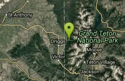
Cold Springs
Moose, Wyoming
0.7 miles WTrail is easiet down as a loop but can be done as a shuttle as well. Take a right into Teton Canyon and park at the first big parking lot on the left. About 50 yards from Ski Hill rd....
Mountain Bike 4.0 mi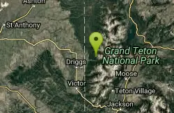
Quakie Ridge
Moose, Wyoming
2.3 miles NETrail starts at the base ski area on a service road then heads out on nice single track. Trail winds through meadows of wildflowers. Some minor altitude gain along the trail. The...
Mountain Bike 2.1 mi
Buffalo Soldier
Moose, Wyoming
2.3 miles NETrail is a nice loop, all singletrack, with about 300' of elevation gain. Trail is about 1.8 miles one way. You can also use it as a connector to Mill Creek or lightning loop. Buffalo...
Mountain Bike 1.9 mi
Perm-a-grin
Moose, Wyoming
2.4 miles NEPerma Grin is guaranteed to fix a smile on your face indefinitely! This swooping, flowing, smooth singletrack descends the hillside above Rick's Basin.
Mountain Bike 1.1 mi
More Cowbell
Moose, Wyoming
2.4 miles NEThis singletrack trail winds through aspens, high alpine meadows and old growth conifers.
Mountain Bike 0.6-4.0 mi
Grand Targhee XC Park
Moose, Wyoming
2.4 miles NEMountain Bike 1.7 mi

Rick's Basin
Driggs, Idaho
2.9 miles NEMountain Bike near Driggs, Idaho
Mountain Bike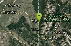
Spring Creek Trail
Alta, Wyoming
3.5 miles SWThis trail starts at the remains of the historic Rapid Creek Ranger Station. The trail heads east following an old road. After crossing Rapid Creek, the trail climbs up to a ridge...
Mountain Bike 3.8-6.4 mi
Table Rock / Table Mountain
Driggs, Idaho
3.5 miles EAt 11,300 feet, Table Mountain is possibly the most beautiful climb this side of the Tetons and offers what may well be the very best view of the Grand Tetons. It's just far enough away...
Camp, Hike 15.0-18.4 mi
Alaska Basin
Driggs, Idaho
3.6 miles EThe Alaska Basin Trail is a stunning trail through the Jedediah Wilderness near Driggs, Idaho and goes East into Wyoming, just outside of Grand Teton National Park. The trail is wide...
Backpack, Hike, Horseback 7.9 mi
Devil's Stairs
Driggs, Idaho
3.6 miles EJust to the West of Table Rock is this often overlooked trail less traveled by, full of beautiful meadows and beautiful views all its own. The trail begins from the same campsite as the Table Rock...
Backpack, Hike 4.5 mi
Aspen Trail
Alta, Wyoming
3.6 miles SWAspen Trail (tr 034) is single track trail for 4.35 miles along 6,800 ft contour to Darby Canyon (tr 012). Spring Creek Trail (tr 032) is double track trail for 3.68 miles to end. The trail starts...
Hike, Mountain Bike 0.1-6.2 mi
Darby Wind Cave
Driggs, Idaho
5.2 miles SDarby Wind Cave is a beautiful hike full of waterfalls, wildflowers, streams, and mountainous views. The sites you see will depend on the time of year you visit but it will always be beautiful and...
Backpack, Cave, Hike, Rock Climb 0.1-0.2 mi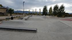
Driggs Bike and Skate Park
Driggs, Idaho
6.3 miles SWThis is a great concrete skatepark and small mountain bike park with great features, both natural and wooden. There's a great pavilion right next to the skatepark and parking lot. While...
Mountain Bike, Skateboard 3.9 mi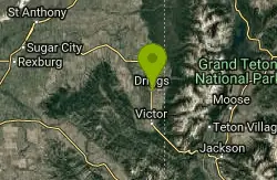
Three Wookie Trail
Driggs, Idaho
6.7 miles SWMountain Bike near Driggs, Idaho
Mountain Bike 4.9 mi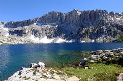
Amphitheater Lake
Alta, Wyoming
10.5 miles EBackpack and Hike near Alta, Wyoming
Backpack, Hike
Badger Creek
Tetonia, Idaho
10.7 miles NWBadger Creek is a stream located just 13.6 miles from Ashton, in Teton County, in the state of Idaho, United States, near France, ID. Whether you’re spinning, baitcasting or fly fishing your...
Camp, Cross-country Ski, Hike, Mountain Bike, Rock Climb
Mt. Moran
Alta, Wyoming
11.7 miles NEMount Moran (12,610 feet (3,840 m)) is a mountain in Grand Teton National Park of western Wyoming, USA. The mountain is named for Thomas Moran, an American western frontier landscape artist....
Hike 0.3-5.1 mi
Jenny Lake Trail
Jackson Hole, Wyoming
11.8 miles EOne of the most popular trails to visit in Grand Teton is the Jenny Lake Trail. The Jenny Lake Trail, located near Moose, Wyoming, is an easy trail that loops around the lake. Along with the sheer...
HikeNearby Campsites

Reunion Flat Campground
Alta, Wyoming
1.8 miles ECamp near Alta, Wyoming
Camp
Teton Canyon Campground
Alta, Wyoming
3.4 miles ETeton Canyon is the start of several great adventures, including the Alaska Basin Trail, Table Rock, Devil's Stairs, and the Teton Crest. The campground offers a perfect basecamp to get an...
Camp 3.8-6.4 mi
Table Rock / Table Mountain
Driggs, Idaho
3.5 miles EAt 11,300 feet, Table Mountain is possibly the most beautiful climb this side of the Tetons and offers what may well be the very best view of the Grand Tetons. It's just far enough away...
Camp, Hike
Darby Canyon Camping
Alta, Wyoming
6.2 miles SThere's no official campgrounds up the canyon but there are several dispersed campsites with existing fire lays. Please adhere to principles of Leave No Trace. Use existing fire lays and leave...
Camp
Badger Creek
Tetonia, Idaho
10.7 miles NWBadger Creek is a stream located just 13.6 miles from Ashton, in Teton County, in the state of Idaho, United States, near France, ID. Whether you’re spinning, baitcasting or fly fishing your...
Camp, Cross-country Ski, Hike, Mountain Bike, Rock Climb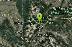
Jenny Lake Campground
Jackson Hole, WY
13.3 miles EJenny Lake campground is a scenic beauty in the heart of Grand Teton National Park. It's understandable why it often fills before 8 AM during peak summer periods. It's nestled right at the...
Camp 1.3-4.3 mi
Phelps Lake
Jackson, Wyoming
14.1 miles SEThe Phelps Lake trail, located in Teton National Park, Wyoming, is in one of the most scenic locations of the park. Usually overshadowed by nearby Jenny Lake, it can often be missed by visitors of...
Backpack, Camp, Dive, Hike, Swim
Mike Harris Campground
Victor, Idaho
14.7 miles SMike Harris Campground is located along scenic Teton Pass, just 5 miles from Victor, Idaho at an elevation of 6,200 feet. Visitors enjoy fishing, exploring local trails and sightseeing in this...
Camp
Pine Creek Campground
Victor, Idaho
17.0 miles SWThe Pine Creek Campground has 10 single units and has restrooms.
Camp
Sheep Falls on Fall River
Ashton, Idaho
22.7 miles NThe lesser known Sheep Falls on Fall River is a local treasure off of Cave Falls road. There are primitive campsites and beautiful views for a great picnic spot. The water splits and comes down in...
Camp
Loon Lake
Ashton, Idaho
24.4 miles NCamp, Kayak, and Swim near Ashton, Idaho
Camp, Kayak, Swim
Moody Meadows
Driggs, Idaho
24.5 miles WGood place for kids, they can ride bikes in the meadow, play in the stream, and camping is off of the road. Hiking, motorbiking, and horseback riding trails are abundant in the area.
Camp
Porcupine Creek
Ashton, Idaho
25.4 miles NWPorcupine Creek is a hunting, fishing, camping, and swimming spot near Ashton, Idaho in Fremont County within Targhee National Forest. It's surrounded by forests, meadows, and a creek...
Camp, Swim
Cave Falls of Yellowstone
Ashton, Idaho
26.4 miles NThis campgrond is situated on the banks of Fall River in Wyoming along the south border of Yellowstone National Park. Cave Falls Campground has 23 single site units and a terrific area for...
Camp, Hike 5.6-8.3 mi
Palisades Creek Trail / Lakes and Waterfall Canyon
Irwin, Idaho
27.5 miles SWPalisades Creek Trail is located about 50 miles southeast of Idaho Falls and about 60 miles west of Jackson Hole WY in Swan Valley Idaho. The four mile hike up to lower Palisades Lake or the 6.2 mile...
Backpack, Camp, Hike, Horseback, Mountain Bike
Horseshoe Lake
Ashton, Idaho
28.3 miles NHorseshoe Lake is hidden back in the Targhee National Forest. It's a beautiful lake with plenty of lily pads. The road to get there is well maintained and there are many options for pull-outs...
Camp, Canoe, Dive, Swim
Falls Campground
Victor, Idaho
29.5 miles SWFalls Campground is located next to the Snake River near beautiful Swan Valley, only 45 miles east of Idaho Falls, Idaho. Mixed growth cottonwood trees provide partial shade, and grassy meadows...
Camp
Fall Creek Falls
Swan Valley, Idaho
29.5 miles SWFalls Campground is located next to the Snake River near beautiful Swan Valley, only 45 miles east of Idaho Falls, Idaho. Mixed growth cottonwood trees provide partial shade, and grassy meadows with...
Camp, Cave, Hike, Kayak, Swim
Warm River Campground
Ashton, Idaho
29.6 miles NWWarm River Campground is located nine miles northeast of Ashton, Idaho, along the slow-moving Warm River at an elevation of 5,200 feet. Willows line the riverbanks and pine trees offer partial...
Camp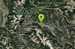
Crystal Creek Campground
Jackson, Wyoming
29.7 miles ECrystal Creek Campground is located along the Gros Ventre River and Crystal Creek, both designated Wild and Scenic Rivers for the spectacular surrounding scenery and excellent fishing opportunities....
Camp


