


39 Mountain Bike Trails near Lone Star Geyser Trail
first prev 1 2 next lastShowing Mountain Bike Trails within 50 miles Distance miles of 85PFC59V+97 City, Zip, or Address

Ashton to Tetonia Trail
Ashton, Idaho
39.2 miles SWThe Idaho Department of Parks and Recreation undertook the project to transform the old Teton Valley Branch of the Union Pacific Railroad from Ashton to Tetonia into a trail for bikes, ATVs, and...
Mountain Bike
Mile Creek Trail
39.4 miles NW
It is important to note that Mile Creek Trail is part of the Continental Divide Trail system, so it connects to other trails of various difficulties. Mile Creek Trail itself is a great...
Mountain Bike
Cabin Creek
West Yellowstone, Montana
40.9 miles NWStarts out as a nice, buff trail. After a mile or two, there are a lot of tough creek crossings and when I rode it in 2010 there were a lot of trees down. This was from a recent...
Mountain Bike
Sheep Creek Trail
41.2 miles NW
The trail has a few interesting spots (rocks, roots, etc.), but mostly it's pretty simple and straightforward. A pretty good climb, especially the last few hundred yards to the lake....
Mountain Bike
Badger Creek
Tetonia, Idaho
42.1 miles SWBadger Creek is a stream located just 13.6 miles from Ashton, in Teton County, in the state of Idaho, United States, near France, ID. Whether you’re spinning, baitcasting or fly fishing your...
Camp, Cross-country Ski, Hike, Mountain Bike, Rock Climb 3.8 mi
Abandoned Railroad Bed Bike Trail
Gardiner, Montana
42.7 miles NThe Abandoned Railroad Bed Bike Trail, otherwise known as Shortline Trail, is a easily accessible bike trail found just inside the North Entrance of Yellowstone National Park. This bike trail follows...
Mountain Bike
Howard Creek Trail
Island Park, Idaho
43.3 miles WThe Howard Creek trail follows Howard Creek upstream to the old Taylor Creek Road. The old Taylor Creek Road connects the Howard Creek trail to the Continental Divide Trail. Howard...
Mountain Bike 1.7 mi
Rick's Basin
Driggs, Idaho
43.6 miles SMountain Bike near Driggs, Idaho
Mountain Bike 0.6-4.0 mi
Grand Targhee XC Park
Moose, Wyoming
44.2 miles SMountain Bike 1.9 mi

Perm-a-grin
Moose, Wyoming
44.2 miles SPerma Grin is guaranteed to fix a smile on your face indefinitely! This swooping, flowing, smooth singletrack descends the hillside above Rick's Basin.
Mountain Bike 1.1 mi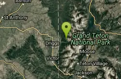
More Cowbell
Moose, Wyoming
44.2 miles SThis singletrack trail winds through aspens, high alpine meadows and old growth conifers.
Mountain Bike 2.1 mi
Buffalo Soldier
Moose, Wyoming
44.2 miles STrail is a nice loop, all singletrack, with about 300' of elevation gain. Trail is about 1.8 miles one way. You can also use it as a connector to Mill Creek or lightning loop. Buffalo...
Mountain Bike 4.0 mi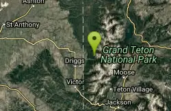
Quakie Ridge
Moose, Wyoming
44.3 miles STrail starts at the base ski area on a service road then heads out on nice single track. Trail winds through meadows of wildflowers. Some minor altitude gain along the trail. The...
Mountain Bike
Cold Springs
Moose, Wyoming
46.3 miles STrail is easiet down as a loop but can be done as a shuttle as well. Take a right into Teton Canyon and park at the first big parking lot on the left. About 50 yards from Ski Hill rd....
Mountain Bike 7.1 mi
Mill Creek Trail
Moose, Wyoming
46.3 miles SThere are two ways to do this ride, one as a loop with the Targhee road providing the bulk of the climb, or as an out and back (up the trail and back down). Keep in mind that this trail is...
Cross-country Ski, Mountain Bike, Snowshoe 4.5 mi
Sheep Bridge Trail
Driggs, Idaho
46.4 miles SThis is a great easy trail for beginner hikers or mountain bikers. In the early summer, you'll find many beautiful wildflowers and large kaleidoscopes of butterflies to go with them. You...
Hike, Mountain Bike
Little Wapiti
Gallatin Gateway, Montana
48.8 miles NWThe climb is partially double track. The descent is narrow, at times rocky, singletrack. Gorgeous views. At 9,000 plus feet...wolf tracks, too.
Mountain Bike
Spring Creek Trail
Alta, Wyoming
49.3 miles SThis trail starts at the remains of the historic Rapid Creek Ranger Station. The trail heads east following an old road. After crossing Rapid Creek, the trail climbs up to a ridge...
Mountain Bike 4.5 mi
Aspen Trail
Alta, Wyoming
49.5 miles SAspen Trail (tr 034) is single track trail for 4.35 miles along 6,800 ft contour to Darby Canyon (tr 012). Spring Creek Trail (tr 032) is double track trail for 3.68 miles to end. The trail starts...
Hike, Mountain Bike


