


123 Mountain Bike Trails near Palisade to Basalt to Circumference Trail Loop
first prev 1 2 3 4 5 6 7 next lastShowing Mountain Bike Trails within 50 miles Distance miles of Circumference Trail, Phoenix, AZ 85083, USA City, Zip, or Address

Black jack
Goodyear, Arizona
32.2 miles SWExtreme terrain, advance riders only.
Mountain Bike
East Maricopa Floodway
Mesa, Arizona
32.9 miles SEWith a primary entrance located at the intersection between Main Street and Higley Road, the East Maricopa Floodway provides riding to cyclists and mountain bikers. The surface of the floodway...
Mountain Bike
Pass Mountain
Mesa, Arizona
34.5 miles SEMultiple loop options and trails with various degrees of difficulty. Beginners/novices will enjoy Moonrock and Blevins trails while experts will enjoy Pass Mt and the Cat Peaks loops. I...
Mountain Bike 1.5 mi
Moon Rock Loop
Apache Junction, Arizona
35.7 miles SELocated within the larger Usery Mountain Regional Park, the Moon Rock loop is a fast and smooth trail that adds 1.3 miles to the more famous Blevins Trail. Although the Moon Rock loop is not known as...
Hike, Horseback, Mountain Bike
Usery Mountain Regional Park
Mesa, Arizona
35.7 miles SEThere are many miles of two-way single-track trails in the park at several levels of difficulty. The Pass Mountain Trail should challenge intermediate to advanced riders. The Cat Peaks...
Mountain Bike 1.7 mi
Levee Trail
Mesa, Arizona
35.8 miles SELocated within the Usery Mountain Regional Park, the Levee trail is named so because it mostly follows the top of levee, running parallel to a large section of the channel trail and a Phoenix...
Hike, Horseback, Mountain Bike
Cat Peaks - Blevin - Moonrock
Apache Junction, Arizona
36.0 miles SEFollow Blevins trail 0.6 miles, the entrance to the Moonrock loop will be on your right, marked by a brown sign and arrow. Take this loop (around 1.4 miles) until it returns to Blevin's...
Mountain Bike
Crismon Wash Trail
Mesa, Arizona
36.2 miles SEThe Crismon Wash Trail is 1.8 mile trail that is accessible from the south at the Crismon road trailhead. It is also accessible from the Blevins train to the north. There are several...
Hike, Horseback, Mountain Bike
Blevins Via Meridian
Apache Junction, Arizona
37.6 miles SEThe ride East down Meridian trail is a one mile intermediate to beginner ride. However if you can stay on the pedals through the several dry wash crossings you are definitely not a...
Mountain Bike
Cat Peaks Via Ruidoso
Apache Junction, Arizona
38.0 miles SEThe Ruidoso trail is a beginner ride with a few tricky dry wash crossings that will challenge you to try and stay on the pedals. This trail ends at the Spillway trail after 1.2 miles....
Mountain Bike
Prospector Loop
Apache Junction, Arizona
40.1 miles SEA fast beginners to intermediate (only if youre into speed) training loop. The trail has no markings but is the only trail in the area as it is undeveloped gravel desert. The trail is...
Mountain Bike
Slate Creek Divide Loop
Phoenix, Arizona
42.5 miles EVarious routes available - Alternative #1 (From above): 13 Mi. (22 km) Alternative #2 (From above): 10 Mi. (16 km) Loop top half only (Inc. dirt. to 8 from SR 87): 12 Mi. (19 km) Figure eight: 16 Mi....
Mountain Bike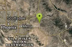
Lost Dutchman State Park
Apache Junction, Arizona
42.6 miles SEThis park has dirt biking trails. Bikes can use the lower trails (#58) shared with hikers. Bikes are not allowed above Jacobs Crosscut Trail.The park has added a new "Mountain Bike...
Mountain Bike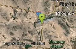
Buckeye Hills Regional Park
Buckeye, Arizona
43.1 miles SWBiking is primitive. The park has restrooms but no running water or electricity.
Mountain Bike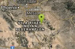
San Tan
Queen Creek, Arizona
46.8 miles SETke the Goldmine trail (approximately 1.1 miles uphill on wide trail) Take left onto SanTan for approximately 1.5 miles. At this point you will reach a T. Go to right for the San Tan...
Mountain Bike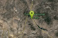
Park Trail #66
Tonto Basin, Arizona
46.9 miles EFrom the Park Creek Trailhead, the trail crosses Park Creek and climbs gradually through lower Sonoran Desert and riparian vegetation for ½ mile. The trail then ascends steeply...
Mountain Bike 5.4 mi
Denton Trail #69
Tonto Basin, Arizona
47.4 miles EFrom FR 421, the trail climbs steadily up the east face of the mountain. Some sections are quite steep. The trail eventually tops out at 5,760 feet elevation and then descends to Big Pine Flat for...
Hike, Mountain Bike
Sycamore Trail #68
Tonto Basin, Arizona
47.5 miles EFrom FR 421, the trail climbs steadily through lower Sonoran Desert and riparian vegetation up the arroyo formed by Sycamore Creek. It turns northward and continues to climb along a...
Mountain Bike
K-trail & Vortex
Gold Canyon, Arizona
47.8 miles SEThis is definitely a challenging way to ride both the entire K and Vortex trails. They are best ridden from the North to the South but to do this you need to get to the North end of the...
Mountain Bike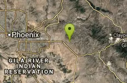
Lost Goldmine & Cougar Loop
Gold Canyon, Arizona
47.8 miles SEThis is a short, fun but pretty technical ride. The technical part is the fact that it starts out with a ride on the Lost Goldmine trail which is a very rocky trail built for hiking....
Mountain Bike


