


Usery Mountain Regional Park
Mesa, Arizona

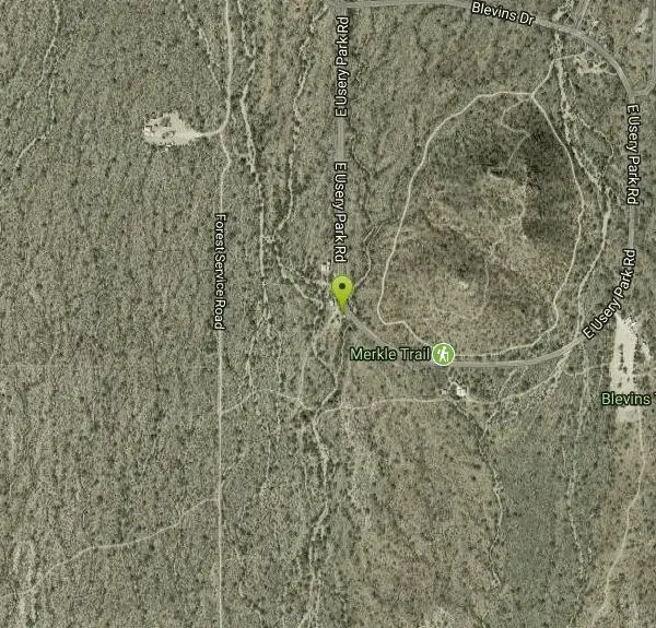
| GPS: |
33°28'0.6"N 111°36'46.5"W Maps | Directions |
| State: | Arizona |
| Trail Length: | 20.00 miles |
| MTB Difficulty: | Intermediate |
| Trail Type: | Network |
| MTB Trail Type: | Singletrack |
Mountain Bike
There are many miles of two-way single-track trails in the park at several levels of difficulty. The Pass Mountain Trail should challenge intermediate to advanced riders. The Cat Peaks Trail isn't that tough but it has a nice little climb and intermediate riders should have fun with the moderate technical features. For me the Cat Peaks Pass trail isn't really ride-able for its entire length although an advanced or expert rider may find it possible or even fun. Most of the rest of the trails are okay for beginners for most of their length. If you are unsure then just walk your bike through the washes. This system gets extremely hot in the summer. During this season you should consider riding in the early morning hours or in the late afternoon. Be sure to bring lots of water on your rides. A first aid kit is a good idea too, collisions with a cactus can hurt a lot. For your first visit it is a good idea to enter the park from the Ellsworth entrance. The day use fee is $6 per car but you get a paper map and can spend hours exploring the park on a mountain bike on your first visit. There are also seven access points located around the perimeter of the park. Learn more about these by checking out the individual rides listed here. Courtesy of Singletracks.com
More Information
Add ResourceNever modify trail features. Ride trails when they're dry enough that you won't leave ruts. Speak up when you see others on the trail and always yield to hikers, horses, and others coming uphill. Always ride on the established trail.
Read More- Plan Ahead and Prepare
- Travel & camp on durable surfaces
- Dispose of waste properly
- Leave what you find
- Minimize campfire impacts
- Respect wildlife
- Be considerate of other visitors
Directions
From Mesa, Arizona
- Head north on N Center St toward W Main St (1.4 mi)
- Turn left onto W Brown Rd (0.5 mi)
- Turn right onto N Country Club Dr (1.4 mi)
- Turn right to merge onto AZ-202 Loop E (9.4 mi)
- Continue onto AZ-202 S (1.8 mi)
- Take exit 24 for McKellips Rd (0.4 mi)
- Keep left at the fork, follow signs for McKellips Rd E (223 ft)
- At the traffic circle, take the 2nd exit onto E McKellips Rd (0.2 mi)
- At the traffic circle, take the 1st exit and stay on E McKellips Rd (2.0 mi)
- Turn left onto N Ellsworth Rd/N Usery Pass Rd (2.2 mi)
- Turn right onto E Usery Park RdPartial restricted usage road(1.0 mi)
- Turn right to stay on E Usery Park RdDestination will be on the right(0.3 mi)
Other Mountain Bike Trails Nearby

Moon Rock Loop
Apache Junction, Arizona
0.3 miles SWLocated within the larger Usery Mountain Regional Park, the Moon Rock loop is a fast and smooth trail that adds 1.3 miles to the more famous Blevins Trail. Although the Moon Rock loop is not known as...
Hike, Horseback, Mountain Bike
Cat Peaks - Blevin - Moonrock
Apache Junction, Arizona
0.3 miles EFollow Blevins trail 0.6 miles, the entrance to the Moonrock loop will be on your right, marked by a brown sign and arrow. Take this loop (around 1.4 miles) until it returns to Blevin's...
Mountain Bike 1.7 mi
Levee Trail
Mesa, Arizona
0.6 miles SLocated within the Usery Mountain Regional Park, the Levee trail is named so because it mostly follows the top of levee, running parallel to a large section of the channel trail and a Phoenix...
Hike, Horseback, Mountain Bike
Crismon Wash Trail
Mesa, Arizona
1.1 miles SThe Crismon Wash Trail is 1.8 mile trail that is accessible from the south at the Crismon road trailhead. It is also accessible from the Blevins train to the north. There are several...
Hike, Horseback, Mountain Bike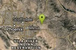
Blevins Via Meridian
Apache Junction, Arizona
1.9 miles EThe ride East down Meridian trail is a one mile intermediate to beginner ride. However if you can stay on the pedals through the several dry wash crossings you are definitely not a...
Mountain Bike
Pass Mountain
Mesa, Arizona
2.0 miles NMultiple loop options and trails with various degrees of difficulty. Beginners/novices will enjoy Moonrock and Blevins trails while experts will enjoy Pass Mt and the Cat Peaks loops. I...
Mountain Bike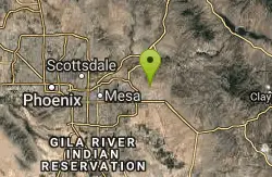
Cat Peaks Via Ruidoso
Apache Junction, Arizona
2.3 miles SEThe Ruidoso trail is a beginner ride with a few tricky dry wash crossings that will challenge you to try and stay on the pedals. This trail ends at the Spillway trail after 1.2 miles....
Mountain Bike
Prospector Loop
Apache Junction, Arizona
4.4 miles SEA fast beginners to intermediate (only if youre into speed) training loop. The trail has no markings but is the only trail in the area as it is undeveloped gravel desert. The trail is...
Mountain Bike 7.5 mi
Hawe's Loop
Mesa, Arizona
4.9 miles NWMost of the trails in the Phoenix metropolitan area were originally built by mountain bikers, and the Hawe's loop trail system and trail are no exeptions. This trail features fantastic...
Hike, Mountain Bike 1.3 mi
Ridge Trail
Mesa, Arizona
4.9 miles NWThe trails within the Hawes loop system were originally built by mountain bikers for mountain bikers, so the trails feature fantastic singletrack that twist and turn for miles. Be warned,...
Mountain Bike 1.5 mi
The Saddle
Mesa, Arizona
4.9 miles NWSaddle trail is an intermediate mountain biking trail that connects to the greater Hawes trail network. The trail is 1.5-2mi long and it offers beautiful views of the neighboring Salt River and Red...
Hike, Mountain Bike
Desert Trails Bike Park
Mesa, Arizona
5.1 miles WHike and Mountain Bike near Mesa, Arizona
Hike, Mountain Bike
East Maricopa Floodway
Mesa, Arizona
7.1 miles SWWith a primary entrance located at the intersection between Main Street and Higley Road, the East Maricopa Floodway provides riding to cyclists and mountain bikers. The surface of the floodway...
Mountain Bike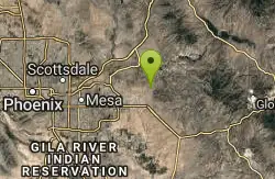
Lost Dutchman State Park
Apache Junction, Arizona
7.5 miles EThis park has dirt biking trails. Bikes can use the lower trails (#58) shared with hikers. Bikes are not allowed above Jacobs Crosscut Trail.The park has added a new "Mountain Bike...
Mountain Bike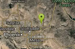
Fountain Park Trail
Fountain Hills, Arizona
11.3 miles NWFountain views, Four Peaks view, desert vegetation, close to coffee! The trail is well groomed and well marked. It parallels some house as you begin to go up the first hill. About 15...
Hike, Mountain Bike
K-trail & Vortex
Gold Canyon, Arizona
12.1 miles SEThis is definitely a challenging way to ride both the entire K and Vortex trails. They are best ridden from the North to the South but to do this you need to get to the North end of the...
Mountain Bike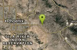
Lost Goldmine & Cougar Loop
Gold Canyon, Arizona
12.1 miles SEThis is a short, fun but pretty technical ride. The technical part is the fact that it starts out with a ride on the Lost Goldmine trail which is a very rocky trail built for hiking....
Mountain Bike
Cloudview
Gold Canyon, Arizona
12.1 miles SEThis parking area is used primarily for the very popular Hieroglyphs hiking trail and the Lost Goldmine hiking trail which connects with Peralta Road seven miles to the East. It is also...
Mountain Bike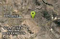
Holy Hill And Gila Monster
Gold Canyon, Arizona
12.6 miles SEThe Holy Hill By-Pass Trail was the newest trail in the Gold Canyon system as of April 2012. The Gila monster trail was listed as still under construction earlier in the year but seemed...
Mountain Bike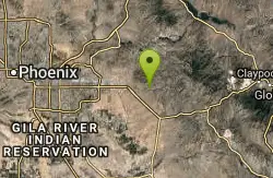
Secret, Tech & K
Gold Canyon, Arizona
14.0 miles SEFrom the parking lot start riding the main trail by the sign. Ride about 30 feet and then take the single track trail to the right. This is called the Horse Trail and leads to all of...
Mountain BikeNearby Campsites

Buckhorn Campground Nature Trail
Apache Junction, Arizona
0.6 miles NWCamp and Hike near Apache Junction, Arizona
Camp, Hike 2.1 mi
Lower Salt River Nature Trail
Fort McDowell, Arizona
6.1 miles NWThe Lower Salt River Nature Trail is a scenic walk to take at the Tonto National Forest. This trail provides stunning views as you walk alongside the Salt River. This rustic trail is older and less...
Camp, Hike


