


Slate Creek Divide Loop
Phoenix, Arizona
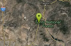
| GPS: |
33°56'44.8"N 111°26'49.3"W Maps | Directions |
| State: | Arizona |
| Trail Length: | 16.00 miles |
| MTB Difficulty: | Advanced |
| Trail Type: | Figure 8 |
Mountain Bike
Various routes available - Alternative #1 (From above): 13 Mi. (22 km) Alternative #2 (From above): 10 Mi. (16 km) Loop top half only (Inc. dirt. to 8 from SR 87): 12 Mi. (19 km) Figure eight: 16 Mi. (26 km) Scenery varies from chapparal communities and the riparian habitat associated with the Sycamore West Fork to Douglas Fir and Ponderosa Pine overstory in the northern portions of the loop. Check current/forecasted weather conditions as northern portions of the loop do receive snowfall. East and West Sycamore creeks may have substantial flow during and/or after storms. Since this trail is on the boundary of the Mazatzal Wilderness, please be aware that bicycles are not allowed in the wilderness area. Courtesy of Singletracks.com
More Information
Slate Creek Divide Loop
Slate Creek Divide Loop is a singletrack mountain bike trail in Tonto Basin, Arizona. View maps, videos, photos, and reviews of Slate Creek Divide Loop bike trail in Tonto Basin.
http://www.singletracks.com/bike-trails/slate-creek-divide-loop/Never modify trail features. Ride trails when they're dry enough that you won't leave ruts. Speak up when you see others on the trail and always yield to hikers, horses, and others coming uphill. Always ride on the established trail.
Read More
- Plan Ahead and Prepare
- Travel & camp on durable surfaces
- Dispose of waste properly
- Leave what you find
- Minimize campfire impacts
- Respect wildlife
- Be considerate of other visitors
Directions
From Phoenix, Arizona
- Head west on W Washington St toward 1st Ave (0.5 mi)
- Turn right onto N 7th Ave (0.2 mi)
- Continue straight to stay on N 7th Ave (0.6 mi)
- Turn right to merge onto I-10 E toward Tucson (2.3 mi)
- Take exit 147A-147B for AZ-202 Loop E (0.4 mi)
- Keep left to continue toward AZ-202 Loop E (0.3 mi)
- Continue onto AZ-202 Loop E (12.1 mi)
- Take exit 13 for Country Club Dr (0.3 mi)
- Turn left onto AZ-87 N/N Country Club DrContinue to follow AZ-87 N(45.7 mi)
- Turn left onto Fr 626 (1.2 mi)
- Turn right onto N Beeline Hwy (1.3 mi)
- Continue onto Nf-201 (0.4 mi)

Other Mountain Bike Trails Nearby
Park Trail #66
Tonto Basin, Arizona
8.0 miles SEA diverse desert trail in Tonto Basin climbing through chaparral and juniper to a ponderosa meadow at Edwards Park — seasonal pools and waterfalls along Park Creek near the top.
Mountain Bike 
Sycamore Trail #68
Tonto Basin, Arizona
12.7 miles SEA rugged desert-to-forest hike near Tonto Basin climbing from Sonoran Desert through chaparral and juniper woodland to Ponderosa pine forest and El Oso Divide views.
Mountain Bike 5.4 mi
Denton Trail #69
Tonto Basin, Arizona
12.7 miles SEA strenuous trail climbing to 5,760 feet through Ponderosa pine with nice Tonto Basin vistas — rough, steep sections require caution and make this one for experienced riders.
Hike, Mountain Bike 
Three Bar Route
Tonto Basin, Arizona
20.5 miles SEA scenic loop around the Three Bar Wildlife Enclosure near Roosevelt Lake in Tonto Basin, with riparian habitat, chaparral, and the option to cool off at the lake after your ride.
Mountain Bike 
Whiskey Bottle Trail
Scottsdale, Arizona
21.3 miles SWSandy singletrack climbs 800 feet up Fraesfield Mountain with rocky terrain and tight curves through yucca and cholla before descending to the Power Line trail near Scottsdale.
Mountain Bike 
Vineyard Trail #131
Tonto Basin, Arizona
22.8 miles SEA scenic desert trail in Tonto Basin passing through historic Camp O'Rourke with panoramic views of Roosevelt Lake, Roosevelt Dam, and Four Peaks.
Mountain Bike 
Granite Mountain Loop
Scottsdale, Arizona
23.0 miles SWA multi-use loop on the rocky west side of Granite Mountain in Scottsdale, open to hikers and equestrians, with mostly singletrack that doesn't see heavy traffic.
Mountain Bike 
McDowell Mountain Park
Fort McDowell, Arizona
23.5 miles SWTwisty one-way singletrack loops on rolling contour near Fort McDowell — less rocky than most Phoenix-area trails with a satisfying ripping sound through the turns.
Mountain Bike 
Pemberton Loop
Fort McDowell, Arizona
23.6 miles SWA fast, open 15-mile desert loop with a roller-coaster flow and plenty of side trails — including routes to an abandoned mine, Fountain Hills, and Bell Pass.
Mountain Bike 
Hawksnest Stagecoach Loop
Scottsdale, Arizona
23.6 miles SWAn easy mountain bike loop in Scottsdale with moderate climbs, fantastic downhill tracks, and a well-maintained, sparsely populated trail through the desert.
Mountain Bike 
Wagner Trail
Scottsdale, Arizona
23.9 miles SWA 2.2-mile beginner-to-intermediate loop trail in the McDowell Sonoran Preserve in Scottsdale, winding through a hoodoo canyon to a vantage point with views of Weaver's Needle at Fremont Saddle.
Hike, Horseback, Mountain Bike 
Wagner-Granite-Bluff Trails
Scottsdale, Arizona
23.9 miles SWHike and Mountain Bike near Scottsdale, Arizona
Hike, Mountain Bike 
Sport Loop
Fountain Hills, Arizona
25.1 miles SWMountain Bike near Fountain Hills, Arizona
Mountain Bike 
Coachwhip Trail Loop
Fountain Hills, Arizona
25.2 miles SWA multi-trail loop at McDowell Mountain Regional Park and McDowell Sonoran Preserve near Fountain Hills, weaving through Granite Trail, Coachwhip Trail, Dixie Mine Trail, and Pemberton Trail with connections to many spur trails.
Mountain Bike 
Tonto Pass
Fountain Hills, Arizona
25.9 miles SWA counterclockwise Pemberton loop that climbs 5.25 miles before turning right to Tonto Pass for a fun, all-downhill return — a rewarding desert mountain bike experience.
Mountain Bike 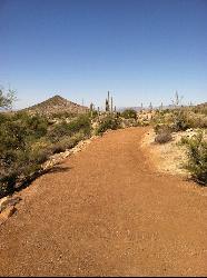
Jane Rau Brown's Canyon Trail
Scottsdale, Arizona
26.1 miles SWA wide, semi-paved half-mile loop honors a McDowell Sonoran Conservancy pioneer with interpretive plaques, desert views, and a shaded picnic area — perfect for all ages.
Hike, Horseback, Mountain Bike 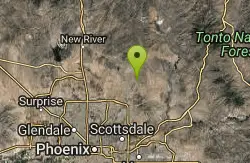
Browns Ranch to Granite Mountain
Scottsdale, Arizona
26.1 miles SWA Scottsdale trailhead leading onto a two-track that branches into a variety of trails toward Granite Mountain — a versatile starting point for desert riding.
Mountain Bike 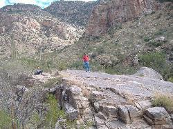
Pima and Dynamite Trail
Scottsdale, Arizona
26.1 miles SWA 100-plus-mile singletrack network in North Scottsdale rolls through fast Sonoran desert terrain with variety for beginners to advanced without serious gnarly descents.
Hike, Mountain Bike 2.2 mi
Marcus Landslide Trail
Scottsdale, Arizona
26.7 miles SWNamed for geographer Melvin Marcus, this trail winds through an ancient McDowell Mountain landslide with sweeping Superstition and Mazatzal mountain views and boulder-filled formations.
Hike, Horseback, Mountain Bike, Rock Climb 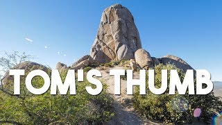
Tom's Thumb Trail
Scottsdale, Arizona
26.8 miles SWA 4.7-mile out-and-back hike in Scottsdale's McDowell Sonoran Preserve with 1,200 feet of elevation gain to a unique thumb-shaped granite rock formation — pet friendly, but no water on trail.
Hike, Mountain Bike, Rock ClimbNearby Campsites

Hell's Gate
Payson, Arizona
27.5 miles NEHellsgate Wilderness hides deep canyon pools possibly separated by impassable falls in a remote 37,000-acre preserve — a true adventure for spring and fall explorers.
Backpack, Camp, Hike, Swim 2.1 mi
Lower Salt River Nature Trail
Fort McDowell, Arizona
30.3 miles SWA 2-mile beginner loop alongside the Salt River in Tonto National Forest, with worn markers that keep things adventurous — watch for wild horses and spring cactus blooms.
Camp, Hike 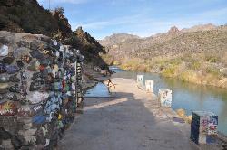
Verde Hot Springs
Camp Verde, Arizona
31.2 miles NWNatural hot spring pools beside the Verde River — the remnants of an old resort — reached by wading upstream from a dispersed camping area with no amenities near Sedona.
Camp, Hike, Hot Springs 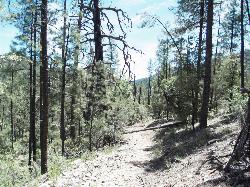
Haigler Canyon Campground
Payson, Arizona
33.5 miles NEA 2007-built campground along Haigler Creek with 14 overnight sites, trout fishing stocked April through late August, and chiseled canyon swimming holes nearby.
Camp, Hike, Swim 
Upper Tonto Creek Campground
Payson, Arizona
33.6 miles NEA 9-site first-come-first-served campground at the junction of Tonto and Horton Creeks — with vault toilets, drinking water, and trailheads for Horton Spring and the Highline Trail nearby.
Camp, Hike 1.1-3.5 mi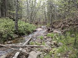
Horton Springs
Payson, Arizona
33.8 miles NEA spring on the Mogollon Rim where water emerges dramatically from the mountainside — hike the easy Horton Creek Trail through wildflowers and maples, splash in the cold creek, and camp near the spring.
Backpack, Camp, Hike 
Buckhorn Campground Nature Trail
Apache Junction, Arizona
34.1 miles SCamp and Hike near Apache Junction, Arizona
Camp, Hike 1.1 mi
Christopher Creek Campground
Payson, Arizona
34.4 miles NEA creekside campground east of Payson with swimming holes, small waterfalls, spring trout stocking, and cross-country skiing in winter — open for day-use and overnight camping spring through fall.
Camp, Canyoneer, Cross-country Ski, Hike, Swim 
Aspen Campground
Payson, Arizona
38.9 miles NEA large, popular campground near Woods Canyon Lake in the Apache-Sitgreaves National Forest — note that Rim Road closes in winter, so the site is inaccessible during that time.
Camp 4.0 mi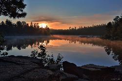
Woods Canyon Lake
Payson, Arizona
39.3 miles NEA trout-fishing lake near Payson with a scenic loop hike and Mogollon Rim views — swimming is not recommended, but the scenery and fishing make it well worth the visit.
Camp, Hike, Swim 
Sinkhole Campground
Payson, Arizona
40.5 miles NESinkhole Campground sits in cool ponderosa pines atop the Mogollon Rim, a short walk from the trout waters of Willow Springs Lake.
Camp, Hike, Mountain Bike 0.4 mi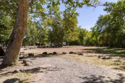
Clear Creek Campground
Camp Verde, Arizona
43.4 miles NWA grassy creekside campground shaded by tall cottonwoods on West Clear Creek — ideal for hiking, swimming, fishing for smallmouth bass and sunfish, and wildlife watching in a desert canyon oasis.
Camp, Hike, Swim


