


Nine Mile Recreation Area
Nine Mile Falls

Canoe, Hike, Kayak, and Swim
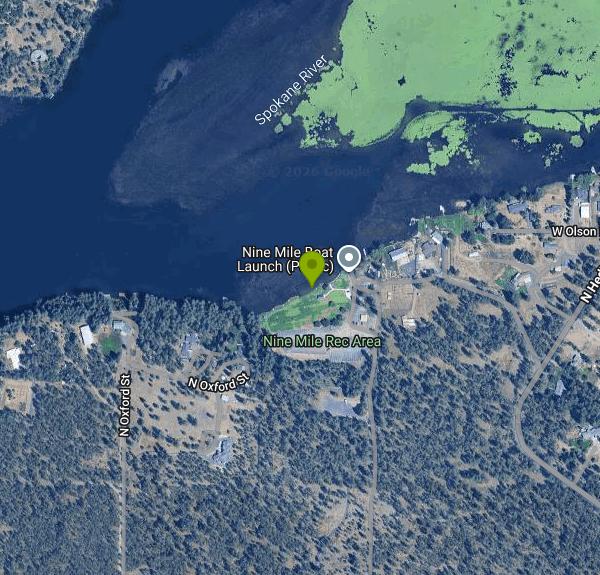
Nine Mile Recreation Area is a day-use unit of Riverside State Park on the shore of Lake Spokane, the reservoir that backs up the Spokane River behind Long Lake Dam and that many locals still call Long Lake. The site sits at the upper, eastern end of the lake, a short distance downriver from Nine Mile Dam, in the community of Nine Mile Falls northwest of Spokane. The land belongs to Avista, the utility that operates both dams, and Washington State Parks has run the day-to-day operation of the area since May 1, 2022.
The entrance is off West Charles Road (Highway 291 to Charles Road from Spokane). Parking is in paved lots a few steps from the water, next to the picnic shelters and the boat launch. The launch and its two docks handle both motorized boats and paddle craft and are open from April 1 to October 31. The paved Spokane River Centennial Trail also reaches the lake here, so some visitors arrive by bike.
Swimming is allowed only in the designated swim area, a marked strip of shoreline just west of the launch and docks. There are no lifeguards, so everyone swims at their own risk. This is reservoir water fed by the Spokane River: it is flat and slow at the beach, but it runs cool early in the season, so keep children within reach. The launch next door gets heavy use on summer weekends, and with motorboats coming and going a few yards away, stay inside the marked area.
A Discover Pass is required for every vehicle. A one-day pass is $10 and an annual pass is $45, and State Parks asks day visitors to buy it before arriving, online or from a licensed vendor. Launching a boat costs an extra $7 for the day. Riverside State Park day-use hours are 6:30 a.m. to dusk in summer and 8 a.m. to dusk in winter.
The Old Trails and Autumn Lane wildfires burned through parts of Riverside State Park in August 2026 and destroyed the well and pumphouse that supplied water to this area. Nine Mile Recreation Area reopened on August 21, 2026, but there is no drinking water on site, so bring all the water you need. Portable toilets are in place, and State Parks hopes to have the water system rebuilt over the winter. Several nearby parts of the park, including the Knothead Valley and Indian Painted Rocks trailheads, remain closed while burned slopes recover. Upper Lake Spokane has also had blue-green algae blooms in warm, low-flow summers; in 2015 a bloom between Suncrest and Nine Mile tested positive for toxins and families were told to keep kids and pets out of the water. Skip swimming if you see green, paint-like scum on the surface.
Besides the beach, the area has several picnic shelters, a sand volleyball court and plenty of room to fish from shore or the docks. The rest of Riverside State Park, with Bowl and Pitcher, the Deep Creek canyon and the Spokane House Interpretive Center, is a short drive south.
More Information
Home | Discover Pass
Explore Washington's outdoors The Discover Pass gives you unlimited access to millions of acres of unforgettable nature across Washington state. When you buy a Discover Pass, you help preserve and conserve our public lands for everyone—from the first-time visitor to the expert adventurer—and for the generations yet to come.
https://discoverpass.wa.gov/Nine Mile Recreation Area, Plese Flats reopen at Riverside State Park
Two more sections of Riverside State Park are reopening to the public after being closed because of the Old Trails and Autumn Lane fires.
https://www.spokesman.com/stories/2026/aug/21/nine-mile-recreation-area-plese-flats-reopen-at-ri/River activities along the Spokane River | Avista Connections
The Spokane River spans 111 miles with amazing places to explore. Check out our guide for the top 10 favorite river activities along the Spokane River!
https://www.myavista.com/connect/articles/2020/07/ten-spokane-river-recreational-opportunities-to-explore-and-enjoyRiverside State Park beginning to recover and reopen sections after recent fires in Spokane | News |
SPOKANE, WASH. — More than 1,600 acres of Riverside State Park burned in two recent fires, but park officials are moving quickly to restore access to the popular recreation area.
https://www.kxly.com/news/riverside-state-park-recovering-and-reopening-after-recent-fires-in-spokane/article_8bfe0e9b-4ffe-4a75-8698-a6729df6a82f.htmlRiverside State Park | Washington State Parks
The weather is cooler, but wildfire season is not over. Conditions remain dry in many areas and can change quickly. All parks are under a Level 2 or Level 3 Burn Ban. Check park alerts and burn restrictions before lighting any fires.
https://parks.wa.gov/find-parks/state-parks/riverside-state-parkRiverside wildfire recovery | Washington State Parks
The weather is cooler, but wildfire season is not over. Conditions remain dry in many areas and can change quickly. All parks are under a Level 2 or Level 3 Burn Ban. Check park alerts and burn restrictions before lighting any fires.
https://parks.wa.gov/about/strategic-planning-projects-public-input/projects/riverside-wildfire-recoveryState Parks will manage areas owned by Avista at Nine Mile, Lake Spokane | Washington State Parks
The weather is cooler, but wildfire season is not over. Conditions remain dry in many areas and can change quickly. All parks are under a Level 2 or Level 3 Burn Ban. Check park alerts and burn restrictions before lighting any fires.
https://parks.wa.gov/news/2022/state-parks-will-manage-areas-owned-avista-nine-mile-lake-spokaneToxic blue green algae bloom on Lake Spokane latest outcome of warm, dry year – Spokane River Forum
Community Events & Volunteer Opportunities ResourcesExpand Battery Smart H2O Breakfast 2026 VideosExpand H2O Breakfast Having Fun on the Spokane River Protection & Restoration Recycle Right Stormwater Toxics Reduction Food Waste Reduction Tribal Stories Spokane River DO TMDLExpand Purpose & Ground Rules Meetings Toolbox Tracking/Monitoring DO TMDL Model Resource Links Members Reports & Materials Improvement Projects DO TMDL Content Archive The Great Gorge Plan Links to Agencies & Groups The Spokane Valley – Rathdrum Prairie Aquifer Atlas Toxic Chemicals & Heavy Metals in the Spokane RiverExpand Valuing the Spokane River Meeting Spokane River Needs Chemicals and Heavy Metals in Our Environment Chemicals and Heavy Metals in the Spokane River Sources and Pathways Evaluating Exposure and Risk Fish Consumption Advisory Urban Waters Initiative What You Can Do Combined Sewer Overflow Upgrades Status of Toxic Chemicals & Heavy Metals Frequently Asked Questions Where Can I Get More Information? Stormwater GuidesExpand Stormwater Permitting in the City of Spokane City of Spokane Stormwater Compliance Guide Ecology Industrial Stormwater Permit Guide Avista Spokane River Project River Talk AboutExpand Who We Are Meet Our Staff Meet Our Board Sign up for enews! Contact Us Donate SEARCH Search Menu Toggle Menu Learn how to be Battery Smart » Toxic blue green algae bloom on Lake Spokane latest outcome of warm, dry year August 4, 2015December 30, 2015 Blue-green algae bloom on Lake Spokane near Nine Mile. Photos courtesy of Al Leach. Since the middle of July blue green algae (cyanobacteria) blooms have been identified at various locations in the upper half of Lake Spokane. The blooms vary from day to day depending on wind and weather but are becoming denser. Galen Buterbaugh, Technical Advisor to the Lake Spokane Association, reports the blooms are worse in the morning when the wind is still. Samples collected on Monday, July 27th at Suncrest Park, indicated that the bloom did contain toxins. Warning signs have been posted at the Suncrest Park swimming beach.
https://spokaneriver.net/news/uncategorized/toxic-blue-green-algae-bloom-on-lake-spokane-latest-outcome-of-warm-dry-year/Be courteous, informed, and prepared. Read trailhead guidelines, stay on the trail, and don't feed the wildlife.
Read More
- Plan Ahead and Prepare
- Travel & camp on durable surfaces
- Dispose of waste properly
- Leave what you find
- Minimize campfire impacts
- Respect wildlife
- Be considerate of other visitors
Directions
From Nine Mile Falls
- Head northwest on W Charles Rd/
Rte 1 toward N Tormey Rd Continue to follow W Charles Rd(0.9 mi) - Turn right (0.5 mi)
- Turn left (151 ft)

Other Swimming Holes, Hiking Trails, Canoeing Areas, and Kayaking Areas Nearby

John Shields Park
Spokane, Washington
13.4 miles SEA 26-acre park on Spokane's north side near the Upriver Dam, jointly owned by Spokane County and the City — purchased partly with funds from the Spokane Mountaineers.
Hike, Rock Climb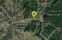
Q'emilin Park trail system (Ka-Mee-Lin)
Post Falls, Idaho
29.2 miles EA 78.5-acre park on the Spokane River in Post Falls with a guarded swimming beach, boat launch, BBQ pits, picnic shelters, horseshoe pits, volleyball courts, and a 40-acre trail system.
Hike, Rock Climb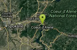
Tubbs Hill Coeur d'Alene
Coeur d'Alene, Idaho
37.5 miles EA 135-acre forested peninsula jutting into Lake Coeur d'Alene with trails past three-story caves, beaches, scenic overlooks, and excellent bird watching for osprey, eagles, mergansers, and grebes.
Hike
Priest River Recreation Area (The Mudhole)
Priest River, Idaho
40.5 miles NECorps of Engineers swim beach, boat ramp and campground on the Pend Oreille River a mile east of Priest River, known to locals as the Mudhole.
Camp, Hike, Kayak, Swim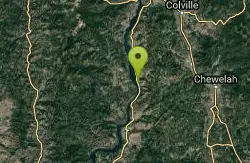
Cloverleaf Campground
Gifford, Washington
43.8 miles NWA 15-unit campground on the banks of St. Charles Creek near the North Fork in Washington state, open May through September with drinking water, restrooms, and picnic tables.
Camp, SwimNearby Campsites
Hunters Campground
Hunters, Washington
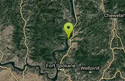
37.9 miles NWA group-friendly campground on the northern shoreline of Lake Roosevelt in Washington, with a boat launch, beach, and access to 130 miles of Columbia River lake managed by the National Park Service.
Camp
Priest River Recreation Area (The Mudhole)
Priest River, Idaho
40.5 miles NECorps of Engineers swim beach, boat ramp and campground on the Pend Oreille River a mile east of Priest River, known to locals as the Mudhole.
Camp, Hike, Kayak, Swim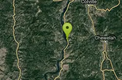
Gifford Campground
Gifford, Washington
43.3 miles NWA group campsite for up to 50 people along the shoreline of Lake Roosevelt with spectacular lake views from every vantage point.
Camp
Cloverleaf Campground
Gifford, Washington
43.8 miles NWA 15-unit campground on the banks of St. Charles Creek near the North Fork in Washington state, open May through September with drinking water, restrooms, and picnic tables.
Camp, Swim


