


Riley Creek Recreation Area
Laclede

Camp, Canoe, Hike, Kayak, and Swim
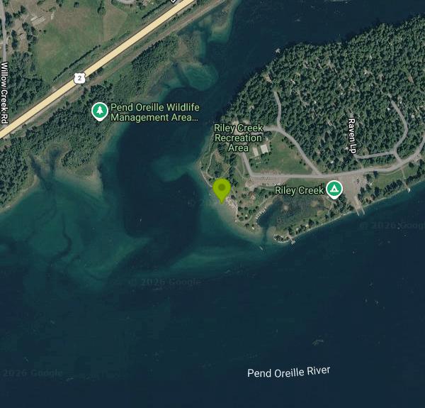
Riley Creek Recreation Area is a U.S. Army Corps of Engineers park on the south bank of the Pend Oreille River at Laclede, in Bonner County, Idaho. It is part of the Albeni Falls Dam project, and the river here is the slack-water pool the dam holds back below Lake Pend Oreille, so it behaves more like a long lake than a moving river. The Corps calls Riley Creek its largest developed overnight facility on the project: 67 campsites with water and electric hookups, big shaded lawns, two reservable picnic shelters and a designated swim beach on a small peninsula about a mile southwest of the Laclede store.
To get there, follow U.S. Highway 2 to Laclede, roughly nine miles east of Priest River or 13 miles west of Sandpoint, and turn south on Riley Creek Road at the highway signs. The paved road ends at the recreation area after about a mile, passing the entrance station and park office. Day visitors park in the paved lots near the boat ramp and the central lawn, and the beach is a short walk across the grass past the Eagle and Osprey picnic shelters, the playground and the sand volleyball court.
The swim area is a roped section of shoreline beside a strip of sand and small gravel. Visitors describe the bottom as shelving very gradually, which makes it popular with families who have young kids, and the water stays shallow for a good distance out before it drops into the main channel. There is no lifeguard on duty at any time. The water comes off a big, deep, cold lake, so it is cool in June and warms through July and August. The boat ramp, fishing piers and a boat tie-up basin sit close to the beach, so watch for boat traffic and stay inside the swim lines.
There is no entrance fee and no day-use fee at Riley Creek, according to the Corps' Albeni Falls recreation page. Fees apply only to camping ($35 per night per site for 2026, reserved through Recreation.gov, with no first-come sites) and to the two picnic shelters ($75 per day). The Corps listed the 2026 season as May 19 through September 20, and the area operates as a seasonal park, so plan your visit for that window; outside it the gate and facilities are closed. Recreation.gov notes that campsites cannot be reserved just for day use and that unlicensed vehicles such as ATVs and side-by-sides are not allowed.
The main hazards here are boats, cold water early in the season and the lack of lifeguards. River levels on the Pend Oreille are controlled by Albeni Falls Dam, which keeps the pool high through summer and lowers it in the fall, so the shoreline changes after the season ends. Check with the Albeni Falls Dam office at 208-437-3133 before a trip for current conditions or closures. Life jackets are encouraged for children and weak swimmers.
Beyond the beach there are two fishing piers, a two-lane boat ramp, a half-court basketball hoop, horseshoe pits, flush restrooms, and a hiking and biking trail that leaves from the campground. Rangers run campfire programs at the amphitheater on summer weekend evenings. Bald eagles, osprey and deer are common, and the Pend Oreille Wildlife Management Area borders the park. Gas and groceries are in Laclede, and the Albeni Falls Dam Visitor Center, with summer dam tours, is about 15 miles west near Oldtown.
More Information
Be courteous, informed, and prepared. Read trailhead guidelines, stay on the trail, and don't feed the wildlife.
Read More
- Plan Ahead and Prepare
- Travel & camp on durable surfaces
- Dispose of waste properly
- Leave what you find
- Minimize campfire impacts
- Respect wildlife
- Be considerate of other visitors
Directions
From Laclede
- Head west on County Rd MM-312/
Grindstone Rd (4.0 mi) - Turn left onto Hwy Mm (0.8 mi)
- Turn right onto Pennington Dr (3.3 mi)
- Turn left onto State Hwy F/
U.S. Route 66 Continue to follow State Hwy F(5.1 mi) - Continue onto State Hwy BB (2.4 mi)
- Turn right onto MO-5 N (24.9 mi)
- Turn left onto MO-7 N (31.1 mi)
- Turn right onto US-65 N (6.2 mi)
- Take the MO-7 N exit toward Warsaw/
Clinton (0.2 mi) - Turn left onto MO-7 N (signs for Warsaw/
Clinton) Pass by Subway (on the right in 28.1 mi)(28.3 mi) - Turn right onto MO-7 N/
E Hwy 7 Continue to follow MO-7 N(38.9 mi) - Keep right to continue on MO-7 N/
E 275th St (0.4 mi) - Merge onto I-49 N (26.6 mi)
- Continue onto US-71 N (4.3 mi)
- Keep left to stay on US-71 N (2.4 mi)
- Continue straight to stay on US-71 N (4.7 mi)
- Merge onto I-70 W/
US-71 N (0.3 mi) - Keep right to continue on US-71 N, follow signs for I-29 N/
I-35 N/ Saint Joseph/ Des Moines (0.2 mi) - Continue onto I-29 N/
I-35 N/ US-71 N (4.5 mi) - Keep left to continue on I-29 N/
US-71 N, follow signs for KCI Airport/ St Joseph (3.5 mi) - Keep right to continue on I-29 N (42.6 mi)
- Keep left to stay on I-29 NEntering Iowa(131 mi)
- Keep left to stay on I-29 NEntering South Dakota(183 mi)
- Take exit 84B to merge onto I-90 W toward Rapid City (372 mi)
- Take exit 23 for SD-34 W toward Whitewood (0.3 mi)
- Turn right onto SD-34 W (17.3 mi)
- Turn right onto US-85 N/
Heartland Expy/ Theodore Roosevelt Expy (2.3 mi) - Turn left onto US-212 WPassing through WyomingEntering Montana(94.2 mi)
- Turn left onto US-212 W/
Holt St Continue to follow US-212 W(64.3 mi) - At the traffic circle, continue straight to stay on US-212 W (41.7 mi)
- Merge onto I-90 W/
US-212 W/ US-87 N via the ramp to Billings (54.1 mi) - Take the exit onto I-90 W toward Billings (358 mi)
- Take exit 96 to merge onto MT-200 W/
US-93 N/ U.S. Hwy 93 N toward Kalispell Continue to follow MT-200 W/(27.3 mi)US-93 N - Turn left onto MT-200 WEntering Idaho(116 mi)
- Continue onto ID-200 W (33.1 mi)
- Continue onto US-2 WPass by Sandpoint Hotel & Suites (on the left in 1.1 mi)(1.3 mi)
- Turn right onto US-2 W/
Pine St Continue to follow US-2 W(13.8 mi) - Turn left onto Riley Creek Park Dr (0.4 mi)
- Turn right to stay on Riley Creek Park DrDestination will be on the left(1.0 mi)


Other Swimming Holes, Hiking Trails, Canoeing Areas, and Kayaking Areas Nearby

Priest River Recreation Area (The Mudhole)
Priest River, Idaho
6.3 miles WCorps of Engineers swim beach, boat ramp and campground on the Pend Oreille River a mile east of Priest River, known to locals as the Mudhole.
Camp, Hike, Kayak, Swim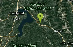
Huckleberry Tent and Breakfast
Clark Fork, Idaho
30.5 miles EA secluded canvas-wall tent camping experience near Clark Fork with a screened camp kitchen, hand pump water, outdoor heated shower, fire pit, and lit campsites.
Camp, Canoe, Hike, Horseback, Mountain Bike, Snowshoe 6.4 mi
Blacktail Lake
Sandpoint, Idaho
32.0 miles NEA 3.3-mile one-way trail from the Moose Lake trailhead to a quiet lake in the Selkirk Mountains — can be turned into a loop via the Moose Mountain Trail #237.
Hike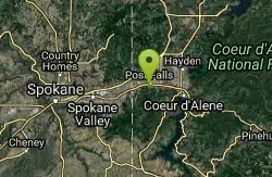
Q'emilin Park trail system (Ka-Mee-Lin)
Post Falls, Idaho
32.6 miles SA 78.5-acre park on the Spokane River in Post Falls with a guarded swimming beach, boat launch, BBQ pits, picnic shelters, horseshoe pits, volleyball courts, and a 40-acre trail system.
Hike, Rock Climb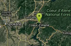
Tubbs Hill Coeur d'Alene
Coeur d'Alene, Idaho
33.7 miles SA 135-acre forested peninsula jutting into Lake Coeur d'Alene with trails past three-story caves, beaches, scenic overlooks, and excellent bird watching for osprey, eagles, mergansers, and grebes.
Hike
John Shields Park
Spokane, Washington
41.4 miles SWA 26-acre park on Spokane's north side near the Upriver Dam, jointly owned by Spokane County and the City — purchased partly with funds from the Spokane Mountaineers.
Hike, Rock Climb 3.0 mi
Lionhead Natural Water Slide
Coolin, Idaho
41.4 miles NA perfectly angled natural water slide in the forest near Priest Lake — grab a trash bag for padding, lean back, and let the current carry you for endless summer fun.
Hike, Swim
Nine Mile Recreation Area
Nine Mile Falls
44.6 miles SWDay-use area of Riverside State Park at the upper end of Lake Spokane with a designated swim area, boat launch and docks. Discover Pass required; no lifeguards and no drinking water since the 2026 fires.
Canoe, Hike, Kayak, Swim
Flodelle Creek
Colville, Washington
45.1 miles NWCamping near the Little Pend Oreille River. Nearby winter snopark run by the Forest Service offers groomed ski & cross country trails.
Atv/motorcycle, Camp, Hike
Lake Gillette Campground
Colville, Washington
46.8 miles NWA campground near Lake Gillette with 30 spacious sites, multi-use ORV, hiking, and biking trails, access to Rufus Trail #148, picnic areas, a beach, and an amphitheater.
Camp, Hike, Swim
Frater Lake Trail and Lake Leo Trail
Colville, Washington
47.1 miles NWA series of loop trails around Frater Lake in Colville, Washington — including a 4.8-mile Coyote Loop through glacial terrain, a picnic area, and a warming cabin open year-round for overnight stays.
Cross-country Ski, Hike, Horseback, Mountain Bike, Snowshoe
Lake Thomas Campground
Colville, Washington
47.3 miles NWA shaded lakeside campground with 16 sites, a sandy swimming beach, nearby hiking trails, fishing, canoeing, and motorized boating — plus access to Lake Gillette next door.
Camp, CanoeNearby Campsites
Priest River Recreation Area (The Mudhole)
Priest River, Idaho
6.3 miles WCorps of Engineers swim beach, boat ramp and campground on the Pend Oreille River a mile east of Priest River, known to locals as the Mudhole.
Camp, Hike, Kayak, Swim
Huckleberry Tent and Breakfast
Clark Fork, Idaho
30.5 miles EA secluded canvas-wall tent camping experience near Clark Fork with a screened camp kitchen, hand pump water, outdoor heated shower, fire pit, and lit campsites.
Camp, Canoe, Hike, Horseback, Mountain Bike, Snowshoe
Flodelle Creek
Colville, Washington
45.1 miles NWCamping near the Little Pend Oreille River. Nearby winter snopark run by the Forest Service offers groomed ski & cross country trails.
Atv/motorcycle, Camp, Hike
Lake Gillette Campground
Colville, Washington
46.8 miles NWA campground near Lake Gillette with 30 spacious sites, multi-use ORV, hiking, and biking trails, access to Rufus Trail #148, picnic areas, a beach, and an amphitheater.
Camp, Hike, Swim
Beaver Lodge Campground and Resort
Colville, Washington
47.1 miles NWA family resort on beautiful Lake Gillette in Colville National Forest, open year-round with excellent cutthroat and brook trout fishing, snow activities, and hunting access.
Camp
Lake Leo Campground
Colville, Washington
47.3 miles NW3200ft elevation. 8 campsites located near the lakeshore, some with lake views and all in the trees. Activities include fishing, canoeing, and motorboating.
Camp
Lake Thomas Campground
Colville, Washington
47.3 miles NWA shaded lakeside campground with 16 sites, a sandy swimming beach, nearby hiking trails, fishing, canoeing, and motorized boating — plus access to Lake Gillette next door.
Camp, Canoe
Little Twin Lakes Campground
Colville, Washington
49.0 miles NWA 3,700-foot elevation campground with 20 lakeside sites, great wildlife viewing, boating, fishing, and nearby ORV trails at the Radar Dome Area.
Camp


