


Peterson Ridge Loop
Sisters, Oregon
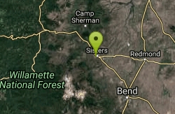
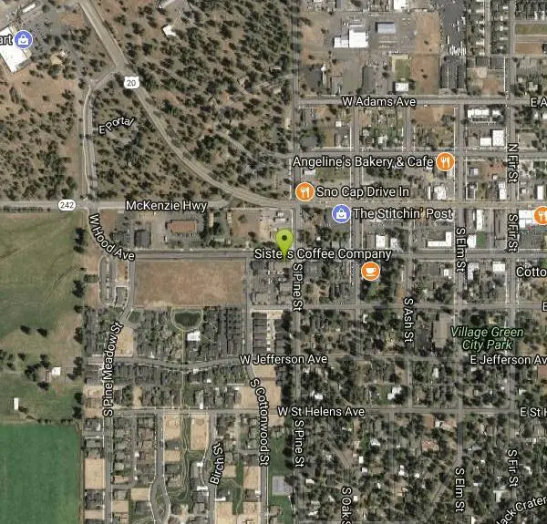
| Address: | ~413 W Hood Ave, Sisters, OR 97759, USA |
| GPS: |
44°17'25.4"N 121°33'14.8"W Maps | Directions |
| State: | Oregon |
| Trail Length: | 25.00 miles |
| MTB Difficulty: | Intermediate |
| Trail Type: | Other |
| MTB Trail Type: | Singletrack |
Mountain Bike
X-country riders will love this system. Basically this is an 18 mile loop with no less than 12 ‘connector’ trails running between the two sides, PT West & PT East- the ride lengths and different configurations here are almost endless. The local bike shop boasts 28 miles of trails, I guess so if you were to ride them all. The local bike shops and the Forest Service office have free maps available. Like the neighboring systems in Bend all the intersections are marked by a post with a number on it, these correspond with the maps- as you are riding along these #’s are not necessarily in order so having a map, at least for the first time here is kind of important.Although not direction specific I chose to ride the loop counter-clockwise (turning right at every intersection) and for the first 2.5 miles the trail was just a twisty, flat ride through the woods, great for the novice riders. After that there was a slight elevation gain and some semi-technical spots mainly in the form of small rock gardens. The views from the ridge of the surrounding mountains are spectacular. At intersection #28, about 8.5 miles from the start you will want to turn left onto PT East, turning right here leads to the Upper Metolius trail- it is possible to ride singletrack from here all the way to the numerous trail systems in Bend. Back on the loop the trail turns very fast and winds its way back down the ridge towards Sisters. Take a left at intersection #2 near the end as going right will take you to the Five Pine Resort (this is plainly marked). There are several FS roads running through this area and you will cross them frequently, however this trail is all singletrack and if you find yourself riding on a road you somehow missed a turn-These are very well planned and built trails and the signage is some of the best I have ever seen on a system this size. Courtesy of Singletracks.com
More Information
Add ResourceNever modify trail features. Ride trails when they're dry enough that you won't leave ruts. Speak up when you see others on the trail and always yield to hikers, horses, and others coming uphill. Always ride on the established trail.
Read More- Plan Ahead and Prepare
- Travel & camp on durable surfaces
- Dispose of waste properly
- Leave what you find
- Minimize campfire impacts
- Respect wildlife
- Be considerate of other visitors
Directions
From Sisters, Oregon
- Head south toward E Hood Ave (174 ft)
- Turn right onto E Hood AveDestination will be on the left(0.2 mi)
Other Mountain Bike Trails Nearby
Stevens Canyon Loop
Sisters, Oregon
5.3 miles NSingle track, 20 mile loop, adopted from an old motocross loop.
Mountain Bike
Butte Loops Trail
Sisters, Oregon
7.0 miles NWThis trail consists of two loops: Upper Loop and Lower loop. The Lower Loop is on the low west flank of Black Butte and the Upper Loop circles Black Butte. source: fs.usda.gov...
Mountain Bike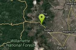
Suttle Lake Loop
Sisters, Oregon
9.2 miles NWThe loop is about 2 miles approximately in length and the highway side of the lake is less congested as several campgrounds border the opposite side. The best part of this trail is not...
Mountain Bike 1.2-7.3 mi
Juniper Trails
Redmond, Oregon
13.8 miles EJuniper Trails is a wonderful destination for mountain bikers of all skill levels. The miles of trails are broken into longer and shorter loops. Beginners can feel confident riding on the main...
Mountain Bike
North Fork
Bend, Oregon
17.9 miles SOne of the most scenic rides around the Bend area. *Special note; this is a one way, up hill ride only, so is to be used as access to other trails farther up the mountain. From the...
Mountain Bike
Farewell
Bend, Oregon
18.0 miles SIf you climb the North Fork trail, Farewell is a killer descent down the other side of the river, ending up back at Tumalo Falls Trailhead. The singletrack is super flowy, with some...
Mountain Bike
Phil's Area
Bend, Oregon
18.0 miles SUpdate 7/22/13 by mtbgreg1:The Phil's Area Trail System is the go-to trail system for mountain biking in Bend. Even the other trails in the region that aren't actually part of the...
Mountain Bike
Tumalo Trail System
Bend, Oregon
18.0 miles SMassive trail system located west of Bend in the national forest.
Mountain Bike
Tumalo Creek
Bend, Oregon
18.0 miles SThe Tumalo Creek Trail is 3.5 miles one-way and parallels Skyliner road. Starting at the Skyliner trailhead, the trail runs up near the road on the ridge side to the Tumalo Falls...
Mountain Bike
Skyliners
Bend, Oregon
18.0 miles SSkyliners is a 3.2-mile intermediate singletrack trail that runs from the Skyliner's trailhead to a junction with Whoops and Ben's trail, which is the corner of the Phil's Area Trail...
Mountain Bike
Ben's Lower
Bend, Oregon
19.0 miles SEBen's is about 7 miles long one-way, and is split into basically two portions. The lower portion is all two-way, flowy cross country trail, but the upper section of Ben's is...
Mountain Bike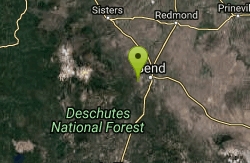
Phil's Trail
Bend, Oregon
19.0 miles SESince this is the namesake for the entire trail system and the oldest trail in the area, I kind of expected a blown-out doubletrack. That is entirely NOT the case! COTA has done an...
Mountain Bike
Horse Ridge Recreation Area
Bend, Oregon
20.0 miles SEExcellent riding.
Mountain Bike
Whoops
Bend, Oregon
20.5 miles SWhoops is a renowned flow/jump trail in the Bend area that connects to Ben's of the Phil's Area on the Eastern End and then the Swede Ridge loop on the Western End (with a connection...
Mountain Bike
Swampy Lakes Trail
Bend, Oregon
20.7 miles SThe Swampy Lakes Trail is a popular way for mountain bikers to get back to Tumalo Falls when doing the North Fork/Metolius-Windigo/Dutchman-Swampy loop around the Bend Municipal...
Mountain Bike
Swampy Dutchman Trail
Bend, Oregon
20.8 miles SThis trail travels from Swampy Lakes Sno-Park to Dutchman Sno-Park. It is a cross country ski/snowmobile trail that is used as a mountain bike trail in the summer. source:...
Mountain Bike
C.O.D.
Bend, Oregon
20.8 miles SThis trail roughly parallels Century Drive, but it is WAY more fun than riding pavement! This is great Bend singletrack: mostly buff, dry, dusty singletrack. It connects to the Storm...
Mountain Bike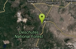
Entrada Loop Trail
Bend, Oregon
20.8 miles SENice for day hiking, or as a mountain bike connector to either the Tumalo Trail System or the Deschutes River Trail. source: fs.usda.gov
Mountain Bike
Sector 16
Bend, Oregon
20.9 miles SThe Sector 16 trail runs for 3.7 miles one-way from the Swede Ridge area to the Whoops Trail. This intermediate singletrack circles around a large, square parcel of private land, so be...
Mountain Bike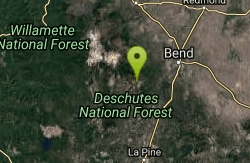
Larsen Trail
Bend, Oregon
21.2 miles SThe Larsen Trail runs for 3 miles one-way from Kiwa Springs to the Tiddlywinks Trail. It parallels USFS road 4130 for most of the way. Intermediate difficulty.
Mountain Bike


