


Port Washington South Beach
Port Washington
Kayak and Swim
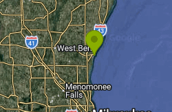
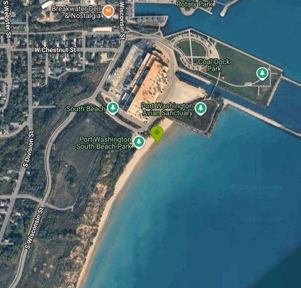
South Beach is the City of Port Washington's public Lake Michigan beach on the south side of the harbor, at 400 South Beach Road. It runs along the lakeshore just south of the We Energies Port Washington Generating Station, with the south bluff rising behind it. The beach opened to the public in 2010, and it has since become the busier of Port Washington's two beaches, partly because bluff slumping has blocked the entrance to the north beach several times in recent years.
To drive there, follow Wisconsin Street south from downtown past the power plant and turn left at the beach sign onto South Beach Road. The paved lot at the end holds only about 22 cars, and on warm days it fills and overflows onto the grass and nearby streets. Parking along South Beach Road is prohibited and police regularly ticket cars left there. The city suggests parking at Coal Dock Park instead and walking south through the Port Washington Avian Sanctuary, a walk of less than a quarter mile. The city has set aside money in its draft 2027 capital plan to expand the lot, so expect changes to parking.
The beach is a long strip of sand facing east onto open Lake Michigan. Water depth is not posted, and conditions change with the wind and the lake level. When the lake ran at record highs in 2020 the beach was far narrower, and it widened again as the water dropped. Lake Michigan stays cold well into summer. In early June the water can be barely above 50 degrees. No lifeguard service is documented for this beach, so plan on swimming without one. Kayakers and kiteboarders launch straight off the sand, so watch for boards when the wind picks up.
There is no admission or parking fee. Posted hours are 6 a.m. to 10 p.m. all year. A portable toilet sits in the parking area in summer. Leashed dogs are allowed if owners clean up after them, and alcohol and fires are banned on the beach and in the lot. The local health department samples the water for E. coli about once a week from late May to early September, and results and any advisory or closure are posted on the Wisconsin DNR's Wisconsin Beach Health site.
Treat this as open Great Lakes water. Wind-driven waves and currents build fast along this shore, and the city links a real-time rip current watch for Port Washington from its beaches page. A swimmer has drowned here. Stay out when waves are up, and check the National Weather Service Milwaukee forecast and the beach status before you go. Coal Dock Park, the avian sanctuary and the downtown harbor walk are all a short walk north.
More Information
Beaches | Wisconsin DNR
From the cobble beaches of Washington Island, to the gently rolling dunes of Sheboygan, to the soft, sandy beaches of our inland lakes and rivers, beaches are nature's nirvana. Wisconsin's beaches provide wildlife habitat, recreation areas and tourist destinations. Unfortunately, beaches are especially vulnerable to agricultural, urban and industrial land uses, and many of our beaches are showing the effects. We invite you to explore, enjoy and help protect and restore Wisconsin's beaches.
https://dnr.wisconsin.gov/topic/BeachesCity seeks a fix for beach parking | Ozaukee Press
Port Washington’s south beach is without question one of the most popular spots in the city, especially on hot, humid days when the lake breeze offers relief found few other places, but the issue for many has been finding parking nearby. That may change next year. On Tuesday, the Board of Public Works approved a draft capital improvement plan that includes $50,000 to expand
https://ozaukeepress.com/content/city-seeks-fix-beach-parkingLake Michigan gives Port a tale of two beaches this summer | Ozaukee Press
A lake that has risen relentlessly, swallowing beaches and threatening shorelines, has backed off at last, at least slightly. The Lake Michigan water level last month was 18 inches lower than it was a year ago, although it is still 22 inches above average and is predicted to rise 2 to 3 inches by the end of June.
https://ozaukeepress.com/content/lake-michigan-gives-port-tale-two-beaches-summerMan pulled from water at Port Washington's South Beach dies
CBS 58 is your local source for the Milwaukee news, Milwaukee weather, and Milwaukee sports.
https://www.cbs58.com/news/man-pulled-from-water-at-port-washingtons-south-beachPHOTO OP-ED: Beach lovers’ mecca | Ozaukee Press
They’re coming from in town and out of town, multitudes of beach lovers who have discovered that Port Washington has some of Wisconsin’s finest Lake Michigan beaches. Wide expanses of sand, thanks to a lower lake level, uncommonly warm water and some hot mid-summer weather have brought crowds to Port’s two beaches named after the side of downtown where they’re located.
https://ozaukeepress.com/node/110502PHOTO OP-ED: The south beach crowd | Ozaukee Press
Saturday felt a lot like summer, and that’s all it took to populate Port Washington’s south beach with what looked like a standing-room-only crowd. Lake water temperature barely above 50 degrees did not deter young splashers. Beachgoers’ vehicles spilled over from the packed parking lot to a grassy area and then to city streets several blocks away. Photos by Sam Arendt
https://ozaukeepress.com/content/photo-op-ed-south-beach-crowdPort Washington South Beach - Swim Guide
Located just South of the WE Energies power station on Wisconsin Street. Port Washington’s South Beach provides visitors with a long, sandy beach to take in beautiful views of Lake Michigan. Individuals wishing to launch kayaks or kite boards can do so at the location as well. The beach, although frequently used, allows ample space to spread out for those wishing to enjoy the natural sights and sounds of the lakeshore. The parking area provides spaces for approximately 20 vehicles and allows walking access to the city’s avian sanctuary and Coal Dock Park to the north of the powerstation. Coal Dock Park was where barges once docked to unload coal that was used to generate electricity at the station. Today, the revitalized park allows visitors to enjoy views and refreshing lake breeze. Restrooms- Porta-Potty available in the parking area during summer months Hours- 6am-10pm year round Dogs- Leashed dogs may visit the beach, owners are responsible for cleaning up pet waste. No alcoholic beverages or fires are allowed on the beach or in the parking area. Please read and obey all posted regulations during your visit. Please read and obey all posted regulations during your visit. Prior to your day at the beach, be sure to check the local Weather Forecast at https://www.weather.gov/mkx/ and pay attention to changing weather and water conditions.
https://www.theswimguide.org/beach/10583Port Washington South Beach Kayak Launch - Lake… | Paddling.com
Port Washington South Beach Kayak Launch - Lake Michigan - Find info about paddling launch sites including directions, ammenities, & fees to plan your…
https://paddling.com/paddle/locations/port-washington-kayak-launchPort Washington South Beach | Great Lakes Guide
Connect with Port Washington South Beach using Great Lakes Guide to discover current water quality and weather data, general information, and nearby des...
https://greatlakes.guide/beaches/port-washington-south-beachSouth Beach | Travel Wisconsin
This newly opened stretch of beach south of the downtown is accessible swimmers, paddlers, hikers, and picnickers. A great place to watch a Lake Michigan sunrise! Follow Wisconsin Ave. south past the We Energies plant and turn left at the sign.
https://www.travelwisconsin.com/outdoors/on-the-water/south-beach
- Plan Ahead and Prepare
- Travel & camp on durable surfaces
- Dispose of waste properly
- Leave what you find
- Minimize campfire impacts
- Respect wildlife
- Be considerate of other visitors
Directions
From Port Washington
- Head west on Murray Ave toward N Plandome Rd (0.1 mi)
- Turn left onto N Plandome Rd (1.1 mi)
- Turn right onto Plandome Rd (1.1 mi)
- Sharp right onto Colonial Pkwy (141 ft)
- Turn left onto Locust Pl (0.1 mi)
- Turn right onto Bayview Ave (0.8 mi)
- Turn left onto E Shore Rd (0.3 mi)
- Continue onto Community Dr (1.3 mi)
- Turn right onto Horace Harding Blvd (200 ft)
- Slight left to merge onto I-495 W toward New York (2.2 mi)
- Take exit 31N-S for Cross Island Parkway toward Whitestone Brg/
Kennedy Arpt (0.2 mi) - Keep right to continue on Exit 31 North, follow signs for Cross Island Pkwy N/
Whitestone Br and merge onto Cross Island Pkwy (3.4 mi) - Take exit 33 for I-295/
Throgs Neck Br toward Bronx/ New England Toll road(0.5 mi) - Merge onto I-295 NToll road(2.6 mi)
- Keep left to stay on I-295 N, follow signs for I-95 S/
Cross Bronx ExpwyW/ Geo Washington Br (1.3 mi) - Continue onto Cross Bronx Expy (0.6 mi)
- Merge onto I-95 S (4.7 mi)
- Slight right onto Cross Bronx Expy/
Interstate 95 Lower Level S/ Trans-Manhattan Expy/ U.S. 1 Lower Level S (signs for I-95 S/ US-1 S/ George Washington Br Lower Level) (0.6 mi) - Keep left to continue on Interstate 95 Lower Level S/
U.S. 1 Lower Level S, follow signs for I-95 S/ New Jersey Entering New Jersey(1.8 mi) - Keep right to continue on I-95 (2.7 mi)
- Take exit 69 for I-80 W toward Paterson (0.7 mi)
- Continue onto I-80 W (8.3 mi)
- Continue straight to stay on I-80 W (13.2 mi)
- Keep left to stay on I-80 W, follow signs for Netcong/
Del Water Gap Toll roadEntering Pennsylvania(46.5 mi) - Keep left to stay on I-80 WToll road(254 mi)
- Slight left (2.0 mi)
- Merge onto I-80 WEntering Ohio(71.4 mi)
- Take the exit to stay on I-80 WToll road(215 mi)
- Keep left to continue on I-90 WToll roadEntering Indiana(160 mi)
- Keep left to stay on I-90 WToll roadEntering Illinois(7.8 mi)
- Take the I-94 W/
I-90 W exit on the left toward Ryan Expy Toll road(0.3 mi) - Merge onto I-90Exp W/
I-94Exp W (4.8 mi) - Merge onto I-90 W/
I-94 W (10.7 mi) - Keep right to continue on I-94 W, follow signs for Edens Expwy/
Milwaukee (13.5 mi) - Take the I-94 W exit toward MilwaukeeToll road(0.5 mi)
- Continue onto I-94 WToll road(2.7 mi)
- Keep left to stay on I-94 WToll road(21.7 mi)
- Keep left to stay on I-94 WToll roadParts of this road may be closed at certain times or daysEntering Wisconsin(36.6 mi)
- Keep left to stay on I-94 W (2.6 mi)
- Continue onto I-43 N (4.2 mi)
- Keep left to stay on I-43 N (21.3 mi)
- Take exit 93 for WI-32 N/
Port Washington toward County Hwy V S/ Grafton (0.5 mi) - Slight right onto the ramp to Port Washington (269 ft)
- Merge onto WI-32 N/
N Port Washington Rd Continue to follow WI-32 N(2.8 mi) - Turn right onto W Sunset Rd (0.8 mi)
- Continue onto S Wisconsin St (0.7 mi)
- Turn rightRestricted usage road(0.1 mi)
Other Swimming Holes and Kayaking Areas Nearby
Port Washington North Beach
Port Washington
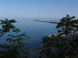
1.0 miles NFree city-run Lake Michigan sand beach below the Upper Lake Park bluff in Port Washington, reached by an 83-step stairway or a walk around the wastewater plant. Bluff slides close it at times.
Swim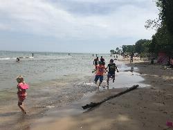
Harrington Beach State Park
Belgium
8.8 miles NEWisconsin state park with more than a mile of Lake Michigan beach near Belgium. Swimming is on the big lake only, with no lifeguard, and the 26-acre quarry lake is closed to swimming and boating.
Camp, Hike, Kayak, Swim
McKinley Beach
Milwaukee
22.8 miles SMcKinley Beach reopened in May 2024 after a nearly four-year closure that followed four drownings in 2020 and a $1.1 million rebuild that hauled in some 12,000 cubic yards of sand to bring the swimming area back to waist depth. It is open for swimming wit
Hike, Swim
Pike Lake Beach
Hartford
23.4 miles WSand swimming beach with a buoyed, shallow swim area on Pike Lake in the Kettle Moraine State Forest's Pike Lake Unit east of Hartford. No lifeguards; a Wisconsin state park vehicle pass is required.
Camp, Canoe, Hike, Kayak, Swim
Jaycee Quarry Park
Sheboygan, Wisconsin
28.2 miles NSwim near Sheboygan, Wisconsin
Swim
Grant Park Beach
South Milwaukee
32.8 miles SFree, unguarded Lake Michigan beach in Milwaukee County's Grant Park in South Milwaukee, with soft sand, free parking, a seasonal grill in the 1937 pavilion, and summer E. coli testing.
Hike, Kayak, Swim
Muskego Park
Muskego
36.7 miles SWWaukesha County's Muskego Park has a roped, unguarded swim beach on a small pond, open sunrise to sunset from mid-May through late September. A $7 county daily vehicle permit or annual membership is required.
Camp, Hike, Swim
Kettle Morain South Trail Head
Dousman, Wisconsin
43.2 miles SWOver 30 miles of connected mostly single-track trails through the Southern Unit of Kettle Moraine State Forest — the John Muir and Emma Carlin systems linked by a connector trail.
Camp, Cross-country Ski, Hike, SwimNearby Campsites
Harrington Beach State Park
Belgium
8.8 miles NEWisconsin state park with more than a mile of Lake Michigan beach near Belgium. Swimming is on the big lake only, with no lifeguard, and the 26-acre quarry lake is closed to swimming and boating.
Camp, Hike, Kayak, Swim
Pike Lake Beach
Hartford
23.4 miles WSand swimming beach with a buoyed, shallow swim area on Pike Lake in the Kettle Moraine State Forest's Pike Lake Unit east of Hartford. No lifeguards; a Wisconsin state park vehicle pass is required.
Camp, Canoe, Hike, Kayak, Swim
Muskego Park
Muskego
36.7 miles SWWaukesha County's Muskego Park has a roped, unguarded swim beach on a small pond, open sunrise to sunset from mid-May through late September. A $7 county daily vehicle permit or annual membership is required.
Camp, Hike, Swim
Pinewoods Campground
Dousman, Wisconsin
43.1 miles SWA 101-site campground with flush toilets, pit toilets, showers, and a playground — no electrical hookups, but a quiet, nature-focused setting near Dousman.
Camp
Kettle Morain South Trail Head
Dousman, Wisconsin
43.2 miles SWOver 30 miles of connected mostly single-track trails through the Southern Unit of Kettle Moraine State Forest — the John Muir and Emma Carlin systems linked by a connector trail.
Camp, Cross-country Ski, Hike, Swim
Ottawa Lake Campground
Eagle, Wisconsin
47.9 miles SWA beautiful northwoods campground surrounded by National Forest on Lake Ottawa, with hiking trails, a Ge-Che Trail, nearby lakes and rivers, and a historic CCC-built picnic shelter.
Camp


