


Stone Lake Beach
La Porte

Hike, Kayak, and Swim
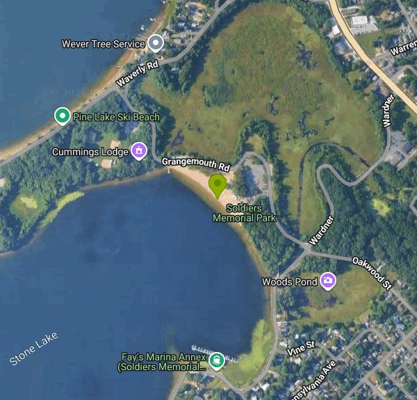
Stone Lake Beach is the City of La Porte's public swimming beach, a strip of sand on the northeast shore of Stone Lake inside Soldiers Memorial Park. The park, dedicated in 1928, covers 556 acres and takes in the whole lake along with nearly all of its shoreline, so the water here is ringed by city woods and parkland instead of private docks. La Porte Park and Recreation runs the beach, and its main office sits in the same park at 250 Pine Lake Avenue.
The beach address is 300 Grangemouth Drive, about a mile northwest of downtown La Porte. Enter Soldiers Memorial Park from Pine Lake Avenue (US 35) and follow the park roads to Grangemouth Drive and the beach house; a large paved lot sits right behind the sand. Grangemouth Drive also connects north to Waverly Road on the Pine Lake side of the park. A new paved trail along Lake Shore Drive and Grangemouth Drive is planned to link the beach house with Craven Drive, the first piece of a loop around the lake.
Swimmers use a designated area of sandy shallows in front of the beach house. Stone Lake is a natural glacial lake of about 125 acres, and the Indiana DNR's 2017 depth survey found it reaches 43 feet at its deepest point, so stay within the marked swim area where guards can see you. Lifeguards are on duty from 10:30 a.m. to 4 p.m. starting Memorial Day weekend and then daily for as long as La Porte Community Schools are on summer break, so the guarded season ends when school resumes in August. Outside those hours and months there is no guard. Like other northern Indiana lakes, the water is chilly in early June and warmest from mid July into August.
There is no admission charge. The city's park fee schedule lists charges only for shelter, lodge and amphitheater rentals and has no line for beach entry or parking, and the city describes the beach as open to the public. The beach house, renovated in 1999, has restrooms, a concession stand and outdoor rinse showers, and it is the only reliable place for food and toilets near the water.
The La Porte County Health Department samples the city beaches on Tuesdays and Thursdays through the summer, and the state's IDEM BeachAlert system lists separate sampling points for the beach. When E. coli tops the state standard of 235 colonies per 100 ml, the county posts a Swim with Caution advisory. Check the posted signs or BeachAlert before you go in after heavy rain. Boats use the open lake beyond the swim area, and a channel near Ski Beach connects Stone Lake to the larger Pine Lake.
Away from the water there is a sand volleyball court, a playground rebuilt in 2018 with two new play structures from the La Porte Park Foundation, picnic tables, grills and benches. Self-service kayak rentals and kayak lockers are available at the beach for paddling the lake. Soldiers Memorial Park also has mountain bike trails, nature trails, ball diamonds and Cummings Lodge. Locals hold an informal New Year's Day polar plunge on this beach each winter.
More Information
City of La Porte PARK DEPARTMENT 2025/2026 FEES 2025 2026
City of La Porte PARK DEPARTMENT 2025/2026 FEES 2025 2026 Approved Approved Picnic Shelter Reservations Department Affiliated (Little “L”, Jr. & Sr.
https://laporteparkandrec.com/uploads/Park%20%20fees_2025_26.pdfCity of La Porte, Indiana Careers | Official Website
Careers | Official Website
https://cityoflaporte.com/jobs/54Swim with Caution advisory issued in La Porte County
LA PORTE COUNTY, Ind. -- The La Porte County Health Department has issued a Swim with Caution Advisory for Kiwanis-Teledyne Park and Stone Lake Beach.
https://abc57.com/news/Swim-with-Caution-advisory-issued-in-La-Porte-CountyTrails | City of La Porte Parks & Rec
The City of La Porte in conjunction with the Health Foundation of La Porte is excited to offer the community a network of paved walking, running and bicycling paths that stretch throughout La Porte. You’ll find trails that are perfect for walking, biking, hiking, as well as mountain biking. Following is more information on each trail.
https://laporteparkandrec.com/trails/Be courteous, informed, and prepared. Read trailhead guidelines, stay on the trail, and don't feed the wildlife.
Read More
- Plan Ahead and Prepare
- Travel & camp on durable surfaces
- Dispose of waste properly
- Leave what you find
- Minimize campfire impacts
- Respect wildlife
- Be considerate of other visitors
Directions
From La Porte
- Head south on N Broadway St toward W Main St (95 ft)
- Turn right onto W Main StPass by Allen & Kerber Auto Supply (on the right in 0.3 mi)(0.5 mi)
- Turn right onto TX-146 (0.2 mi)
- Slight left to merge onto TX-146 N (1.0 mi)
- Take the TX-225 W exit toward Pasadena/
Houston (0.6 mi) - Continue onto TX-225 W/
Hwy 225 W (6.7 mi) - Take the exit toward Sam Houston/
Tollway/ Texas 8 Beltway/ Sam Houston Tollway (0.1 mi) - Merge onto Pasadena Fwy Frontage Rd (0.5 mi)
- Take the ramp to I-10Toll road(0.3 mi)
- Merge onto Sam Houston Tollway NToll road(459 ft)
- Continue onto TX-8 Beltway N/
Sam Houston Tollway N Toll road(20.9 mi) - Take the exit onto I-69/
US-59 N toward Airport/ Cleveland (33.8 mi) - Continue onto US-59 N (70.9 mi)
- Slight right to merge onto TX-287 Loop E/
US-59 N/ S Medford Dr toward Nacogdoches (5.7 mi) - Continue straight onto US-59 N (15.6 mi)
- Turn left onto the US-59 N/
TX-224 Loop N ramp to Texarkana (0.4 mi) - Slight right onto the ramp to TX-7/
Crockett (289 ft) - Slight left to merge onto TX-224 Loop N/
US-59 N/ SW Stallings Dr Continue to follow US-59 N(7.4 mi) - Merge onto US-259 N via the ramp to Henderson (17.1 mi)
- Slight right onto TX-315 E (24.9 mi)
- Turn left to merge onto TX-149 W/
NW Loop Continue to follow TX-149 W(1.8 mi) - Continue onto US-79 N (1.6 mi)
- Take the US-59 N ramp to Marshall (0.2 mi)
- Turn left onto US-59 BUS N (377 ft)
- Continue onto US-59 NPass by Pizza Hut (on the left in 24.4 mi)(71.2 mi)
- Turn left to stay on US-59 NPass by Anytime Fitness (on the right in 0.3 mi)(21.0 mi)
- Turn right onto the US-59 N/
I-369 N ramp to I-30 W/ Dallas/ Texarkana (0.7 mi) - Continue onto I-369/
US-59 N (3.5 mi) - Take the exit onto I-30 E/
US-59 N toward Little Rock/ Ashdown Continue to follow I-30 EEntering Arkansas(141 mi) - Take exit 138A for I-440 E toward L.R. National Airport/
L.R. River Prt/ Memphis (1.0 mi) - Continue onto I-440 E (9.0 mi)
- Take exit 11 to merge onto I-40 E toward Memphis (118 mi)
- Take exit 277 to merge onto I-55 N toward Blytheville/
St. Louis (8.3 mi) - Continue onto US-61 N/
US-78 (6.8 mi) - Continue onto I-55 NEntering Missouri(116 mi)
- Take exit 66A to merge onto I-57 N/
US-60 E toward Chicago Continue to follow I-57 NEntering Illinois(118 mi) - Slight right to stay on I-57 N (signs for Chicago) (62.0 mi)
- Merge onto I-70 (5.3 mi)
- Slight left onto I-57 (182 mi)
- Take exit 345A to merge onto I-80 E toward Indiana/
I-294 Toll road(3.4 mi) - Keep left to stay on I-80 EToll roadEntering Indiana(23.7 mi)
- Continue onto I-94 E (24.1 mi)
- Take exit 40A for US-20 E/
US-35 S toward La Porte/ S Bend (0.4 mi) - Turn right onto US-20 E (0.1 mi)
- Turn right onto US-35 S (6.5 mi)
- Turn right onto Lake Shore Dr/
Wardner (0.4 mi) - Turn right onto Grangemouth Dr (0.1 mi)
- Turn left (79 ft)
- Turn leftDestination will be on the left(187 ft)


Other Swimming Holes, Hiking Trails, and Kayaking Areas Nearby
Washington Park Beach
Michigan City
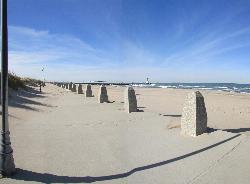
11.5 miles NWMichigan City's lifeguarded Lake Michigan beach in historic Washington Park, beside the East Pier lighthouse. Entry on foot is free; parking is $3 to $7 an hour in 2026.
Swim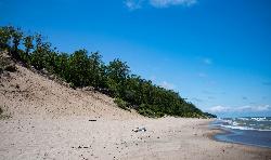
Mount Baldy Beach
Michigan City
11.5 miles NWA 120 foot living dune that creeps inland about four feet a year. The Lake Michigan beach below it is open for swimming with no lifeguards, but the summit is closed except on ranger led hikes.
Hike, Swim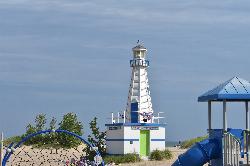
New Buffalo Beach
New Buffalo
12.8 miles NThe City of New Buffalo charges $25.00 a day to park at its Lake Michigan beach, the first public one north of the Indiana line. It is guarded in summer and sits right beside the harbor piers that generate the lake's structural currents.
Canoe, Kayak, Swim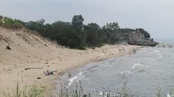
Portage Lakefront and Riverwalk Beach
Portage
22.7 miles WUnguarded Lake Michigan beach at Indiana Dunes National Park's Portage Lakefront and Riverwalk, reached by a short paved path from a pavilion with restrooms. A park entrance pass ($25 per car) is required.
Hike, Swim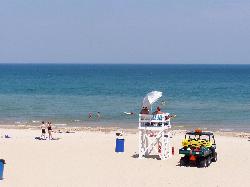
West Beach
Portage
24.1 miles WThe National Park Service's main lifeguarded swimming beach at Indiana Dunes, a wide Lake Michigan beach with a bath house and Chicago skyline views. A national park entrance pass ($25 per vehicle) is required.
Hike, Swim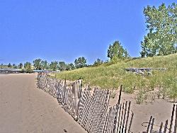
Silver Beach County Park
St. Joseph
36.5 miles NA wide county-run swimming beach on Lake Michigan at the mouth of the St. Joseph River, on the site of the old Silver Beach Amusement Park. Parking is the only fee, but the piers make the currents here genuinely dangerous outside the short lifeguard seaso
Kayak, Swim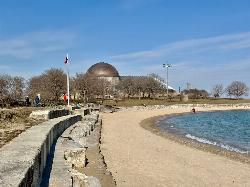
12th Street Beach
Chicago
47.7 miles WFree, lifeguarded Lake Michigan beach on Chicago's Northerly Island, just south of the Adler Planetarium, with a beach house, paddle launch and swimming from 11 am to 7 pm in summer.
Canoe, Kayak, Swim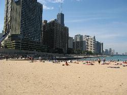
Ohio Street Beach
Chicago
48.7 miles NWA free, lifeguarded Chicago Park District beach on Lake Michigan just north of Navy Pier, and the city's main open water training spot, with a half-mile swim along the seawall toward Oak Street.
Swim


