


Switzer Falls
Altadena, California
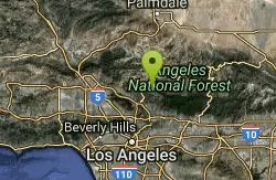
| GPS: |
34°15'59.0"N 118°8'41.4"W Maps | Directions |
| State: | California |
Swim
Fees: Yes. Must buy Adventure Pass prior to driving up here. Some sold at Clear Creek Ranger Station.
More Information
swimmingholes.org: CALIFORNIA SWIMMING HOLES
THE web site for beautiful, natural places for a cool dip or hot soak.
https://www.swimmingholes.org/ca.html- Plan Ahead and Prepare
- Travel & camp on durable surfaces
- Dispose of waste properly
- Leave what you find
- Minimize campfire impacts
- Respect wildlife
- Be considerate of other visitors
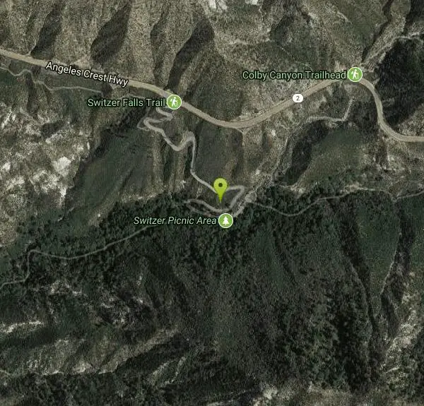
Directions
From Altadena, California
- Head north on E Altadena Dr toward E Altadena Dr (0.6 mi)
- Turn left onto Marengo Ave (0.7 mi)
- Turn right onto E Woodbury Rd (1.3 mi)
- Turn left onto N Windsor Ave (0.1 mi)
- Turn right to merge onto I-210 W toward San Fernando (2.3 mi)
- Take exit 20 for CA-2/Angeles Crest Hwy toward La Cañada Flintridge (0.4 mi)
- Turn right onto CA-2 E/Angeles Crest Hwy (9.6 mi)
- Turn right onto Switzer Truck TrailDestination will be on the right(0.4 mi)
Other Swimming Holes Nearby

Fish Creek
Lake Hughes, California
33.7 miles NWA super-deep upper pool and a lower pool about 5 feet deep, with a slideable waterfall — plus some higher jump spots for those willing to do a bit of rock climbing.
Hike, Rock Climb, Swim 0.3-1.0 mi
Rock Pool
Agoura Hills, California
35.6 miles WA river-fed swimming hole deep in Malibu Creek State Park, ringed by forest and rock formations — reach it via a short level path from the Visitor Center or a scenic 2-mile out-and-back from the campsite.
Camp, Hike, Swim
Point Dume State Beach
Malibu, California
42.2 miles SWHeadlands, rocky coves, a quiet beach, gray whale watching from December to April, an easy coastal hike to sweeping views, and a fun Iron Man movie cameo — all at Point Dume in Malibu.
Dive, Hike, Rock Climb, SwimNearby Campsites

Bandido Group Campground
Pearblossom, California
9.7 miles NEA rustic group campground in the Angeles National Forest designed for equestrian campers, with horse corrals, hitch racks, and five sites accommodating up to 150 campers total.
Camp, Hike, Horseback
Malibu Creek State Park
Calabasas, California
35.5 miles WJust 25 miles from downtown LA, 15 miles of streamside trail wind through oak and sycamore woodlands in a park with rich Chumash history and film location fame.
Camp, Hike, Horseback, Mountain Bike, Rock Climb 0.3-1.0 mi
Rock Pool
Agoura Hills, California
35.6 miles WA river-fed swimming hole deep in Malibu Creek State Park, ringed by forest and rock formations — reach it via a short level path from the Visitor Center or a scenic 2-mile out-and-back from the campsite.
Camp, Hike, Swim


