


253 Things to do near Bonneville Shoreline Trail - Northern Salt Lake City
first prev 1 2 3 4 5 6 7 8 9 10 next lastShowing results within 50 miles Distance miles of 300 Red Butte Canyon Rd, Salt Lake City, UT 84108, USA City, Zip, or Address
Mill Creek Pipeline
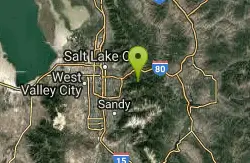
Salt Lake City, Utah
7.6 miles SEthere are quite a few hiking trails that connect into this trail coming up the mountain from your left you will go about 6.5 miles and then a sign post will mark the Rattlesnake down...
Mountain Bike
Pete's Rock
Salt Lake City, Utah
7.9 miles SA large rock next to the Mount Olympus trailhead known locally as Pete's Rock and is a popular place for casual rock climbing. Mount Olympus is a prominent 9,026 feet peak on the east side of the...
Hike, Rock Climb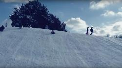
Murray Park
Murray, Utah
8.0 miles SSled near Murray, Utah
Sled
Holbrook Trailhead
Bountiful, Utah
8.0 miles Nairsoft feaild woth bunkers
Airsoft, Backpack, Camp, Paintball, Snowshoe
Mills Park
Woods Cross, Utah
8.6 miles NWShort recreational course in multi-use park. Public (No Fee)
Disc Golf
Bountiful to Farmington ATV Trail
Bountiful, Utah
9.1 miles NThe Farmington Canyon (or Skyline Drive) trail system ties into the same trail system as the Skyline Drive trail system in Bountiful. This is a fun trail that's close to home (if you live along...
Atv/motorcycle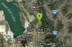
Bountiful City Park
Bountiful, Utah
9.3 miles NLength: ~100-200ft Slope: ~45°
Sled
Bella Vista Elementary School'
Cottonwood Heights, Utah
9.8 miles SSled near Cottonwood Heights, Utah
Sled
Valley Regional Park Disc Golf Course
Salt Lake City, Utah
10.1 miles SWLined with trees and a paved jogging path. Front 9 is flat with young trees and grass. Maturing back 9. The rec center has softball fields, and a swimming pool. Good signs - easy navigation....
Disc Golf

Hidden Falls
Salt Lake City, Utah
10.6 miles SEHidden Falls is a popular road side attraction for anyone cruising Big Cottonwood Canyon on a sunny afternoon. The falls are within strolling distance of the parking lot and only require about 15...
Hike
Storm Mountain
Salt Lake City, Utah
10.8 miles SEStorm Mountain is on of the smaller peaks included in the Wasatch Range. Storm Mountain is located in Cottonwood Canyon. Storm Mountain Day Use Area is just 3 miles up Big Cottonwood Canyon,...
Hike, Mountain Bike, Rock Climb
Ferguson Canyon
Cottonwood Heights, Utah
11.0 miles SFerguson canyon is small canyon between Big and Little Cottonwood Canyons. This canyon has gained popularity over the last few year and is a popular destination for rock climbers. This is one hike...
Hike, Mountain Bike, Rock Climb
Parrish Canyon Trail
Centerville, Utah
11.0 miles NParrish Canyon Trail goes long the Wasatch Mountains; from the top of the mountain, this trail has beautiful views of Salt Lake City from a distance and interconnects with the Barnard Creek. It's...
Hike, Mountain Bike
Bennion Park
Salt Lake City, Utah
11.0 miles SWThe park is open from 7:00 a.m. to 10:00 p.m. It's a pretty flat and straight hill that's smaller on the North side but gets pretty big as it goes South.
Sled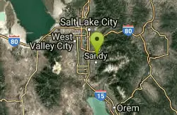
Willow Creek Park
Sandy, Utah
11.6 miles SThese are pretty short slopes for sledding. One is steeper than the other.
Sled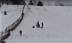
Flat Iron Mesa Park
Sandy, Utah
11.7 miles SSled near Sandy, Utah
Sled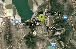
Western Hills Elementary
Kearns, Utah
12.3 miles SWSled near Kearns, Utah
Sled
Donut Falls
Salt Lake City, Utah
12.4 miles SEVery popular beginning hike in the Salt Lake City area. Many take this as a good intro hike into the outdoors, while others go for a trip out with friends to escape the rush of daily life. The...
Hike, Swim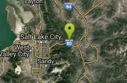
Glenwild
Park City, Utah
12.7 miles EThis easy to follow 8.4 mile loop is located just across from I-80 in Park City. Starting at 6350 feet, the loop has 800 feet of elevation change, with a total of 1200 feet of climbing....
Mountain Bike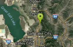
Freedom Hills Park
Centerville, Utah
12.9 miles NShort open course in a well kept park. Tee signs are plaques in the ground near the tee markers. Public (No Fee)
Disc Golf


